|
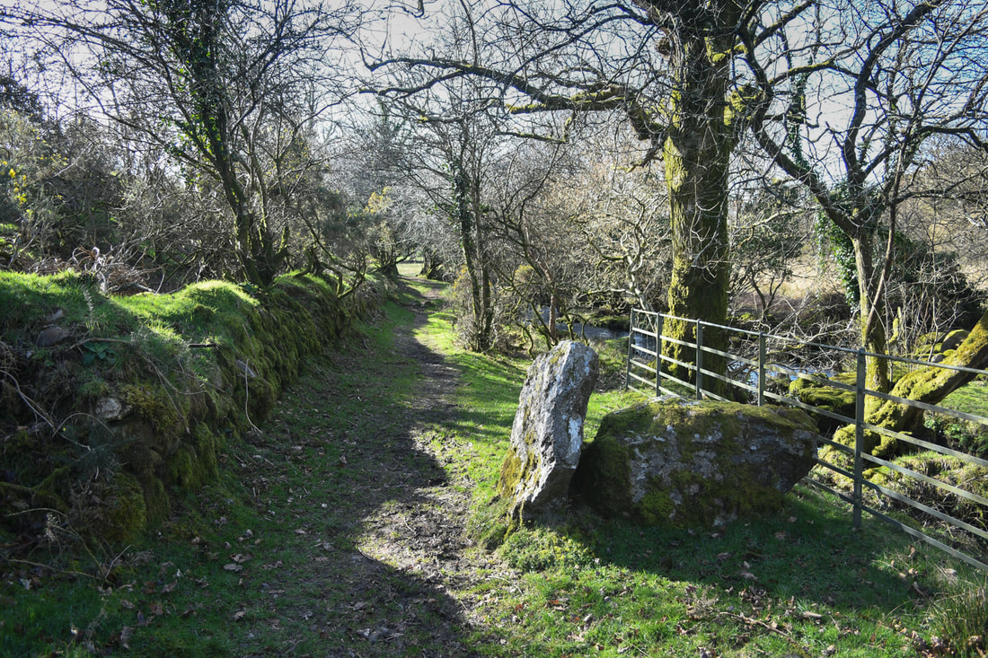
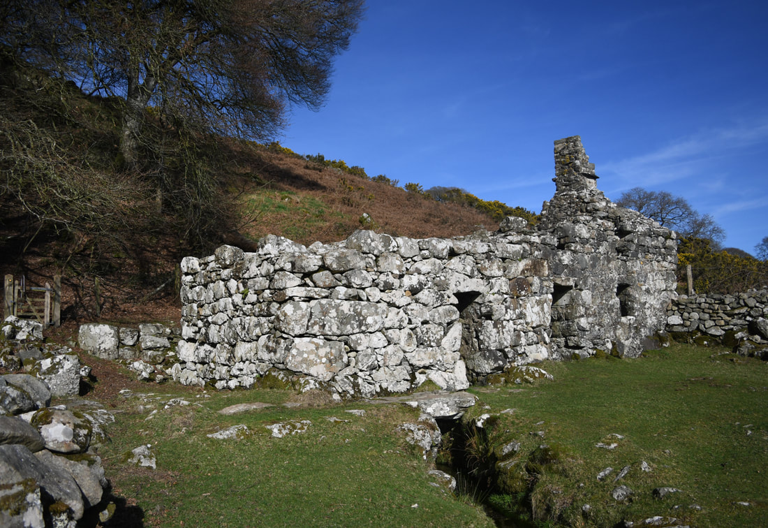
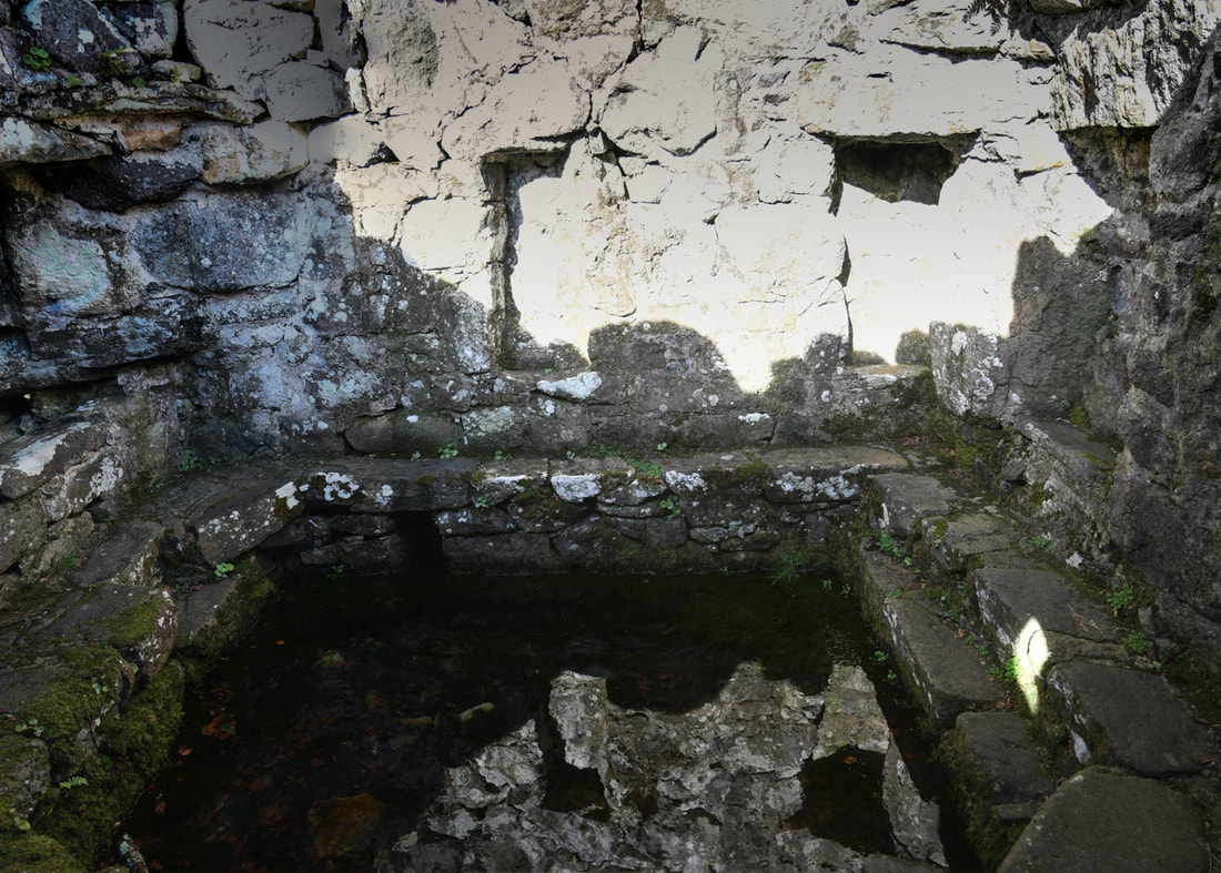
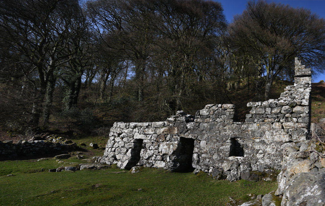
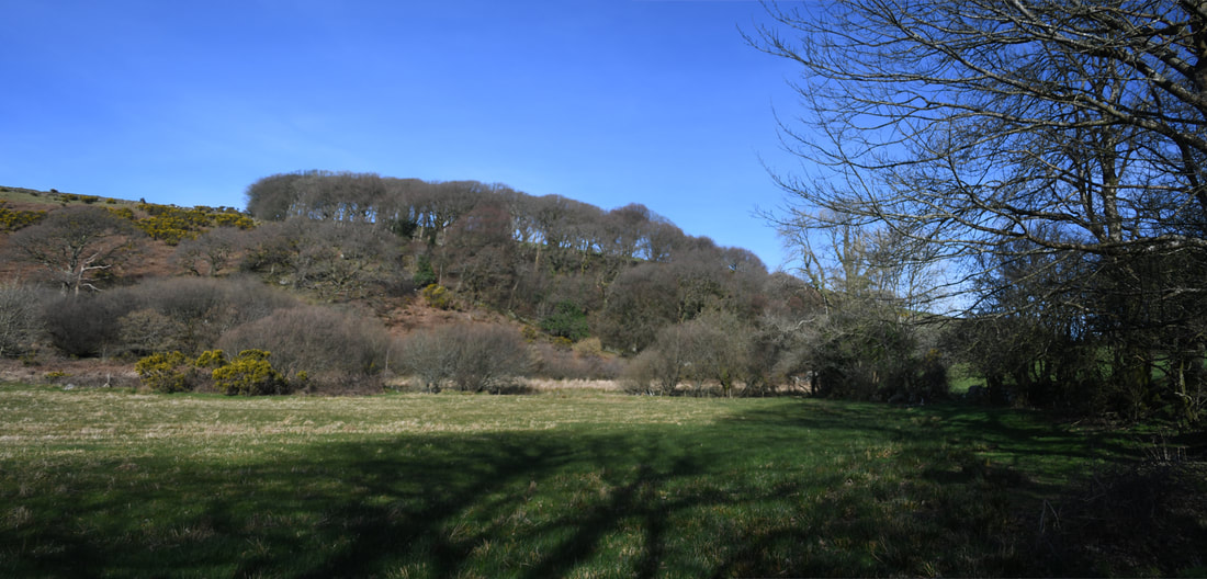
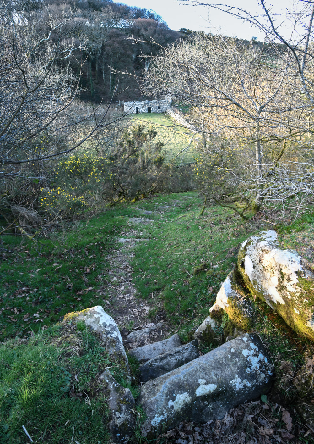
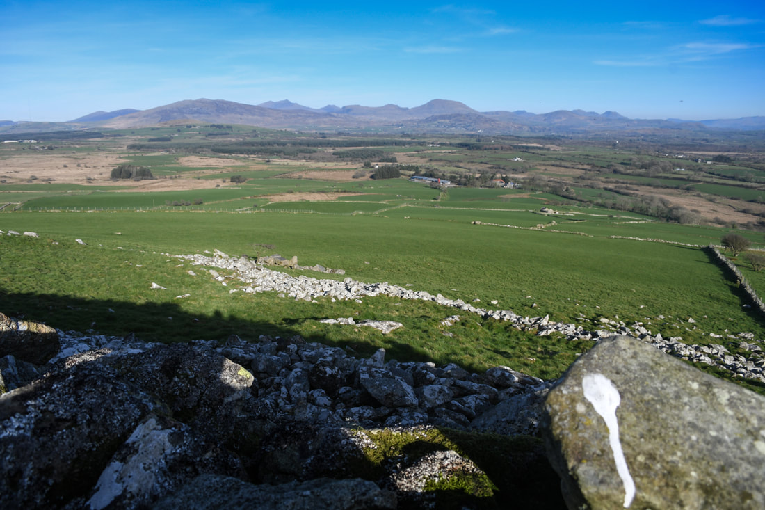
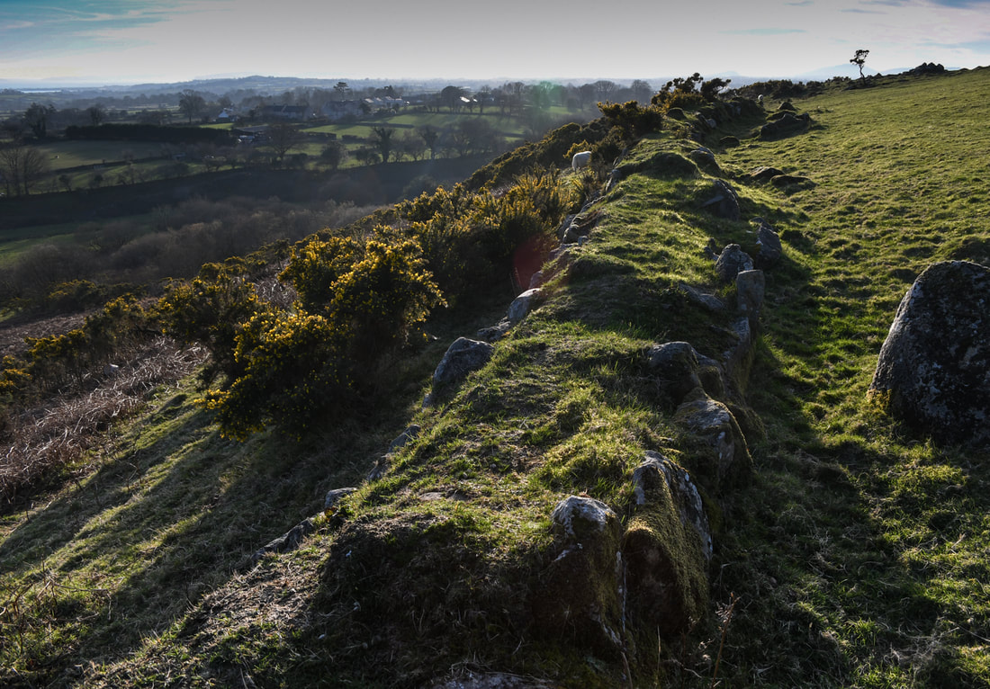
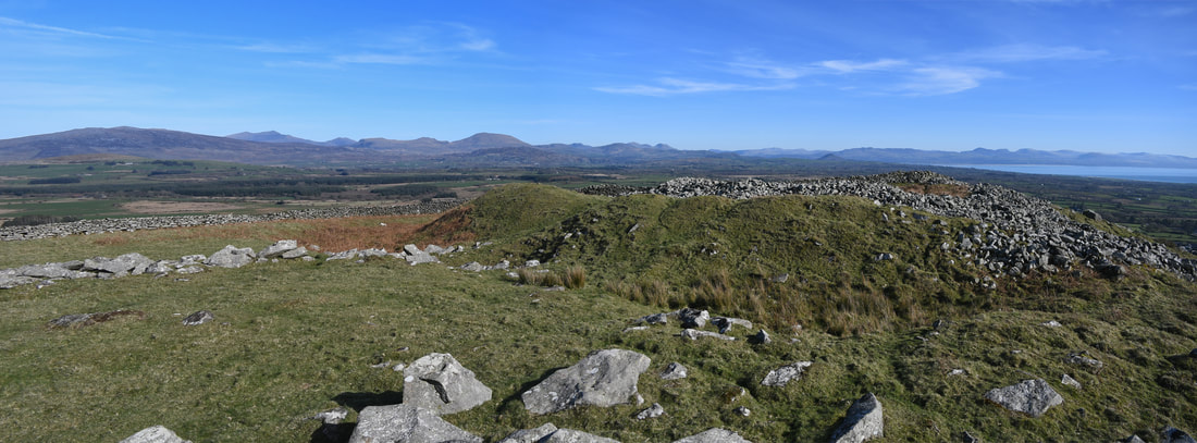
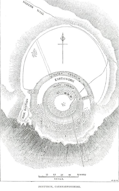
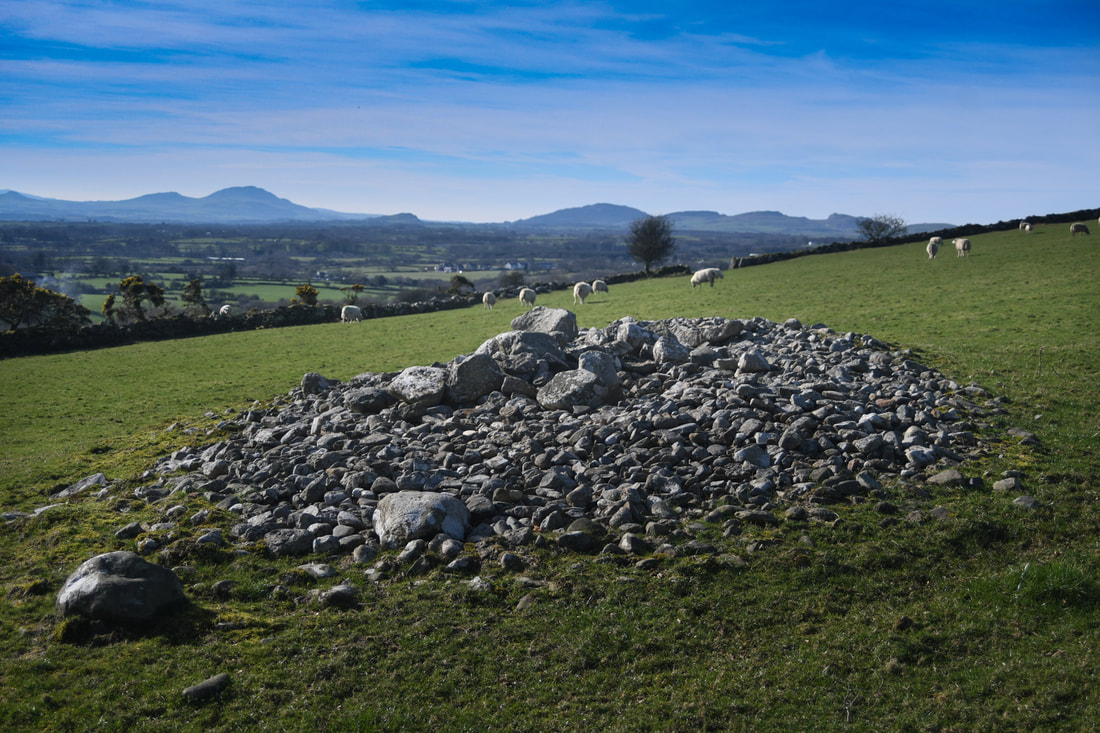
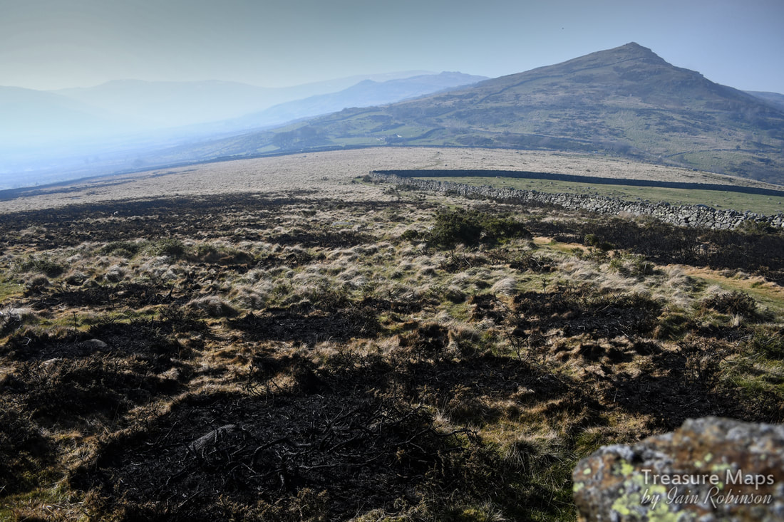
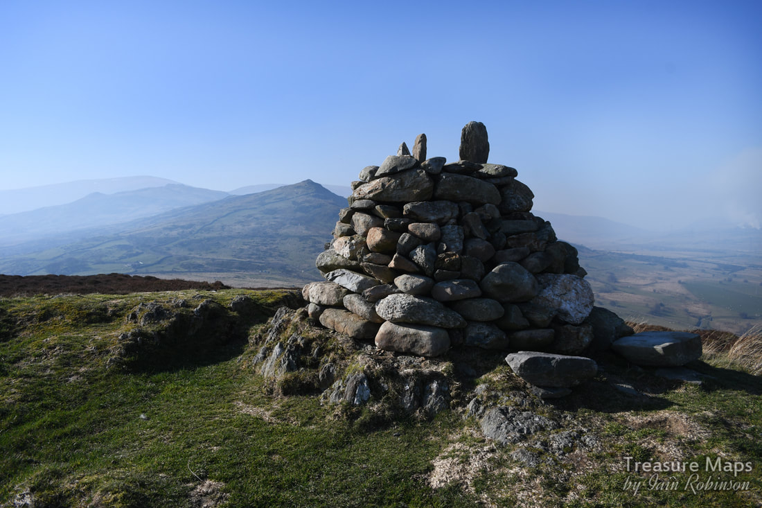
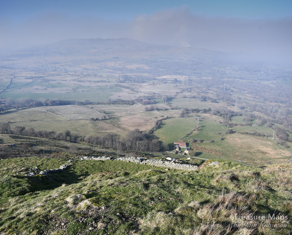
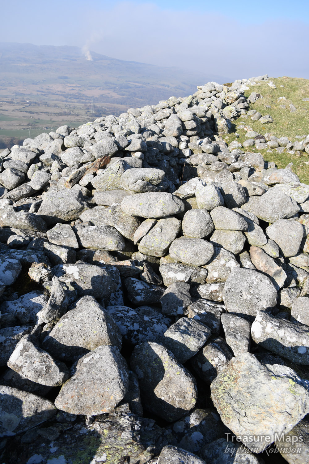
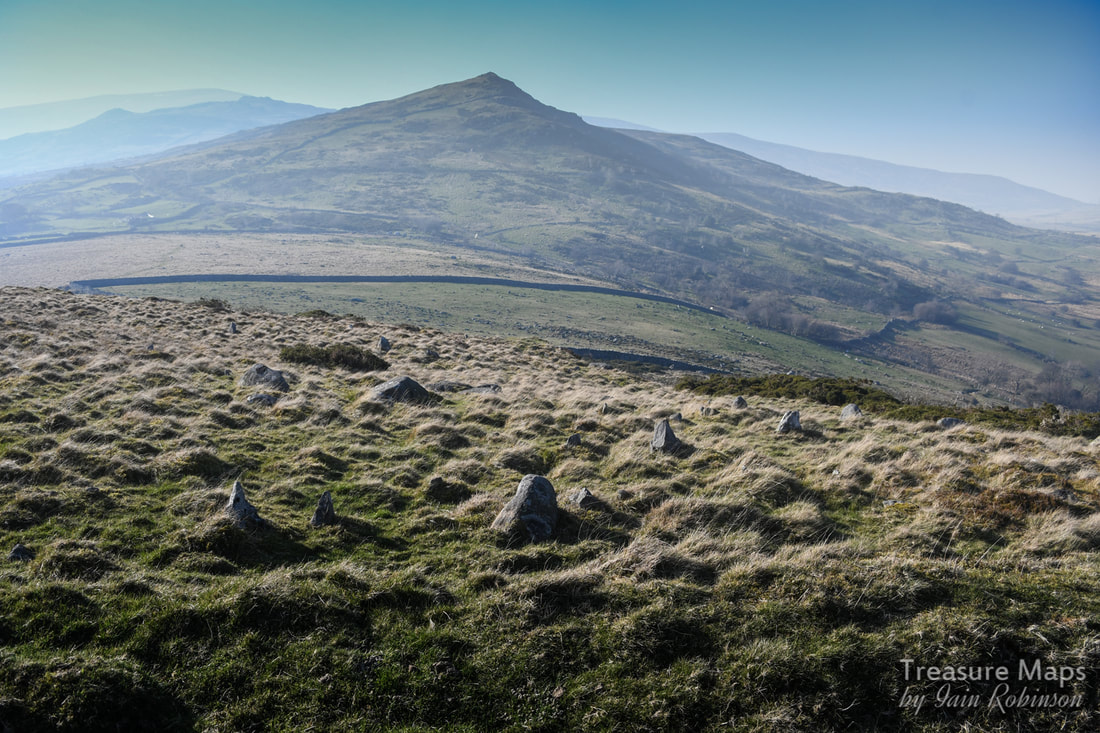
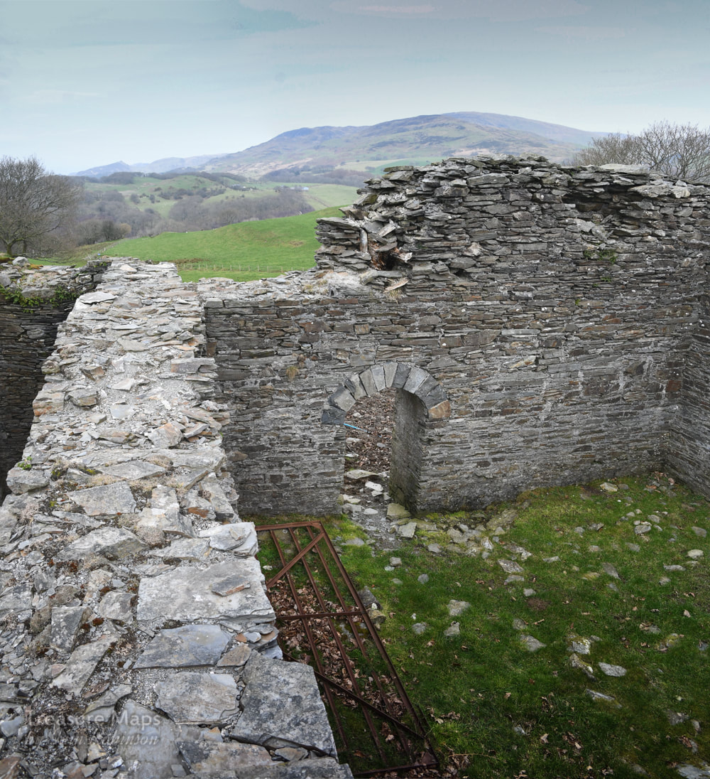
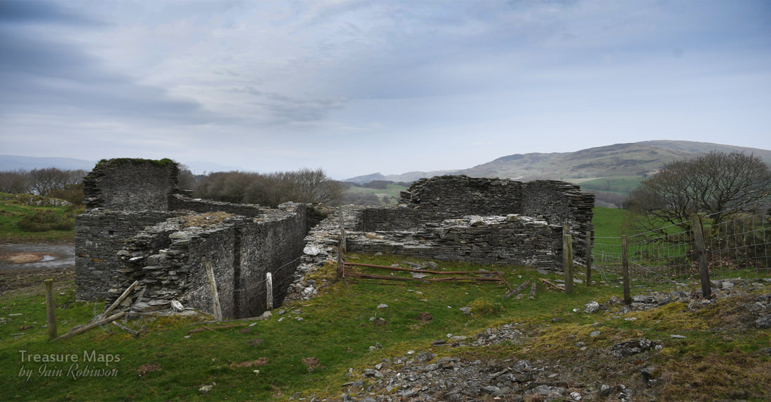
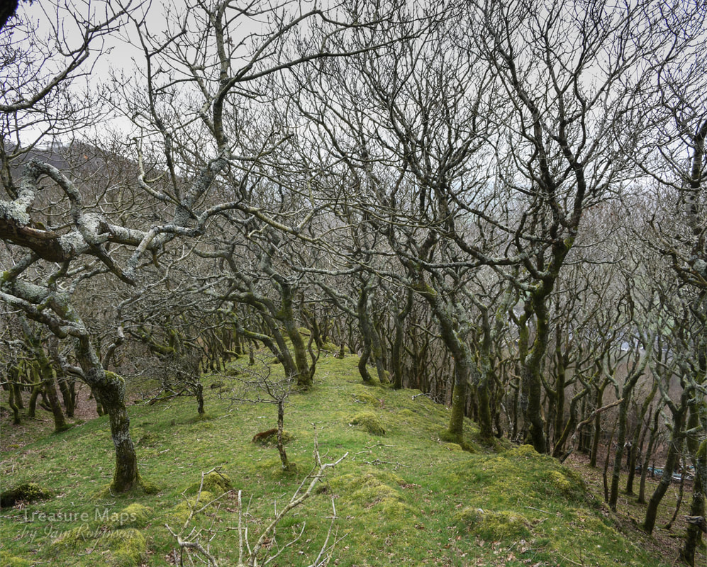
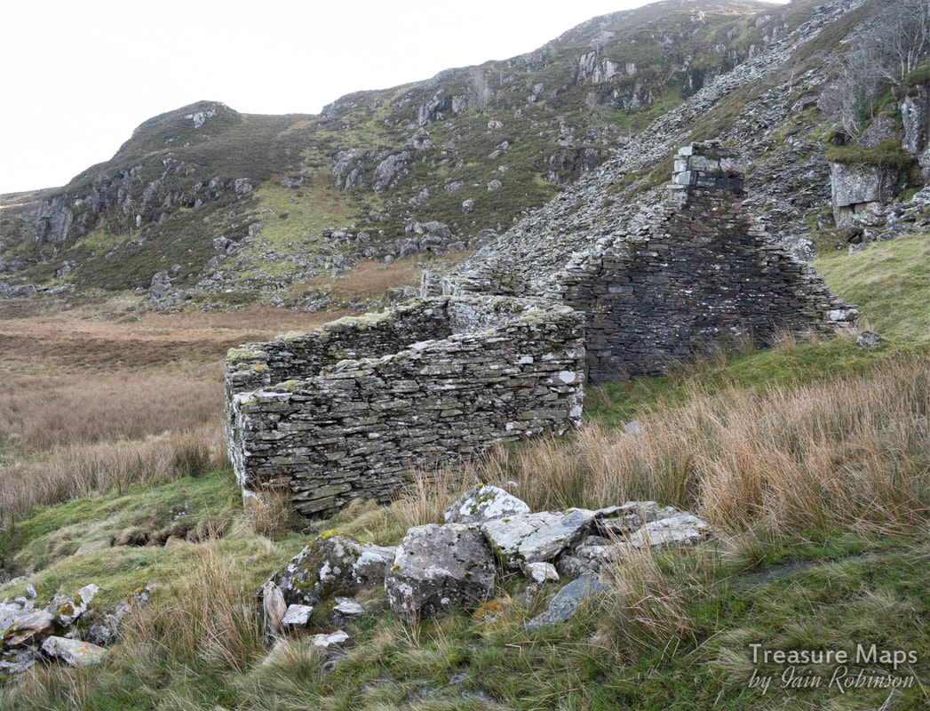
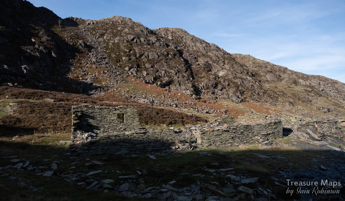
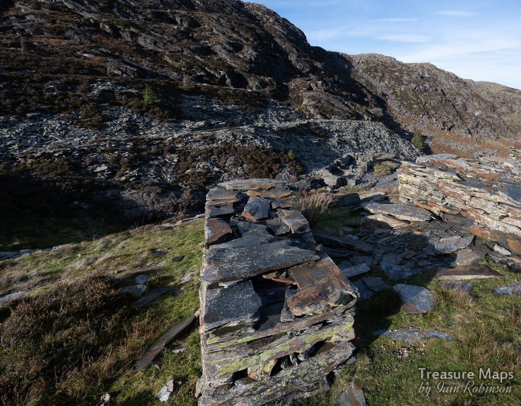
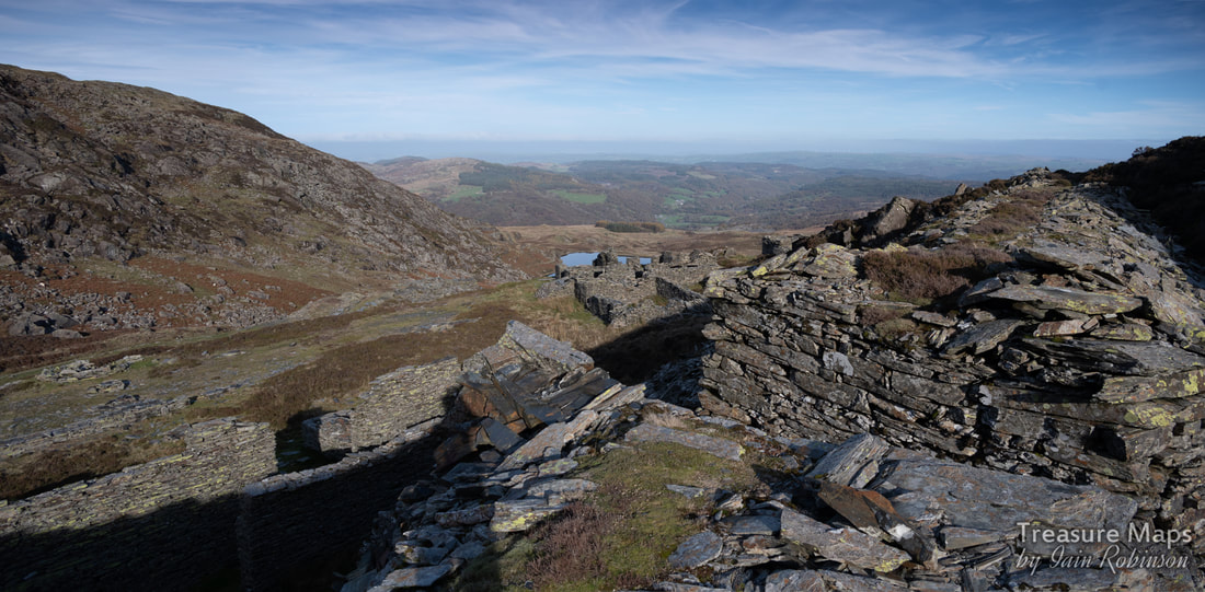
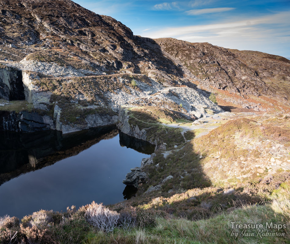
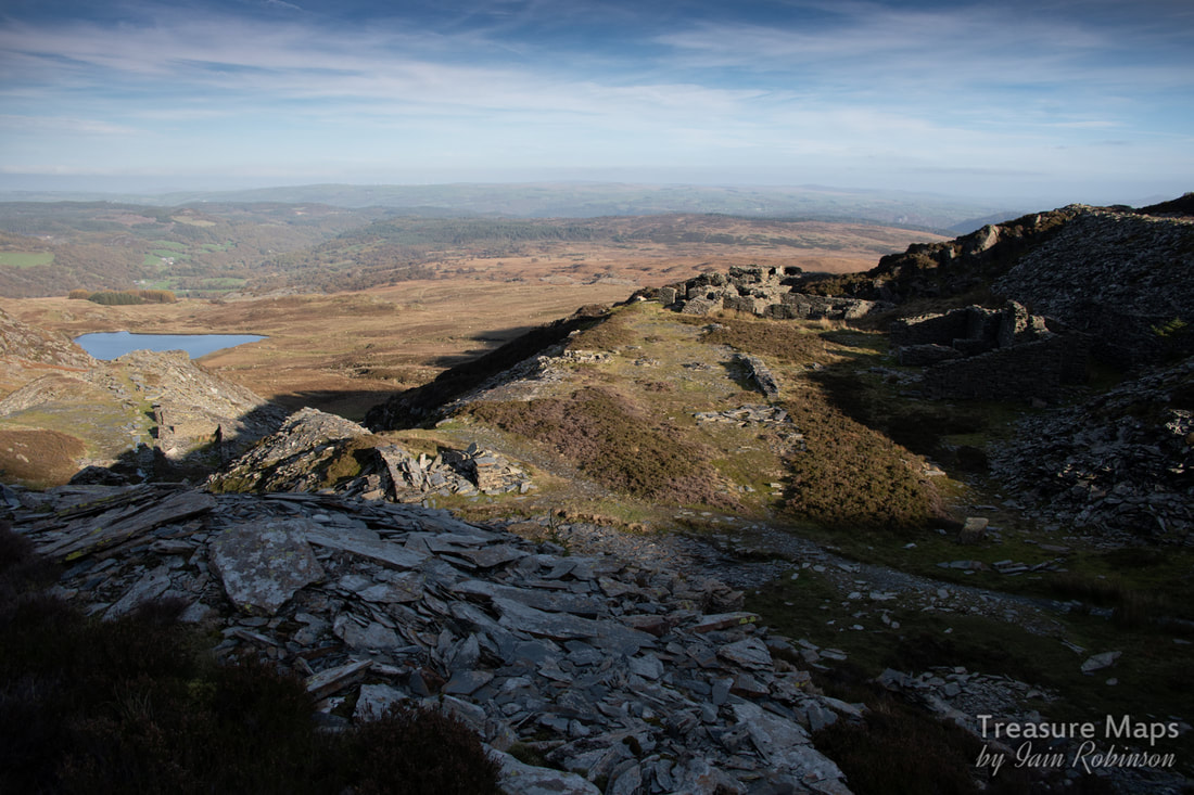
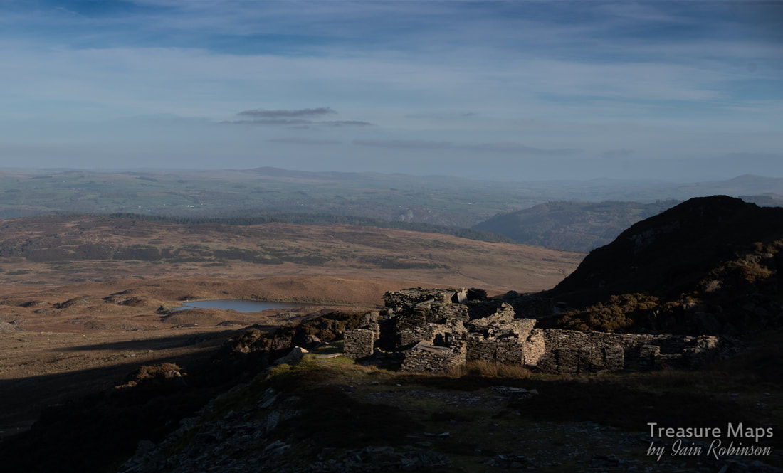
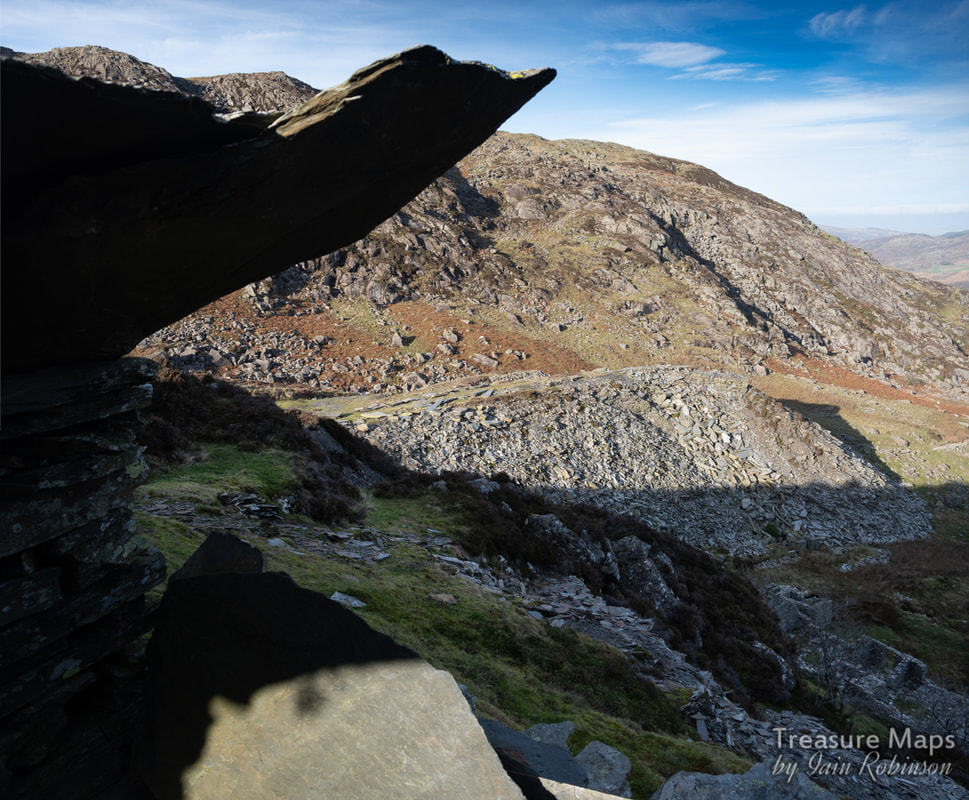
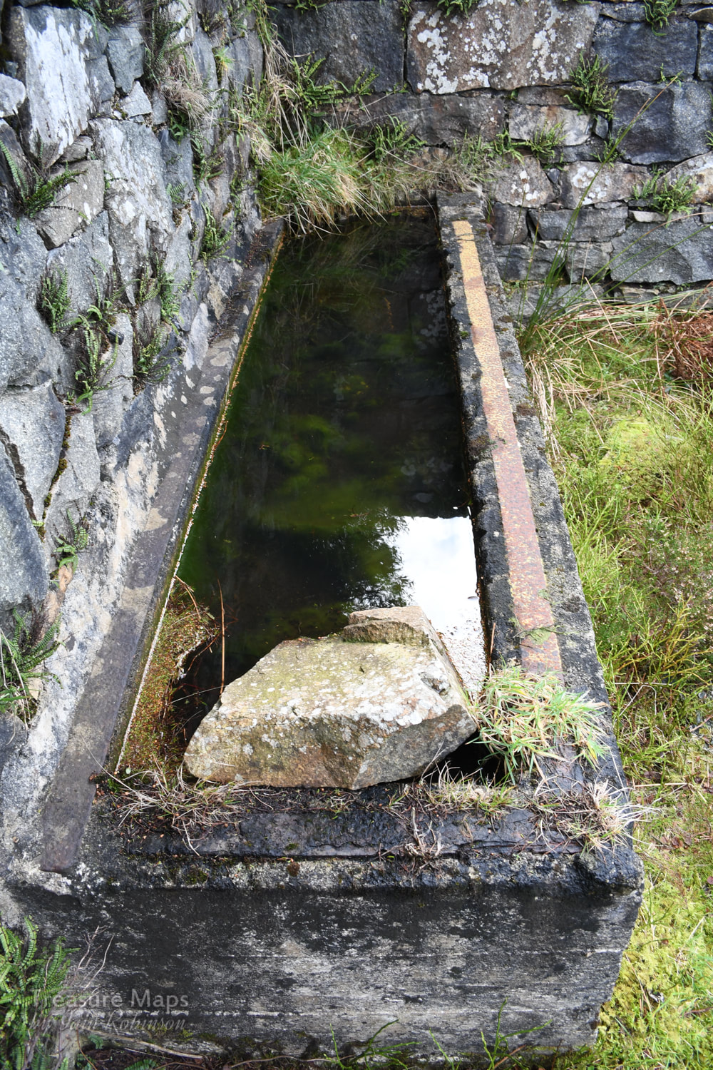
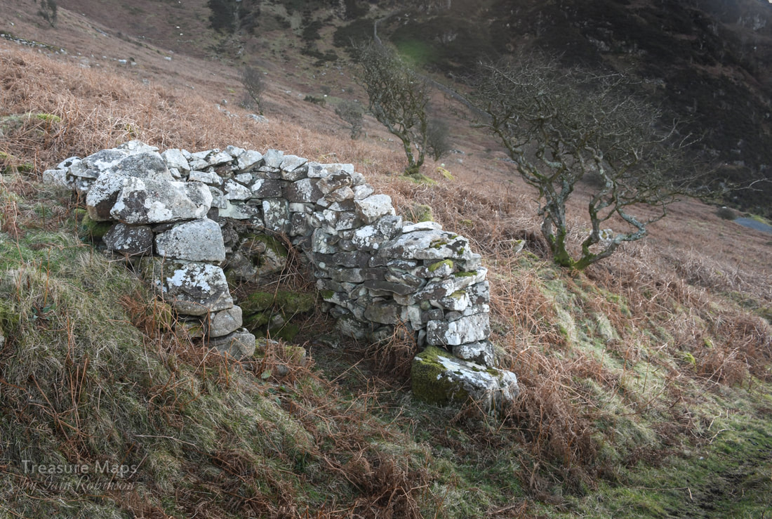
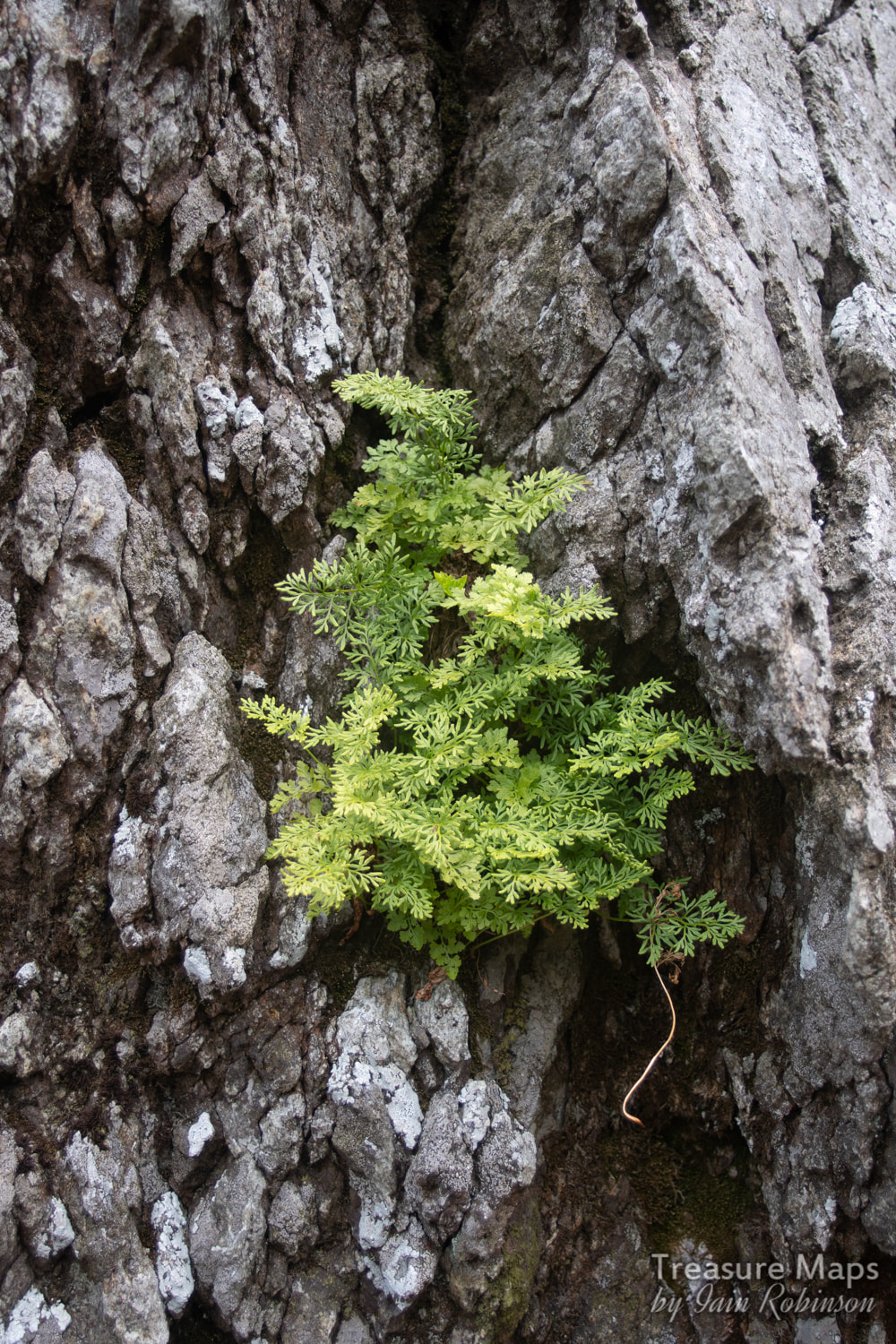
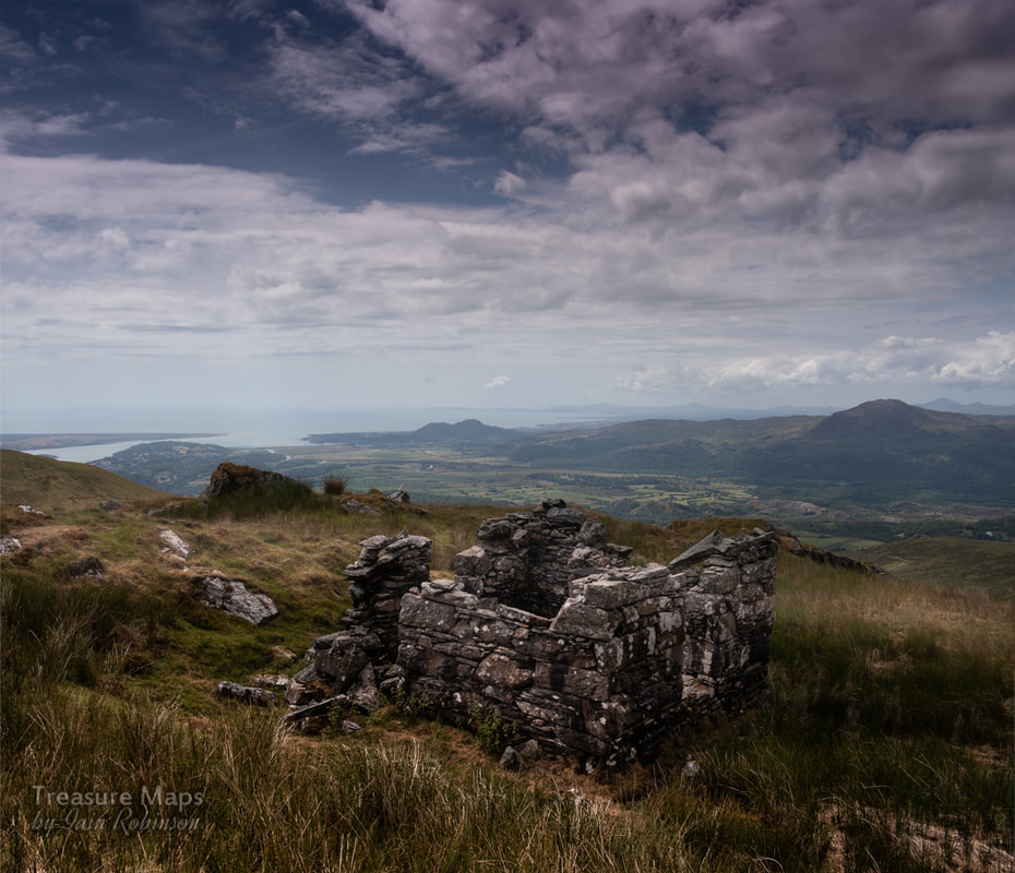
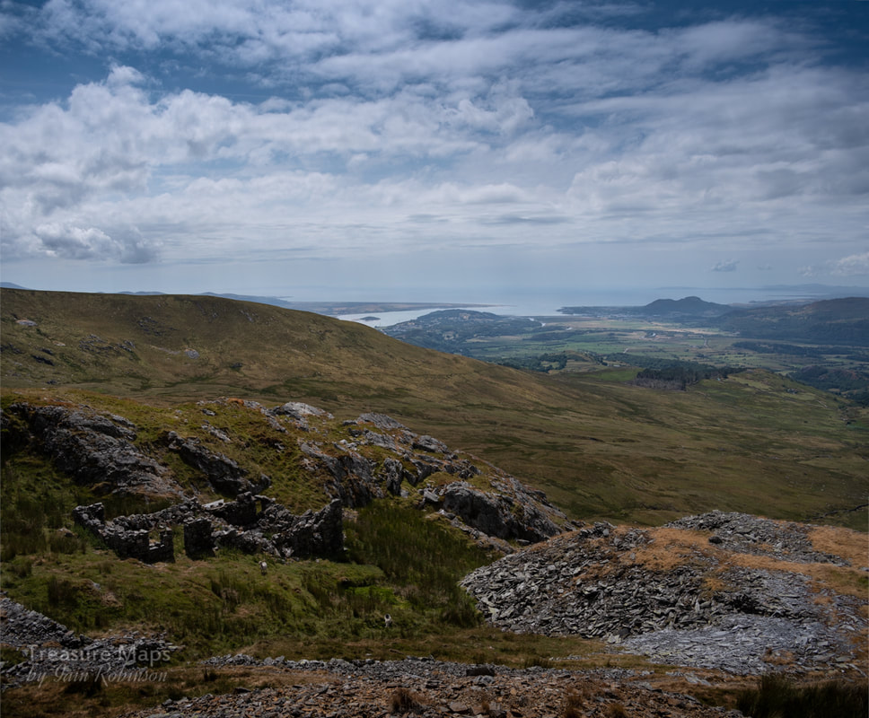
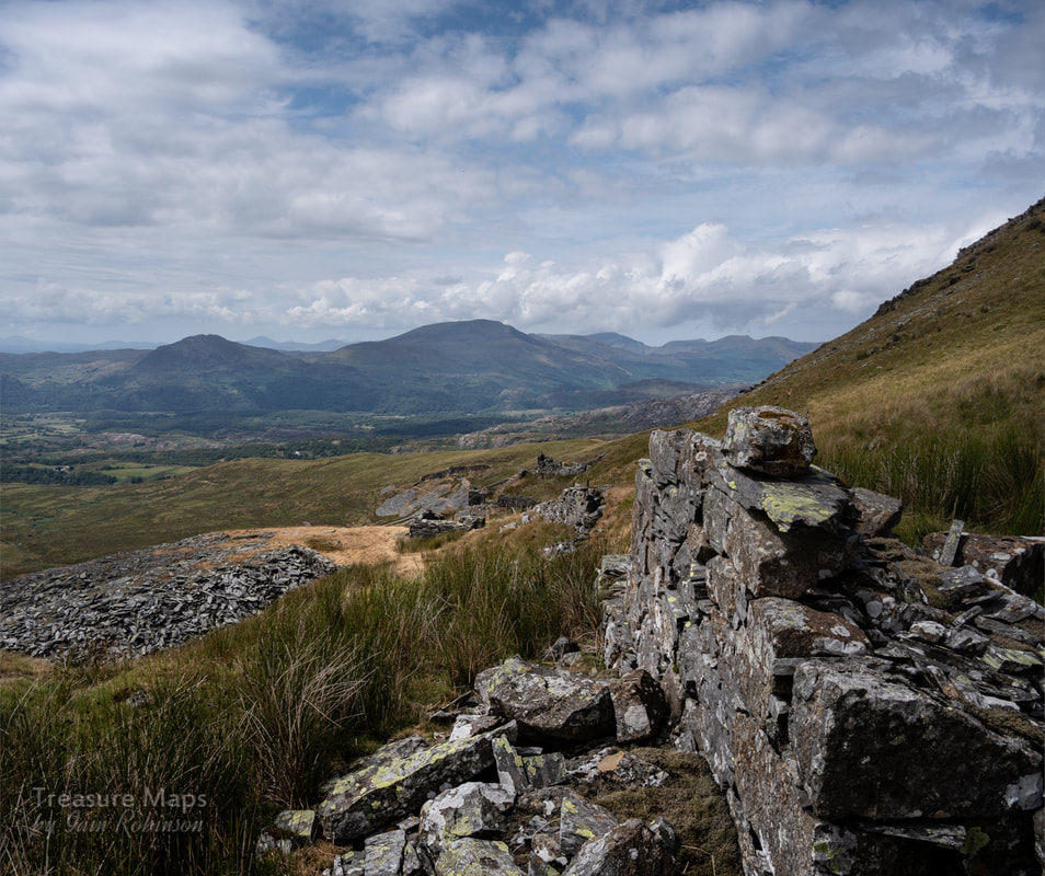
Carn Bentrych and Pen y Gaer, a tale of two ancient hill forts 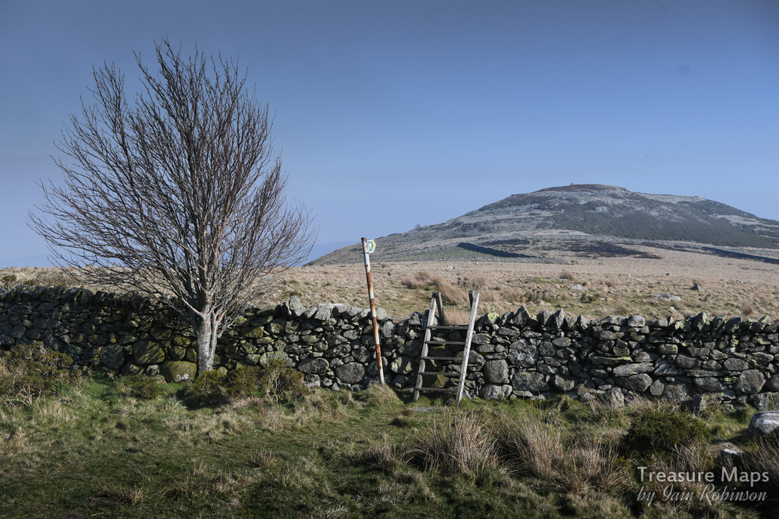 Looking towards Pen y Gaer from the car park. It may seem shocking to readers of this blog, but I am quite partial to a bit of "ancient" history. The 19th century is a fascinating one for me, but like many folk, I am intrigued by the feint handwriting in the landscape of our forebears. Armed with an OS map, it is still relatively easy to encounter prehistoric features- despite the best attempts of farmers and developers to destroy them. We had a couple of expeditions recently to two fine examples of hillforts, one on the Llŷn Peninsula and one nearer the fleshpots of the north coast of Wales at Llanbedr y Cennin. Garn Bentyrch Not an easy fort to find, especially since one of the charms of the Llŷn Peninsula is its winding, hedged lanes and the feeling that all roads lead to nowhere. An absence of useful road signs means that a map is essential! The grid reference is SH423416 / Sheet: 123. We meandered towards the hill on a beautiful February day and arrived in the hamlet of Llangybi, parking outside the church. The whole place is rather quaint, but in an unselfconscious way. We walked south west along the main street and turned right along the road out towards Lon Las until we spied a footpath sign. 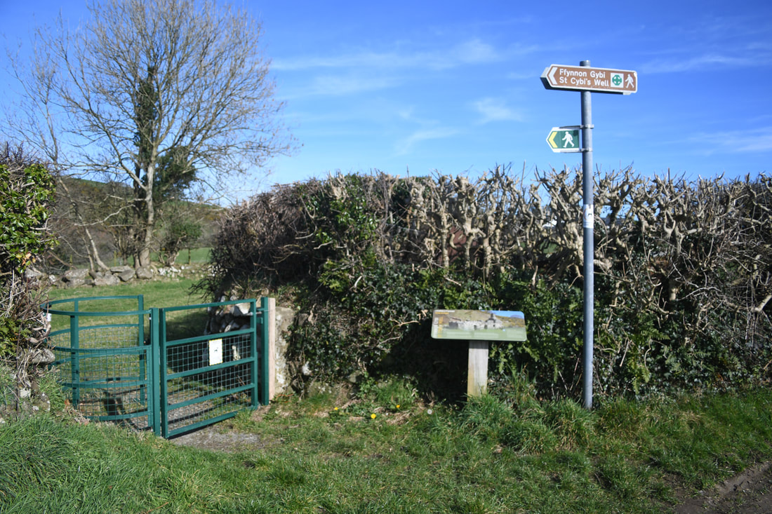 The interpretative board is concerned with the well, St Cybi's, which is along the path. This leads to St Cybi's well, a delightful little spot nestling in the crook of the hill. There's much on the web about this place, suffice here to say people, in earlier times, came to the well to be cured or to get relief from a number of rheumatic ailments. The path followed a stream emanating from the well, which soon came into sight. A spring rises into a square structure to the rear and runs next door into another (nominally) square room which has alcoves for the bathers to put their belongings, or perhaps even to sit within. The pool is a square-ish feature in the middle. The roof appears to have been built up in the manner of a bee-hive above. The building to the right is much more modern, Victorian probably, and was no doubt used as a resting place for the bathers. It did strangely remind me of Bath, except that I suspect the water would taste better here... I suppose I am a philistine, but I was keen to get going through the woods behind the spring. These were just wonderful, a mixture of elderly beech and oak. On the lower slopes, the sheepwreckers have been kept out and there has been some regeneration of the woods with other species such as hazel and birch. Further up, the lower storeys of the woods are unfenced, the ground closely cropped and the trees are not regenerating. They are still a fabulous sight- and while I do love the woolly girls, I wish they could be kept out of the woodland...there's plenty of pasture elsewhere on this site. We spent some time taking photos of the mossy rocks and trunks here. Despite the early part of the year, there were many butterflies out in the unseasonal sunshine, some Painted Ladies and the usual Red Admirals. A thrush was practicing some phrases, his song slightly rusty from the winter...probably feeling selfconscious as a couple of Robins were bugling away very professionally nearby. 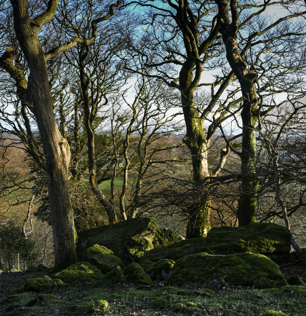 Looking down into the woods, through oaks and beeches. Once out of the woods, we climbed quickly up to the fort. It was a surprise, much more intact than I would have expected. On the way up we followed a massive wall, probably constructed in the early C19 when Wales was carved up by landowners. Most conventional agricultural walls in Britain date to the 18th and 19th centuries, when huge areas of land began to be enclosed, that is, given private ownership and therefore requiring a boundary. The "Inclosure Acts" (notably the General Inclosure Act of 1845) resulted in huge poverty and crippling restrictions for the poor and the working classes. These acts of parliament meant that traditional rights to graze livestock on common land were suddenly ended. That caused a massive de-population of the countryside, with the poor folk heading toward urban areas, desperate for employment. Some stayed to become tenant farmers, but they were often left without rights and suffered much hardship. The severely distressed folk found themselves employed building walls, often alongside Napoleonic prisoners of war. 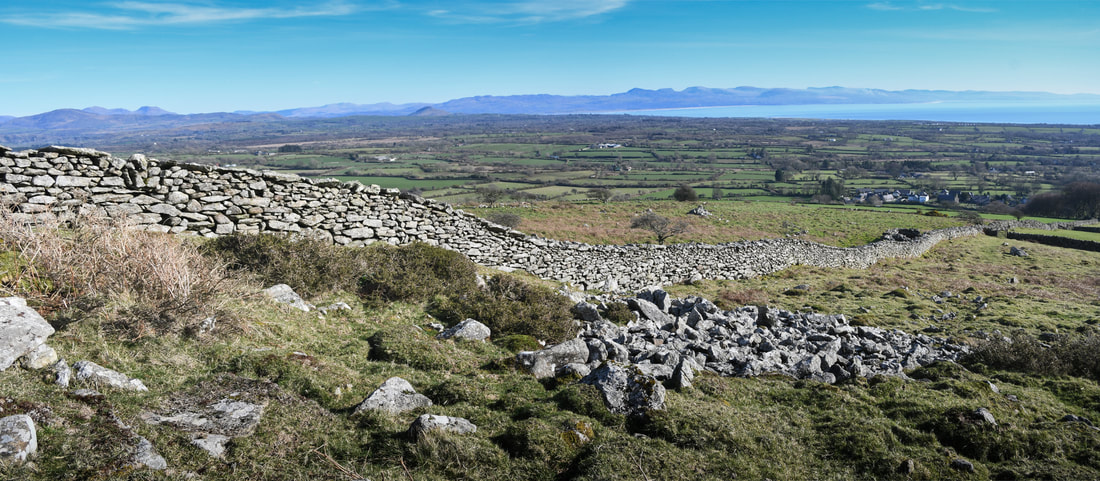 The wall that strides across the fort here, then does a strange arc off to the north, is one such "inclosure" wall, and is undoubtedly built with stones taken from the fortifications. But surprisingly, it doesn't detract too much from the place. I would have liked to have seen the place before though... The ancient fortress consists of what would appear to be a smallish earthwork with two banks, augmented by a larger, less well fortified enclosure to the approx north-west.... the latter might have been for general living and the protection of animals. The innermost defence line looks almost too large, a massive, collapsed dry stone wall which was probably once much more substantial still, given the stone that must have been robbed from it by the "inclosure" wall. Coflein quotes Frances Lynch (A Guide to Ancient and Historic Wales Gwynedd p197 -1995. CADW) as stating that: "The triple defences are probably of different dates. The innermost ring with its thick, high stone wall may be early medieval; the other two lines consist of walls and banks and are probably prehistoric with later alterations and additions". Perhaps the place was built by prehistoric folk (there are a few feint marks in the ground indicating the presence of ring-huts), then possibly the place was repurposed in mediaeval times to serve as a local robber Baron's headquarters. Needless to say, the views- and the sense of history- are wonderful 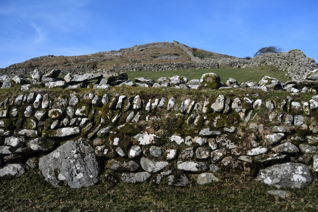 Heading up to the fort, with a traditional wall built in the middle ages. The "Inclosure wall" to the right. 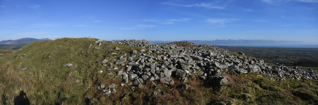 A view of the fort from the trig point showing the wondrous view, the stone ramparts and the earthworks. 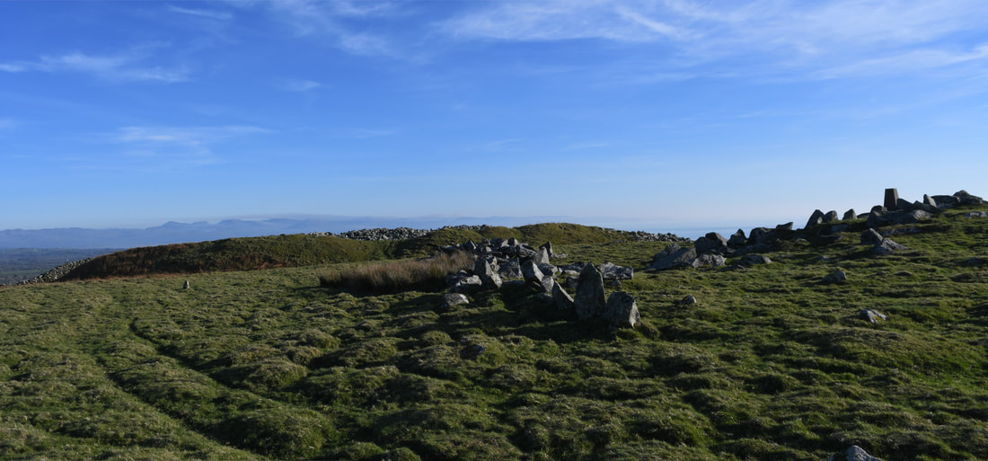 Stepping back slightly from the trig point to show a wider view. Pen y Gaer Hillfort A very impressive site, and a little easier to find than Garn Bentrych! The map ref is SH750693, Landranger Map Number: 115 We drove up the narrow road, a familiar one as it is also the route to the Bwlch y Ddeufaen, with it's standing stones and slate quarries. Near the hill of Pen y Gaer you will see a turning to the left signposted for the fort- this is new and isn't on Google street view. Carry on up this until a small car park is reached. 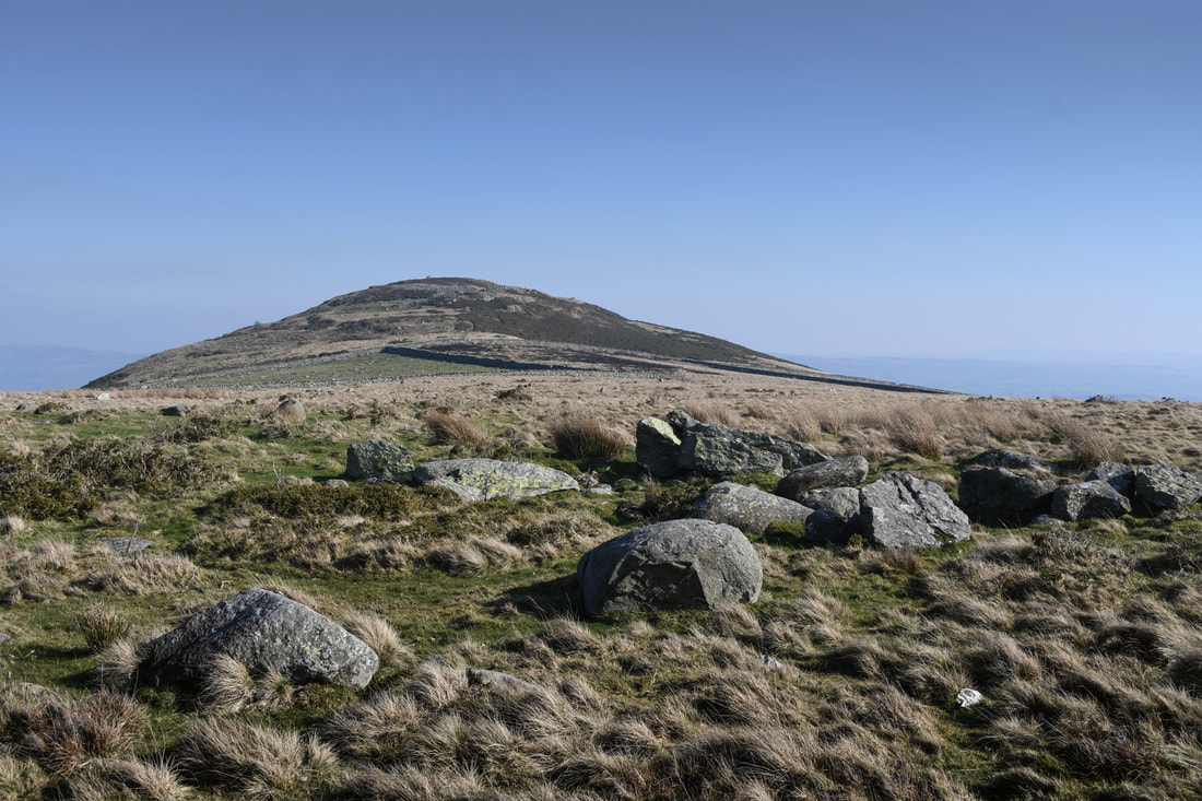 The first sight of Pen y Gaer. We visited on another beautiful day. It would have been idyllic but for the farmers burning gorse. There are conflicting views on this, some sources maintaining that leaving the gorse and heather increases the risk of larger fires fuelled by the oils and dry matter in the plants. I wonder about the pollution, something very evident on our visit as the particulates hung in the air over an area of twenty miles. We set off along the track but were soon sidelined by what appeared to be a ditch of some antiquity...later we found a toppled marker post, revealing that it was a buried electricity line- that was embarrassing! We spotted a lovely set of steps in an "inclosure" wall taking the footpath over. It was an easy scramble to the top. 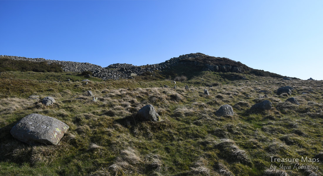 Coming up to the ramparts of the fort, with the "Chevaux de Frise" in the foreground. To paraphrase the excellent interpretative sign board, the site was occupied in the iron age, between about 2300-1900 years ago (3000 BC to 100AD). Within the walls were 19 roundhouses, visible today as platforms cut into the slope. Excavations made here in 1906 uncovered a stone spindle whorl (for spinning wool), sling stones and evidence of iron working. The Celtic tribe thought to occupy this fort were called the Ordovices and Pen y Gaer would have been an important power centre, probably a tribal boundary. The fort was probably attacked and destroyed by the Romans in the first century AD during their conquest of Wales- their fort at Caerhun, Canovium, was built in the valley below 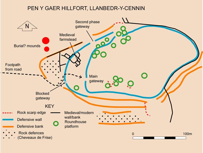 Plan of the fort from the excellent interpretative board on site. The very notable feature here are the areas of stones, up ended so as to stick out from the ground and deter/hinder attackers. These are known as "Cheveaux de Frise" and can still be made out, an incredible survival. This is a really impressive site and well-worth a visit- we will be returning when there is less smoke in the air! 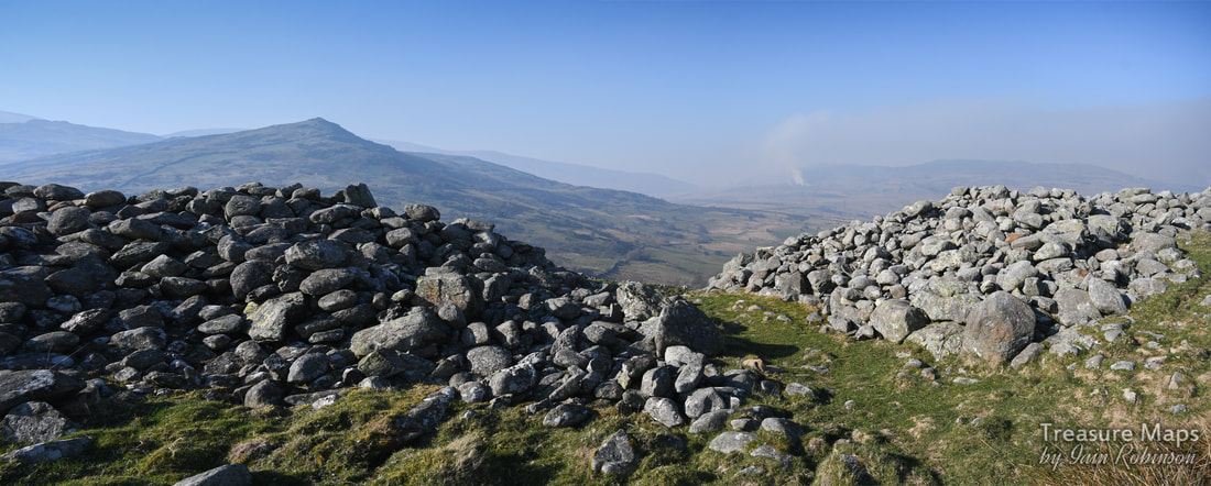 A view from inside the main gateway over towards Pen y Castell, 623m.
4 Comments
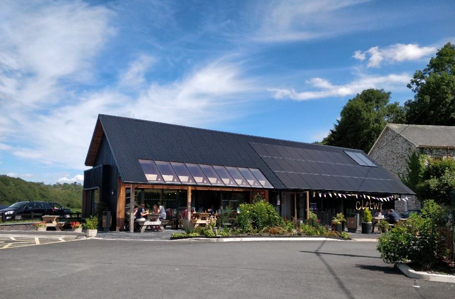
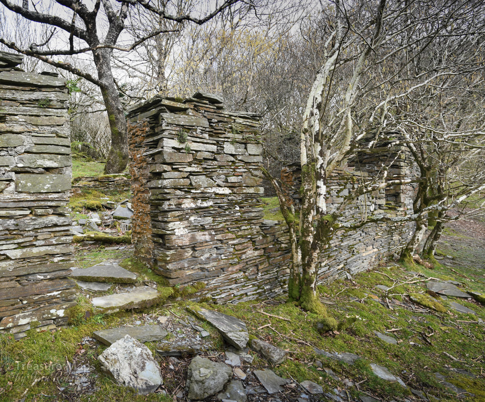
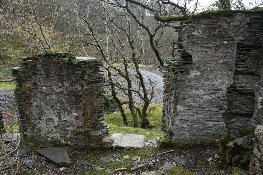
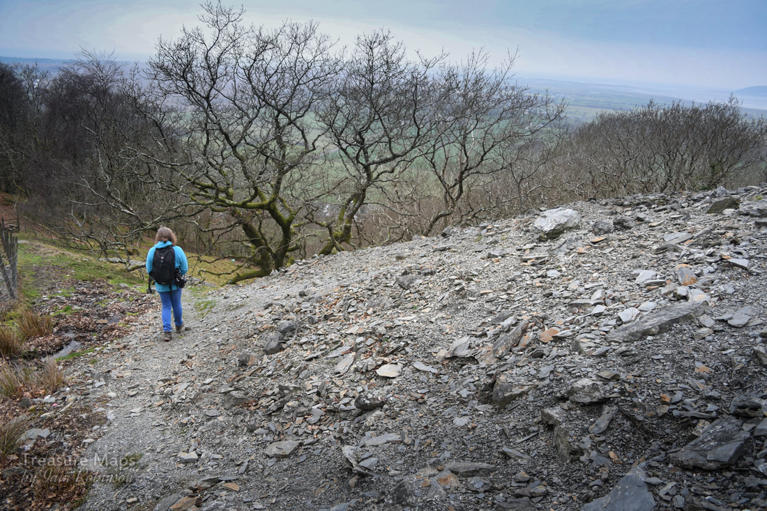
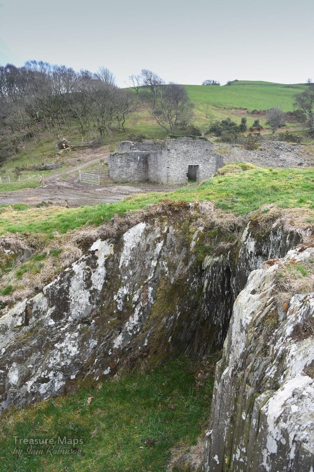
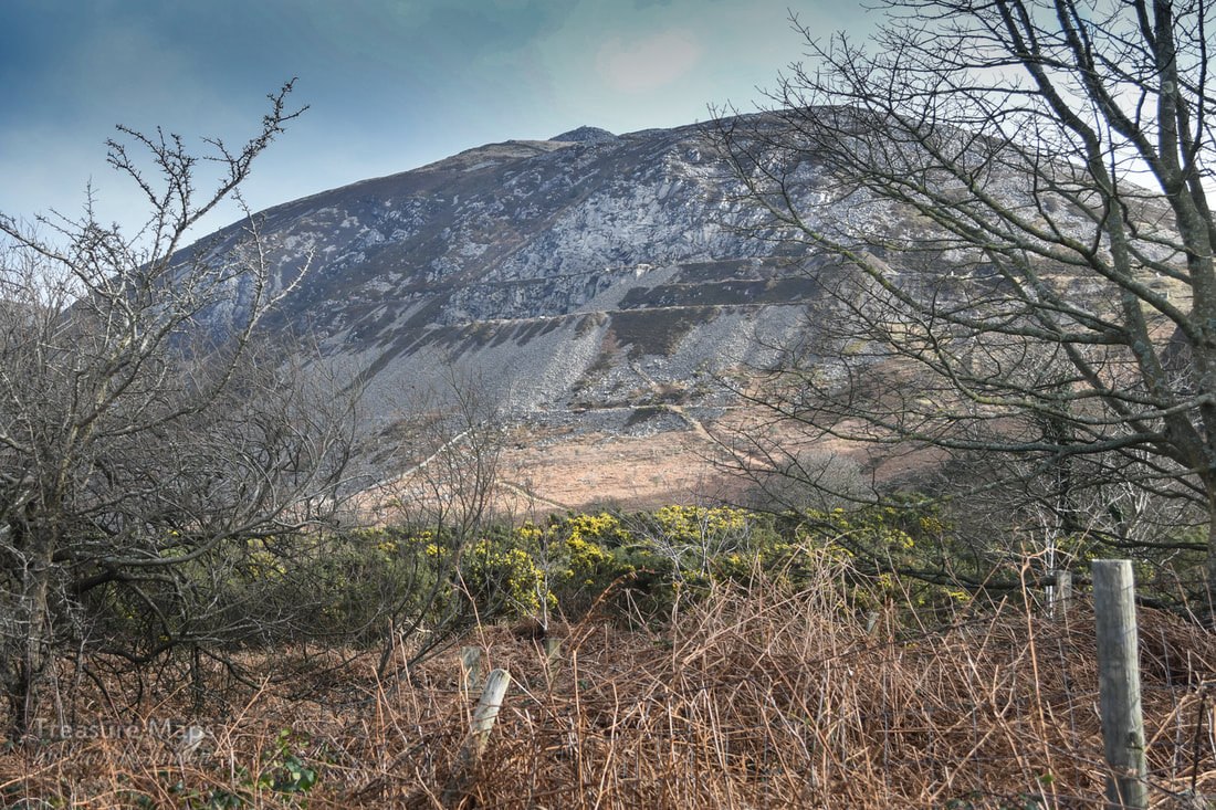
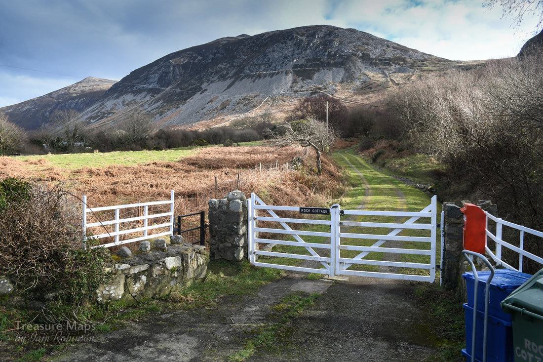
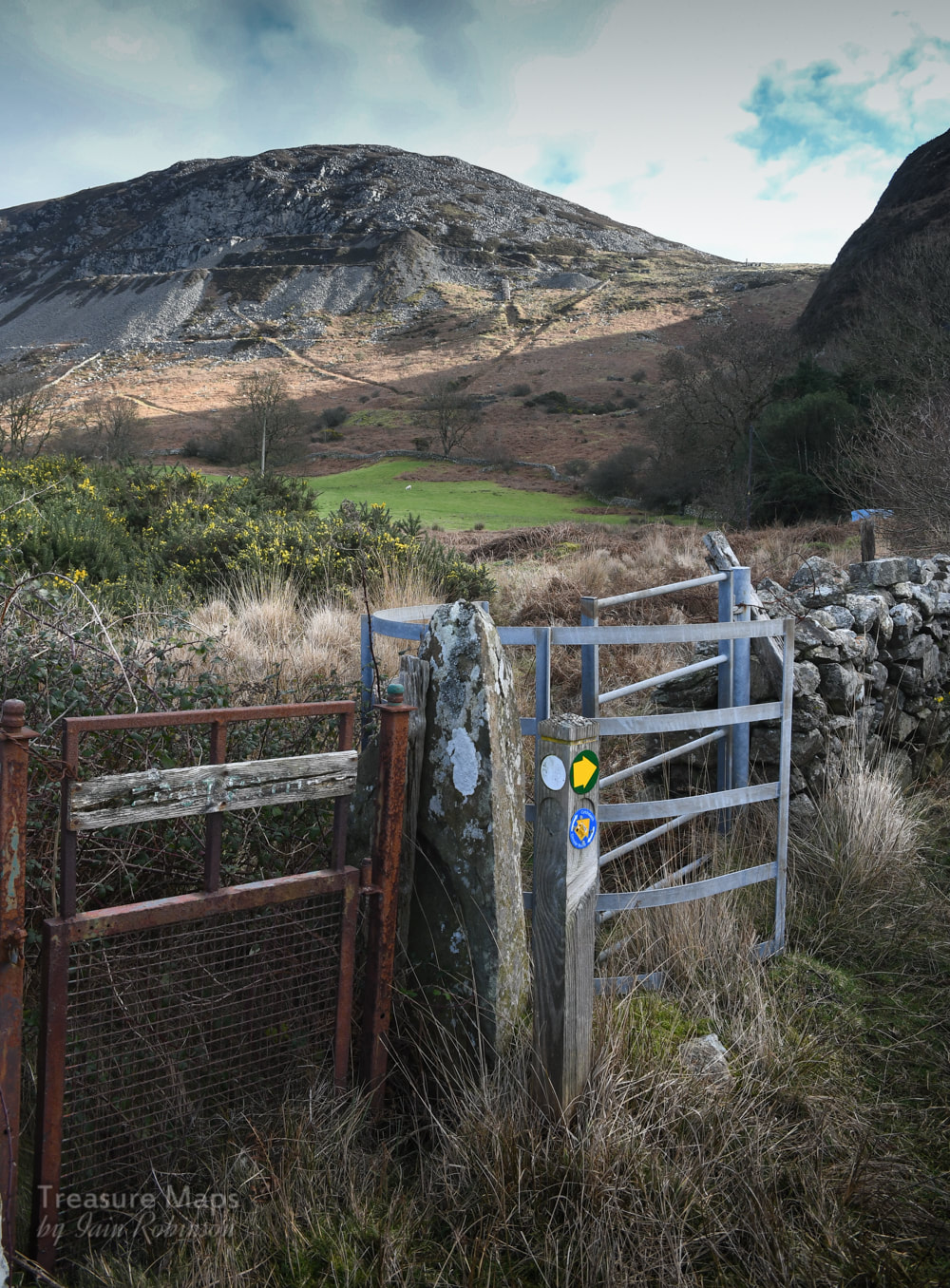
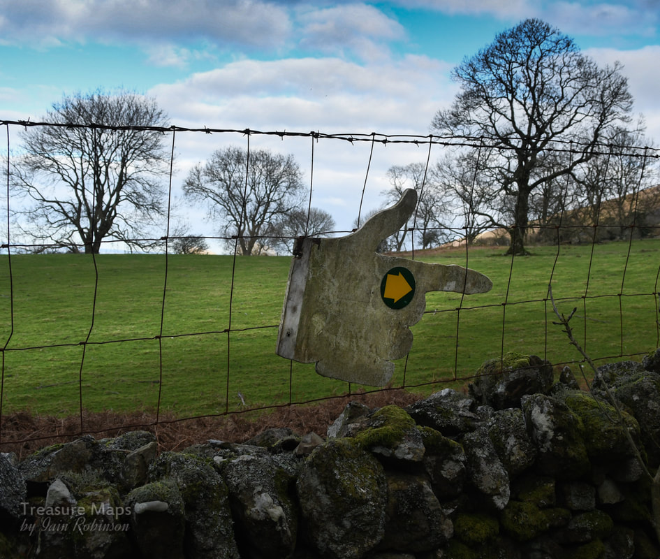
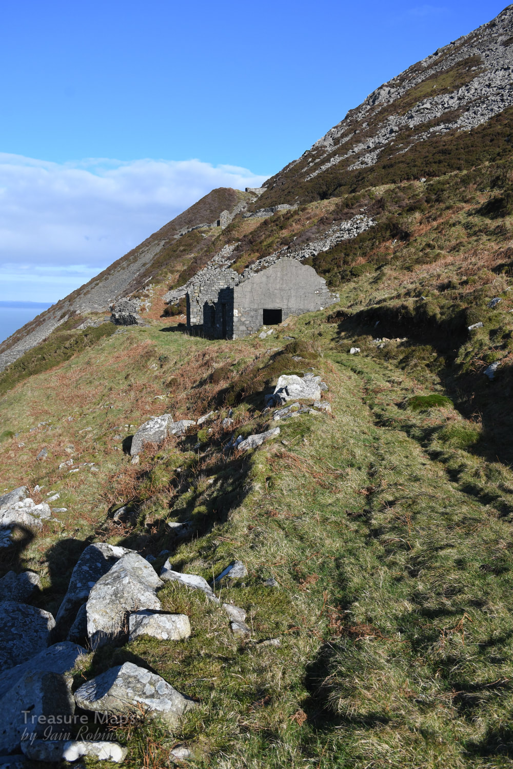
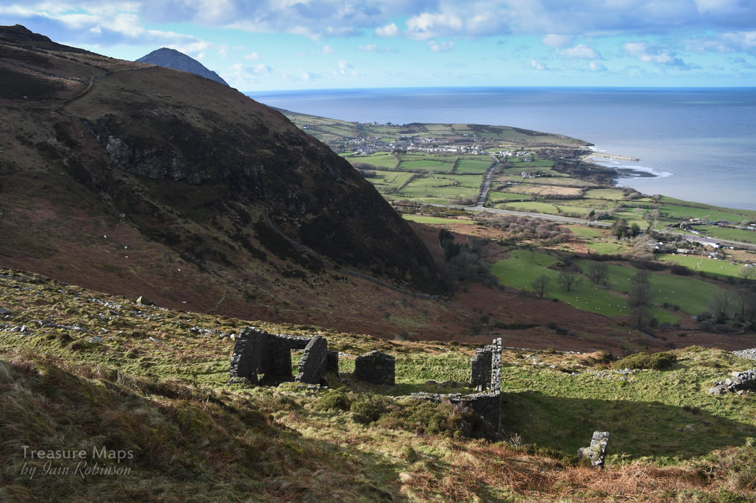
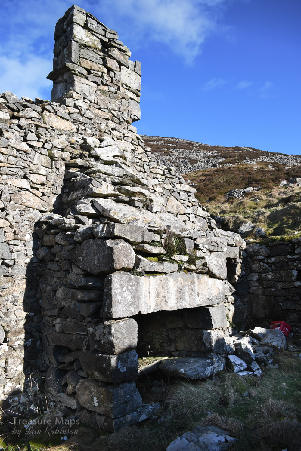
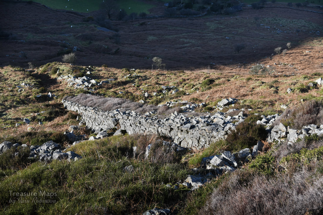
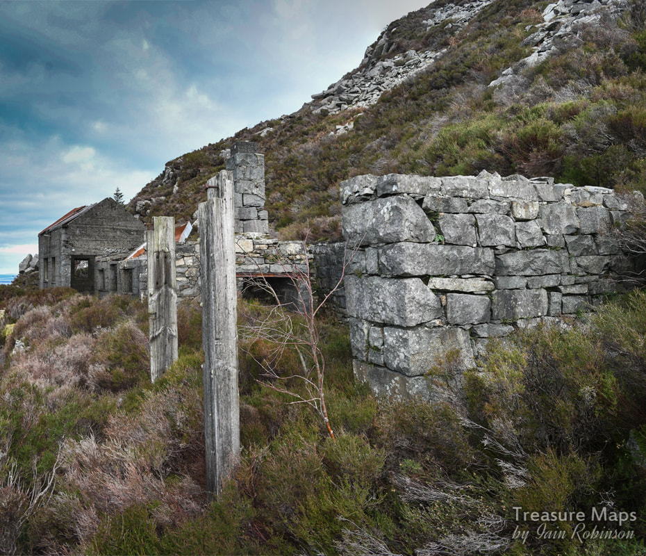
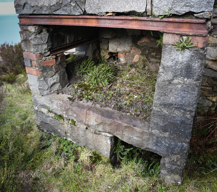
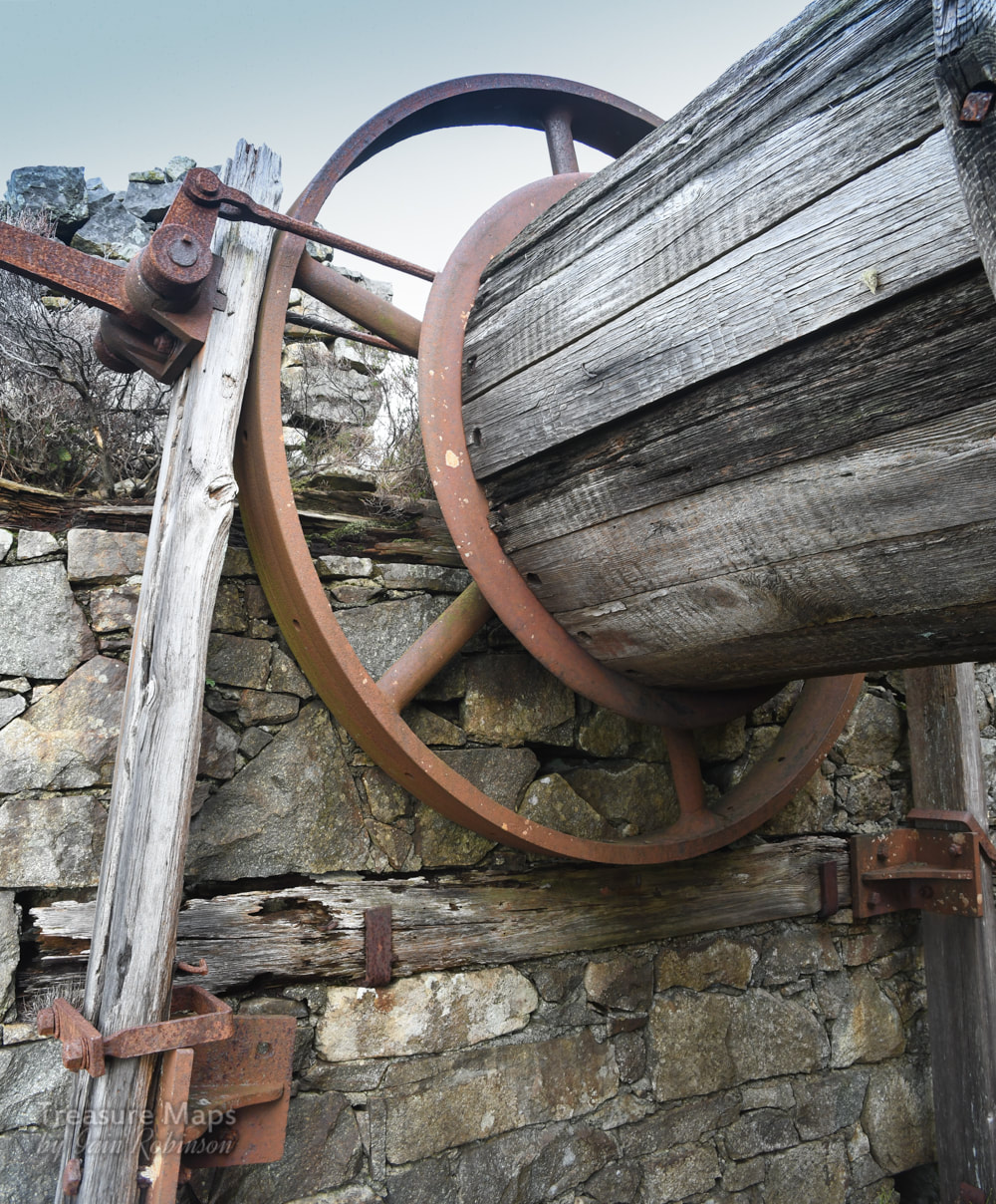
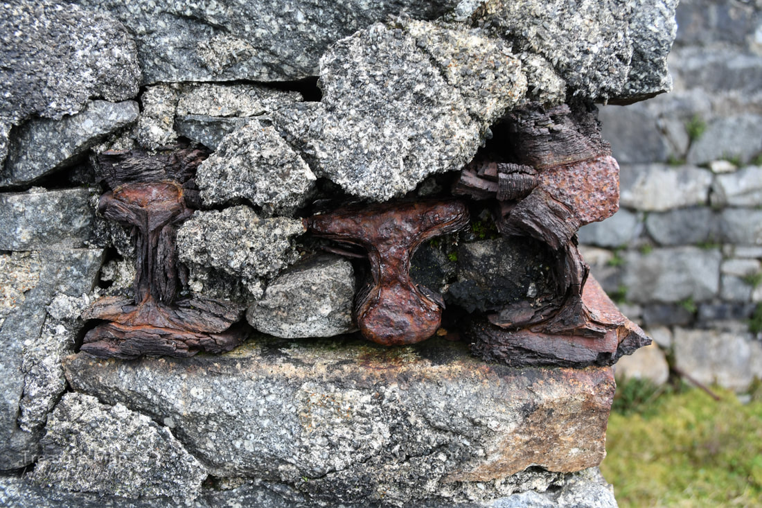
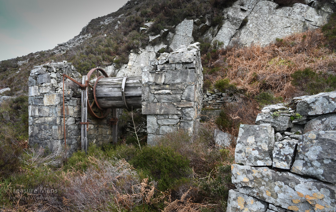
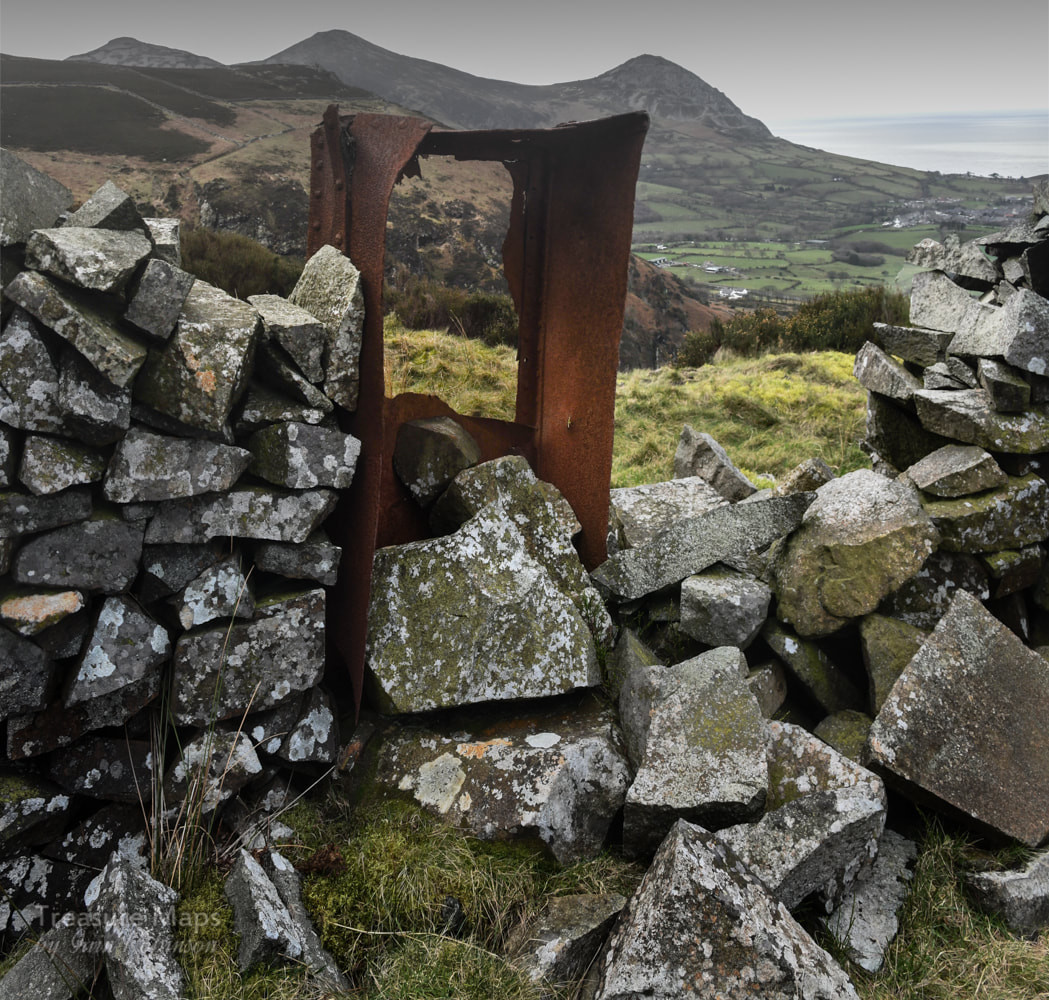
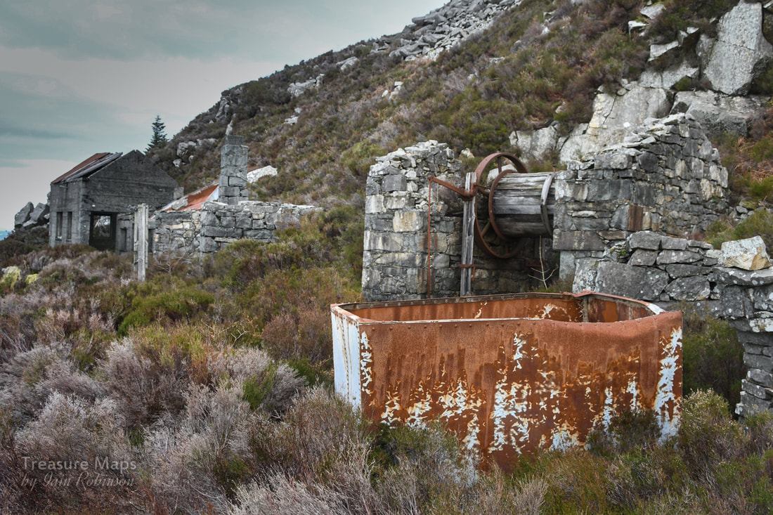
The Gnarly story of the Brynarian mine, or Cardigan Bay Consols.  The mine office at the top of the workings above Hallet's level. The hills rose steeply above Tre'r-ddol as we pulled in to the little mining hamlet, parked and prepared to climb up the track to the Bryn Arian mine. But first, there was something to tick off the list. Breakfast. Tre'r-ddol has a wonderful community cafe...we'd noticed it many times as we drove past, on the way to Aberystwyth- making a mental note to try it when we had time. Now we had, and we were not disappointed! 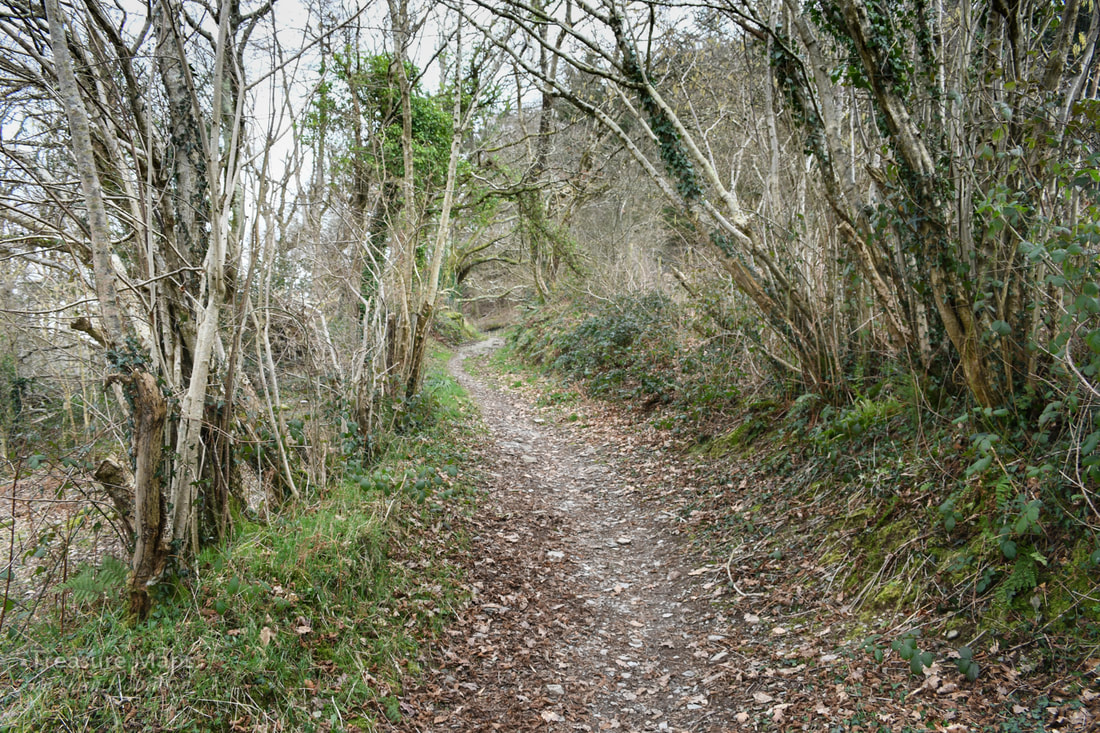 The trackway going up to Cwm Cletwr. Suitably fuelled, we took the path to the side of the imposing Soar Chapel and began to climb upwards into the valley of the Afon Cletwr. The path goes over the bedrock in places and I suspect it might be an old miner's track - there are several mines here, within the cwm and on the hillside. After half a mile, we came to a junction at SN 66267 92019. The path continues straight on and down into the Cwm Cletwr nature reserve, but we turned right, bearing south west, onto a path which parallels a forestry access road. The conifers have been thinned out, revealing the occasional fine beech tree that was probably here before the spruce woods. In the fields below, Vanner horses grazed- they seemed to be quite contented, despite sharing the field with some bullocks. There are several tracks that head off steeply up into the woods on the left, but the third one links with a track coming up from Tre Taliesin, another mining settlement on the A487. You could approach from this village- but then you would miss the fine breakfast. 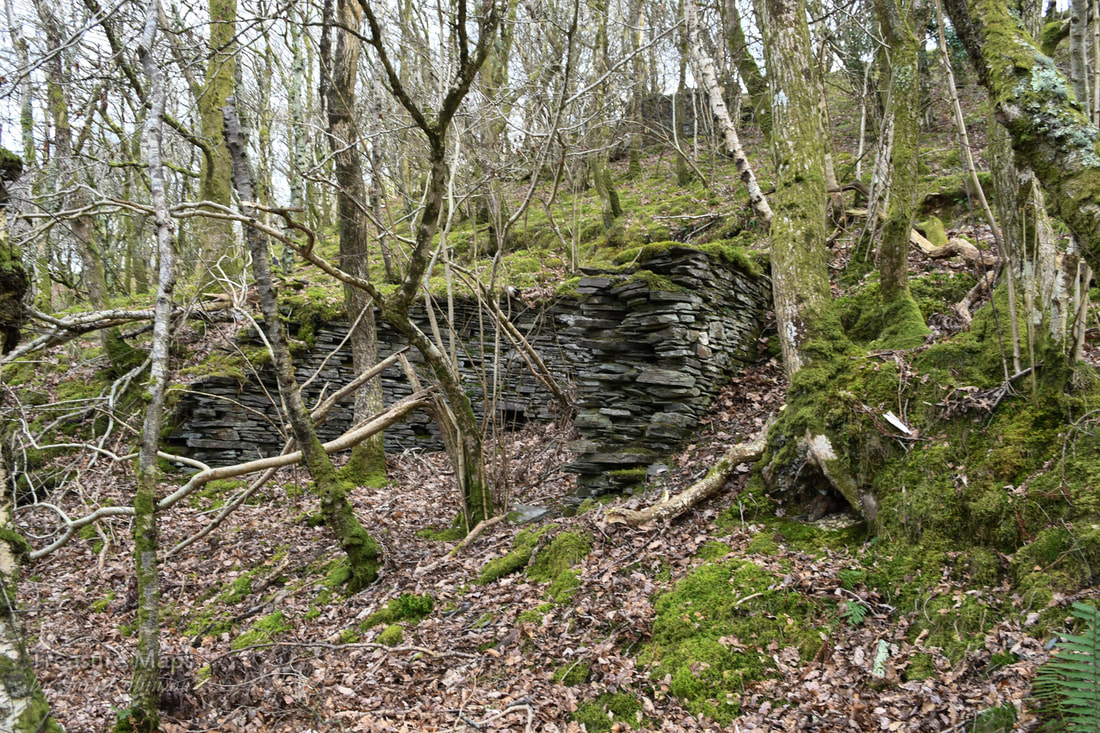 Ore bins below the Hallet's level tramway. As soon as we started to climb, the mine senses kicked in. I was imagining spoil everywhere. The track then did a steep jink uphill to the left and we spotted a real spoil heap. Not much, probably a small trial, but then above that were a couple of bastions made from drystone which might have been for winching. Hard to tell, but this might be the whim that wound the new Boundary adit below- it seemed to be connected by the remains of a tramway level. The path went away to the left, but we crossed the fence and went off-piste up to some huge tips that spread across the hill and into the woods here. There appeared to be a number of shafts and two ore bins. The ground was disturbed and bore the marks of many excavations over the years, with run-in adits and trials. Oak trees had re-colonised here, reminding me of Bryndyfi a few miles to the north. 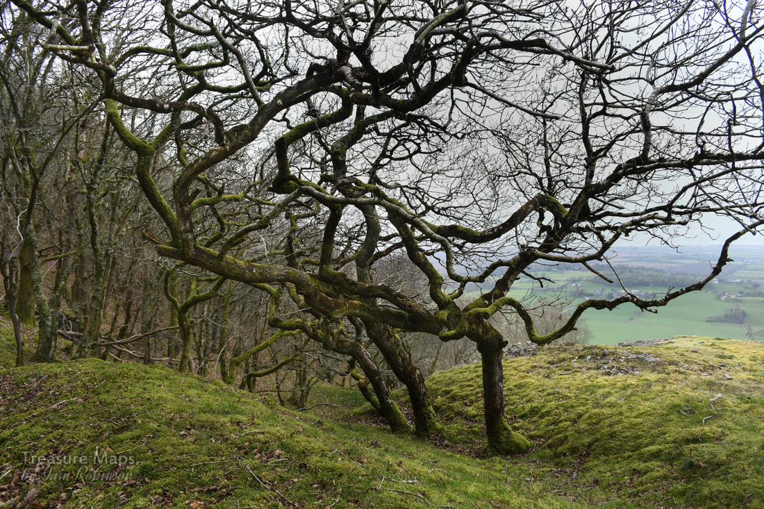 Young oak trees inbetween the old tips. Then Petra spotted a big opencut and shouted to me that she'd found what looked like Hallet's adit. It was open, but not at all amusing, being belly deep in mud. According to a survey by David James, this adit once reached into the workings and connected with the engine shaft further up the hill. There was a labyrynthine network of stoping and crosscuts underground which I would dearly like to see- but I also value my life.  Hallet's adit, in all its muddy glory. We moved on over the tips to a ruin which appeared to be a mine office, situated on an eminence above this area of working. One of the rooms seemed much lower and more strongly constructed, I wondered if there had been machinery in there. The tips around here were not at all rich in other minerals and the overwhelming feeling was of shaley rock- normally in lead mine tips you would expect to find some quartz at least, possibly some pyrites and the occasional blob of galena. There was nothing. 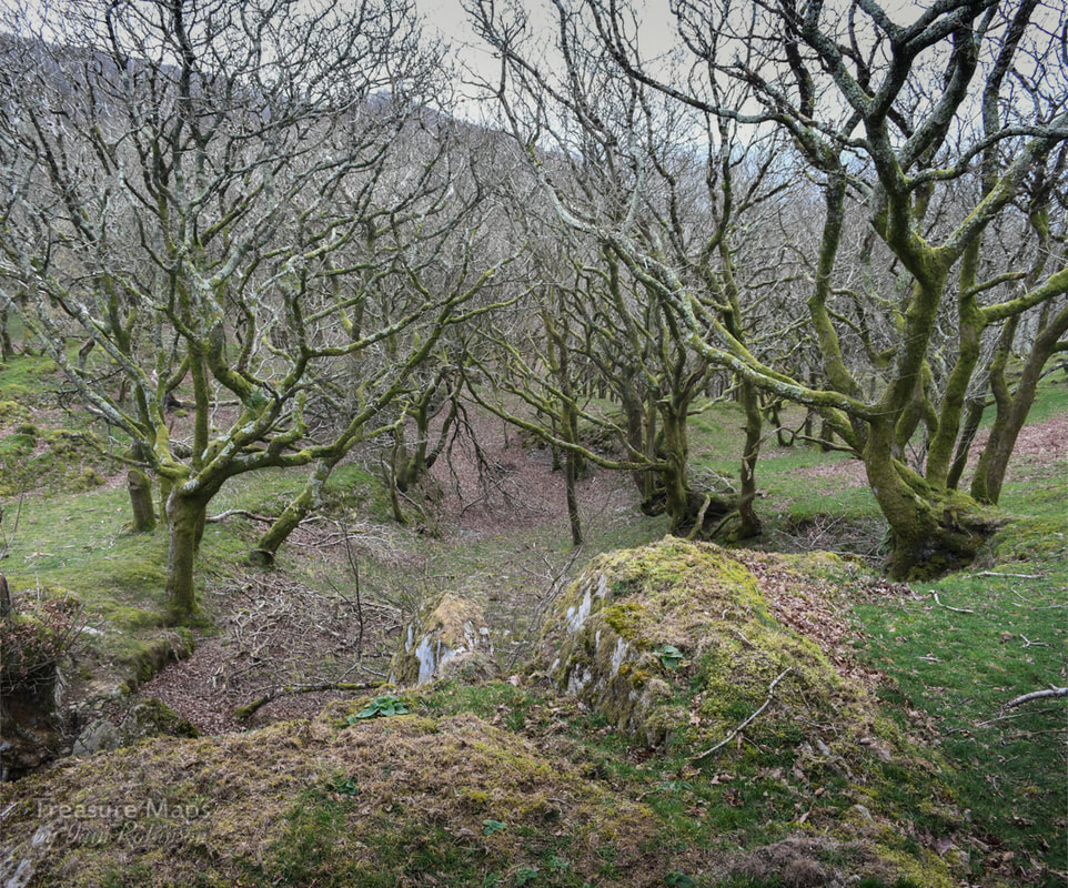 One of the old man's excavations, probably dating from the mid C18. We moved on upward, rejoining the public footpath again, towards the ruined waterwheel house and crusher that we knew waited on clear ground above us. The oak woods here were enchanting, low growing trees contorting their limbs in ever more crazy shapes, masking numerous opencuts made by the "old man*". 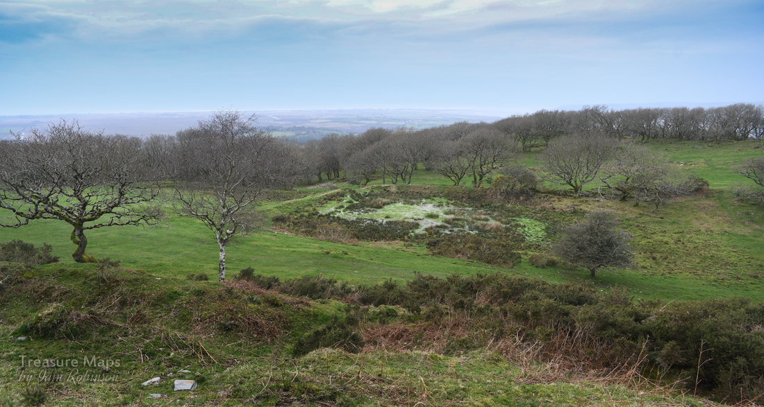 The reservoir, still holding water. Taken from another opencut above. Here and there were suggestions in the ground of leats*, supplying the workings below. Grass-grown tips pointed accusingly from stands of trees, crown holes were disguised by the growth of more oaks. I marvelled at how nature quickly takes back and absorbs the works of humans. Then, we came to an old reservoir with a leat going off to the south. The leat was badly degraded by cattle- the whole area had been poached by them, obscuring the remains. But it was obvious where the old man had been digging the low hanging fruit, areas where gossans* of ore had broken out at surface and been quarried. These workings pre-dated the Victorian miners and could date back to the C17th. 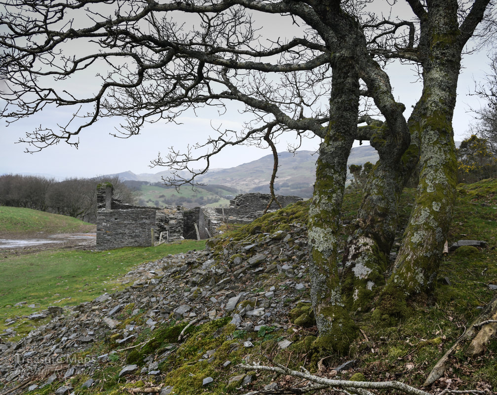 The waterwheel pit and crushing house seen from an old shaft collar. Then we climbed up to the wheel house and crusher building. It was an impressive structure and very well-built, although repurposed to some extent by the farmer. Rusty old gates and farm junk lay around while the structure itself was marooned in a sea of cow poo. The farmer here was obviously doing his bit towards climate change. Nearby were the various shafts sunk to Hallet's level. The spoil here was the real deal, rich in quartz and other minerals. As if to confirm, small craters had formed where mineral hunters had been "mining "for the rare specimens that have been found here. Further to the south, along a public footpath, we found another major shaft and some stoping breaking out to bank. The shaft was interesting in that it had a masonry support to the side that might have housed a sheave to haul material up, perhaps worked by a horse-whim*. This was all very intriguing - the visit had exceeded our expectations. We had an idea to walk along the footpath to the east towards the nearby Pensarn mine and on perhaps to the megalithic site of Bedd Taliesin, but the footpath through the farm was like the Ypres salient rendered in cow poo, so we headed back down the woods the way we had come. 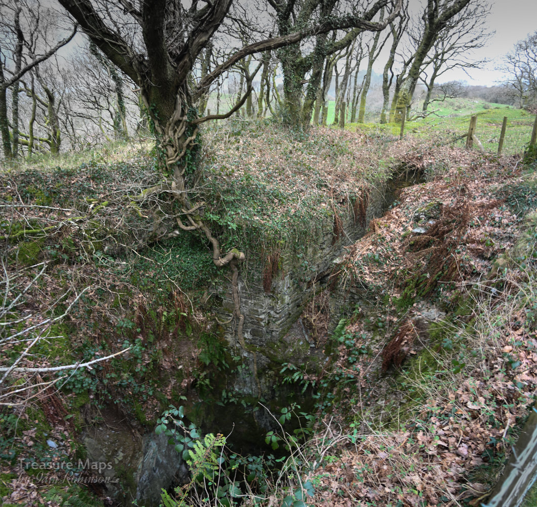 The shaft with masonry support/re-inforcement, top right. Later, we took the car up to Pensarn, only to find that the site of the mine was being used by a contractor to quarry gravel. The horse whim circle and structures described by David Bick were gone. The waterwheel pit beside the road appeared to still be intact, but by this time I felt too upset to continue. As for Bedd Taliesin, again, the farmer hasn't really been taking care of it. A vast pile of almost prehistoric silage sits nearby, filling the air with the smell of rotting vegetation, while it is quite a challenge to imagine anything historic, let alone Neolithic about the site. The precious signs and signifiers of our landscape, left in the hands of a bunch of philistines. We had taken the minor road up to Bedd Taliesin from Tre'r-ddol- a route I would not recommend. Although it is beautiful and interesting, passing the site of more vestigial mines, it is a very narrow road. I will let the photograph below, from John Lucas give the idea. 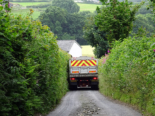 "Not a lot of room"... between Pensarn and Talybont. © Copyright John Lucas and licensed for reuse from Geograph under this Creative Commons Licence. Cardigan Bay Consols/Bryn Arian Mine Factoids Bryn Arian means "hill of silver" - a tad optimistic perhaps. While most latter day mining went on here between 1845 and 1876, the site had seen a great deal of attention from the "old man", at least a hundred years previously and possibly earlier than that. Mining records from that period are scarce, but it is clear that a great deal of ore had been won. When driving the adits underground, miners would encounter where they thought the lode would be only to find that it had already been mined out from shafts or adits long since run-in. Earlier I mentioned a horse whim that possibly wound the New Boundary adit- this was an embarrassing moment for the mine's proprietors, when they discovered that the original Boundary adit ,below the track at the foot of the woods, lay on the Llanhir sett- and the owners refused them access from the adit! Thus a new adit was dug on the revised boundary. I wonder who was rapped over the knuckles for that misinterpretation of the sett plans! Like many concerns, the mine seemed to exist solely to bankrupt the companies who beat a path to it's portals. One of the early proprietors, a London company, lost £10,000 in the late 1840s, followed hot on their heels by Waddingtons of Leeds who lost £6,000 and Silk and Co. of London who lost another £5,000- and these, of course, were big sums for those times. The final coup de grace was administered by the mine to our old friend the Cwm Dwyfor Company, to quote David Bick: "Owners of a remote and worthless copper mine near Portmadoc (sic)" They flogged away until 1886, having found no ore whatsoever! While we were traversing this fascinating site I did wonder if I could hear the old man laughing still. The mine also had a laugh at my expense, since when we got home, I realised that I had missed a couple of features on the ground, notably the boundary adit near the lower track and a waterwheel pit in the woods. It's not too far to go back, though- and have another breakfast :-) *Glossary of some terms used that may be unfamiliar: Adit- a tunnel driven for access and drainage. Gossan- The weathered upper part of a lode. Lode- Mineralised ground containing ore, often along with valueless material such as quartz. Lodes are usually vertical, 20 or 30 feet wide and can extend for miles. Opencuts- quarry-like excavations on the lode often dating from ancient times. Whim- a large windlass worked by horses, steam or water power. The old man- a term for the original miners, perhaps from bronze-age times, or from earlier than C17. Nowadays explorers refer to anything pre- 1940 as the old man. Leat- also lete or leet, or millstream) is the name, common in the south and west of England and in Wales (Lade in Scotland), for an artificial watercourse or aqueduct dug into the ground, especially one supplying water to a waterwheel or reservoir. Sources and further information: "The Old Metal Mines of Mid Wales" Part 3, North of Goginan- David Bick, Pound House Press 1976 British Mining No.93, "Mines, Trials and Lodes of the Glandyfi Tract" by David M. D. James. Page 83 onwards. "A Guide to the Industrial Archaeology of Mid-Wales", Association for Industrial Archaeology: 1984. Link here 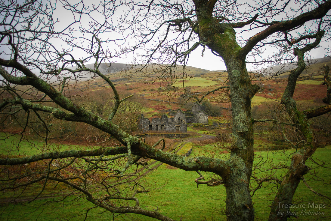 Our first sight of Bryndyfi from the farm track. Bryndyfi Driving south from Machynlleth on the A487, the amateur mine archaeologist becomes preoccupied -the practised eye picks out feint, telltale signs of mining in the lovely wooded slopes either side of the road. It's a dangerous business as the road is a busy one and the tankers of a certain milk contractor don't take prisoners. After Furnace (there's a clue there...) toward the old mining village of Taliesin, it becomes ever more difficult to keep eyes on the road- this was quite a place back in the day, with mines actually in the village and a tramway running through it. The area is part of what is known (by geologists, at any rate) as the Glandyfi tract, a zone of mineralisation caused by faulting in sedimentary Ordovician rock systems and the resultant deposits of ores- firstly in liquid form, latterly as solid deposits of lead and copper ore, notably in "pipes" in the rock. 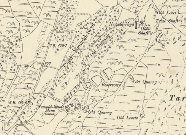 Map by kind permission of the National Library of Scotland from their archive (click the image to go to their site). Note that the mine is denoted as the Neuadd lwyd mine. (Ordnance Survey six-inch, published 1906) Sadly, the remains of these mines are ever more difficult to spot in the field due to "landscaping" and the filling of shafts for safety reasons. They are rather shy and retiring places at the best of times- sometimes our mine senses are telling us there are mines nearby, and it's not until we check the old maps that we realise that we were quite close to an interesting feature. One of the most intact mines is Bryndyfi. It's in a beautiful situation, on private land where permission has to be sought to gain access. It has been a contraversial mine, as it was opened in a great fanfare of publicity in 1880, with much expenditure on a mill at surface, only to close a couple of years later. There are tales of skulduggery, with ore being brought in to dupe investors. Claims that adits had been driven through "a hundred fathoms of continuous ore" and "120 tons of dressed ore at surface"...yet the mine only sold 24 tons of lead in it's short life. The ground was good, there was little pumping needed, nor was transport a problem, with the Cambrian Railway only a couple of miles away...there was no excuse for the failure. 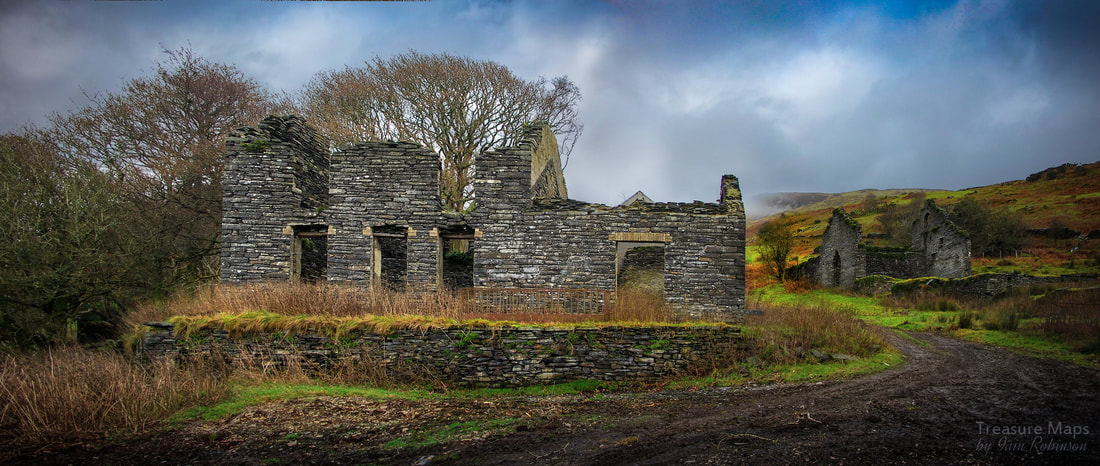 The mine office and manager's house. You would have thought that in the latter part of the C19, after so many deluded mining schemes, people would have become wise to the ways of speculators, but it seems that there were still many greedy folk keen to make some easy "folding". The scheme was mistakenly endorsed by the eminent mine engineer David Davies of Oswestry and, in fairness, it was not far from other mines in the Glandyfi tract such as the Alltycrib, or the Brynarian which did produce returns on investment. Sadly, the mine failed just as the machinery was being installed in the new crusher houses and mill. I guess it employed some local men for a while (over a hundred were engaged) and even now, the remains are impressive. 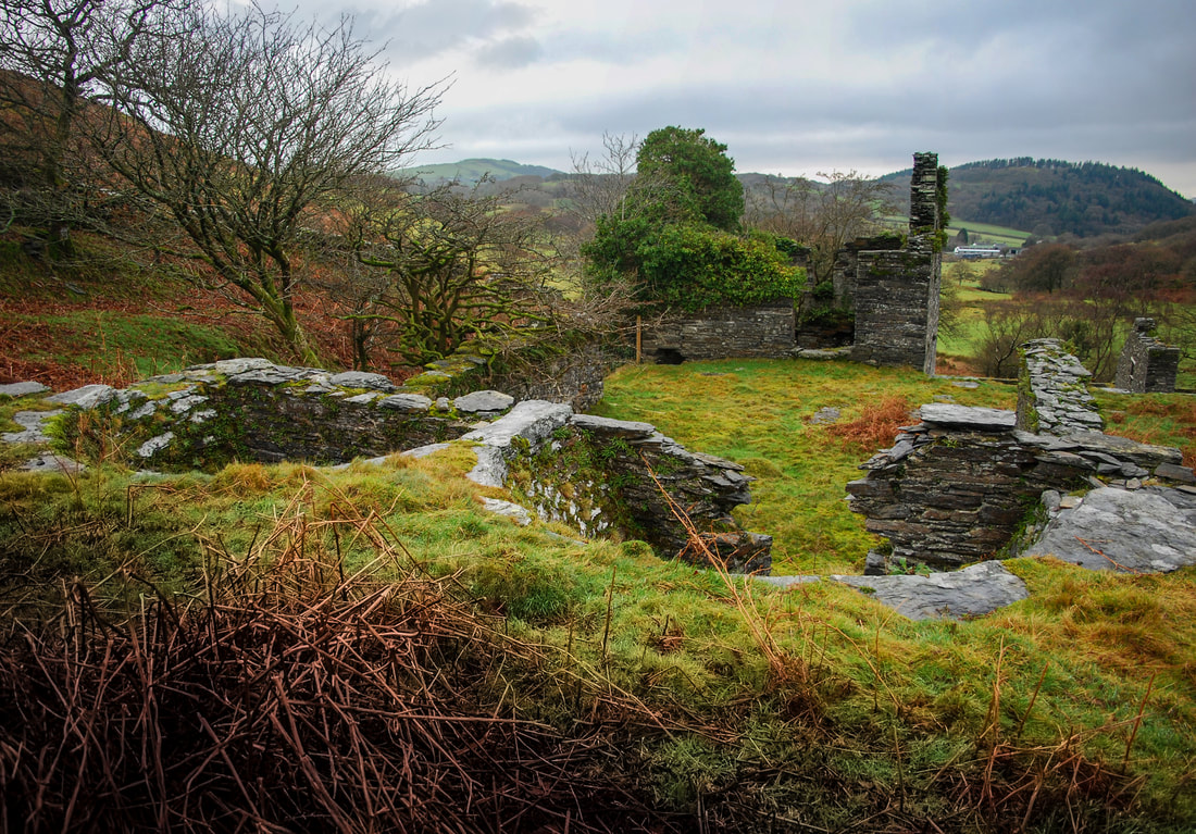 The ore bins, looking towards the crusher house and waterwheel pit to the left. There's a fine crusher house, with a 45 foot wheelpit and some well-preserved buddles and flotation pits - and the remains of a 22 foot wheelpit beside them. The office and manager's house is a fine range, and the tramway is evident throughout most of it's length. We failed to locate the adits, although the mine adjoins some rough hillside and we were sidetracked by some features that we thought were mining related up there...they weren't! There are two reservoirs for the waterwheels which are a very attractive feature- the tramway runs through a stand of fine oaks, their tortuous branches lending a gothic air on wintry days. The mine is located at SN684935 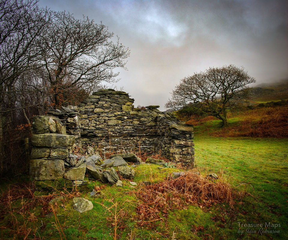 The remains of the powder store. Ystrad Einion Another mine, with similar remains on the ground is not far away in the Artist's Valley near Furnace. Ystrad Einion was featured on my original blog here and here but we returned recently for a wander underground with better cameras and found it pretty much the way we originally encountered it in 2010. It's just off the Furnace turning, about 3km up a narrow road with few passing places. On our way up, I joked to Petra that we might see Robert Plant, since he has a house at the end of the remote valley here. Almost as soon as I had said it, we encountered a very expensive car coming the other way, cautiously towards us. Seeing our very disreputable looking truck, and after the customary polite hesitation, the car gingerly started to reverse for fifty yards or so to a passing place. When we passed the car and exchanged smiles and waves, of course, we saw it was Robert Plant! I've never been keen on "Dad Rock" but I have to say that he's a very pleasant chap. 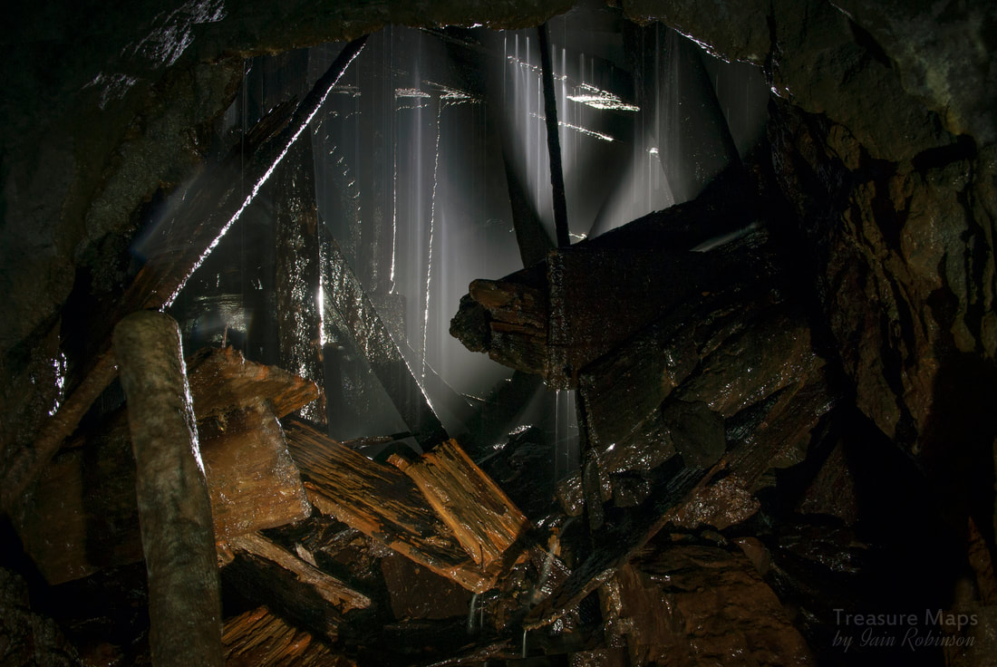 Ystrad Einion is a little wet underground, but it is probably what preserves the unique waterwheel... 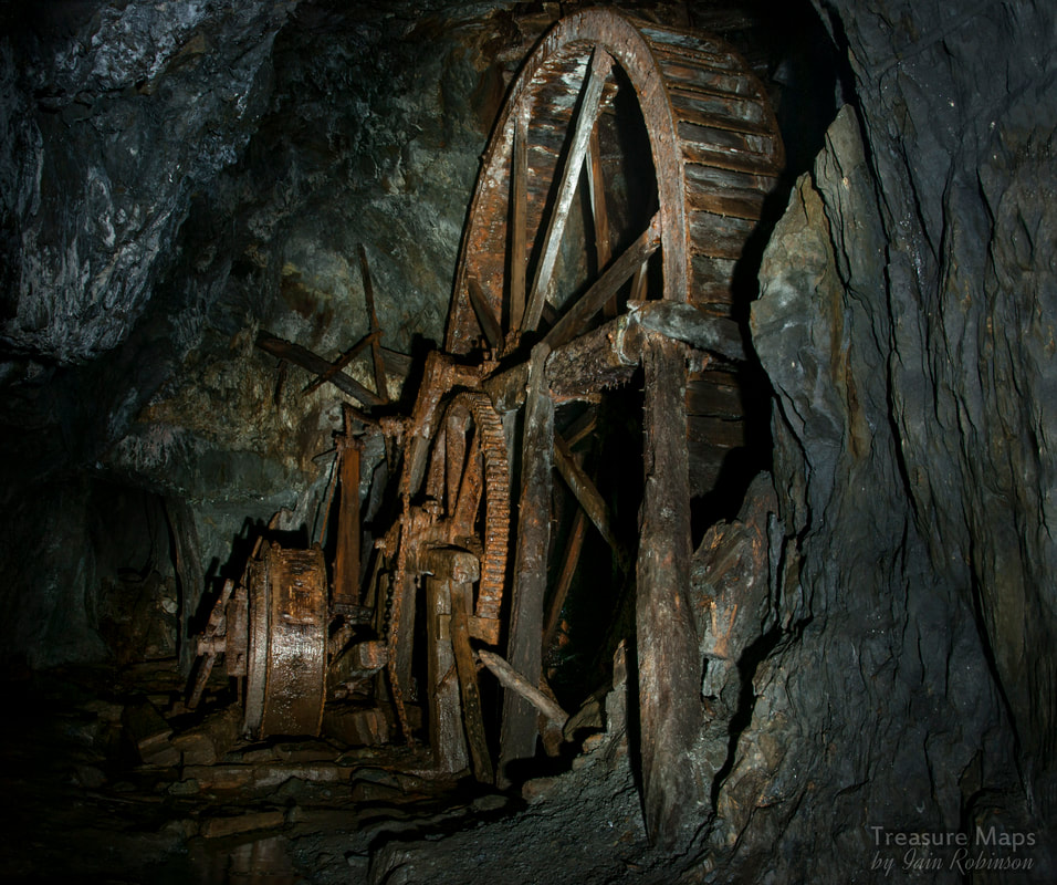 Ystrad Einion's wonderful underground waterwheel. Ystrad Einion produced some lead, zinc and copper. It was first worked about 1700, and again in 1745 to maybe 1760. The next recorded working was in 1853 but this only lasted a year. In 1855 the mine was again taken up, and continued to work occasionally to 1901. Recorded output is very incomplete, only recorded after 1845: 9 tons of lead ore 79 oz of silver ( from 4 tons of lead ore) 10 tons of zinc ore 45 tons of copper ore Incidentally, the correct local pronunciation of the mine is not what you would at first imagine. It sounds like "Ustra-dayneon" Grid Reference: SN707938 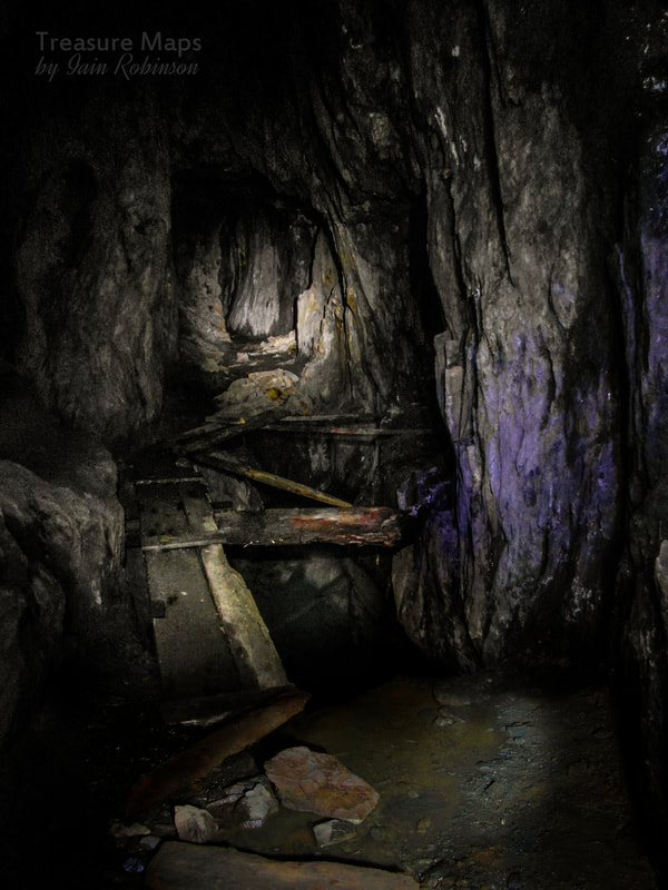 Sources and further information: "The Old Metal Mines of Mid Wales" Part 3, North of Goginan- David Bick, Pound House Press 1976 British Mining No.93, "Mines, Trials and Lodes of the Glandyfi Tract" by David M. D. James. Page 74 onwards. "A Guide to the Industrial Archaeology of Mid-Wales", Association for Industrial Archaeology: 1984. Link here  A collection of vehicle bits at Bryndyfi.  Oak trees near the Tramway at Bryndyfi...photo by Petra. 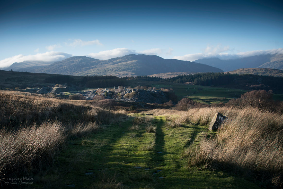 Rhos, from the footpath that goes from Dolwyddelan to Pont Cyfyng. Rhos and Foel are two interesting quarries on the south eastern flanks of Moel Siabod. They are most easily reached from the public footpath which starts from Pont Cyfyng, on the A5 about a mile from Capel Curig. This is also one of the popular routes up to the summit, although we have never found it to be unduly busy. The first time I saw Foel quarry was from the summit of Moel Siabod, one chilly February afternoon in 1984. We'd walked up from the Pen y Gwryd hotel, on the western side- I was fascinated, but there wasn't much info available then- seven years before Alun Richard's Slate Quarry Gazetteer masterwork -and at a time when the internet wasn't the pan-global information superhighway that it is now. Many years later, we managed to get to the two quarries. Rhos is the lower one, a delightful place, although technically out of bounds, due partly to dirt bikers making a nuisance of themselves. There are "No Trespassing" notices; although we have been a few times and have been quiet, unobtrusive -and un-noticed. The way up goes past some old miners cottages and beside a series of inclines to the left. At first, you climb up a steep tree lined road, beautiful in summer and autumn, then on to the open moor, where wonderful views are on offer, if the day is clear. 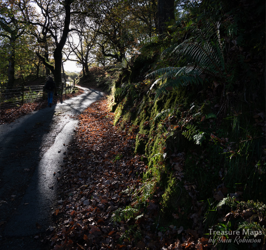 The sylvan approach just before the moorland opens out. You walk up past a steep detour to avoid a farm and then past a holiday cottage. Through the gate and you are on to the moor proper, following a rough road- you can see the Foel incline and drumhouse ruins to your left. After a few hundred yards, there will be a gate to the left where a rough trackway goes due south (SH 73011 56573). The temptation now is to keep going, as the view of Moel Siabod is enticing. But for the keen quarry enthusiast, the ruined barracks of Rhos is already exerting a strong pull. In situations like these, my head is whirring with f numbers and ASA settings, thinking about the best photographic approach. Then, after all that, I usually end up forgetting to change some setting and find I have been shooting all day on f3! 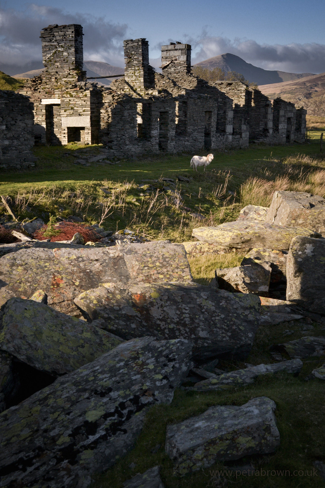 The cottages housing the workers at Rhos- photo by Petra. We've been here a few times, in varied weather conditions, as you might see from the photos. Walking along to the row of cottages, we were aware of the outline of the Carneddau mountains to the north west, with the peak of Pen Llithrig y Wrach (slippery hill of the witch) looking very impressive, then the massif of the Glyders to the west. There were feint clouds draped lazily over the summits, clearing and then returning depending on the wind. 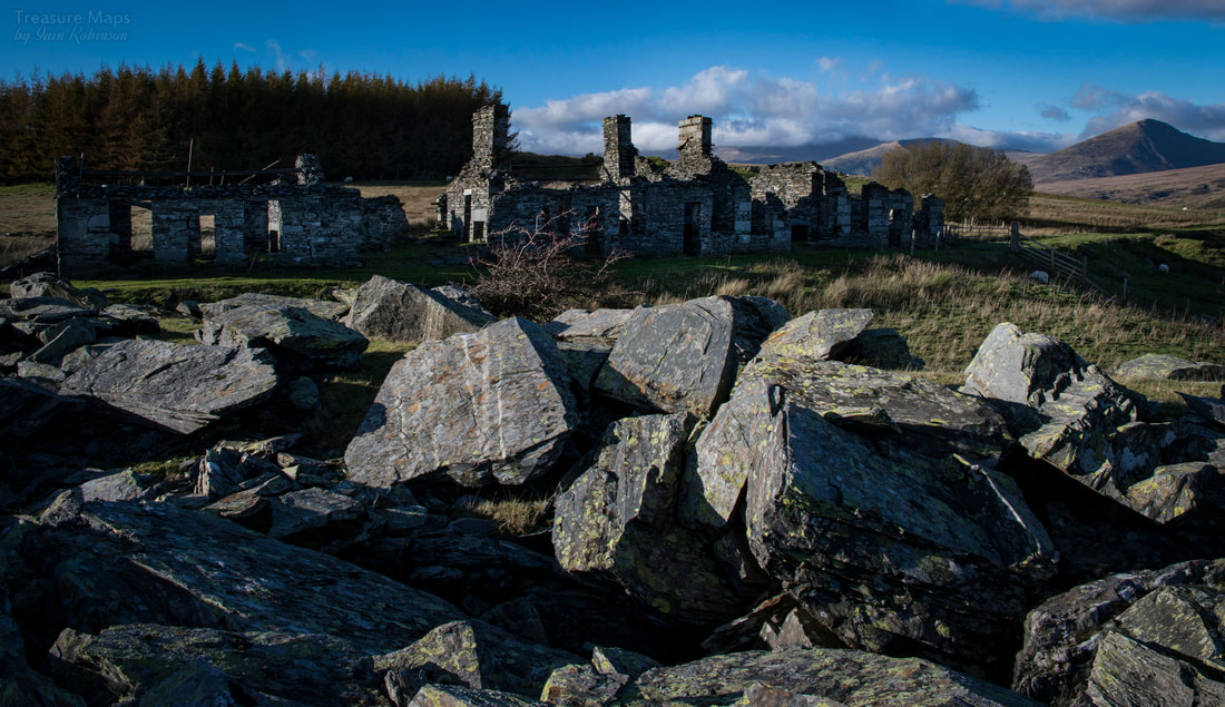 The barracks cottages- the left hand structure is a smithy. There's much to see and to fossick over, bemusedly, here. A large pit and an equally large roofless mill, now lying in some disarray, but with roof timbers and some ironwork still strewn about. The tips from this level are impressive and are currently sporting some fine specimens of birch trees, the first colonists of a slate quarry. 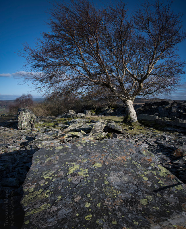 One of the birch trees on the tip- equally impressive is the Geographicum lichen along with some grey crustose lichens, often found together on slate. The tree seems like a witch presiding over the rocks! Rhos was a very productive concern and didn't close until the early 1950s, which explains why the structures are still in reasonable condition, compared to other disused quarries anyway. The pit is a deep one, but like many pits, difficult to photograph meaningfully- that's my excuse! Water power was used extensively. There were reservoirs above the quarry, two of which are now dry- (the dam can be seen at SH 72744 56180) while a larger one can be seen beside the path up to Foel. 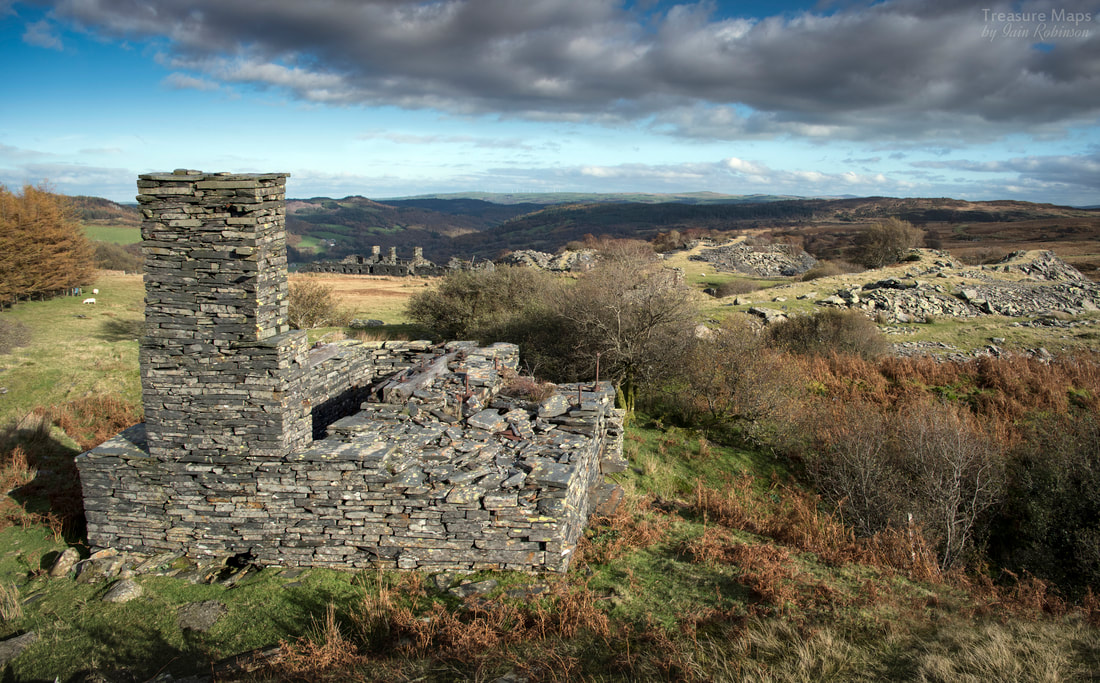 The top waterwheel pit at Rhos, with the barracks in the background. The tower would have been a launder pillar supporting a wooden trough to carry water from the reservoir. Beside the mill there are a couple of structures, one an office with curious arched windows. An opencut goes to the lip of the pit where what looks like some kind of Chain Incline arrangement was sited to bring product up from the pit to the mill. Huge concrete blocks lie as if from some giant child's lego set, discarded because the tea-time call went up. I guess they must have been machine bases. 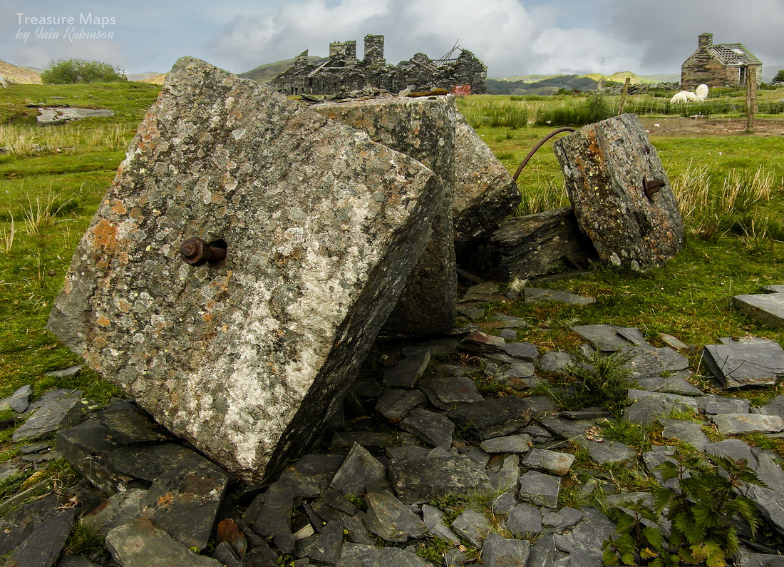 Giant Lego bricks... Venturing lower down the hill, another water wheel pit can be found, and a flooded adit into the base of the pit. It was very overgrown and not too enticing. 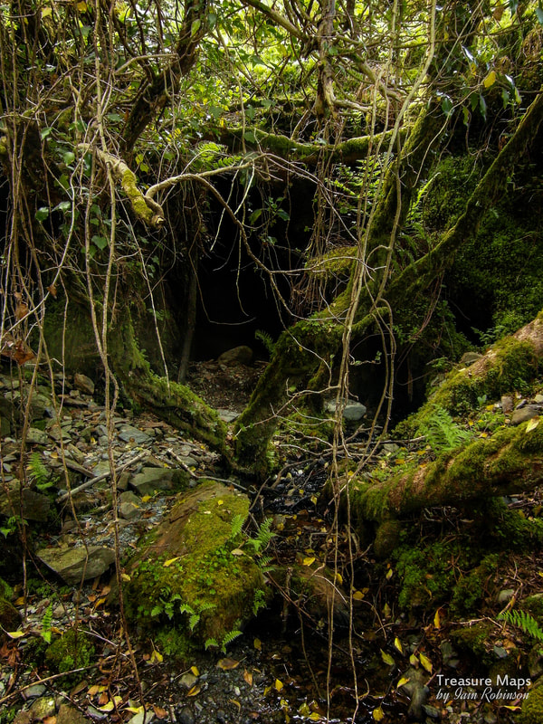 The lower adit entrance into the pit. This was used for tipping waste- all product, good rock etc, would have gone upwards to the mill. It wasn't a great idea to site the mill at the top level- it was as if the management thought that the quarry wouldn't go any deeper. Another waterwheel was built in the 1930s to work a ropeway to pull rock out of the pit, this one was sited near the lower adit and can be seen sitting in glorious isolation in a field. Other waterwheels were built near the mill to work the chain incline- a water balance incline had been put in earlier, but that was built on good slate and was quarried away. 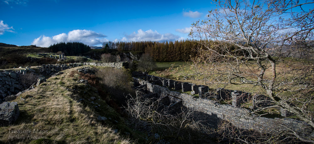 Looking towards the pit with the mill to the right. 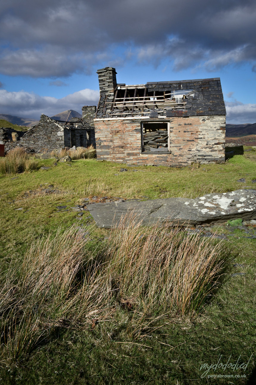 An old weigh-house which seems to have been converted into a loco shed; an inspection pit has been dug in the floor. There was a DeWinton locomotive here from 1898, replaced in 1935 by a diesel locomotive. Photo by Petra. Some Rhos factoids Rhos was that curious thing, a very successful slate quarry. It was opened in the 1850s by John Evans and Ellis Williams, who sold out to a partnership of a Lancashire industrialist and a Trefriw man, who invested in much modern equipment. It was sold again to a Manchester company who had the benefit of the previous spending and reached peak production by the 1870s, with a top output of 1285 tons in 1882. There was a slight decline, but business picked up again in the 1920s with totals around the 1500 tons mark. The demand for slate had then peaked in the industry, but the quarry carried on until 1952, making it the longest working of any of the Gwydir quarries. Latterly it was run by J. J. Riley, a key figure in the later years of the slate industry both here and in Dyffryn Nantlle. The tips were extensive enough to require steam and latterly internal combustion haulage, although there are no details of locomotives used. A link with the Foel inclines was made in 1874 and all produce went to Pont Cyfyng by rail, and then by lorry to the railway station at Betws. 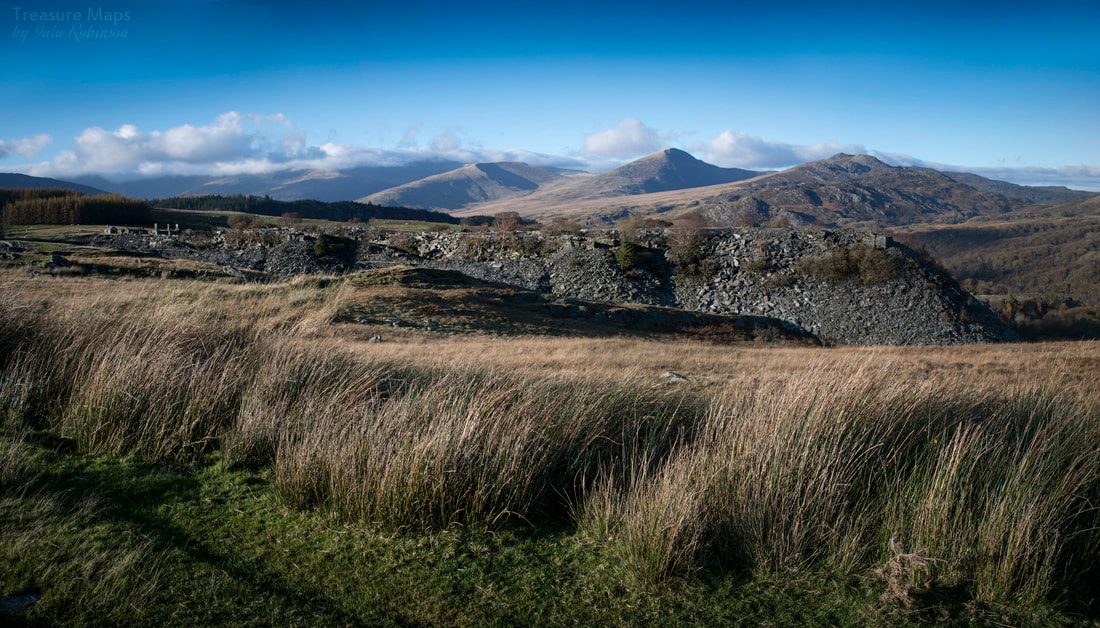 A last look at the Carneddau mountains from the path to the south east of Rhos. Foel Quarry. Now it's time to walk on up the hill for half a mile to Foel. It's a spectacular site, but it wasn't by any means a successful quarry; the rock was not good and the site required extensive inclines and the construction of a mill at Pont Cyfyng, all expenses that just didn't pay off. It was worked in a sporadic way until 1858, when it was taken over by the paper baron, J.C. Fourdrinier, later joined by Joseph Jennings. They invested in sand saws around 1861-3...a small one at the quarry, and a large one at the mill at Pont Cyfyng. This was a spectacular failure. In an equally foolish move, they constructed the inclines, replacing the steep road down to the bridge at road level on the A5. As if the pitches of the inclines weren't steep enough, the "level" stretches between them included spells at 1 in 9!! It couldn't last, and Fourdrinier pulled out, having lost money speculating on similar ventures elsewhere, leaving Jennings with his finger metaphorically in the dam. Work continued, pianissimo, until a massive rock fall in the pit spelt the end for the quarry. Another triumph of optimism over practicality, and in some ways, similar to the story of the Gorseddau concern in Cwmystradlyn. 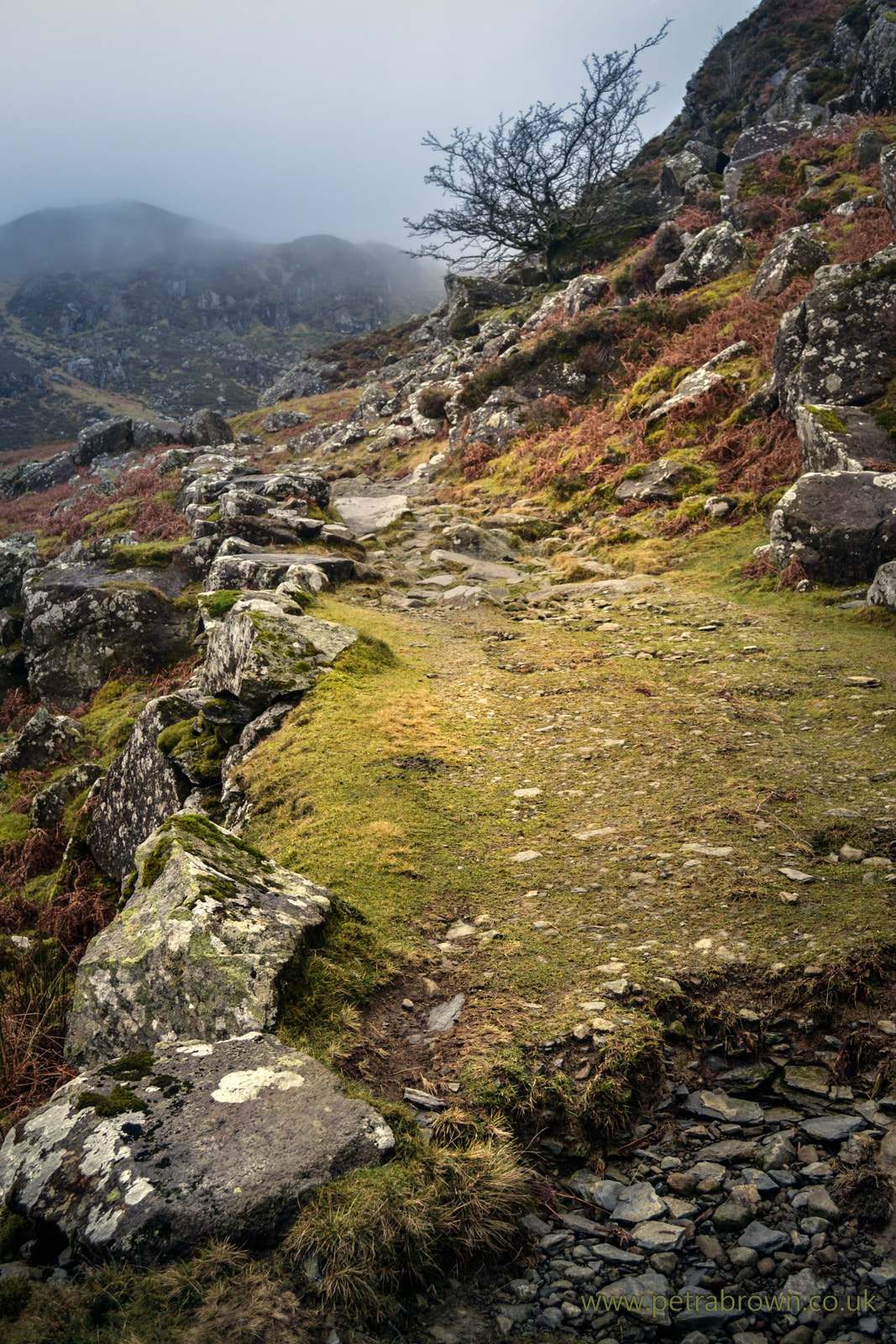 Walking up to Foel on a less than sunny day- but the place is magnificent in most weathers- unless the mist comes down! (photo by Petra) 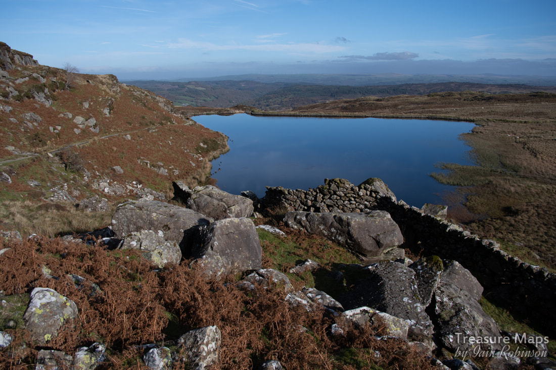 Rhos's reservoir on the way up to Foel. The weather at Foel was a big concern to the workers. They couldn't just build walliau like at other quarries- because of the situation, they constructed massive shelters with baulks of slate cantilevered together for roofs, all in a vain effort to shelter from the elements. I expect that on a fine spring day, the view from these shelters might have seemed idyllic, but then, there would be the memory of that east wind, laden with snow and ice, that had blown through a few months earlier... 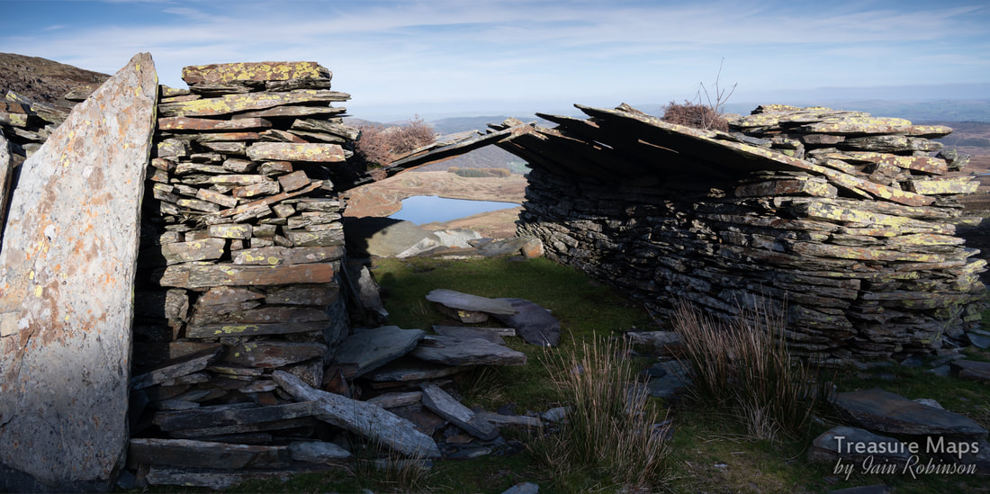 The waterwheel that powered the mill had to be shielded from the weather as in winter, the wind blew the water clean off the wheel. Petra is standing above the wheel pit here on a typically dreich day... 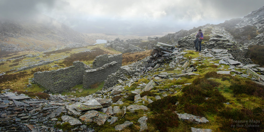 Petra is standing over the waterwheel pit, which was built up either side as the wind here would otherwise blow the water off the wheel! Below are the five floors with mill, walliau, barracks and other ancillary structures. The site is difficult to interpret...there are several barracks, some internal inclines, tunnels to the pit (blocked off) and some intriguing mill ruins- plus a stables and another barracks lower down. There's also supposed to be the base for a horse whim, but we couldn't spot that. The barracks were a very over-optimistic provision, seeing as the quarry only ever employed ten men at best. 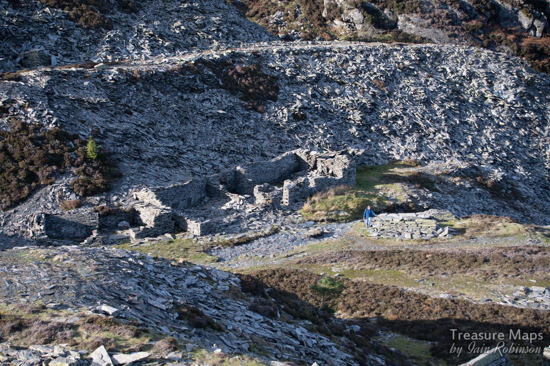 One of the barracks, with Petra standing next to an incline sheave pillar. 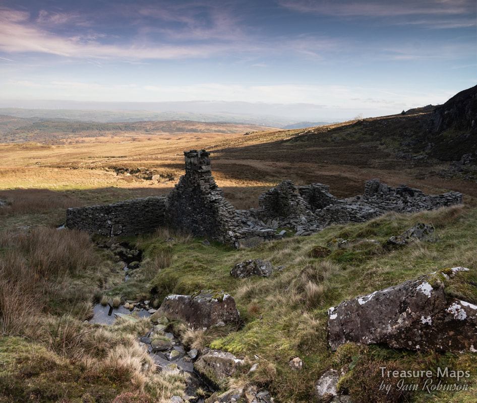 Barracks and stables at the lowest level of the quarry. The horses would mainly be used for hauling the meagre product- and coal and supplies up...poor beasts having to negotiate those steep slopes. The quarry lived on after closure, renting it's inclines to Rhos and suppying water from blocked up tunnels in the pit. The site would repay a closer examination than we have been able to do on our couple of visits. But it's worth the walk just for the view on a fine day, to sit and wonder about the poor souls, men and animals, who had to work through the merciless winters here. Foel Factoids Foel was first opened by a local man, John Hughes in 1836. This might have been the heyday for the quarry, as he employed up to 48 men, but abandoned the place shortly after in 1840. It was never to employ more than 10 men afterwards, despite having six working floors and two short access adits. Annual tonnage rarely exceeded 500 tons. What is a "Sand Saw?" "Evidence for the type of saws used in a particular quarry was sought in the sawn-end offcuts on tips, and in rubble used for building quarry structures. In most cases the saw used was a standard circular pattern, probably the Greaves patent, which involved a slotted table moving against the blade. Offcuts from sand-saws (horizontal saws, in which blades are tensioned in u carriage suspended from a frame and then moved backwards and forwards across the block), with their distinctive smooth lay and ridge where the cut was snapped, were observed at a number or quarries in Dyffryn Conwy and its tributary valleys, particularly Cwm Eigiau (20100) and Cedryn (20106), and it is known from archival sources that sand-saws, once general throughout the county, remained in use far longer here, because they could cope with large slabs and deal better with pyritic rock than circular saws. The Hafodlas mills include the bases for such machines, but no substantial sand-saw remains were observed in any of the sites visited. The Hafodlas mills also provide the best evidence for the use of the Hunter patent saw, with their distinctive machine bases." extract from "Gwynedd Slate Quarries - An Archaeological Survey 1994-95. Report No.154" (G.A.T.)  A sand saw in action from an old postcard. Some assorted photos of Foel... 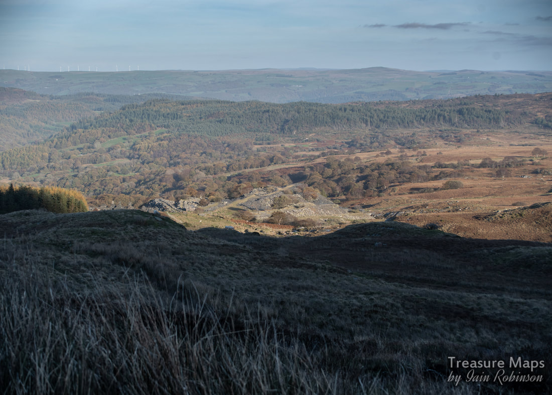 Looking at Rhos, from Foel. 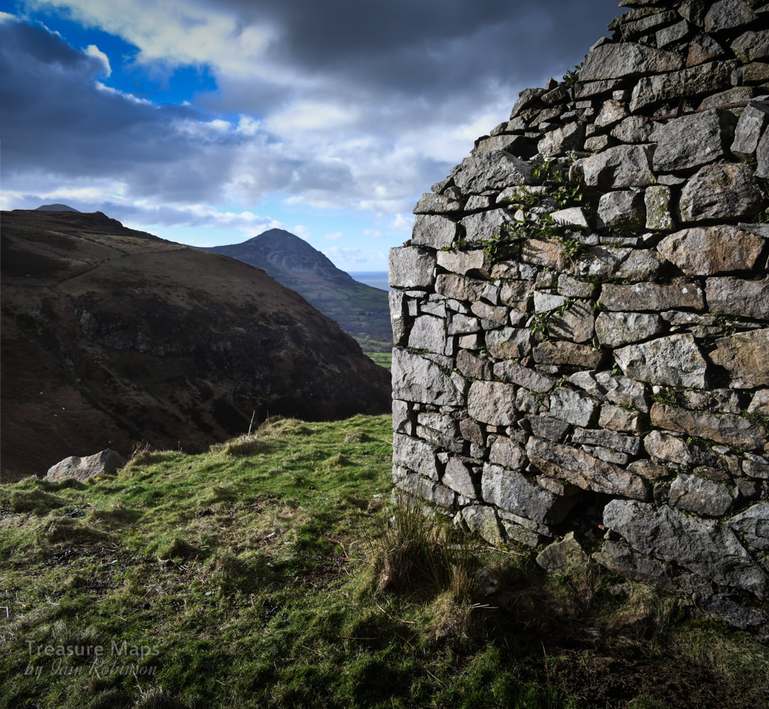 Trefor and Moel Pen-Llechog from the level 1 drumhouse. Tan y Graig means "under the rock"- a good description of this quarry. It is a place we have often glimpsed as we passed by on the A499, after visiting Trefor or one of the other granite quarries on this part of the Llŷn Peninsula. Last week, we decided to take a closer look. It turned out to be a very enjoyable walk, not too taxing after a winter when we haven't been able to get out too much. But no amount of determined pedalling on the exercise bike prepares you for the real thing, slugging up a steep hill track, sun in your eyes and the freezing air biting your lungs- bliss...right?  Our starting point, the cycle track on the A499. We started at the beginning of the cycle track off the A499 at SH3838046491. It's a short step along the track to a gate and a footpath marker leading to the accurately named "Rock Cottage", a sweet property that looks as if it might have been a quarry manager's house. There was an amusing decoration on the gate post which caught Petra's eye... 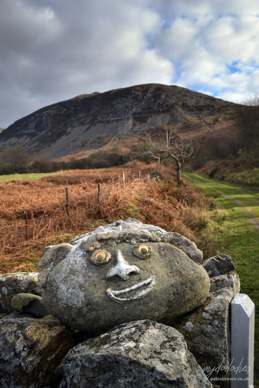 Photo by Petra The path, on the route of the Llŷn Peninsula Coastal Path, starts to climb up past a set of abutments from the quarry incline, which can be seen coming down from high on the hill above. Our way seemed to be determinedly heading away from the coast, but never mind... The incline seems to have passed over the trackway here. According to the old maps, there were extensive tramways converging on the shore and a loading quay. sadly, most traces of the tramway have been absorbed by the landscape and the quay is only visible as a set of stumps below the waterline. It's confusing, as the old map marks at least three inclines, and all are visible in some form or another. I guess they were developed at different times. We passed an unusual structure which I feel may have been the powder store just before the track does a jink uphill to the right and starts to become steep. 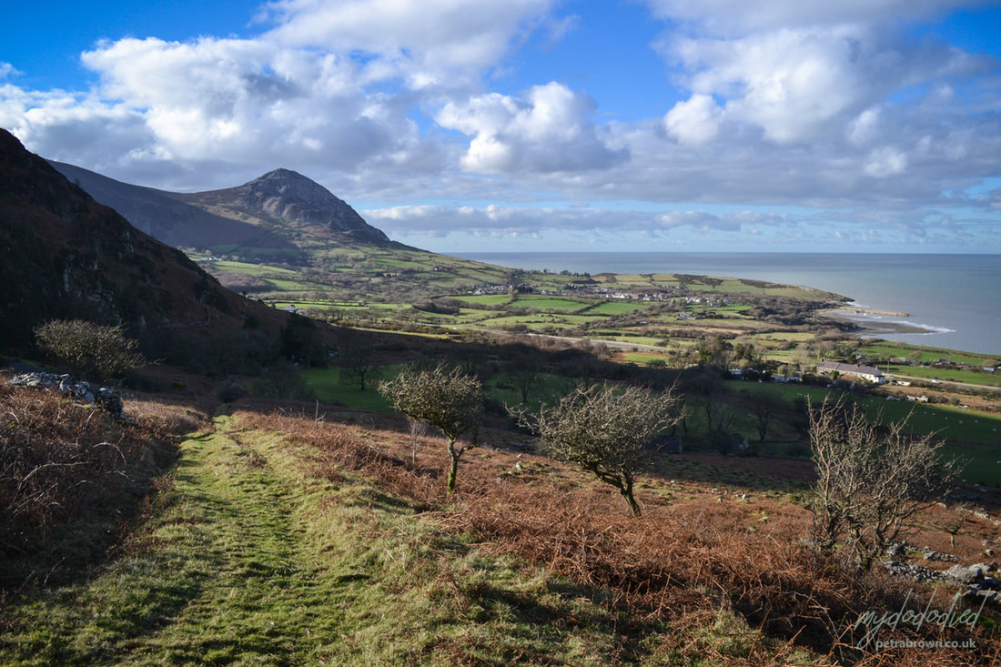 Petra's photo showing the workings of Trefor in the distance- and the possible powder hut on the left of the track. Soon, the path passes between shoulders of rock on either side- two of the inclines passed over the path at this point. Already, spectacular views were opening up below, notably the village of Trefor and it's small harbour, now bereft of the old stone loading quay which became unsafe a few years ago. We could make out the iron mine on the headland- and of course, the amazing structures on the hill belonging to the granite quarry. I've covered Trefor quarry in a couple of posts here. 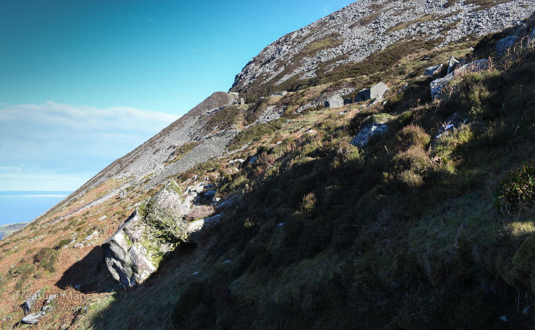 First glimpse of the quarry lower level. It was now a short pull to the first level of the quarry, where we left the coastal path as it forged determinedly inland. That might well be another walk, as there are the remains of a couple of farms and a vestigial manganese working along the path, but I digress. 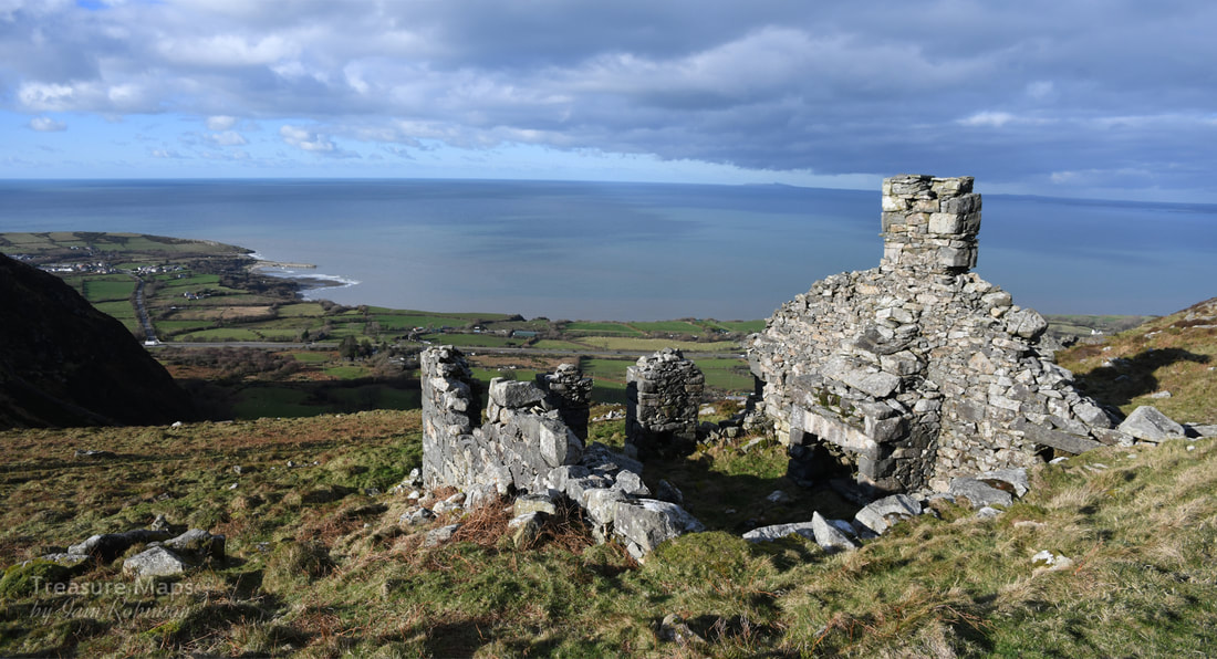 The first of the double smithies that we encountered. No doubt keeping tools sharp was an important consideration in a granite quarry! 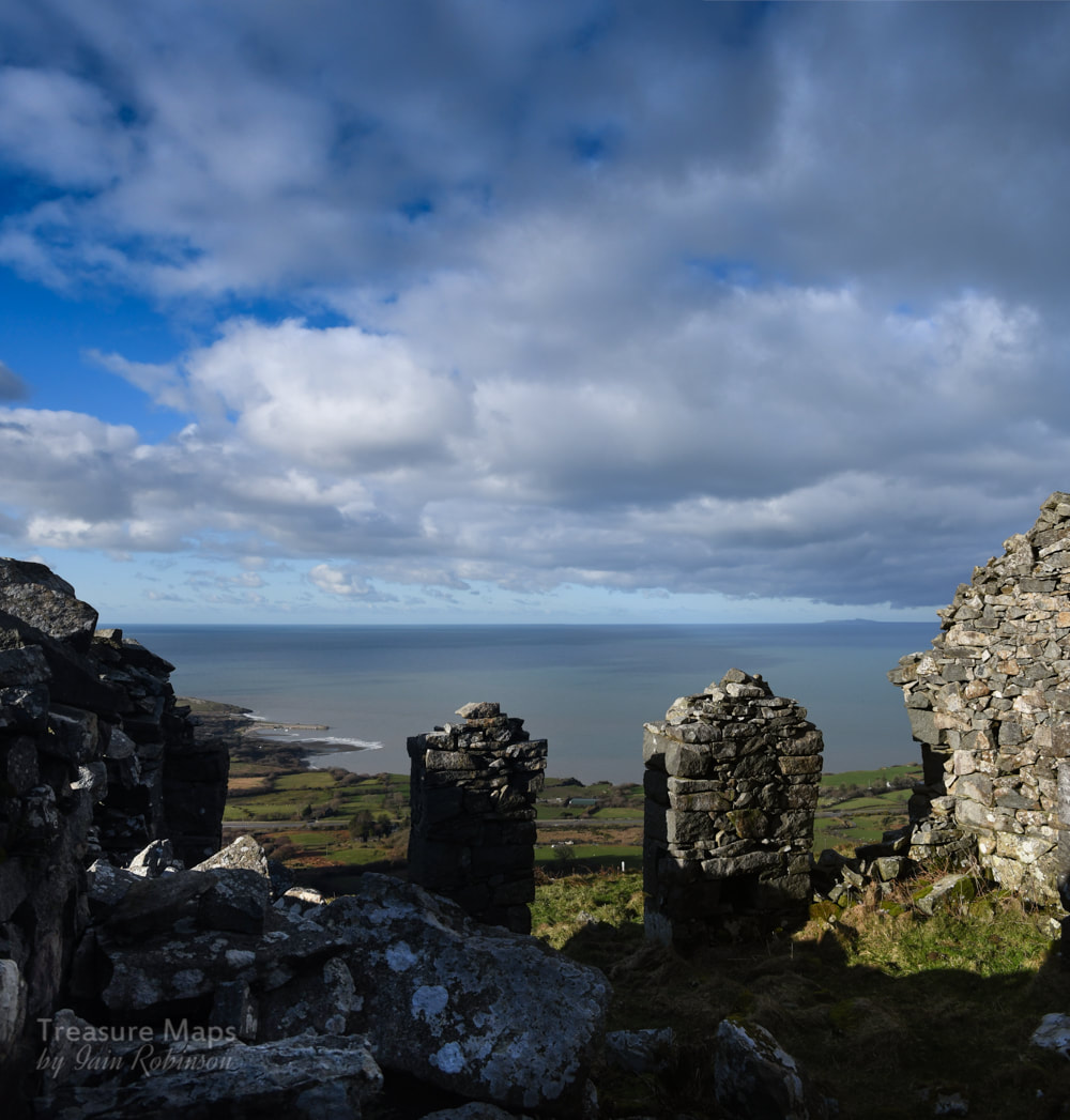 Inside the smithy. We'd seen some buildings as we climbed up, but the level looked even more interesting now we were there. There was a ruined structure slightly above and away from the main workings- it looked like a barracks, so we climbed up to photograph it first. We had a surprise, as it was a smithy, with two blacksmith's forges inside. It was built into the hill at the rear- I can't imagine there would be problems getting the fires to draw up here- the view from the door was amazing. We could see all the way back to Caernarfon and then along the west coast of Anglesey to Holy Island and Holyhead mountain. A ferry was coming out on it's journey to Dublin. Back on the first quarry level we took stock of the buildings and found another pair of forges, attached to what looked like an office. Since the other, upper forges were in better condition, I surmised these lower ones were older. I wonder why they weren't upgraded instead of building a new structure? Further along the level revealed a ruined drumhouse for an incline nestled in against the rock face. I would guess that this was the earliest part of the quarry and that this was the original incline. 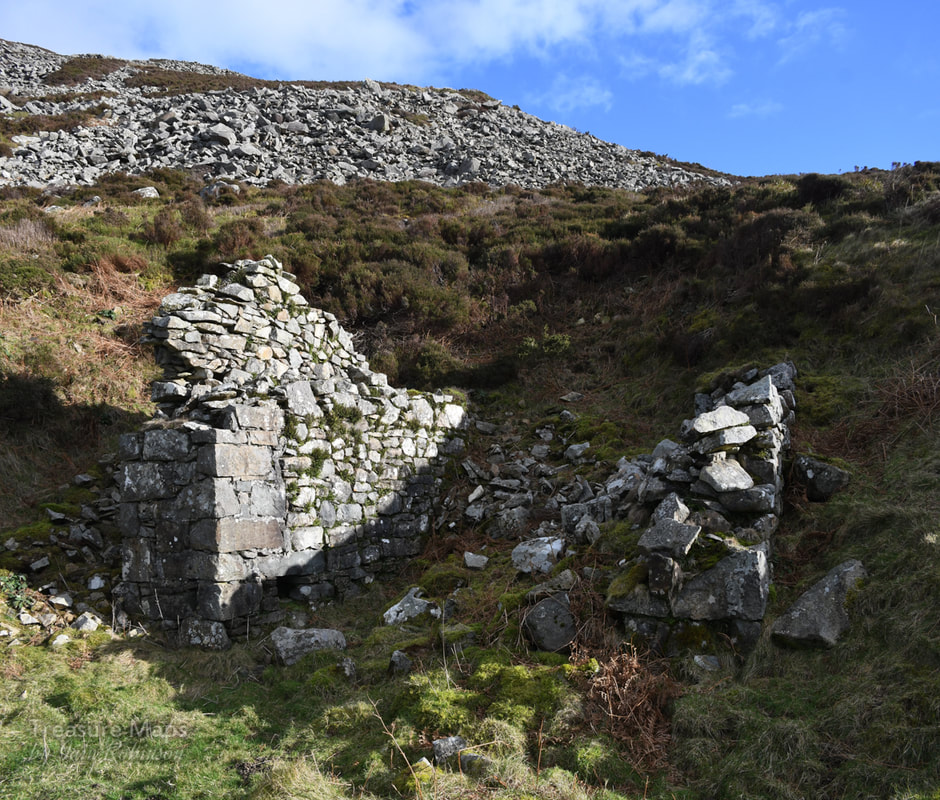 The first drumhouse on the lowest level. Further along the level and some quarrymen's shelters were placed behind another drumhouse. A short incline climbed up to another level and we set off up it to see what we might find. This level sat upon the 700 foot contour- yet for such a small elevation, the views were surprising. This looked to be where the proper quarrying was done- the rock was split and blasted away from the mountain and lay about in a haphazard manner. There were working shelters, ruins without roofs where men would chip away at the stone, fashioning cobbles and blocks with a hammer. Things were beginning to remind me of Penmaenmawr, especially the deep heather covering the floor of the quarry and the elevation. 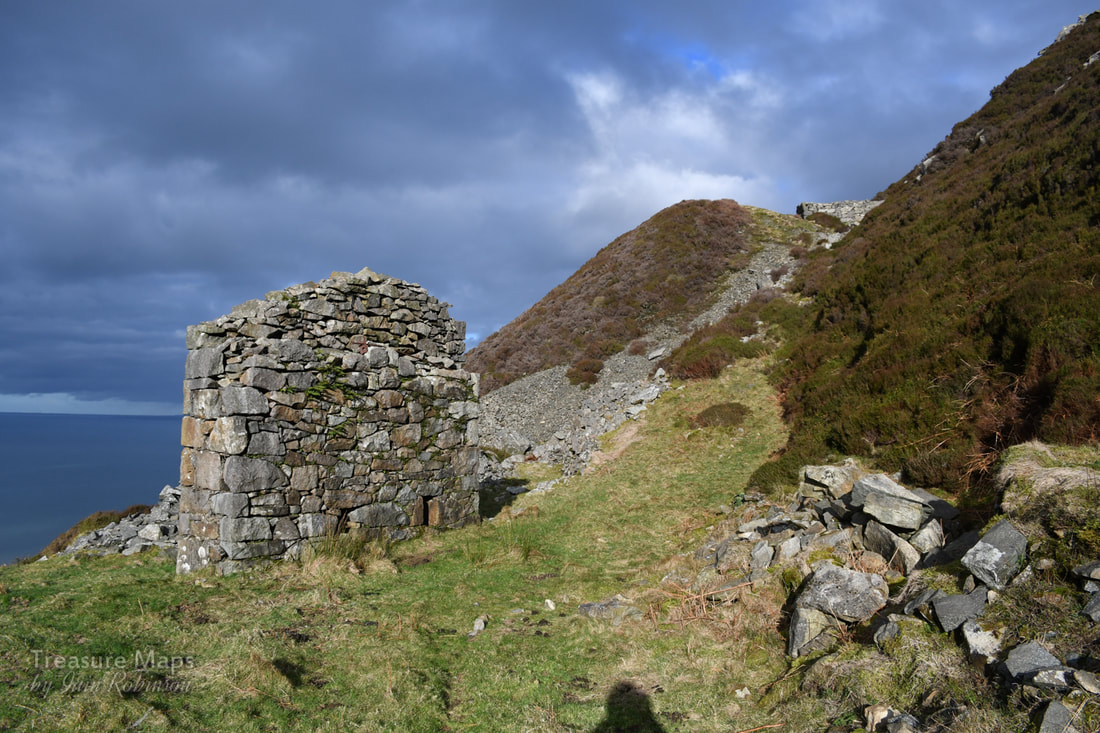 The drumhouse at the north end of the first level. A single sheave, perhaps? There looked to be no sign of a companion wall. We took the sheep path up the short incline to the next level above. 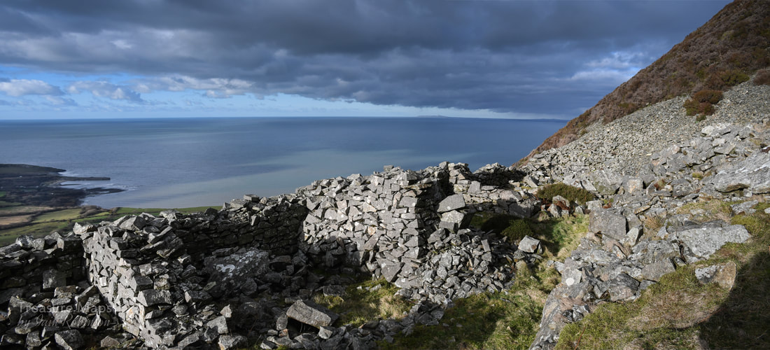 Quarrymen's shelters behind the level 2 drumhouse. Towards the north end of this level a newer range of structures beckoned. By 1913 Tan y Graig Quarry had turned it's production over to roadstone, crushing the stone on site and then sending it down to the quay -as at Penmaenmawr. But here, there was another quarry a couple of hundred yards to the north- a quarry that had a ropeway to the sea. This was Tyddyn Howell, an intriguing site, although one that is almost impossible to access today. As far as I can tell, a new incline built between 1914 and 1920 was below this position- the tramway from this incline went to the yard at SH3955047225. Theres a strange right-angle turn at SH3932447009,marked as a tramway on the 1914 revision of the OS...it must have been a brutal corner! 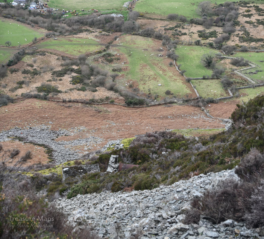 The isolated drumhouse that took the granite down to the Tyddyn Howell quay. On the old 1914 map the route is quite clear, but there's no trace of it today. We could see from the drumhouse on this level, another structure below, a drumhouse with all the wire intact- again, very difficult to access due to land slips. On our upper level, there were more structures - yet another pair of forges and a compressor house, with concrete foundations and holding bolts for machinery. There were sections of pipe lying about which I assumed must have been for compressed air, for the later type of rock drills employed. The structures here were a mixture of cast concrete and granite, showing their relatively modern origins. 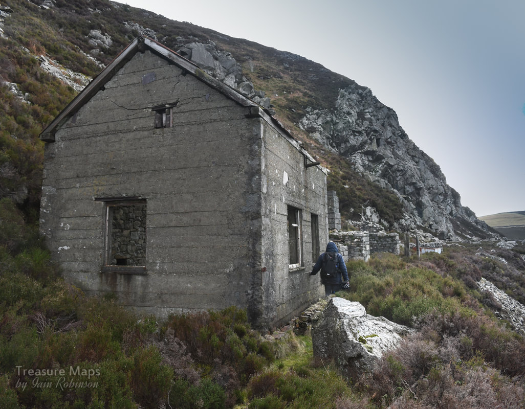 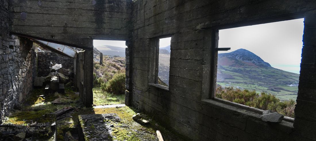 Inside the Compressor House. We set off back, fairly tired after the climb. Coming down, we could make out a square building near the old incline below...this was puzzling, given the location, at a crossing of the two inclines. We left the track to explore, climbing a bank of what looked like fairly new chippings and along to the junction at SH3906346604. After a major skirmish with brambles and a few cuts, we found some quarrymen's shelters and the square structure, which seemed to be a water tank, immediately in front of a set of concrete bases for a machine. Other bases were littered around. Jeremy Wilkinson lists this as part of the National sett quarry. At first I thought perhaps this was associated with what seemed to be a small pit to seaward here, but later I reasoned that it was probably a working area near the base of the inclines where stone could be worked and crushed. 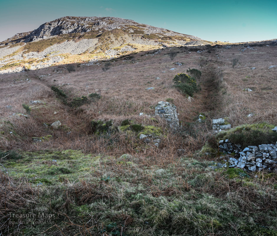 The junction of the two inclines with working area. It may well be worth coming back when the days are longer to check out the prehistoric cairns on the slopes of Gyrn Ddu and the ancient settlement. I will, of course, report it here if we do. We did make one last interesting find as we trudged back to the car, the remains of Tan y Graig farm, a building of some antiquity, now ruined at the base of the hill. It was awkwardly sited for photography and difficult to explore -as the farmer had a penchant for dumping dead sheep in it. Petra braved one rather recent corpse to get a shot of the fireplace. Not a pleasant place- although it could have been, as the ruins were fascinating- but the foul smell drove us off.  Tan y Graig farm...a place of some antiquity with those tiny windows. 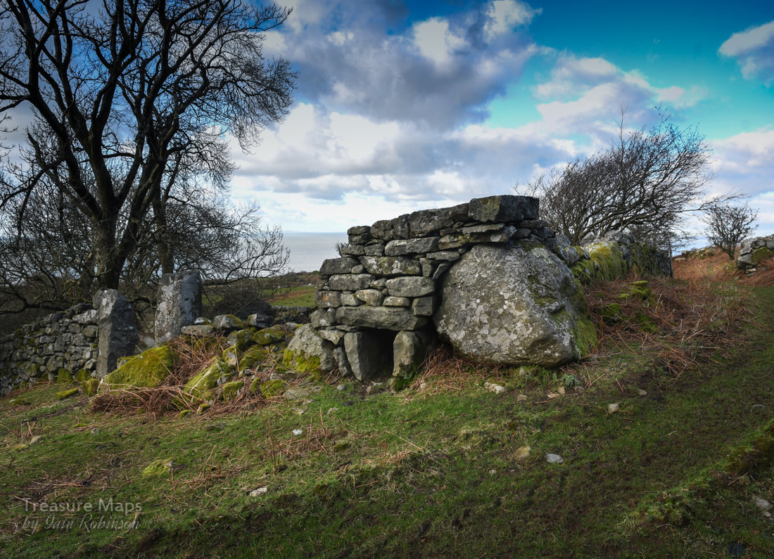 A strange dry stone relic in the farmyard. Some Brief facts-
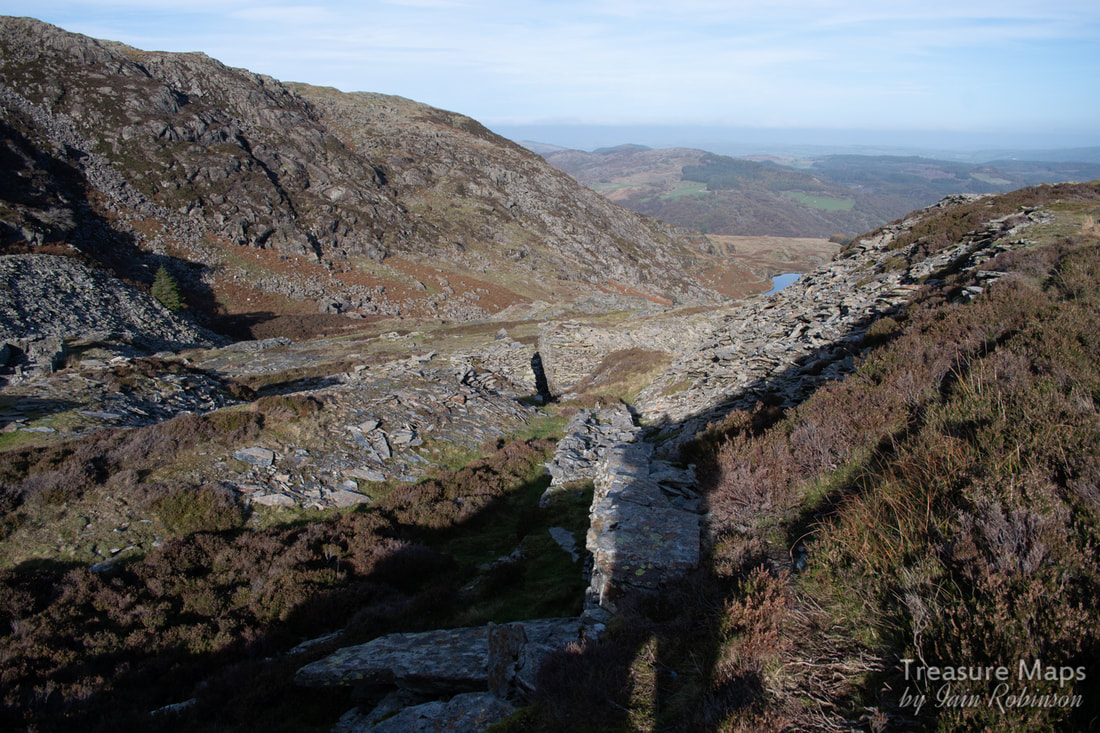
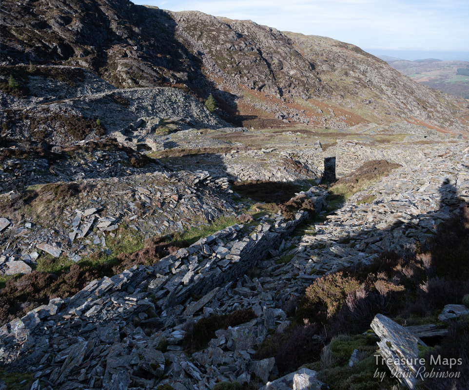
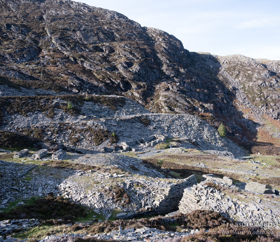
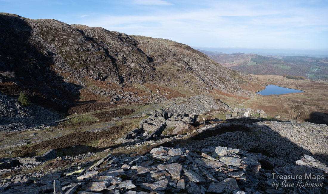
Tan y Graig quarry was operated in one form or another from the mid 1800s until 1880, when it fell into disuse. In 1913 it was re-opened and worked until 1937 at the northern end, when it was working in conjunction with Tyddyn Howell. references- Ordnance Survey, 1888, First edition 25inch Ordnance Survey, 1900, Second edition 25inch Ordnance Survey, 1919, Third edition 25inch RCAHMW AP96-CS 0329-0330 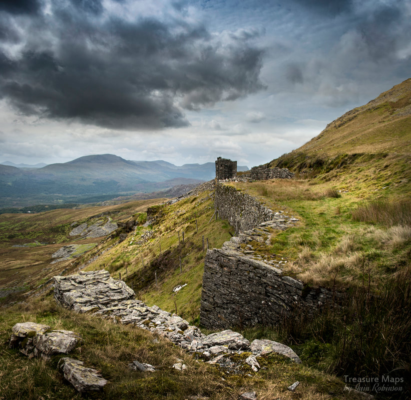 Towards the mill. The first time I made it to the bwlch between the two Moelwyns, I walked on over, bemused at the striking contrast in the landscape. It had been a long day, stravaiging about the hills above Wrysgan and now, time was running out. It would have been sensible to start back down to the dam road before it became too dark, but I was tempted to explore just a little further. I found an intriguing, level mule track, enticing me to investigate-in the dusk light, the silver tips of a distant, unknown quarry seemed to shine, as if phosphorescent. That was several years ago now- and although we have now roamed most of the Moelwyn range I've never forgotten that first sighting of Pant Mawr and it's lower counterpart, Fron Boeth. Yet, foolishly, we've always felt that there were more exciting places to explore, and after all, Pant Mawr is on our doorstep, isn't it? Then, early last summer, I was driving about wondering where to explore. Petra had to work and I was at a loose end without my best pal. I took a right turn off the B4410 after Tan y Bwlch and drove along the narrow lane which goes towards Croesor. The land to the north is infested with forestry plantations. At last, I emerged from the trees onto the moor above Croesor and remembered a parking spot on the right. I stopped and had a coffee from the flask, perusing the map. The lane is a narrow one and I had been lucky not to encounter another vehicle- there are precious few passing places. Now I could savour the perfect coffee and the exquisite view across to Moel y Gest and the sea. Perusing the map, I noted a farm track which seemed to give access to the ridge going up to the Pant Mawr incline head. This was it! My head buzzed with the excitement of the chase...and the coffee, too, I suspect. 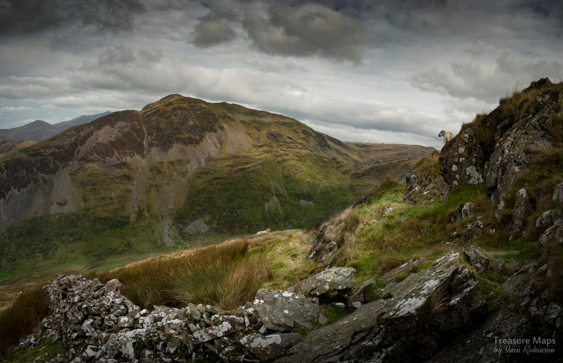 The view of Cnicht as I ascended the ridge towards the Pant Mawr incline head. My parking spot was at SH63464329, a rocky and awkward place, but ideally off the road and out of mischief should a forestry truck or a farmer come along. I walked downhill along the road, through more trees for about three quarters of a mile, passing a couple of farms on the left, until I came to a farm track on the right. (SH6346744001) I had already passed a right-of-way, but reckoned I could pick it up again from the farm track. I had a suspicion that the footpath went through a boggy bit of land and had to cross a stream- why not take the easy way? It was steep going, but gained height quickly- I kept turning round and enjoying the enfolding vista. It was a fine day, a harbinger of the sweltering summer to come. I followed the farmer's road until SH 64082 44511, where it started to decline towards Fron Boeth quarry. For better or worse, I wanted to make that Incline head now, so I struck up along the steep ridge. The footpath wants you to go down the other side, towards the Croseor quarry road, not where I wanted to go, so I kept to the line of the ridge. I noticed the farmer about half a mile below, looking at me with binoculars...I wondered if a "consultation" would ensue, but he buzzed off on his quad bike shortly after eyeballing me. After that, I didn't see another soul all day, although I noticed the summit of Cnicht was busy with folk. Yes, the views of the Croesor valley and Cnicht were becoming rather impressive. It's such a beautiful, if slightly oppressive cwm, one that has been a favourite with me ever since reading J.I.C. Boyd's evocative account of the tramway many years ago when I was exiled in Scotland. From up in my eyrie, I could see the line of the old tramway and the rows of Crawiau Llechi (vertical slate slab fences) either side of it. I reached a rock bastion fifty feet below the incline head and sat on a rock to get my breath back. The flask made another appearance and I surveyed the scene whilst being appraised by a couple of curious sheep.  Looking down the incline. Cnicht looks impressive. I realised that I had a perfect view across the valley of the zig-zag miner's paths going up the slopes of Cnicht, towards the crazily sited Deufaen Quarry, and it's close neighbour, the equally preposterous Clogwyn y Darren Quarry. Situated at 800 feet on an almost vertical slope, this was a triumph of optimism over practical considerations, incredibly producing 20 tons a year in the 1860's. Apparently an adit is still open and there are vestiges of a small building and possibly a sledge way. Later work might have involved a rope way according to Richards. Needless to say, I haven't tried the path up! 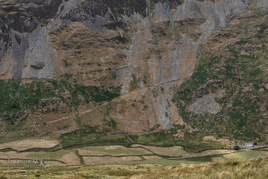 The zig-zag paths. If you open this in lightbox you should be able to see them, the right one comes off the track going from the left to the right uphill. You can also make out the platform with a little imagination. The building on the right lower side is at the base of the Croesor incline- the tramway makes a lovely walk to the foot of the great Rhosydd incline and also the Croesor quarry incline. 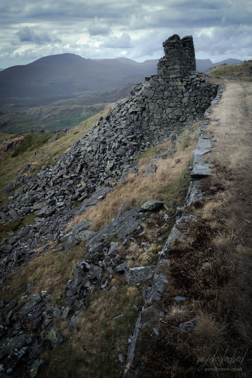 Photo by Petra. The incline head beckoned now and after a slightly hairy scramble up, I stood on the tramway formation. The stone drum house is still a very impressive structure, even if half of it has succumbed to the wind's attentions in this wild spot, over 1000 feet up. Originally, the incline drove down a two-pitch descent, separated by a manoeuvring loop. Later, a tunnel was driven through from Fron Boeth when the lower quarry took over production and used the lower pitch. I've been tempted to explore the incline when walking Cwm Croesor...that is now nearing the top of the "To Do" list! 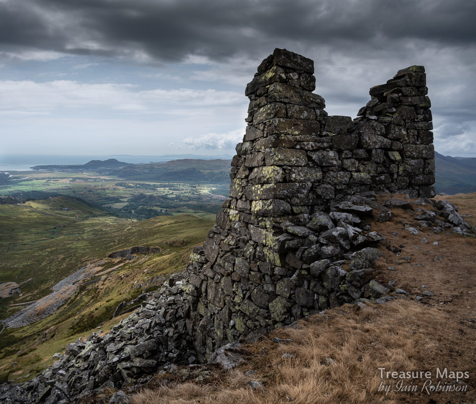 A moody study of the incline head, looking towards Moel y Gest and Porthmadog nestled beneath it. A very attractive feature of this site is the way that the tramway follows the contours of the mountain towards the mill at SH 6523 4473 on a rock-cut shelf. 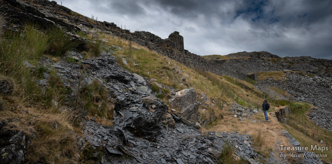 Petra looks up at the mill with fines showing in the foreground. Some of the shots that follow are from when Petra came with me for a return visit- after I told her about it, she was keen to see. The remains of structures are frustrating; the weather really has taken a toll of them and it is difficult to make out what the purpose of some of them was. The mill is unmistakeable, sited atop a very imposing platform made of slate, with fines tipped over the side. The views from here when the mill was working must have been some consolation for having to do such a tough job. 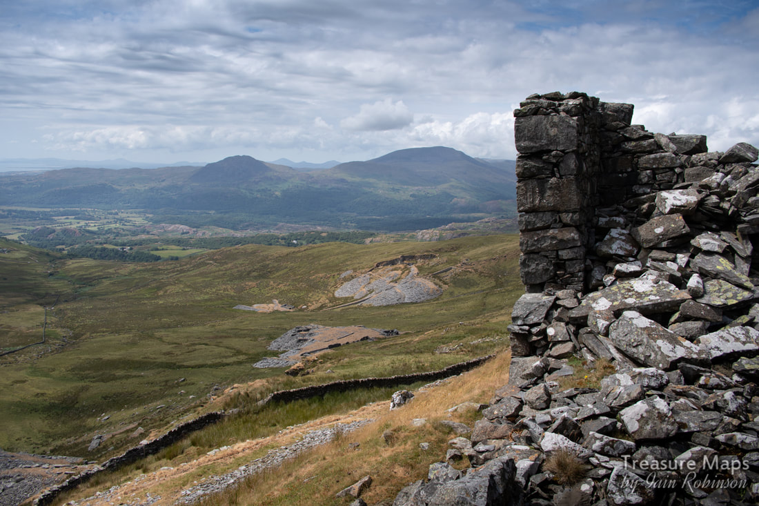 Looking down from the mill ruins to Fron Boeth quarry with Moel Ddu and Moel Hebog in the distance. I haven't mentioned until now, but all the way from the mill towards the bwlch, under the slopes of Craigysgafn (the knife-edge ridge beetling above), are a series of adits. Some are run-in and some are accessible- if you like wading in icy cold water up to your waist! A couple of years ago, some hardy souls from AditNow explored the underground chambers (which are quite extensive) after others from the site had spent two weeks pumping and siphoning the water out. There's also a survey drawing of the tunnels available to registered users of AditNow. The thread on the forum makes for interesting reading. 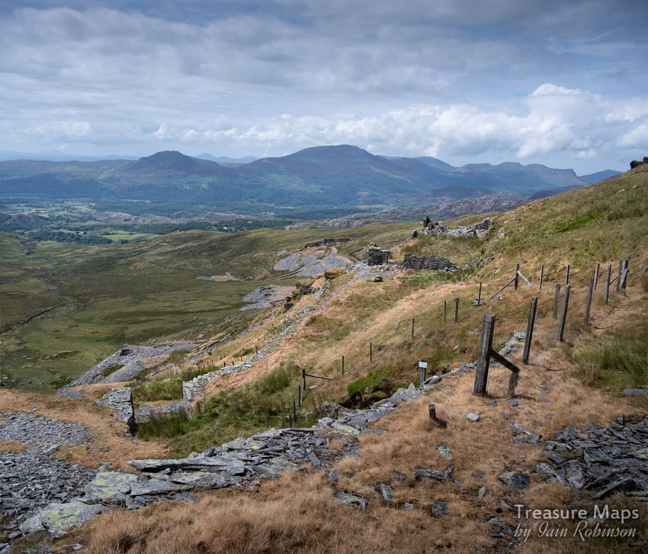 The short incline from the mill level to the exit tramway, with an adit in the foreground, betrayed by the fencing. When I mentioned to a friend that I had been to Pant Mawr, he told me about the old tales of the mine connecting with the Moelwyn mine on the other side of the mountain. I did some research, as at first I thought this was a fanciful notion, but soon found out otherwise. Apparently the Pant Mawr operation worked the lower level of the Moelwyn vein dipping to the west -and connections were made, more to ensure that the Pant Mawr chambers were properly below the Moelwyn ones- it sounds like these were roofing shafts rather than proper tunnels connecting. But in any case, the floors at Pant Mawr were numbered in sequence with the Moelwyn operation as were the floors, lower again, at Fron Boeth. At Pant Mawr and Fron Boeth, there are 19 adits, six of which are impassable/run-in and the others are either too flooded or obstructed to explore without some considerable draining.  The mule road towards the bwlch. My way down and back to the car went along the track seen going to the right in the middle distance. You can just make out the lead trials in this shot, under the trackway going down to Croesor. Towards the mill, there is a short incline from the tramway up to the mill level. After this, a mule track carries on towards the bwlch. On my visit, I followed this as I had an idea that I could hook up with a footpath that goes to Moelwyn Bach from Croesor. This route passes some high adits, the highest is over 1500 feet on the mountain. Trials appear here and there while there are a few ruined buildings and formations that we can only guess at. One range of structures looked like a barracks, others like weigh-houses. The mule track was constructed by the Moelwyn Quarry in 1820s, when Nathan Meyer Rothschild's Cambrian Company employed John Rogers of Wrexham to engineer the track in an attempt to open up the south side of the crown land. It was known as Ffordd yr luddew mawr ('road of the great Jew') and reached Pant Mawr in the 1850s. By then, the days of cart roads and mule tracks were over, as more concerns invested in tramroads and railed inclines to move their product. Reaching the bwlch there are some more trials, probably from before Rothschild's withdrawal from the quarry in 1828. The path from the Croesor road joins here, (SH6584144158) doglegging downhill, but not before passing more trials, this time for lead. These are more easily recognised for what they are on Google Earth.  Looking North West along the trackway towards the mill. On my solo visit, I trudged steadily downhill on the footpath, heading for a stand of trees where I had parked the car. Except that, despite my walking on inexorably for what seemed hours, the trees weren't getting any nearer. The ground was also really wet and I sank into gloop well over my boots at times, although the boots stayed dry (miraculously!). Finally, I seemed to be making headway and I got back to the car. I was pretty tired, and glugged down my last cup of coffee from the flask before setting off for Ffestiniog- except that I didn't feel brave enough to drive back the way I had come- that would have been pushing my luck. I took the other way into Croesor and out towards Plas Brondanw and Garreg... It had been a great day out on the hill with so many interesting things to wonder over...and I promise I will write about Fron Boeth as soon as I can, to complete the story :-) Post script- Petra and I walked up from the Stwlan Dam road, which we thought might be more direct- it wasn't. Although you do get more mines for your money. Below you can see the bwlch on the way up and the Moelwyn mine on the side of Moelwyn Mawr. You also pass the lower (run-in) adits of the Moelwyn Bach mine. 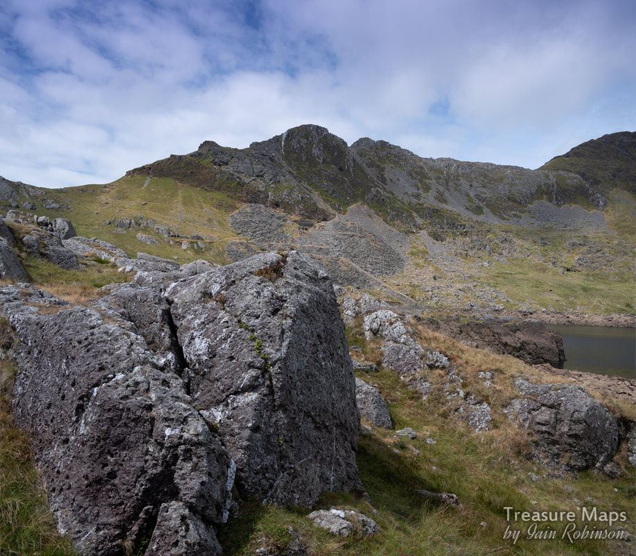 Craigysgafn, with the Moelwyn mine in the centre. Pant mawr is directly on the other side of the mountain, and we walked over the bwlch to the left. Some quick factoids: Pant Mawr was opened in the 1840s, and the incline down to Cwm Croesor was built in 1863. The quarry closed in 1878, but reopened in conjunction with Fron Boeth in 1886. The whole operation fell into disuse around 1912. There was a zig-zag path made down to Fron Boeth from Pant Mawr, this can be traced on Google earth near the mill. References: Gwyn, David (2015). Welsh Slate. Royal Commission on the Ancient and Historical Monuments of Wales. ISBN 978-1-871184-51-8. Lindsay, Jean (1974). A History of the North Wales Slate Industry. David and Charles. ISBN 978-0-7153-6265-5. Richards, Alun John (1999). The Slate Regions of North and Mid Wales. Gwasg Carreg Gwalch. ISBN 978-0-86381-552-2. Richards, Alun John. Gazetteer of Slate Quarrying in Wales: Llygad Gwalch Cyf (1974) ASIN: B01HC1LIUK Boyd, James I.C. Narrow Gauge Railways in North Caernarvonshire, Volume 1, The West. ISBN 0-85361-273-0. 3 vols 1981-6 Quarry page on AditNow (register to see plans) Coflein page about the mill |
TracksReceive the occasional Treasure Maps Newsletter- and alerts when a new post is available!
If you enjoy my content, please buy me a coffee!
Check out my other online activity...
Index
All
|


 RSS Feed