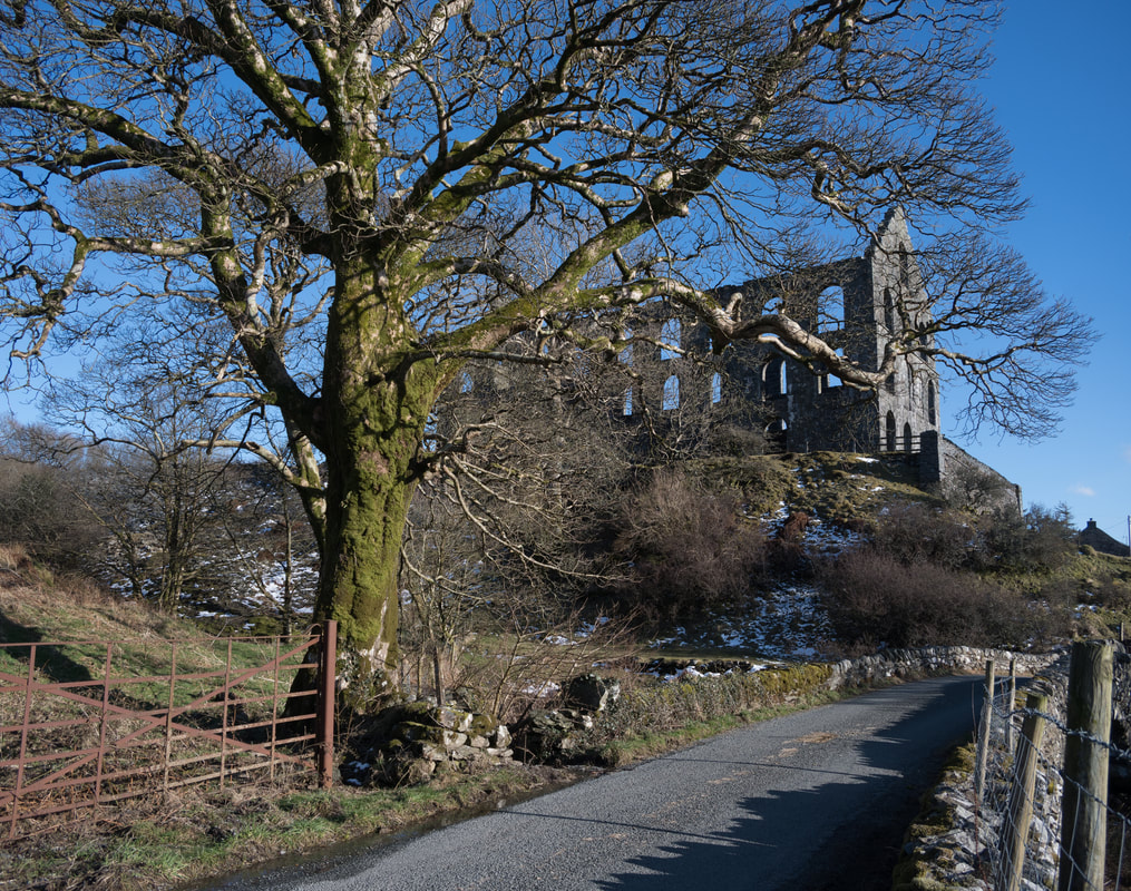
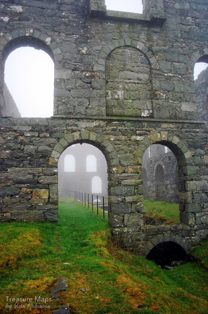
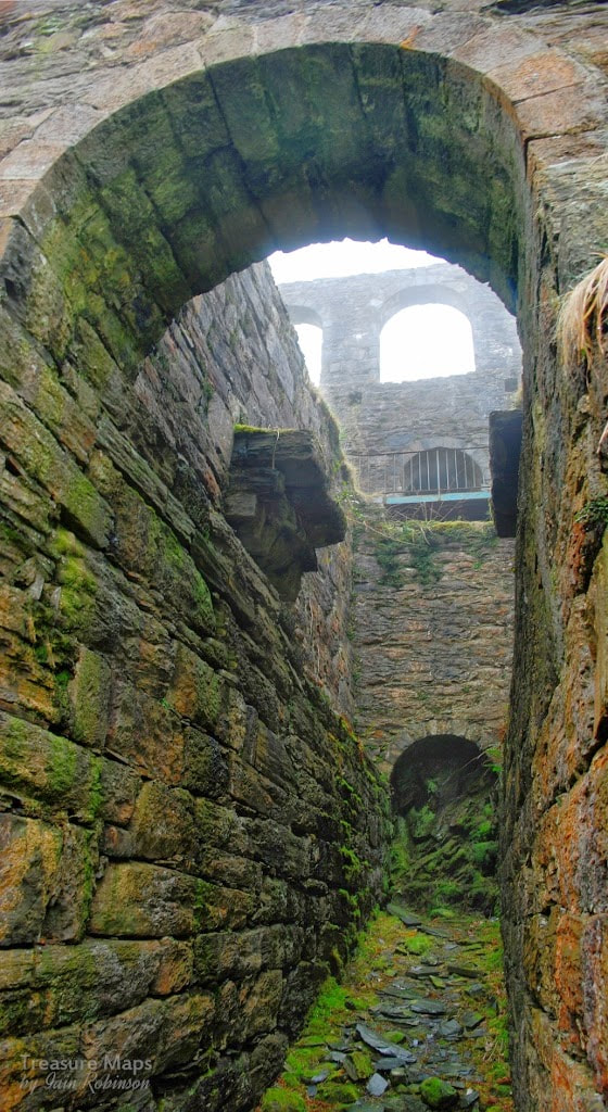
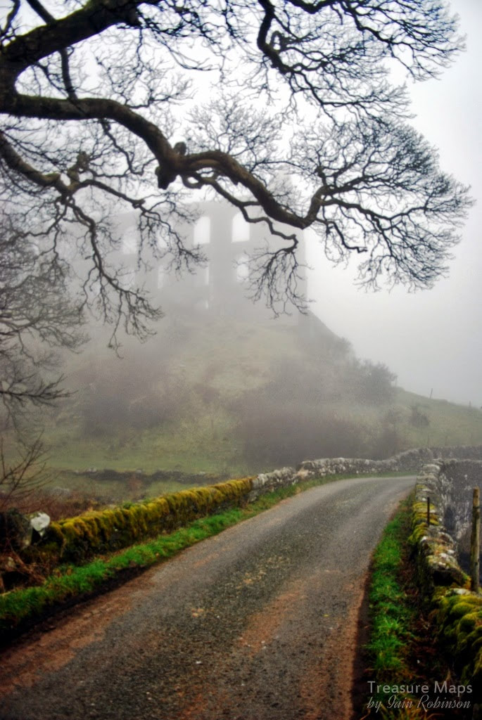
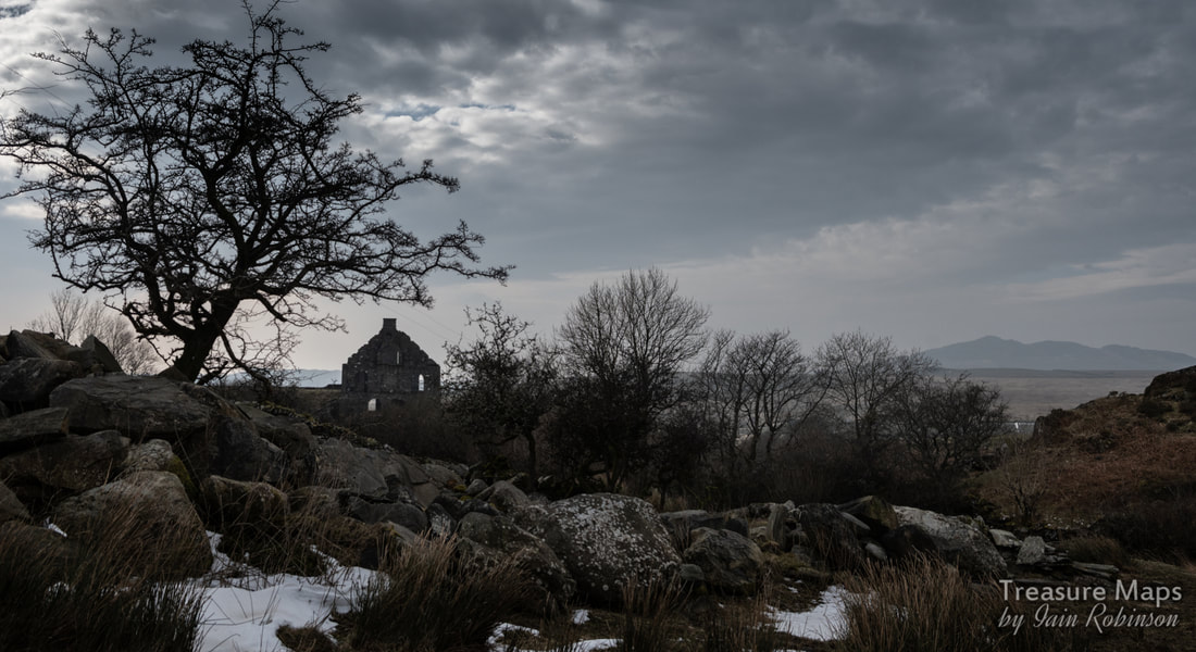
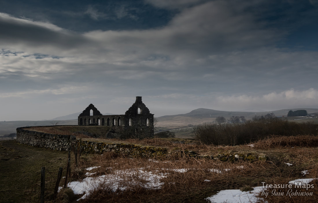
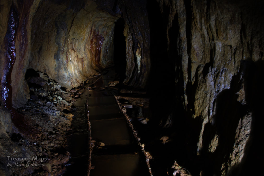
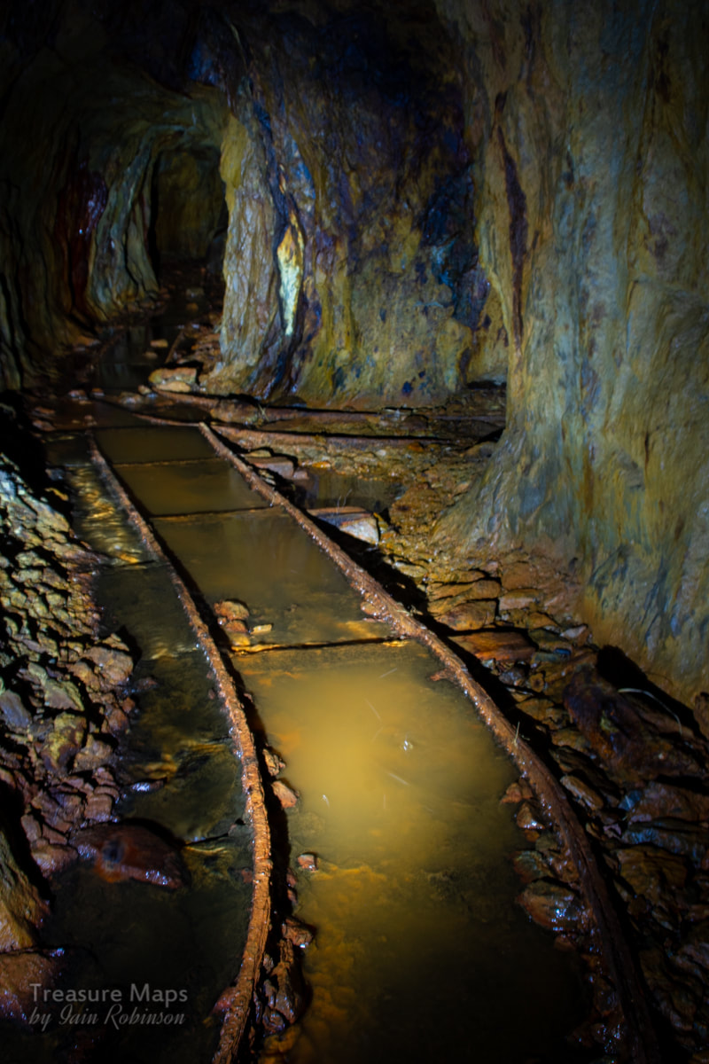
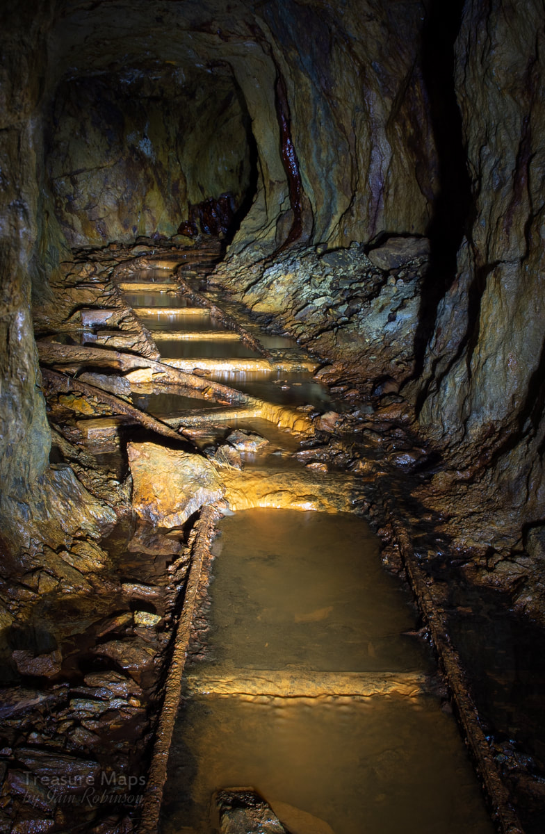
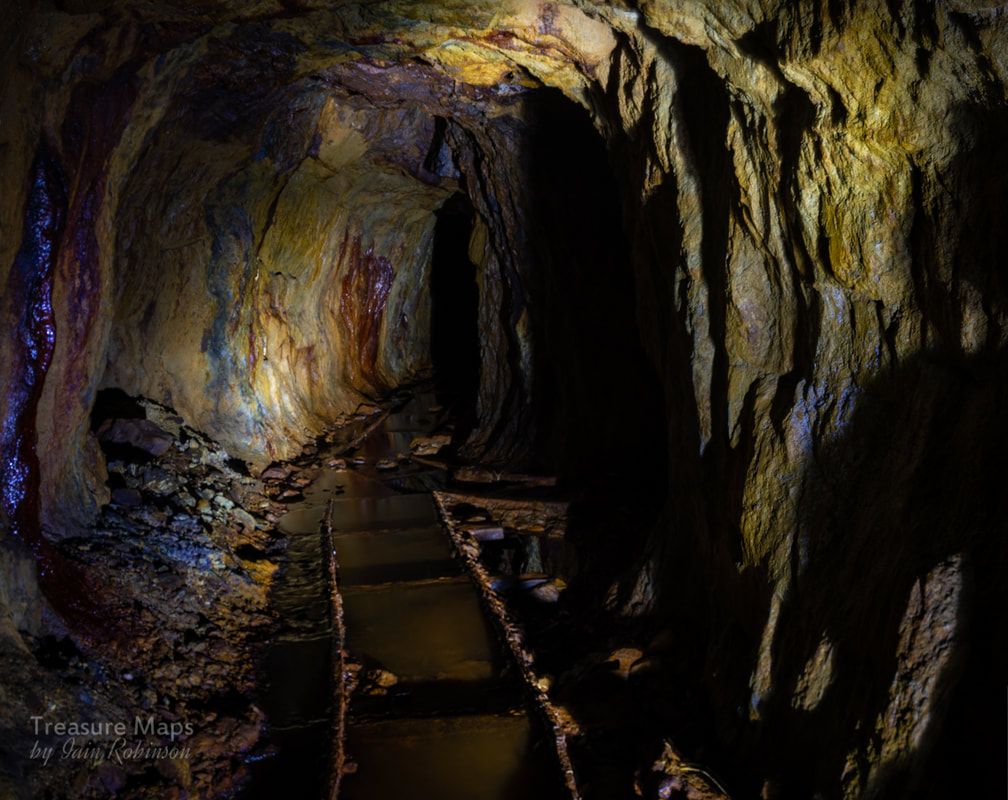
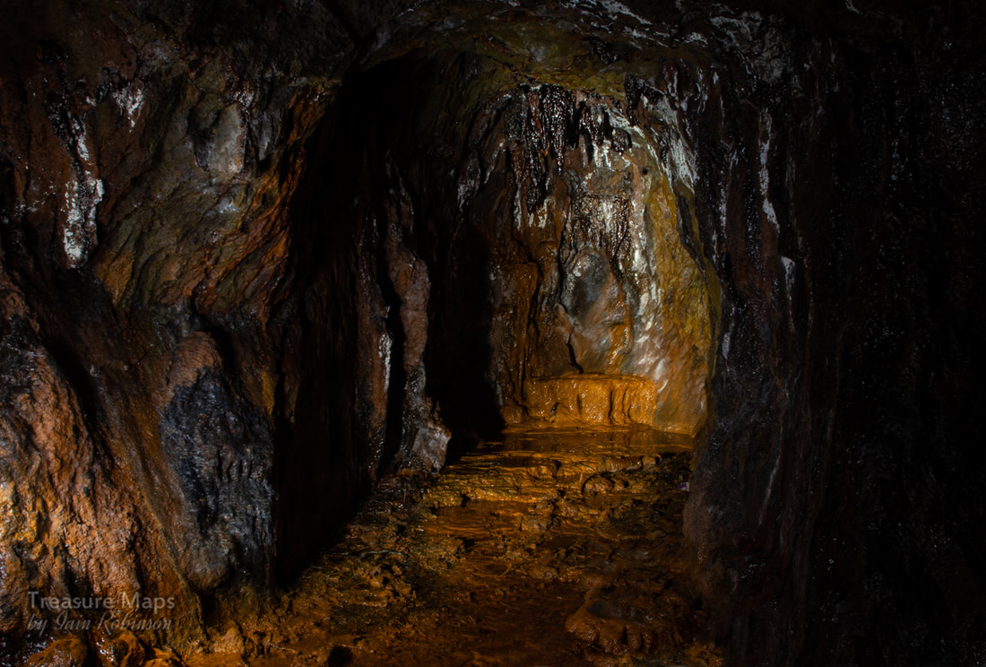
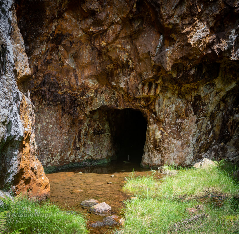
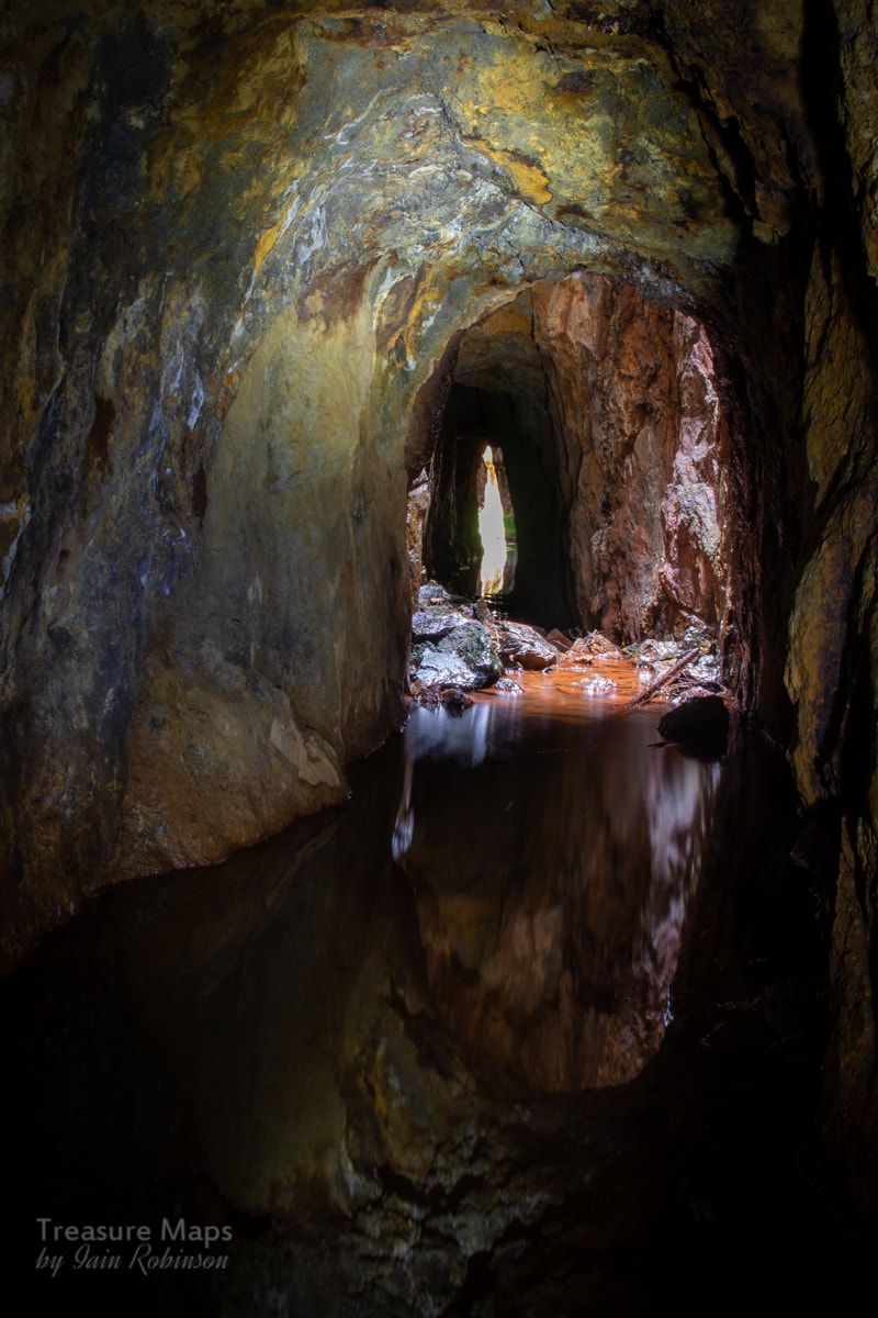
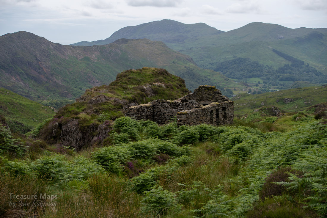
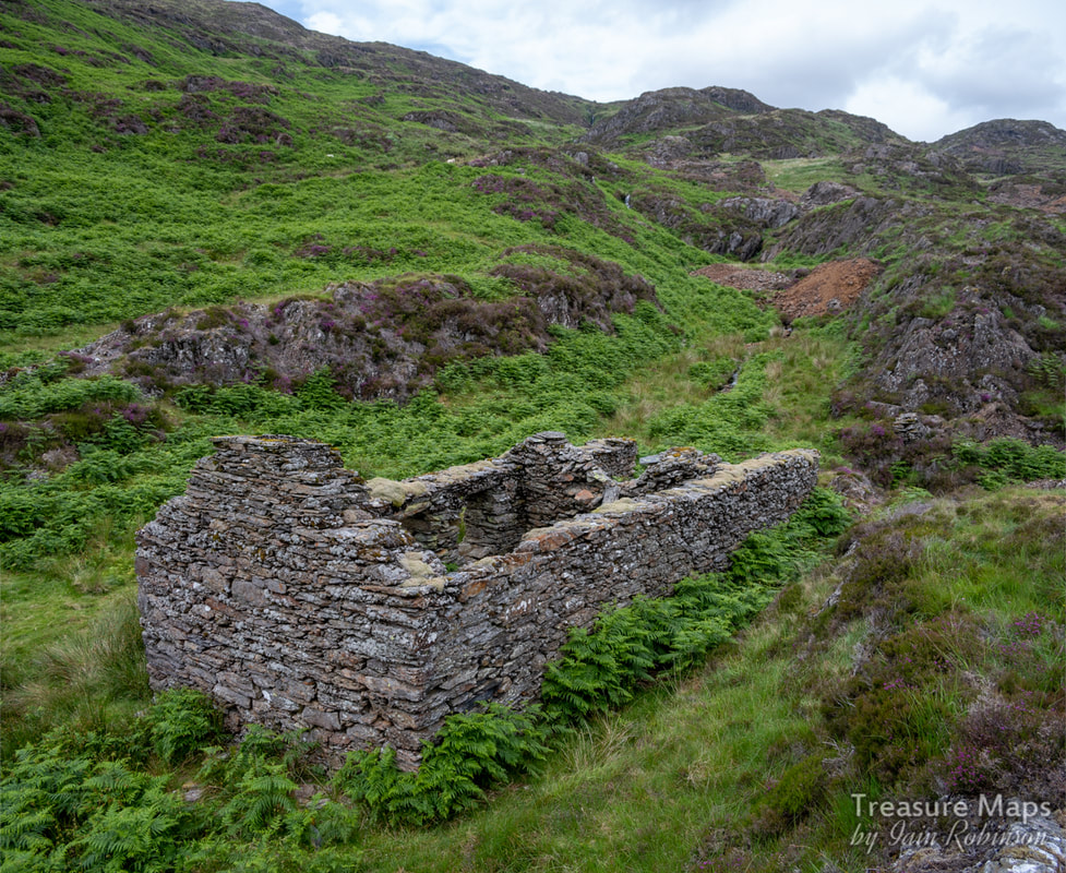
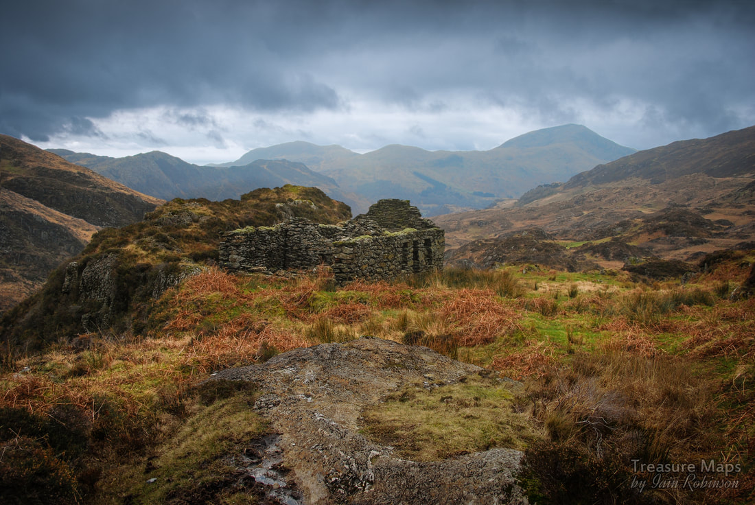
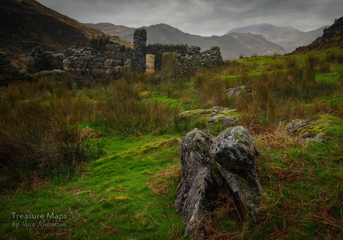
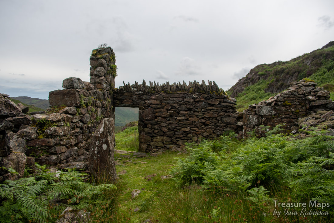
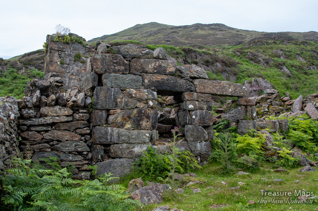
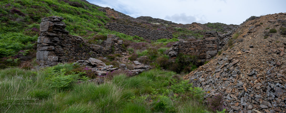
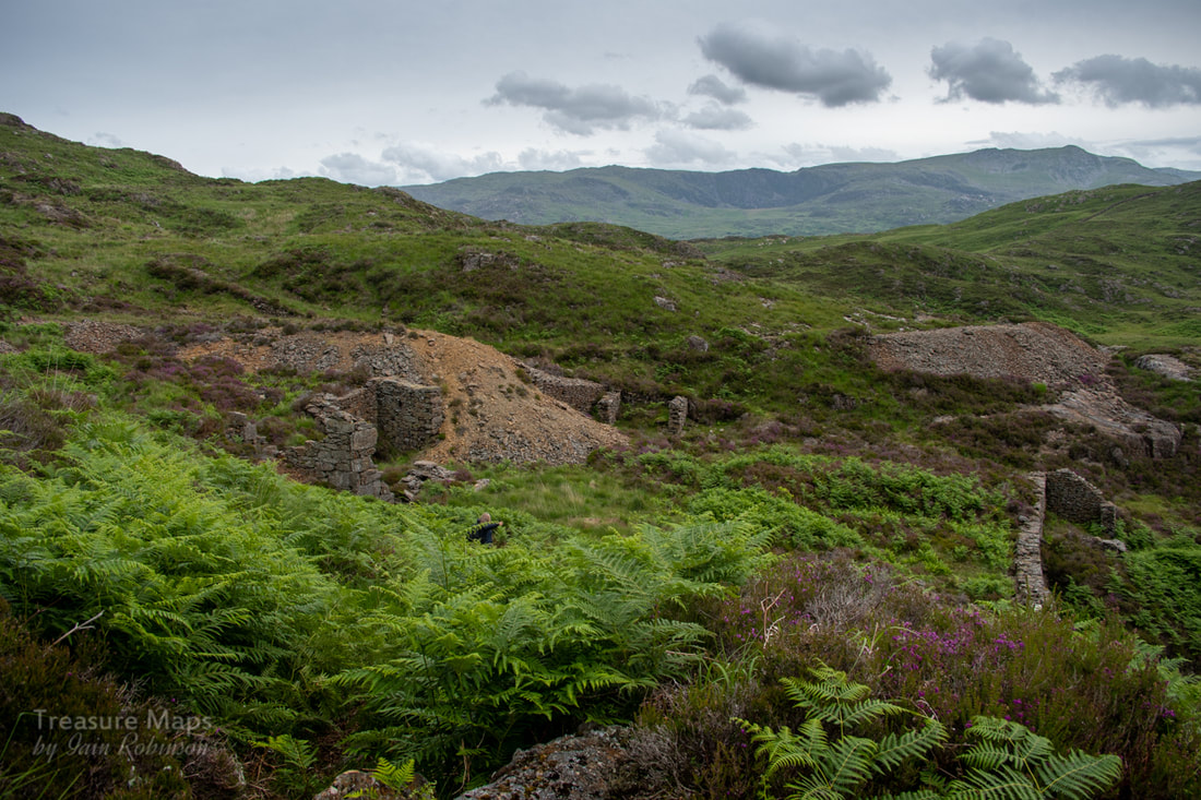
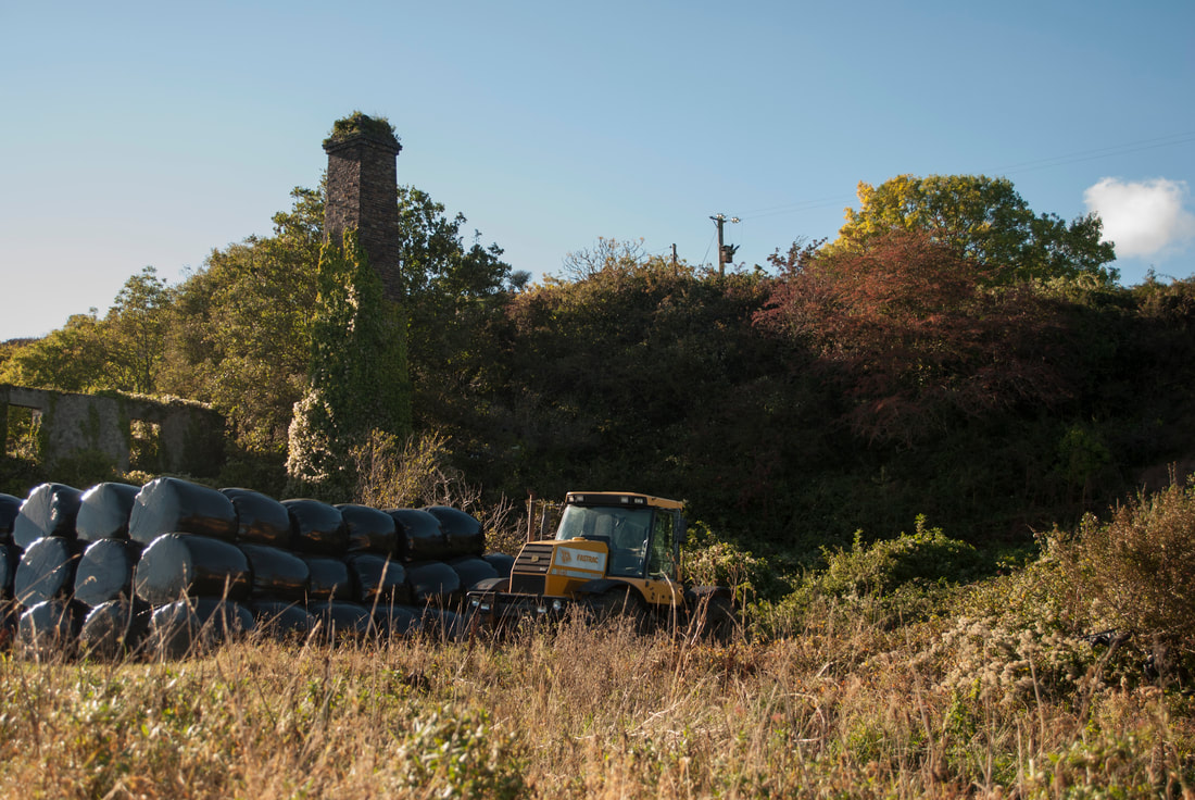
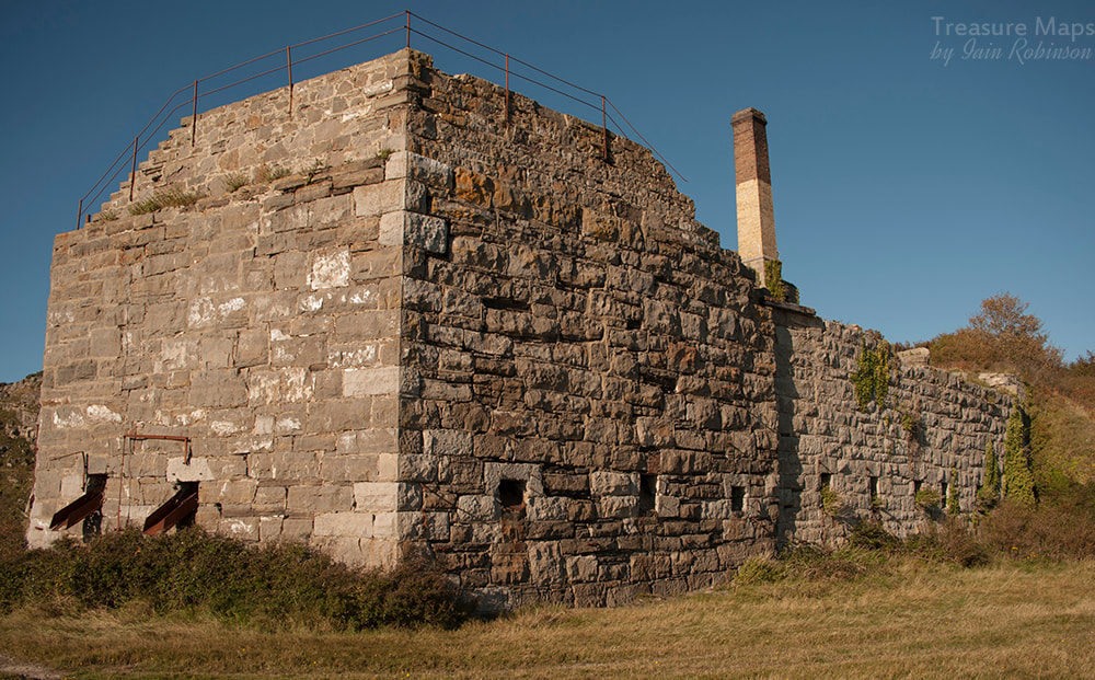
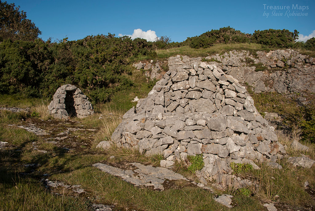
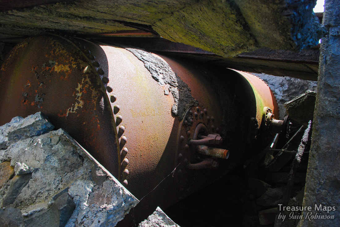
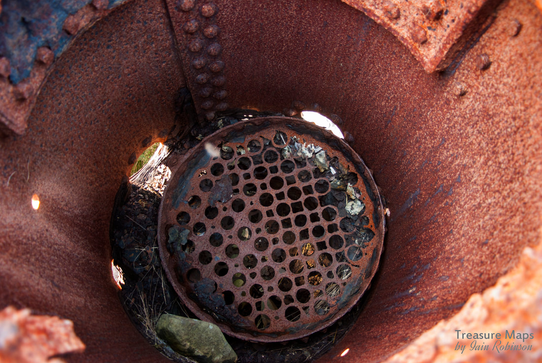
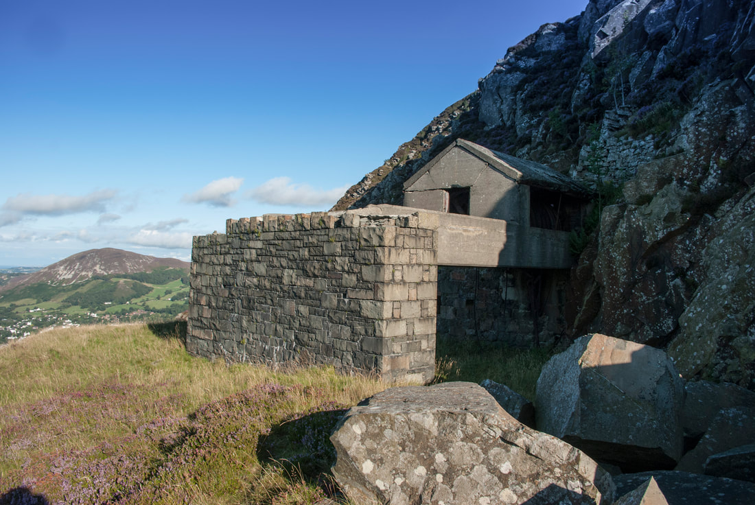
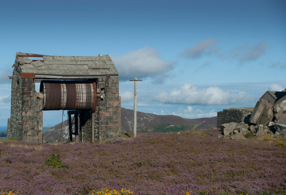
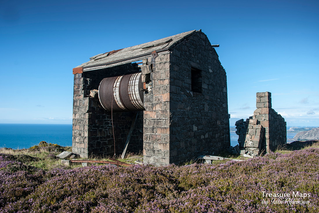
 Of all the mad, marvellous and utterly futile follies in this corner of Wales, Ynysypandy mill ("Ty Mawr" as the locals call it) is right at the top of my list. It looks like a monastery or an ancient abbey- I'm sure it fools many a tourist who has accidentally wandered down the wayward lanes here into thinking they have found a lost Cistercian masterpiece. The truth is possibly even stranger... 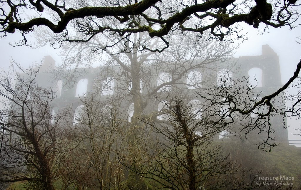 In the 1850s, a couple of wealthy adventurers with money and optimism (but little common sense) pitched up in the Cwmystradllyn area with a view to making a killing on a sizeable investment. They had a hunch that slate was plentiful here and were in a hurry to cash in on the success that slate ventures in Blaenau Ffestiniog and elsewhere had enjoyed. In the middle 1800's the climate of optimism about slate was such that even shopkeepers and their employees were speculating- buying shares and helping to float mining concerns, quarries, railways, and sleek sailing ships for the slate trade. I suppose Robert Gill and John Harris, the men who took over the lease for the Gorseddau Quarry in 1854 thought it was bound to succeed. Their background was in railway engineering and a slate quarry was a logical addition to their portfolio of investments. 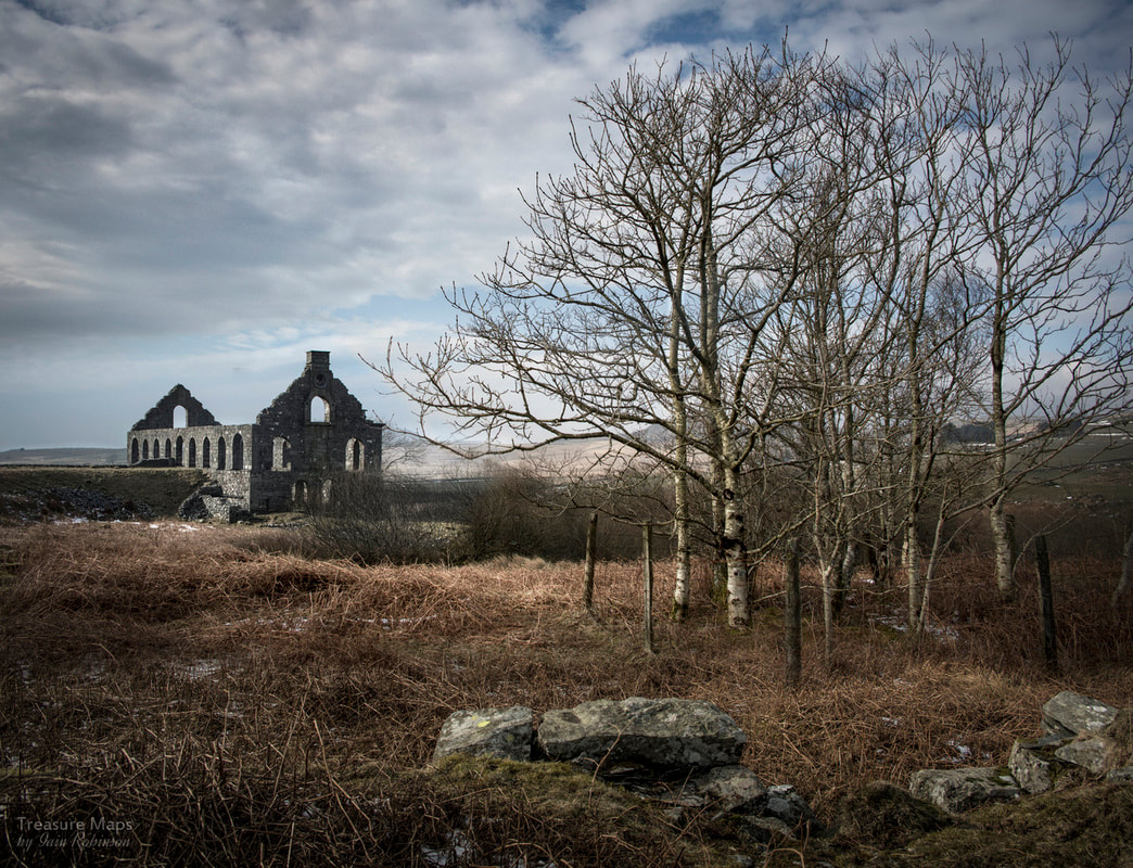 If only it had succeeded, because they did everything by the book. The quarry was run on theoretically ideal lines, having all (except slate, perhaps) that a modern concern would need. The mill was designed by James Brunlees (later Sir James), engineer of the tramway that was to take the finished product to Porthmadog and it's new harbour for slate carrying ships. He had designed several mills in the North West of England, which perhaps explains the sublime proportions of the structure. Thanks to research by Dr Michael Lewis, we know who actually built the mill. It was Evan Jones, a stonemason from Clynnog who settled at Garndolbenmaen, where he and his men built most of the houses on London Road. There are several mysteries which will probably never be completely solved. We know that the mill contained machinery for sawing, planing and dressing slate. But where were they sited? Could blocks from the quarry have been brought in on the curving tramway to the top floor, and then lowered down for carrying forth on the lower tramway? Or was it the other way round? Excavation and study by Dr Lewis has suggested that the heavy machinery was sited on the ground floor, while lighter machines occupied the first floor. These machines would help fashion fireplace surrounds, or clock faces and sundials. The resulting speciality products would be winched down to waggons on the ground floor and sent off along the lower tramway. Simple, large products like sills, lintels and gravestones could have come in as raw blocks on the ground floor, be planed and dressed on that floor and have left the same way. Power came from a large (7.7m diameter) overshot waterwheel sited within the building, driving a shaft from which belt drives were taken to the machines. The bearing blocks can still be seen in the walls. 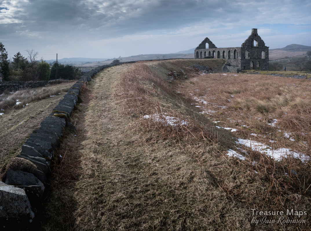 I guess everyone involved in the giant job-creation scheme that this had become was desperately hoping it would succeed, while the owners were in denial, ordering finest slates for the roof and £10,000 worth of top quality machinery from Caernarfon for the works. It is said that the mill had the finest roof in the area, which is saying something in this corner of Wales. Sadly, the slate from the quarry rather disappointed. It wouldn't split well and was only of use as slab. This can be seen today in the quarry pit. The rock is full of quartz intrusions and has been distorted by pressure. It also seems to have a different composition to Blaenau slate, with less of the "soapyness" and ability to cleave; probably due to the molecular distribution of the mica within the rock. Whatever the reason for the poor stone, the tonnages of sellable slate from the quarry were very low. At it's finest moment, only 7 man tons per year were achieved, as opposed to a consistent 14.7 tons per man in Blaenau Ffestiniog (Oakeley Quarry). It was all over by 1867. For a few years, before the roof was stripped, the place was used as a meeting hall. Local eisteddfodiau were held among it's spacious walls- it's a shame the place couldn't have been kept for the local community. I guess, back in the rapacious Victorian era, when only the wealthy mattered, something like that would not be on the agenda, especially for such an out-of-the-way corner. I am not sure why the shell of the mill survived; but I am so glad it did- it's a little miracle to come from such a quixotic scheme. It's now in the hands of the RCAHMW and is open to the public. Go and see it, preferably on a misty spring morning, before the sun burns off the cloud and the ghosts of forlorn hopes and ambitions still flit about the walls. Sources:
LEWIS, Michael J.T., "New Light on Ty Mawr Ynys y Pandy", Gwynedd Diwydiannol/Industrial Gwynedd, vol.3 (1998), ISBN 1-871980-42-9, pp.35-49 RICHARDS, Alun John, "Gazeteer of Slate Quarrying in Wales, ISBN 0-84524-074-X, pp. 145-146 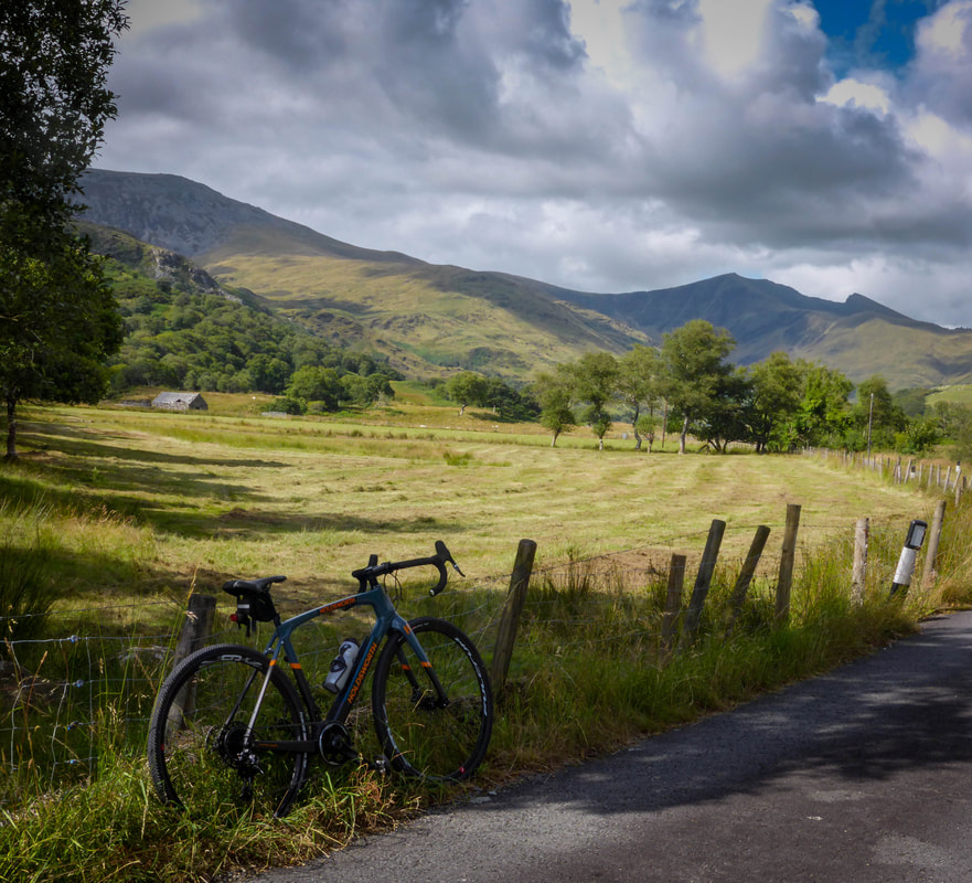 Don't worry, I haven't forsaken mines and industrial archaeology! It just occurred to me that I'm out on my bike an awful lot, and wanted to share some of my favourite rides. They will be on my Falcon Blackwood site (my pen name) which also highlights some of my many other interests.
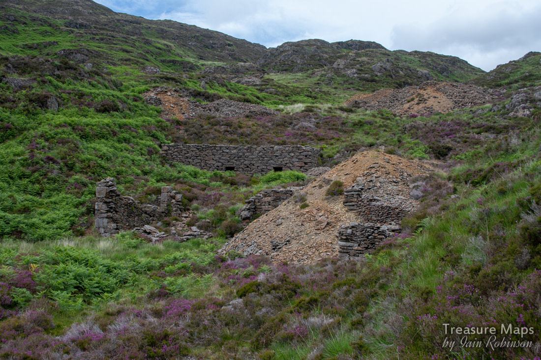
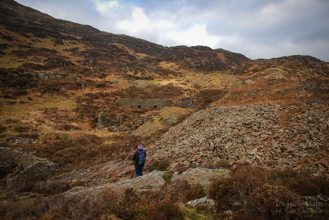
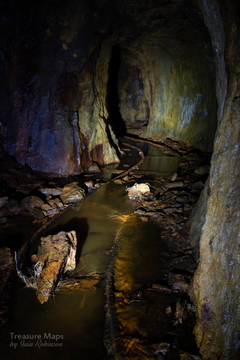
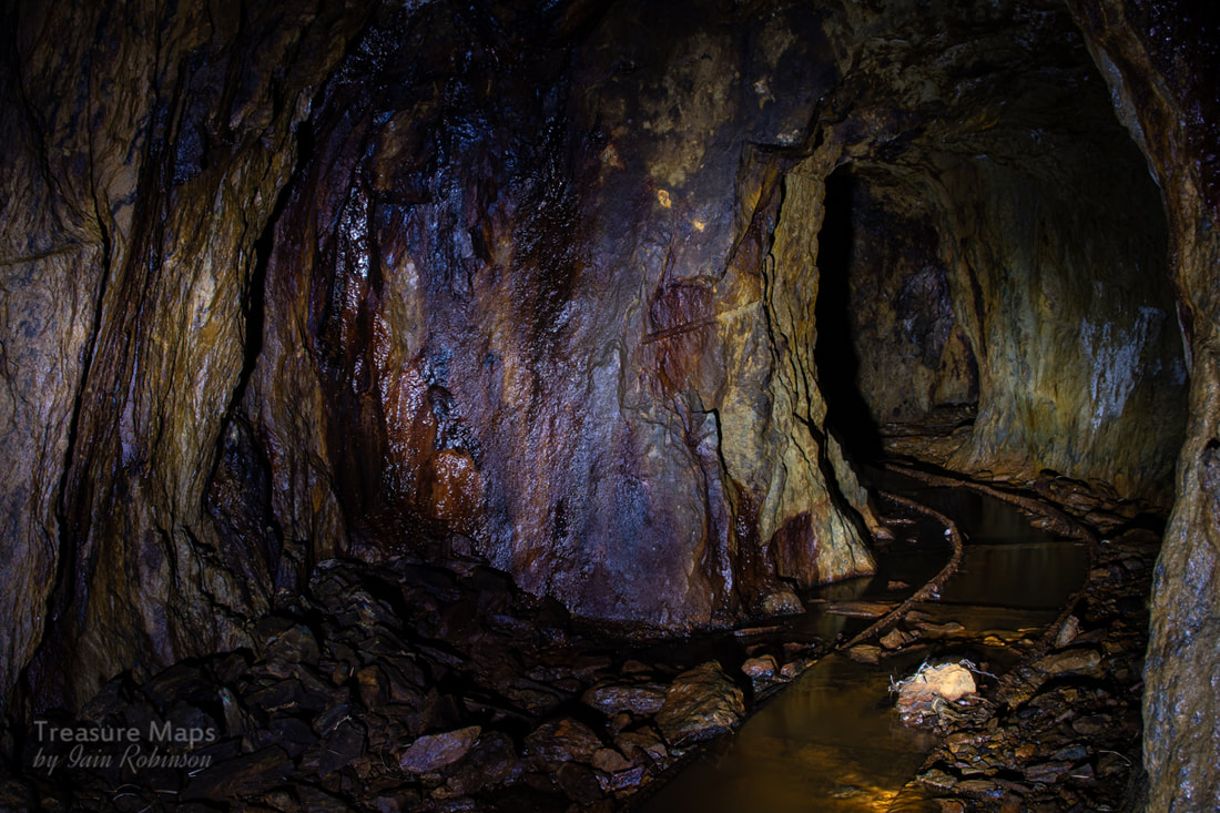
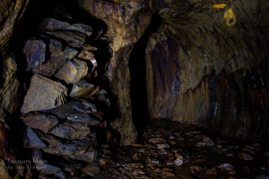
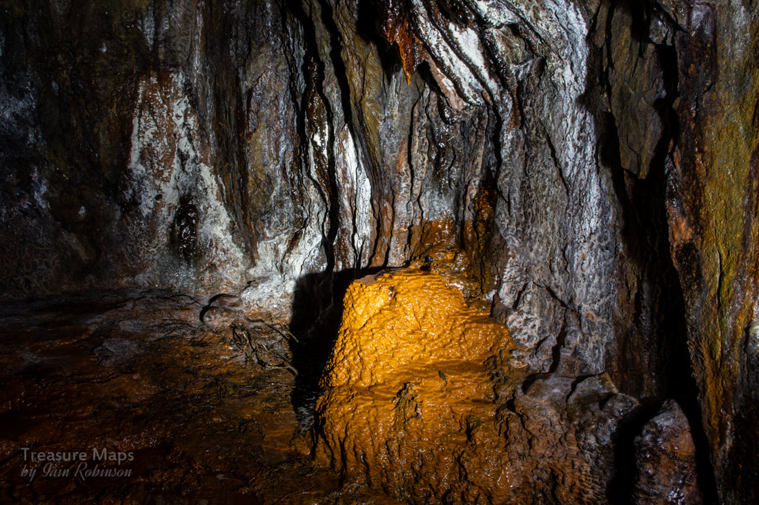
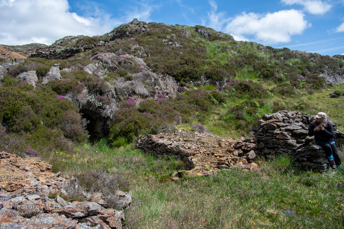
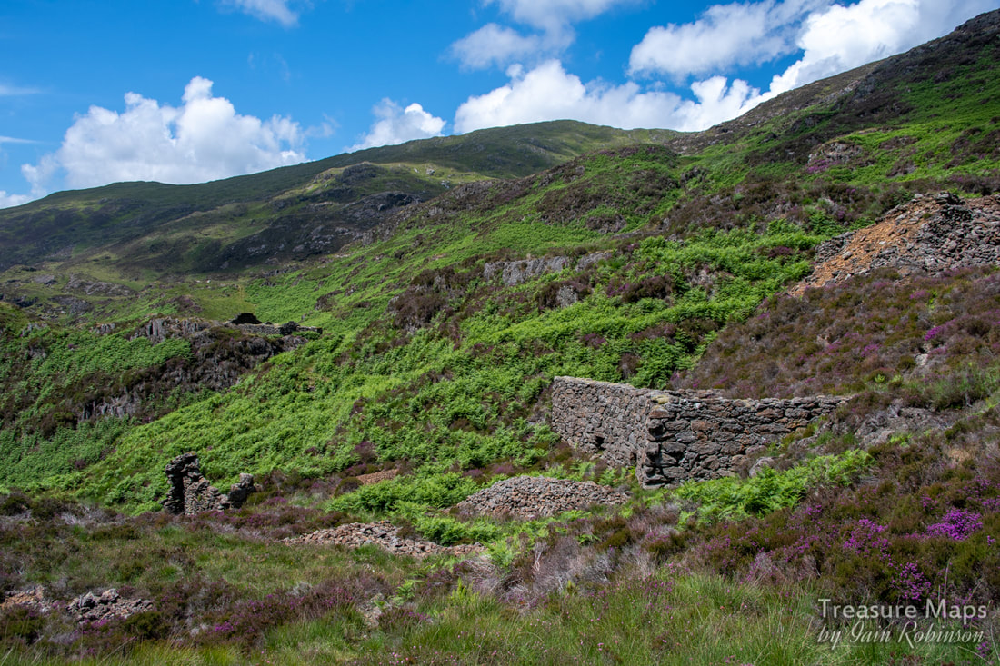
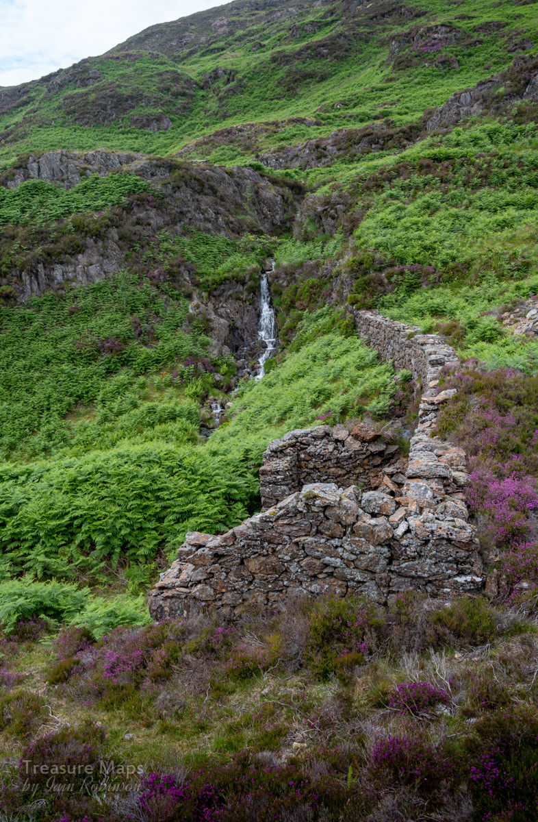
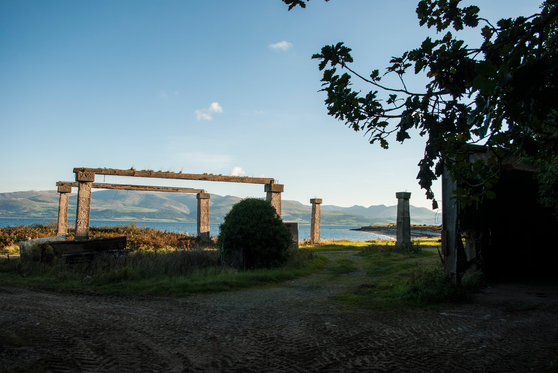
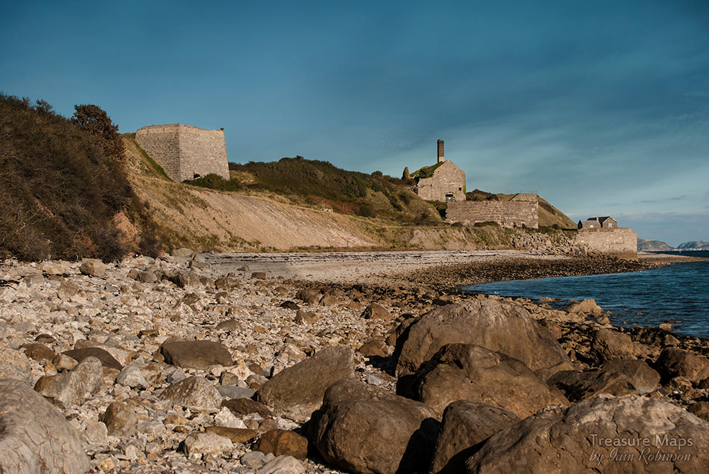
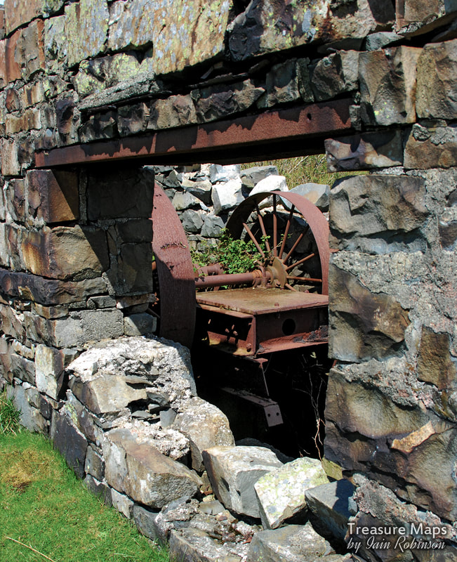
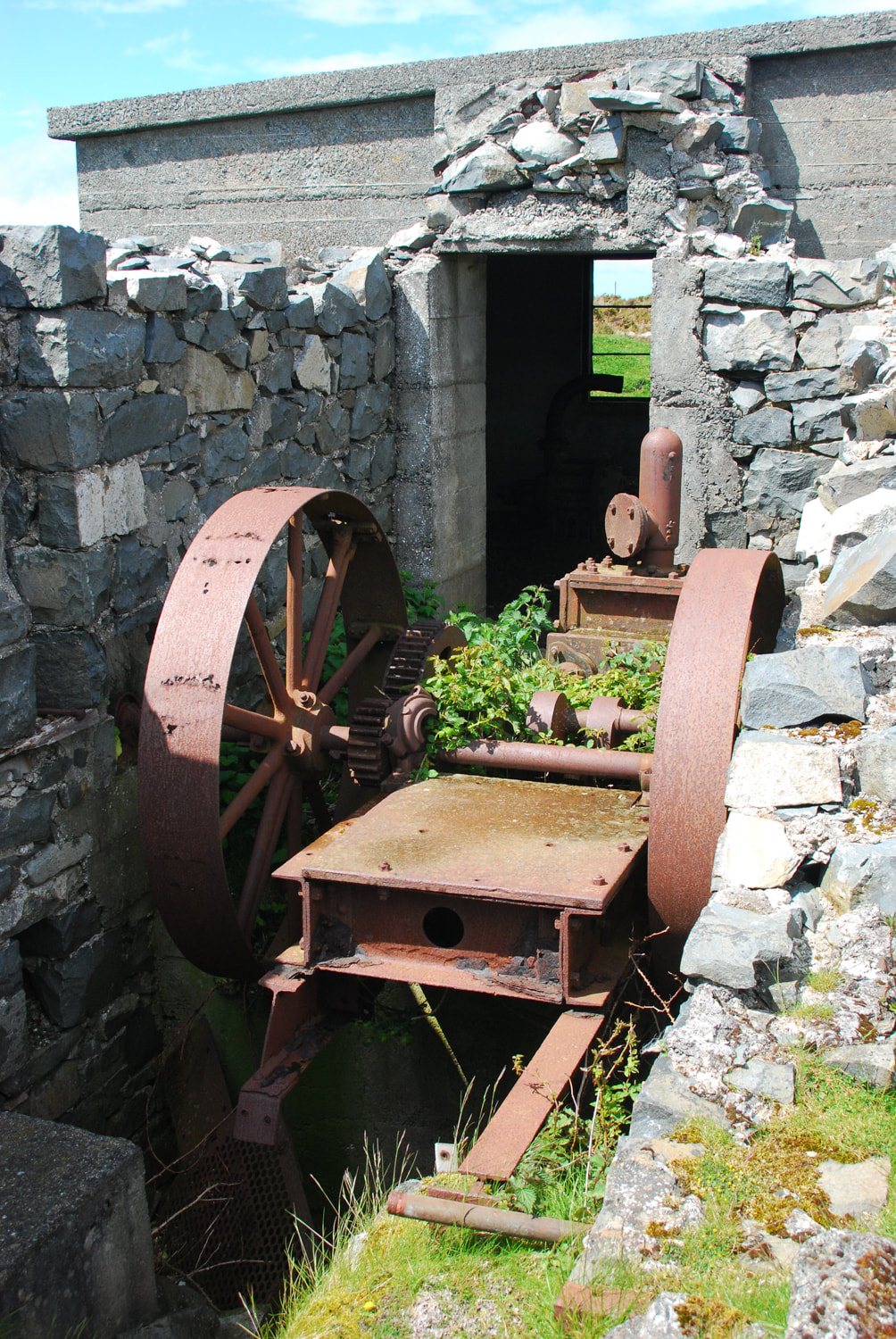
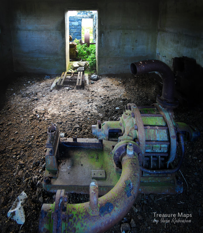
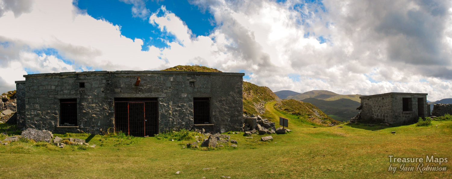
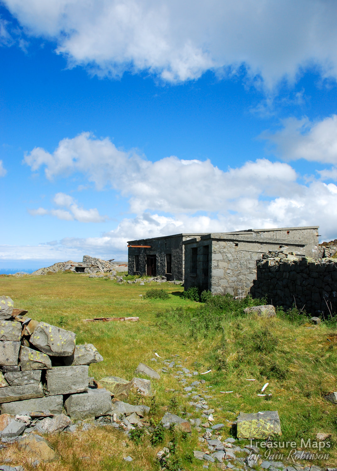
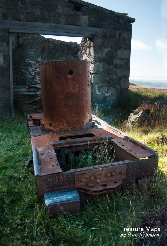
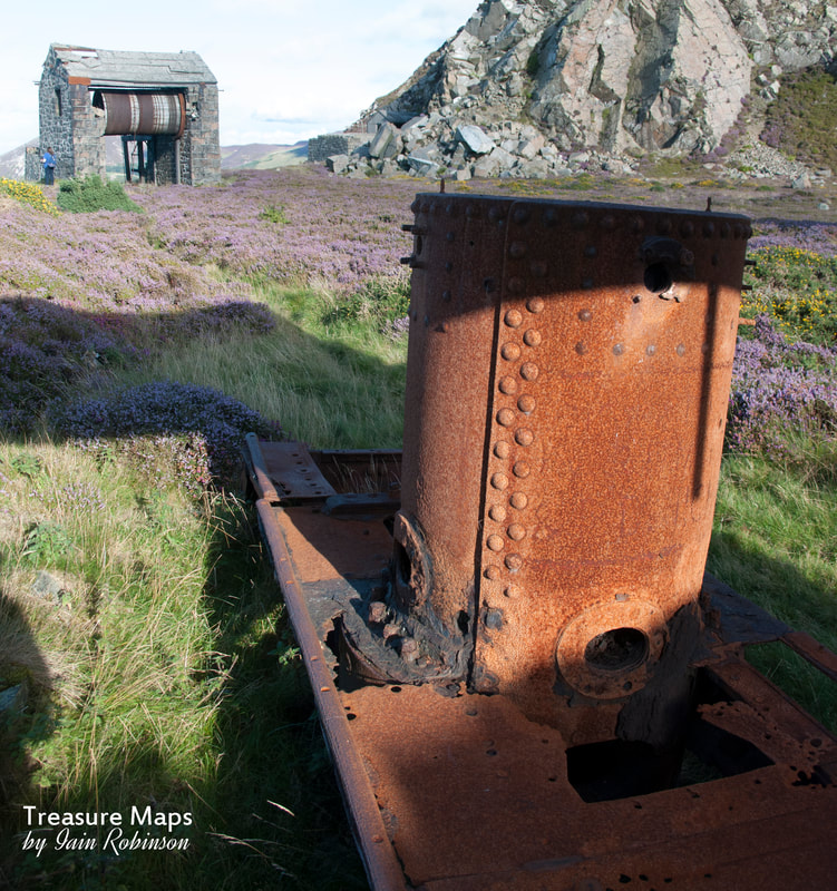
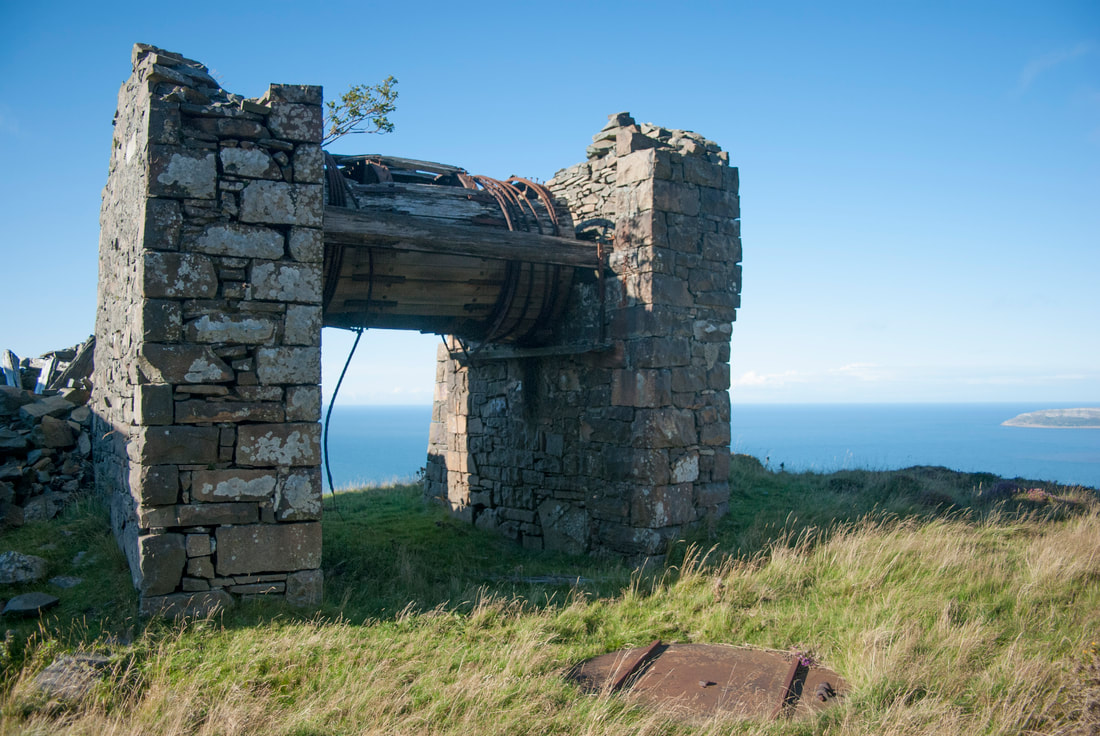
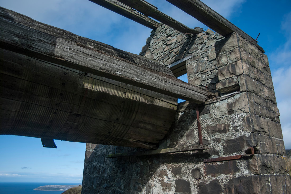
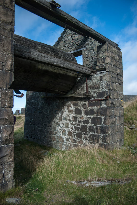
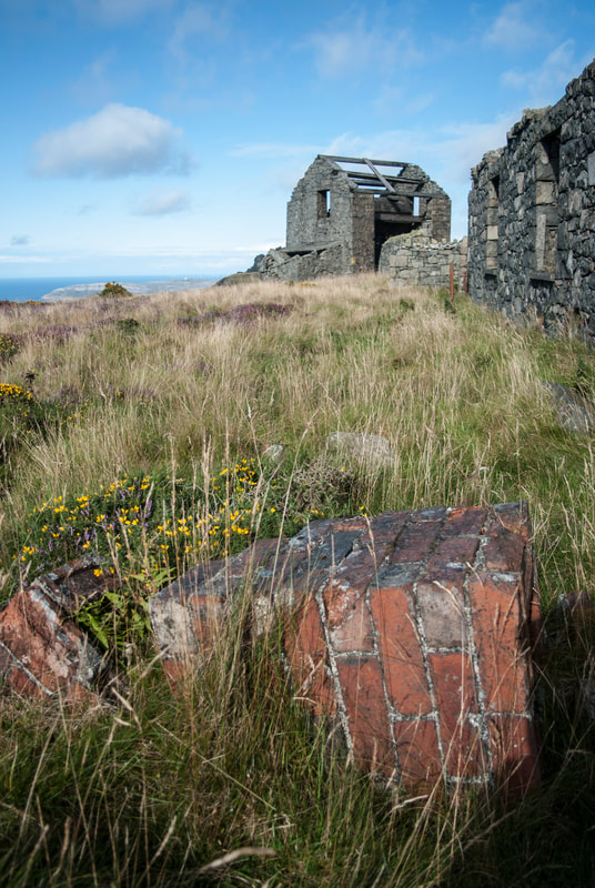
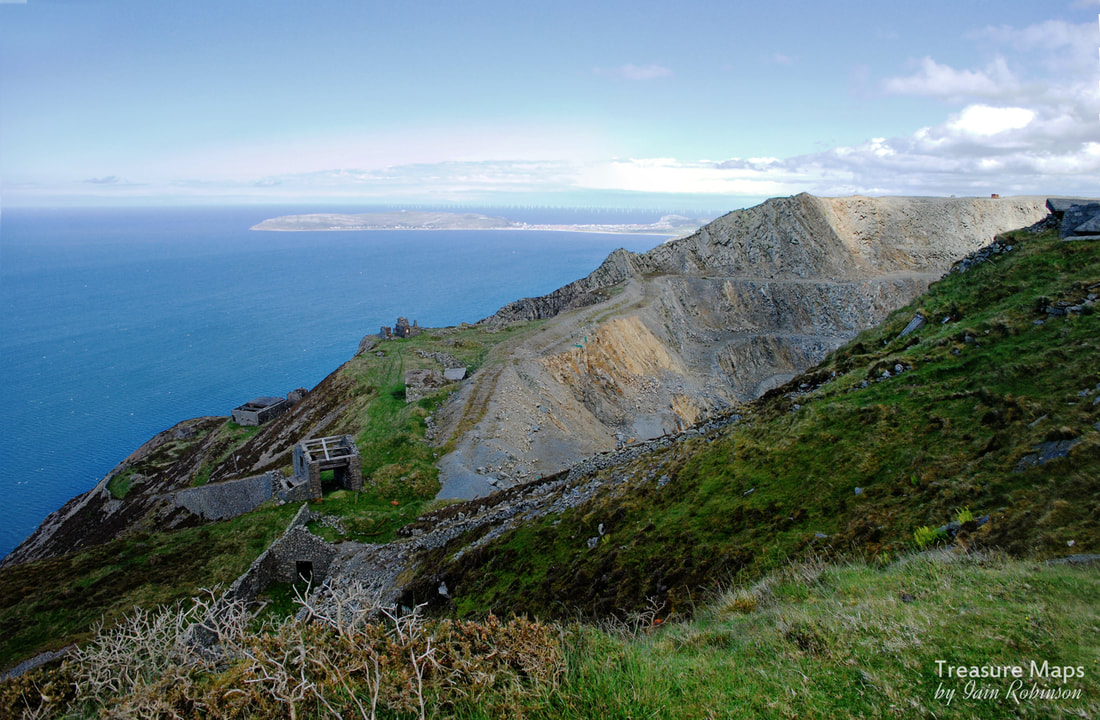
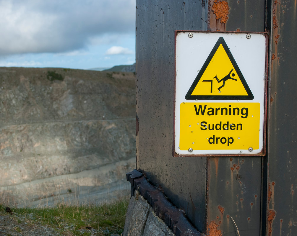
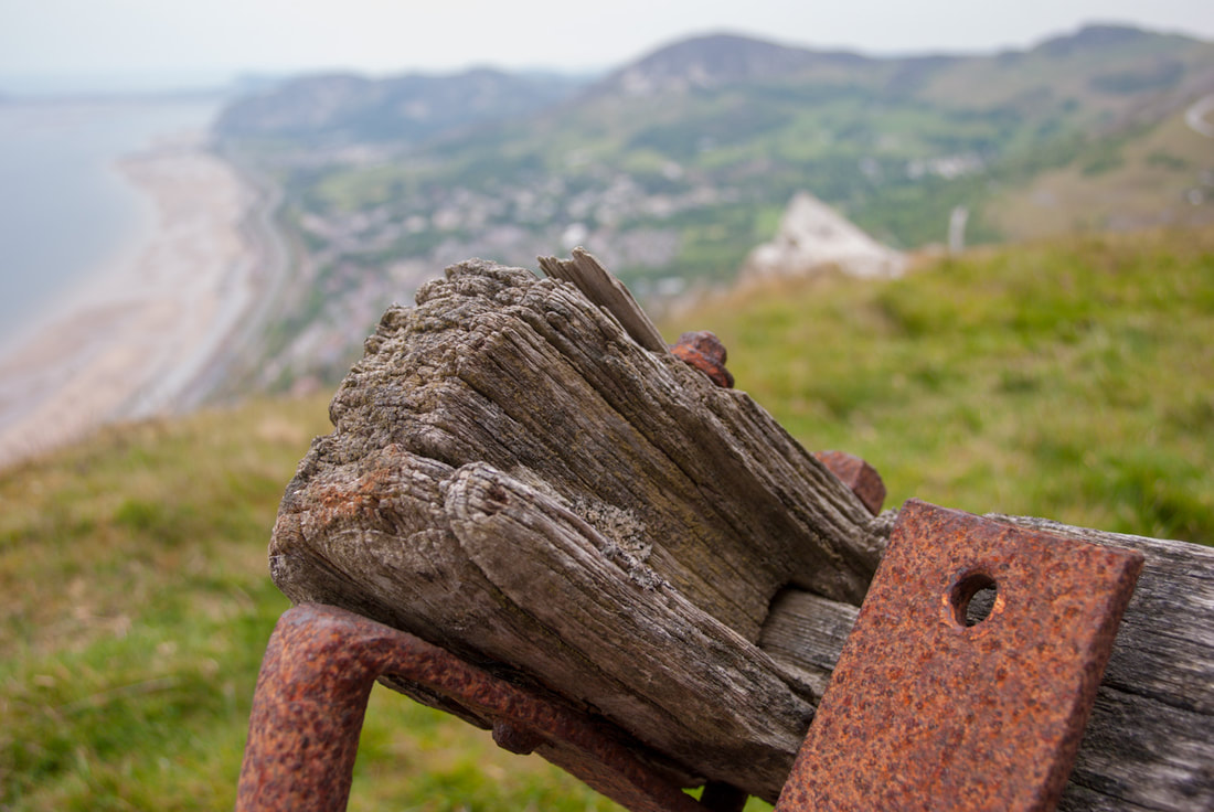
If you'd like to take a look, it's here  Our first view of the mine- the managers house in the middle ground, with Moel Hebog in the distance. To the right are the tips from No3 adit. We've had a few visits to this fascinating mine, set within splendid scenery and isolation at the head of the evocatively named "Cwm yr Bleiddiaid" (Cwm of the Wolves). The last few occasions, we'd come up from Craflwyn, which, to be honest, is a bit of an epic pull. This time, I wondered about going up the Watkin Path and taking the small path that peels off to the south west, at the foot of the mighty South Snowdon Incline. It was July and the Snowdon path was mighty busy, the air full of excited chatter and the smell of fabric conditioner. Yet, when we diverged on our way to Hafod y Porth, we only saw two other folk the whole day. It was a steep but well-made path, more like an old cart road- I wondered if this was actually the way that ore was carried from the mine to the Hafod-y-Llan mill, which is just out of sight, up the cwm in the photo below.  The mighty bulk of Lliwedd towers over the lower stretch of Cwm-y-Llan. The South Snowdon Incline can be seen running down from Clogwyn Brith on the left.  The path passes Bwlchiau Terfyn, a sort of small scale roche moutonee. It affords some fine views towards Carnedd-y-Cribiau and Moel Siabod (above). The path continued over some boggy ground, but the way is made considerably easier by being punctuated by specially laid, large flat boulders like stepping stones. The great advantage of this new route is that it deposits you halfway up the hillside, well above the manager's house- sparing you of the energy sapping climb up. The last time we'd visited, it was early spring. The weather was dull and the vegetation in it's winter colours. As you can see from the two photos below, it was quite a shock to see the change from an ochre coloured landscape to a verdant green one this time! So...what was the story with this mine? It seems to have covered a few acres and there are many structures, some difficult to interpret, including one at the top of the sett that seems like something from a fairy tale. Records are sparse, and I am indebted for some information to J.L.Agnew, who studied the mine as part of his Msc course in 1988. According to his research, the first record about the mine appears in 1755, but it is likely to have been in operation well before this, as with the copper mines of the Migneint. We do know that that there was a 24 foot waterwheel and a 8 head stamp battery, plus many other unexplained structures, but according to official returns, the mine was never profitable. Smaller mines were not required to make official returns before 1867, so perhaps there was some obfuscation with the figures. However, in 1869 the mine only produced 18 tons of dressed ore, with 6.4 % of copper. The record books close on the mine in 1890, when it was abandoned after changing hands for the last time. Looking in some of the adits (there are seven) it becomes apparent that the search for ore was a fairly unsophisticated one with, as Agnew puts it, "no real geological insight". The adits are fairly stable, wet, unpleasant and yet....rather charming. No.3 is the most interesting and illustrates well how the miners literally chased a vein through fault zones, looking for clues in the rock. This is the largest excavation, and switches backward and forwards underground. It is punctuated by shafts from above, some of which may be for ventilation. In places, rails, to a gauge of 19" are still in situ with sleepers. The rail is a mixture of bridge rail and light gauge flat-bottom, spiked to wooden sleepers. There's an interesting crosscut in the mine that has been blocked by stacked deads, and a beautiful grotto with stalagmite formations. Further in to the mine, the floor is covered with deep orange mud which isn't pleasant to negotiate. One of the shafts has some big wooden posts in it, which Agnew speculates, could be the remains of a headframe to winch material out. This area is a waterfall and difficult to negotiate. The adits are numbered from the bottom of the mine upwards, please see the plan below. Adit 1 is short- about 60 metres, flooded and contains some copper staining. Adit 2 is flooded and was not explored. Adit 3 Is fairly long, possibly 100 metres, with several short side passages. There is a shaft from above which allows large quantities of water into the workings. This adit winds left then right before ending in a blind drive. Adit 4 is flooded at the entrance but soon becomes dry and is about 25 metres long. Adit 5 is approx 15 metres long and contains some pyrite on the walls.. Adit 6 is 35 metres long but flooded to 1 metre. Some pyrite decorations on the walls. Adit 7 this is approxiimately 15 metres long. The rocks of the tip and within the adit are dark blue and there is pyrite on the walls inside. When in No. 3 adit, the noise of the water made taking photographs difficult, as I couldn't hear when the shutter was operating- it's difficult enough taking photos in a mine as, once underground, you tend to forget everything you know about the camera anyway, so that was an added stumbling block! The rock is a fascinating mix, as you would expect from an area of volcanic activity. According to geological opinion, there was a hydrothermic system which erupted from the side of a caldera, so that the rock here is varied from Breccia, Tuffs, Rhyolite, Dolerite and surrounding measures of sandstone. 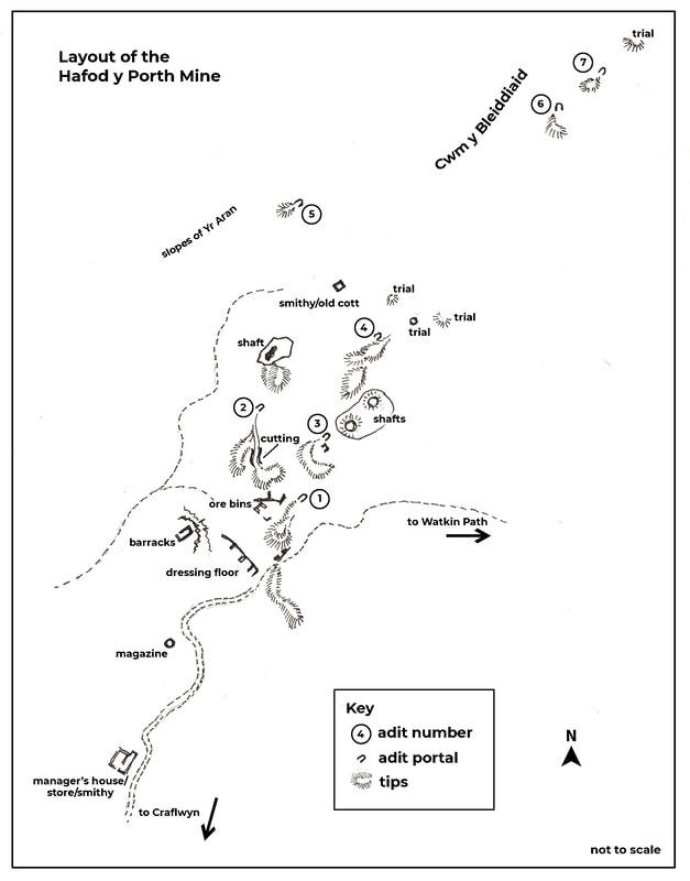 The structures at the mine are very interesting. The barracks is set on a sheltered area behind a rocky knoll to the west of the mine. Lichen grows all over the building, especially on the tops of the walls, giving it a delicate appearance. 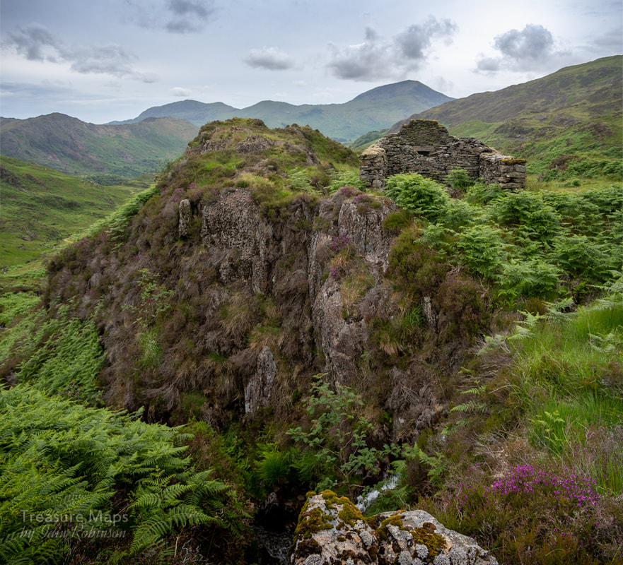 The ravine below the barracks has a waterfall...a very scenic spot, but I hope none of the miners sleepwalked! 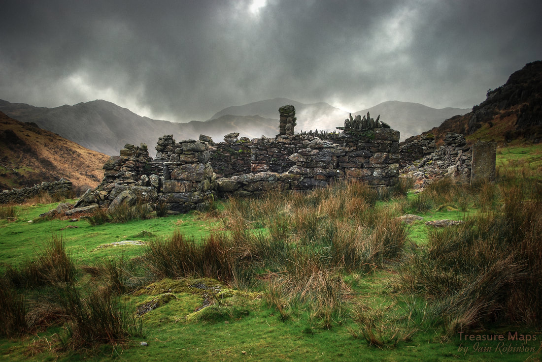 The manager's house on a wild day in March. The place is actually a complex of Smithy, Office, Store and House. Further aspects of the structure are shown below. Above the Manager's accommodation is a typical round powder store... 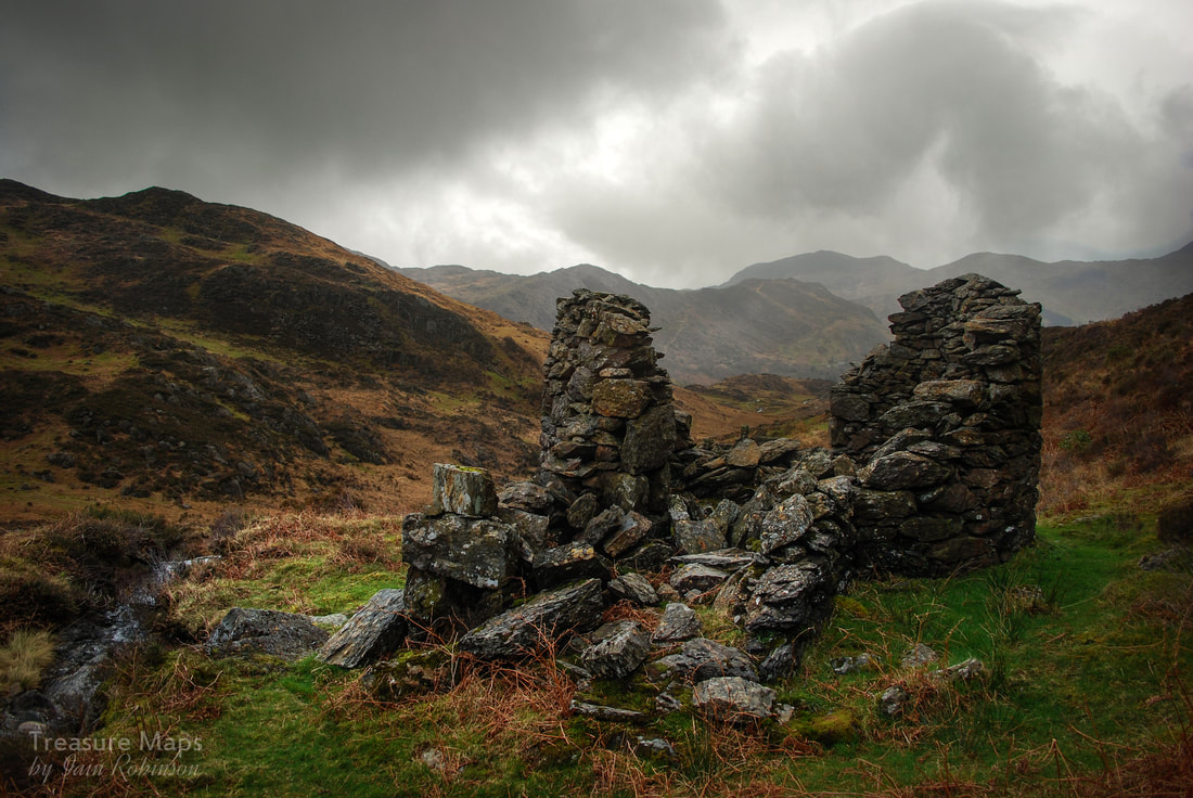 The processing area of the mine is very difficult to interpret- there are tips, obvious ore bins, and the remains of tramways. There's a cutting from one of the western workings to a tip. There is little evidence of the 24' waterwheel or a reservoir to supply it. Near the top of the workings is a curious structure, looking like something from a fairy story. Some sources think it had been a smithy, others that it was a shepherd's cottage...I wonder if it was repurposed as extra barracks for the miners? 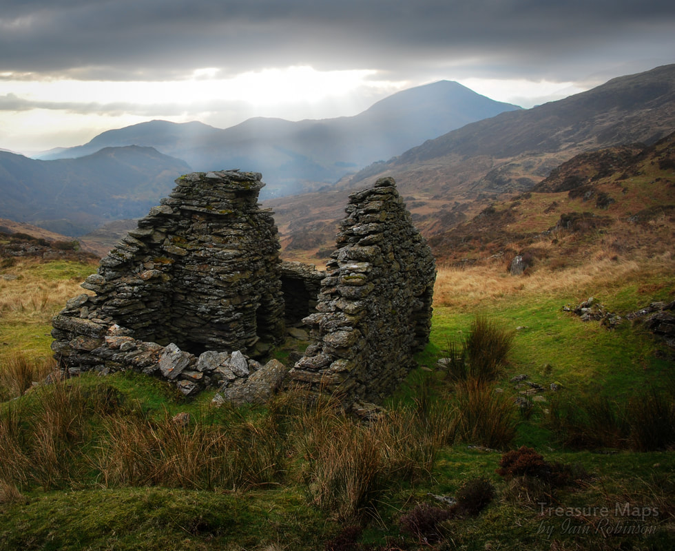 In conclusion, yet another fascinating site, almost quixotic in nature- yet people worked hard here, there was evidence of considerable resolve and determination. Perhaps it supplied some people with wages for a few years; back in the mid 1800s that was perhaps all a miner could ask for. I wish we had some records of the workers, who they were, where they came from. Ironically, a geophysical survey of the site came up with a zone of intense magnetic activity (indicating mineral deposits), around the margins of the complex. There was a plan in the early 1970s to explore this by drilling, but luckily nothing came of it. 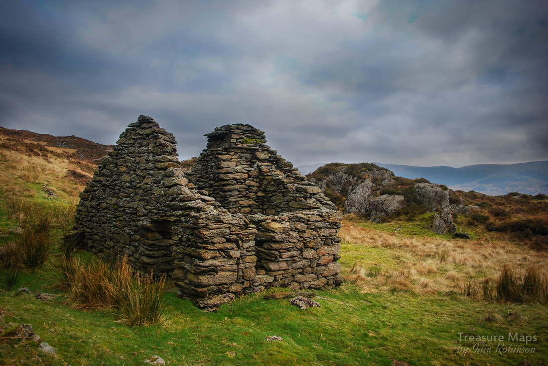 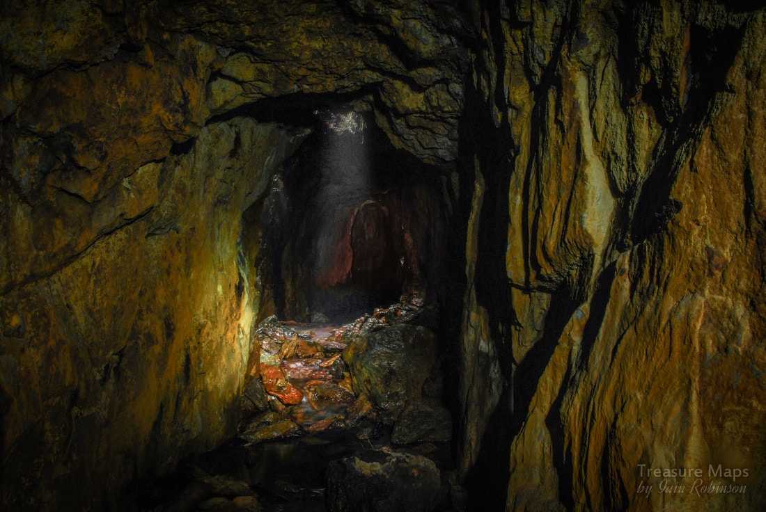 Inside the No.3 adit at one of the shafts, with water pouring down over fallen deads. The tunnel can be seen continuing further. 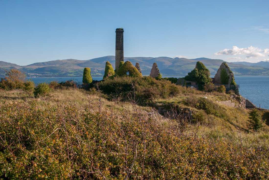 The gables of the processing buildings, covered in Ivy. For some reason, it has taken me over four years to get round to writing about this place. We even came back twice, although I'll admit that it was the small collection of old, seemingly abandoned Land Rovers around one of the quarries that attracted me most. (They've gone to the scrap man now, by the way.) Flagstaff is a very picturesque range of industrial ruins set along a stunning bit of coastline on the south of Anglesey, facing Penmaenmawr and the backdrop of the Carneddau. Of course, Penmon Priory, that tourist magnet, is literally just next door. Beaumaris is a few kilometres to the east. But I'm glad to say this fascinating place is more or less overlooked by those seeking manicured scenic perfection. Could be something to do with the "Strictly Private" notices here and there, although it is possible to walk down from the Priory. 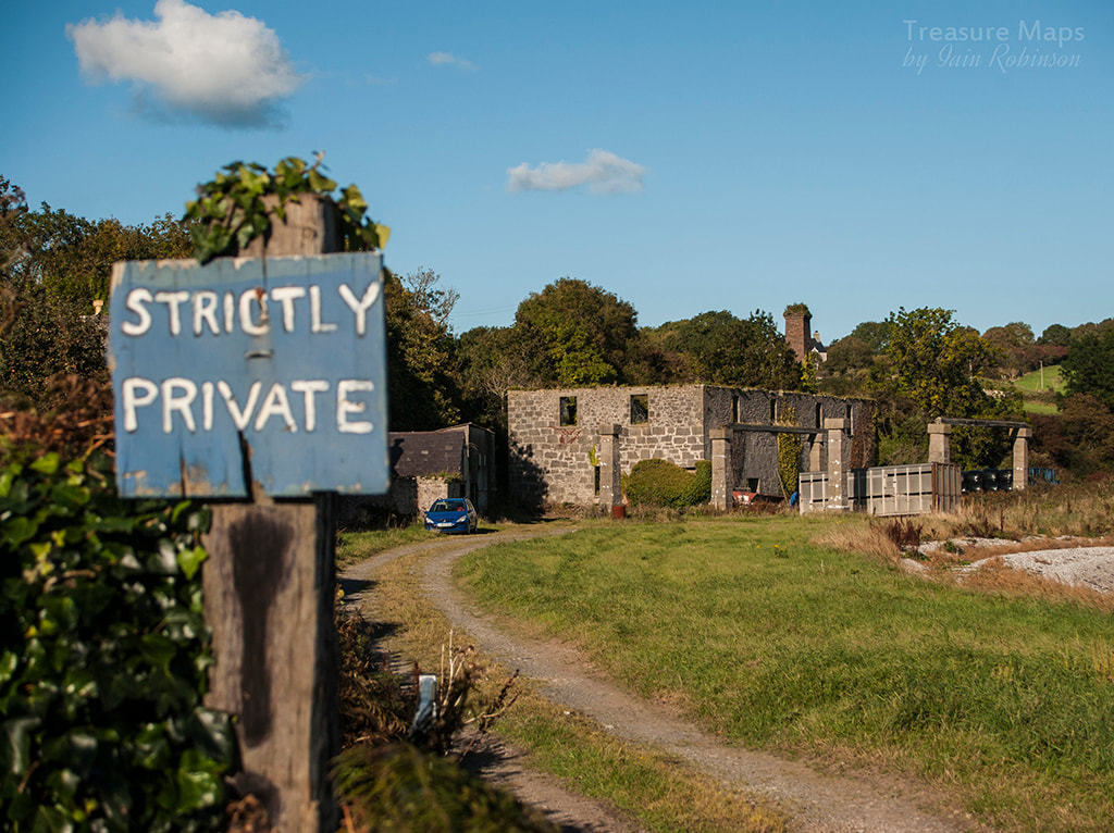 Supports for an overhead conveyor in the Penmon Park quarry yard, now "farmerised". There are actually the remains of several quarries here. The Penmon Park quarry lies 160 m south-west of Penmon Priory- the inclined plane from the quarry to the quay actually runs underneath the road leading to the priory and alerted me to the existence of something interesting when I first visited. There are few traces of the pier nowadays, although the boiler house for the crusher and stone handling conveyors are still in place, albeit ruinous. Inside the quarry itself, a private house has been built from the ruins of one of the buildings. The remains of a powder magazine that was in the vicinity have now been lost. 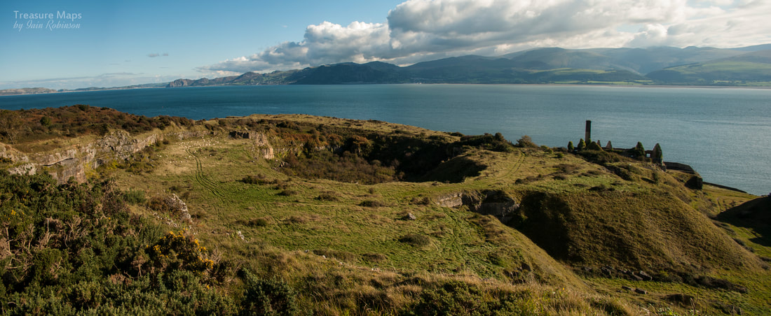 Panoramic shot from the top bench of the quarry, quite close to the Priory. To the north east of the priory lies the larger concern of Flagsaff, which was working eight acres (3.2 ha) at the end of the nineteenth century with offices, buildings and inclined planes taking the stone to a landing stage on the shoreline at Porth Penmon. In 1888 William Baird & Co took over and developed the quarry to supply fluxing stone for their steelworks in Glasgow. Large kilns had been built and the quarry had expanded to 15 acres (6 ha). By the 1920s the quarry had opened 26 acres (10.7 ha). After a period of low activity Dinmore Quarries Ltd commenced working the site, mainly producing kiln burnt lime for agriculture and this continued until 1948 when all production ceased. Further towards Penmon point are one or two small workings- these are probably for agricultural limestone. 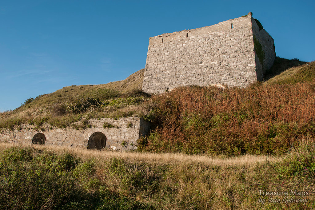 The large lime kiln at Flagstaff. Thinking about the two quarries, it seems to me that the Park quarry was mainly for constructional stone; it had handling facilities but no lime kiln. Against that, there was a boiler house and an engine house for a crusher. But Flagstaff is on an altogether more industrial scale, with massive storage bins and crusher facilities. I can't see much evidence of construction stone being quarried here, although, as always, if you know better, please let me know!. 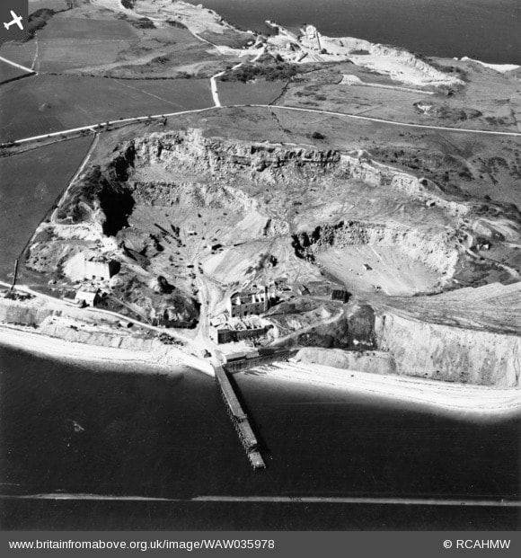 Trawling the internet for further information, I discovered an article from July 2000 on "Agg-net" . The piece states that Lafarge-Redland, who had inherited Flagstaff quarry due to their various acquisitions, had decided to "restore" the site. Sifting through the usual suspicious language about "agricultural opportunities", "renovating old buildings for new uses" or "improving access" it seems that the scheme involved tipping a lot of topsoil, doing some landscaping to disguise the nature of the site and letting the owners, Baron Hill Estate, have access to stone on site. They could have saved their money (around 500,000 Euros) as mother nature could- and has- done the job much better than anyone else. And now to dumb things down completely, I discovered that Flagstaff was used as the site for a celebrity abseil by competitors on "I'm a celebrity..." in 2020. Is that what Lafarge meant by "re-use"? 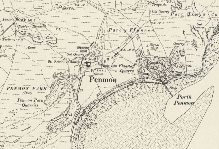 Extract from the OS 6 inch map, published in 1901, by kind permission of the National Library of Scotland. 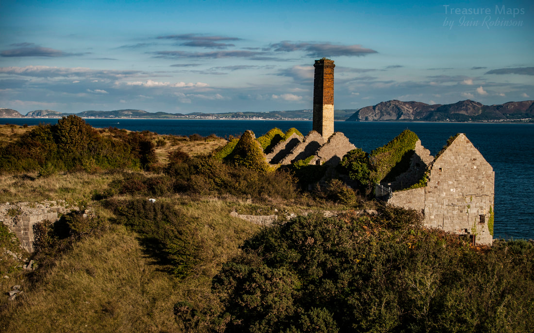 References An intriguing drawing of one of the narrow gauge waggons used at Flagstaff. Coflein's reference to Flagstaff 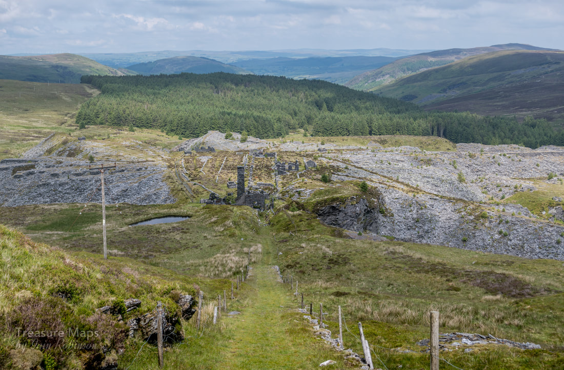 The incline, seen from the last pitch before the crimp. Slate quarries are often sited in awkward places. Rhiwbach is no exception; it is a remote site, spread over a wild corner of the moors between Cwm Penmachno and Blaenau Ffestiniog. As most folk know, the quarry was served by a fascinating tramway which carried the finished slates down to the Ffestiniog railway and on to Porthmadog. Since the area is well above even the elevated position of Blaenau Ffestiniog, several inclined planes were involved. However, rather perversely, Rhiwbach and its near neighbour, Blaen-y-Cwm quarry were both situated below the tramway as it ran over the moor. Thus, they required inclines to lift their slate uphill for transport, rather than the norm, which was for slate to be run downwards. 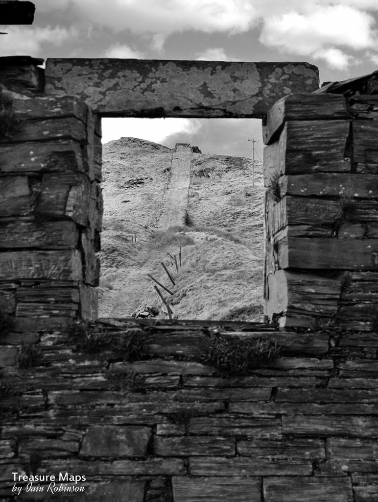 The view from the Engine House. In the first days of the quarry at Rhiwbach, well before the tramway had even been considered, finished slate was sent by horse and cart down through Cwm Penmachno and then to Trefriw wharf for shipment. At least it was downhill all the way. However, wharfage charges and the sheer inconvenience of the distance to the River Conwy began to be an issue and so the quarry management began to look for a cheaper way to send the product to market. In 1820, a new road was built up Cwm Teigl from the south and a cart load of slate was taken down to the quay on the Afon Dwyryd at Trwyn y Garnedd. It is one of those mysteries that will never be satisfactorily cleared up, but although the trip was shorter and easier and the wharfage charges less, the journey was not repeated by the quarry for ten years. Slate continued to be sent to Trefriw until 1830, which seems inexplicable. 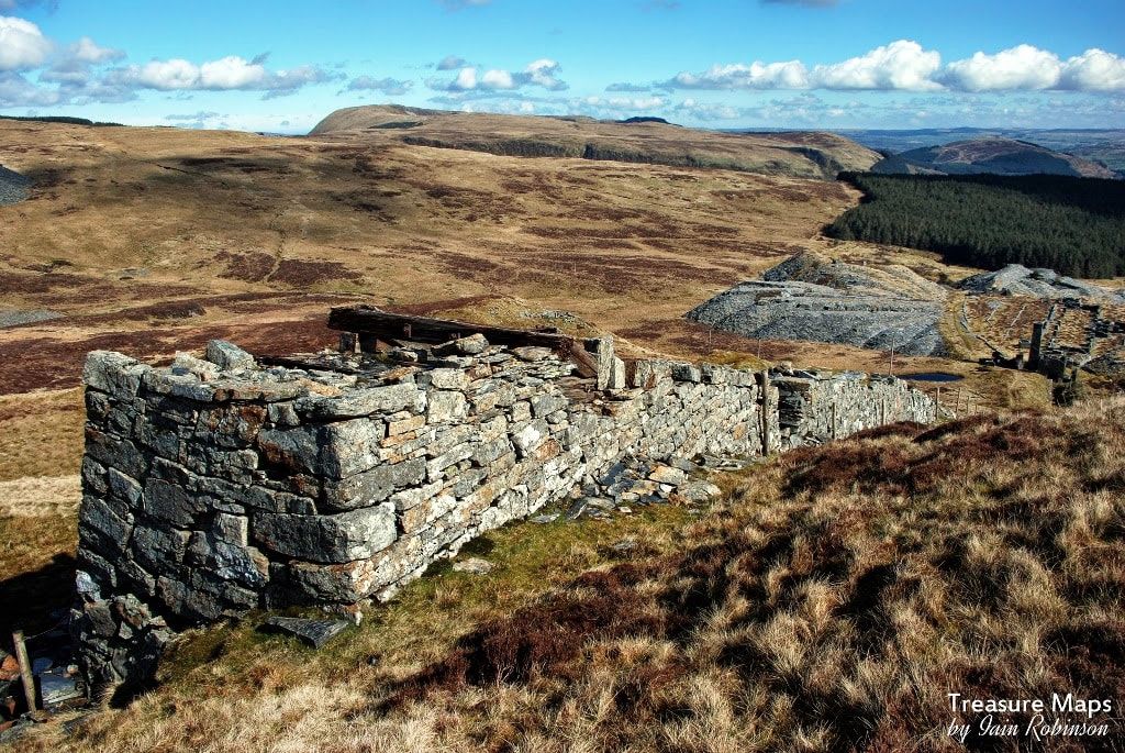 Looking down on Rhiwbach from the top of the incline sheave pillar. A horizontal wheel would have been set atop the pillar in the bearing below the beam. Eventually, in 1860 with the expansion of the quarry, Charles Spooner was asked to survey and design the tramway from Blaenau Ffestiniog to Rhiwbach. The contractor chosen was no less than Owen Gethin Jones, a celebrated local civil engineer, responsible for the railway bridge between Pont-y-Pant and Betws-y-Coed. Ironically, he was a slate mine owner himself, in a small way*. Today, the incline is an impressive feature, which rises up from the mill floor some 220 feet below, to the return sheave at the top. It is is 280 yards in length. At first, it was proposed to build it as a water-balance incline, but no doubt Gethin Jones pointed out that the lack of plentiful water in the vicinity would make anything relying on copious water supplies a non-starter. Instead, he took the unusual step of building an engine house at the foot of the incline, with a cable that would run to the top on sheave guides and then return down in between the rails, being kept taut by a ballast waggon at the end of the cable. It is a tribute to the builders that the incline and the engine house chimney still stand today, despite the wild nature of the weather up on the moor. 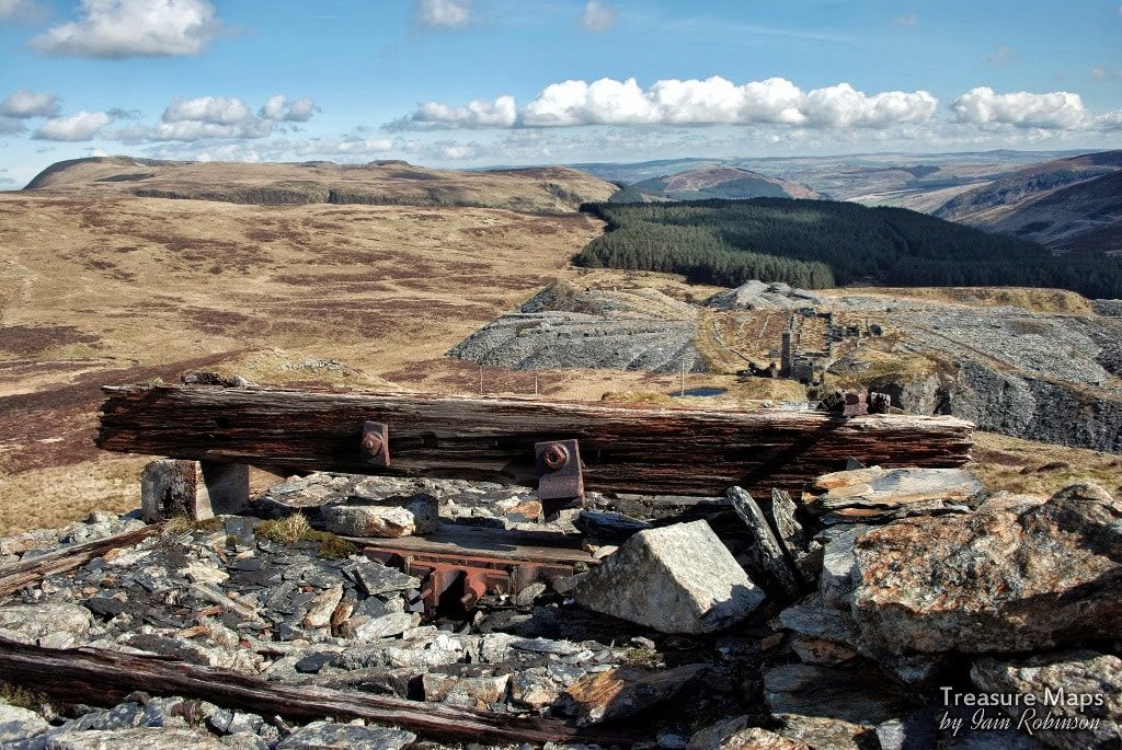 The beam under which the sheave rested. The engine house can be seen behind the sheave beam. While this arrangement is unusual in the area, neighbouring Blaen-y-Cwm quarry also used a similar incline system with a sheave pillar that can still be seen beside the tramway. Back at Rhiwbach, Jones oversaw the building of the engine house and incline. It was powered by a large and powerful, 20" single cylinder horizontal engine of four foot stroke, from the Haigh Foundry in Wigan. It was equipped, we are told, with link motion and reversing gear. Two, later three, six foot diameter winding drums were fitted, one to work the tramway incline, the other to bring slate up from the "New Mill" incline at a lower level. More significantly, the newer drum worked the incline from the Cwm End quarry, the underground workings opened out to the North. Only one incline could be worked at a time. Injan Mawr The men, not surprisingly, dubbed the new machine "Injan Mawr" (Big Engine). Steam was supplied by two massive Cornish Boilers, 24 foot long and 5 feet six inches in diameter. All the machinery was hauled from the railway in Ffestiniog, up Cwm Teigl to the bwlch at Carreg-y-Fran. A journey that taxes empty slate trucks these days, let alone teams of horses pulling heavy machinery up a barely surfaced road. When the boilers were replaced in 1901 they came instead along the tramway and were designed to fit within the loading gauge at the rock cutting just south of the Cwt-y-Bugail quarry branch.  The Engine House today. A team of fitters had come from Lancashire to assemble the "Injan Mawr", but their embarrassment can be imagined when it was found that they were unable to make it work properly, although there was nothing intrinsically amiss with the machine. So, the quarry owners advertised for an engineer who could get the machine to do the work it was designed for. Soon, a man from the Wrexham area, John Jones, applied for the post. By all accounts, he quickly mastered the arcane ways of the machine "without loss or confusion" and was taken on the payroll with some alacrity by the management. He was apparently paid a substantial wage for his skills; most certainly a man who was in the right place at the right time. He later left to become manager at the nearby Bwlch-y-Slaters quarry. A difficult job... It must have been an extremely difficult job, controlling several inclines, especially since the Cwm End incline could not be seen from the engine house. It required a cool and methodical frame of mind. On the railway incline, the driver had a clock dial on the wall . With each revolution of the dial, a bell rang, so that by counting the bells, the driver would know the position of the load on the incline. There was also a lever at the crimp attached to a wire which ran to the engine house, so that when waggons were being lowered the wire would be pulled, ringing a bell in the engine house. Taking waggons up the railway incline was taxing on the engine and stoker, for even though only two loaded waggons were taken up at a time, steam could be lost. Evan Owen Roberts (2), who started work at the quarry in 1922, remembered: "The Railway Incline...where runs (of waggons) were very heavy, we needed to watch these, if the pressure dropped and failed to raise the load, it was serious for you. If you stopped on the way up...the engine's piston had a long stroke and you could not re-start the haulage, you had to lower it down to the bottom again." Raising a run was time-consuming. Firstly, three men would be sent up to the top to act as crewlers, to manage the loaded waggons as they reached the top. There is only a small level area before the sheave pillar itself and it was essential to unhook the waggons before they ran into the pillar. Waggons could only be raised two at a time, so a good run of waggons could take a couple of hours to get on to the tramway. Roberts recalled that he was paid £1.15s per week, but had to raise steam for the engine in his own time on Monday mornings.  One of the sheave/guides which took the steel hawser wire to the top of the incline. Slightly to the north of the engine house is a stone built winding house which was used to raise slate from a shaft to the three underground galleries of the Old Quarry. (The pit to the east of the incline). From documentary records, we know that at one time there were three drums attached to the engine, working the railway incline, the "new mill" incline at floor C and the Cwm End incline. As working in the old quarry had probably been run down by 1860 when the engine house was built, it is unlikely that it was also used to work the headgear for the Old Quarry workings. 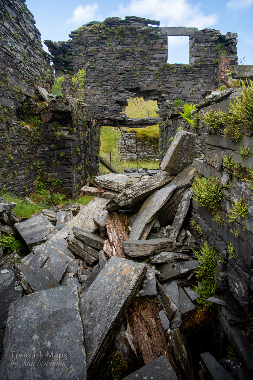 Inside the ruins of the engine house. 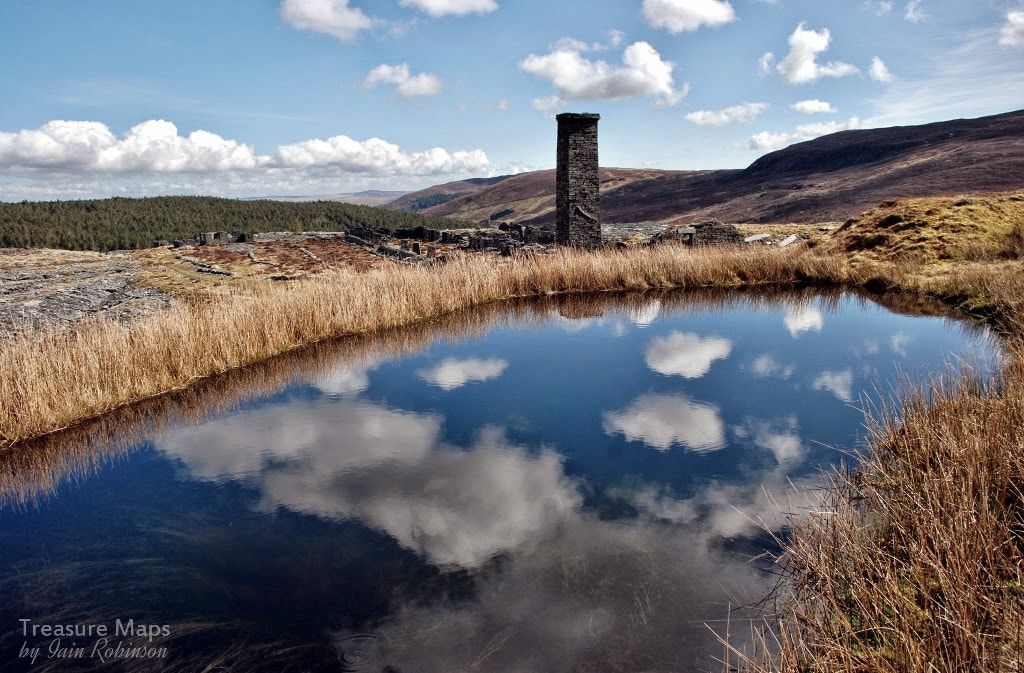 The engine pond- when in use, the engine would consume large amounts of water. Earlier, the lack of any significant surface water was mentioned- luckily, there was enough to fill a small catch pond slightly uphill from the engine house and this proved sufficient to supply the boilers. A pipe went from the pond to a cast-iron tank which ran the length of the east end of the boiler house. Over to Electricity The mill and quarry went over to electricity in 1935, by which time the annual tonnage at the quarry was well below peak 1869 levels. Sadly, nothing is recorded about what happened to the Injan Mawr -presumably it was carted off for scrap along with all the other redundant steam machinery. What a pity that it hadn't been left - along with the engine house and chimney it would have been a jewel in the crown of the windswept moors above Blaenau Ffestiniog.  One of the supports for the Cwm End incline cable as it ran across the mill level from the Engine House to the incline in the north of the site. References: *In the mid 1870s, Gethin Jones opened the Bwlch Gordduant quarry in the Crimea Pass between Blaenau Ffestiniog and Dolwyddelan. (2) From "Rhiwbach Slate Quarry, its History and Development" by Griff R Jones ISBN 0-9533692-2-2-6 "Blaen-y-Cwm and Cwt-y-Bugail Slate Quarries", M. J. T. Lewis, ISBN 0-9522979-3-0 "Gazeteer of Slate Quarrying in Wales", Alun John RichardsISBN 1-84524-074-X Link to the Haigh Foundry Wikipedia entry. Rather surprisingly, part of the original premises is still being used as a foundry, although on a smaller scale. Haigh were renowned engine builders in the C19th and built winding and pumping engines, notably a large Cornish pumping engine for Talacre Lead Mine, near Rhyl, with a 100" diameter steam cylinder in 1862. They also bid, unsuccessfully, for the manufacture of "Prince" for the Ffestiniog Railway. 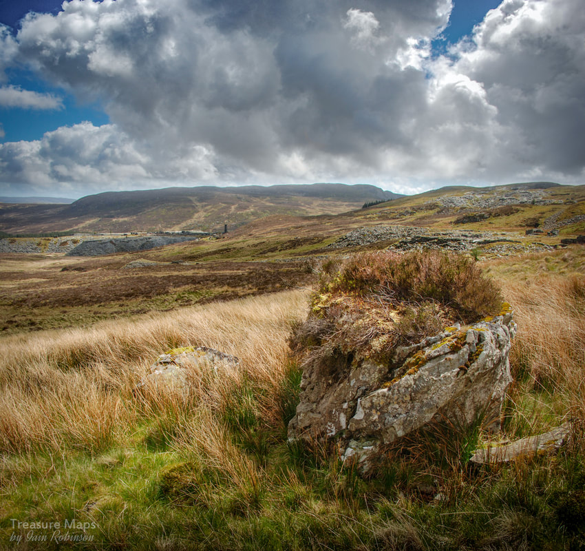 Rhiwbach, as seen from the tramway near Blaen y Cwm. 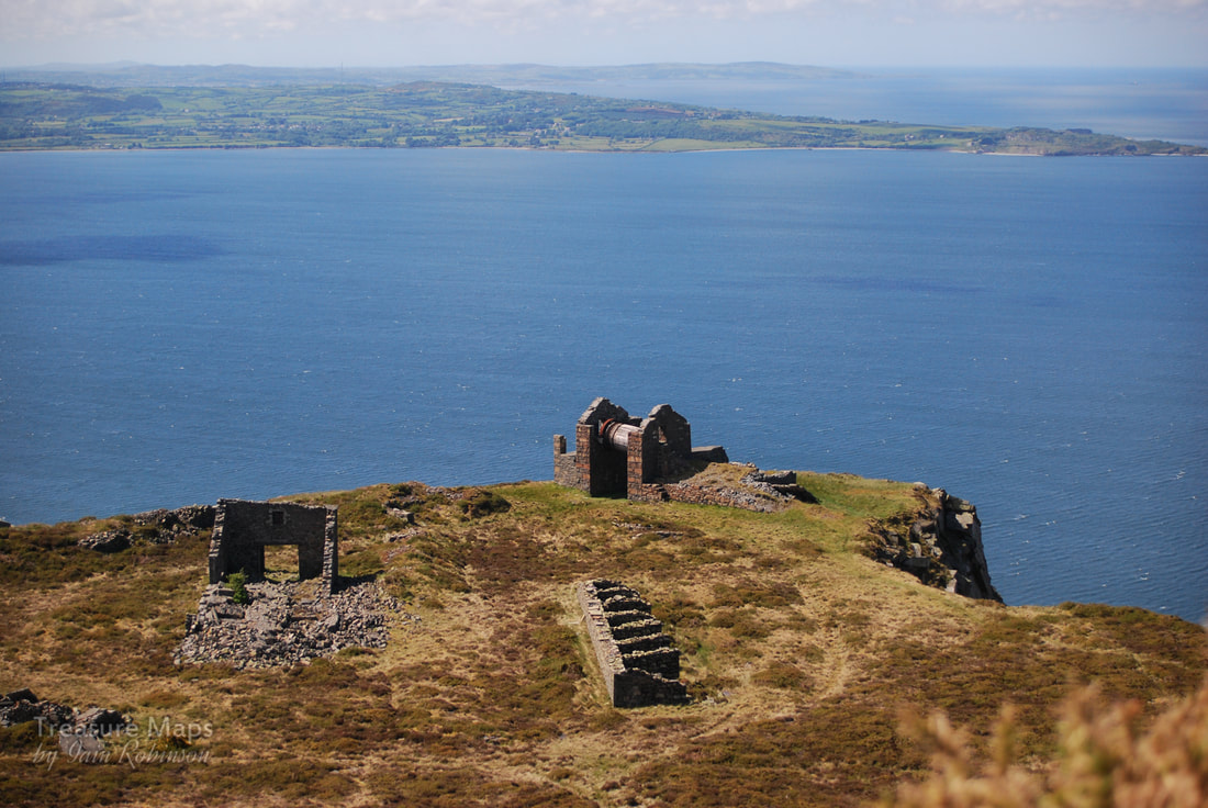 Looking down on Penmaen West Quarry. Over on Anglesey, Penmon quarry can be made out. I always look forward to driving along the A55 from Bangor to Conwy; while it is highly dangerous at times, depending on how late the HGV's are off the ferry at Holyhead, it also rewards with some breathtaking vistas. To seaward, there are views of the Ormes and of Penmon Point on Anglesey, but it is to landward that my attention always wanders. The magnificent remains of the Penmaenmawr inclines and drumhouses cover the headland like weathered veins of mineral on a pebble..for years I'd wondered about taking a closer look at them. There's that funny giant clock, as well... Eventually, we made it and I wrote a blog post...which was subsequently lost on my old Blogger platform, along with a shedload of other stuff.. So this is my attempt at remembering what we did and how we got there- please bear with me if it seems a little sporadic here and there... 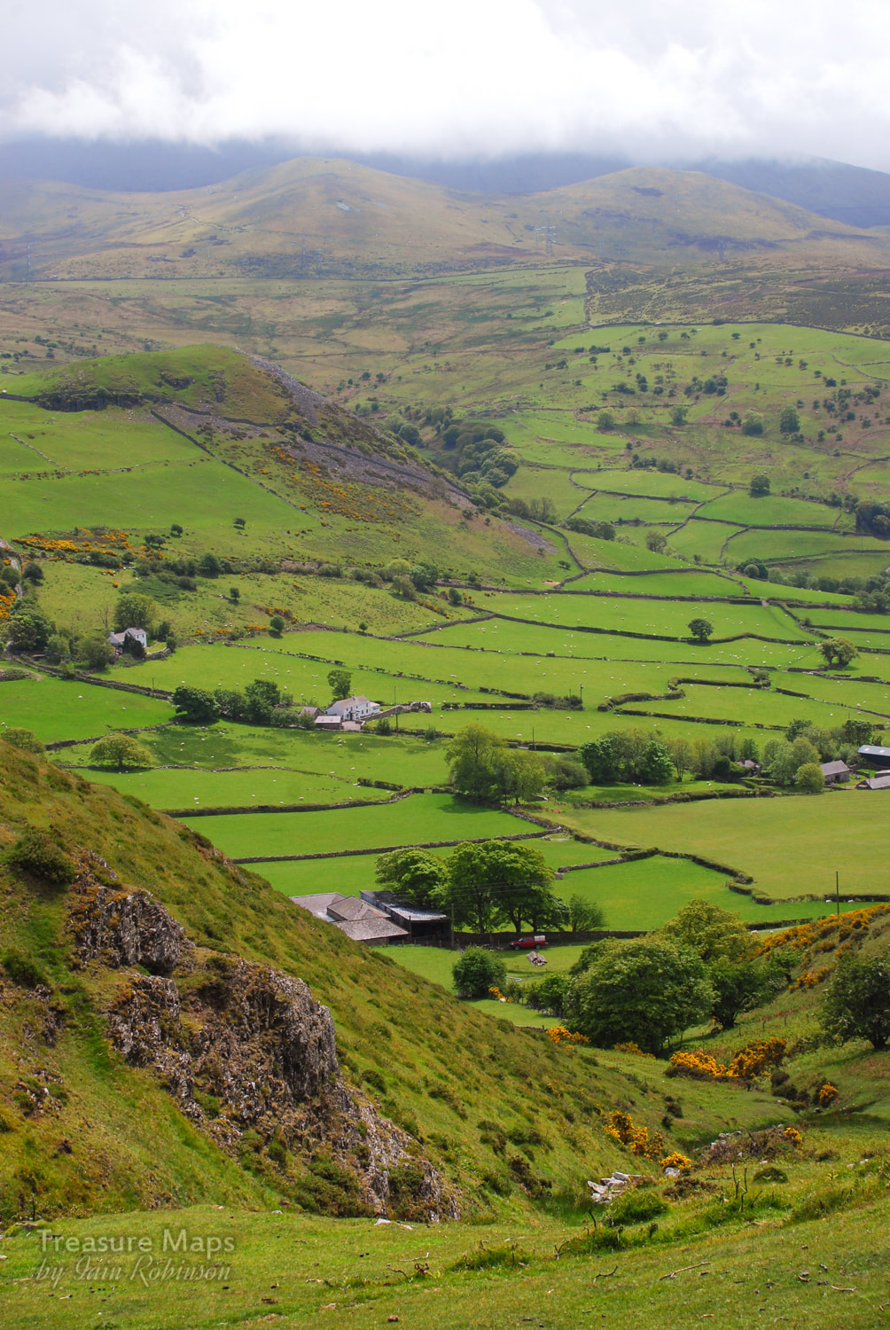 Dinas, from the slopes of Penmaenmawr...the hill is, like Penmaenmawr, an ancient settlement and guards the western end of the Bwlch-y-Ddeufaen. From any angle, Dinas looks like a South Wales coal bing! The slopes of the mountain are criss crossed with footpaths, some made by the quarrymen themselves in days of yore. The best one to reach the upper levels is the North Wales Coastal Path. If you're feeling bold, you can drive all the way up to the Hanson Aggregates old gateway to the quarry at SH 69907 74735. You have to start in Lalnfairfechan at the crossroads, taking the Valley Road up to Plas Heulog. It's very steep and very narrow! There's parking at the gate for two or three cars. The gate is locked, but there's a way round for pedestrians. If using the quarry road, peel off when it starts to turn towards the east and into the pit. You definitely don't want that way! Instead head across the moor as it climbs steeply towards Penmaen West, a lovely airy walk through heather and wild flowers. 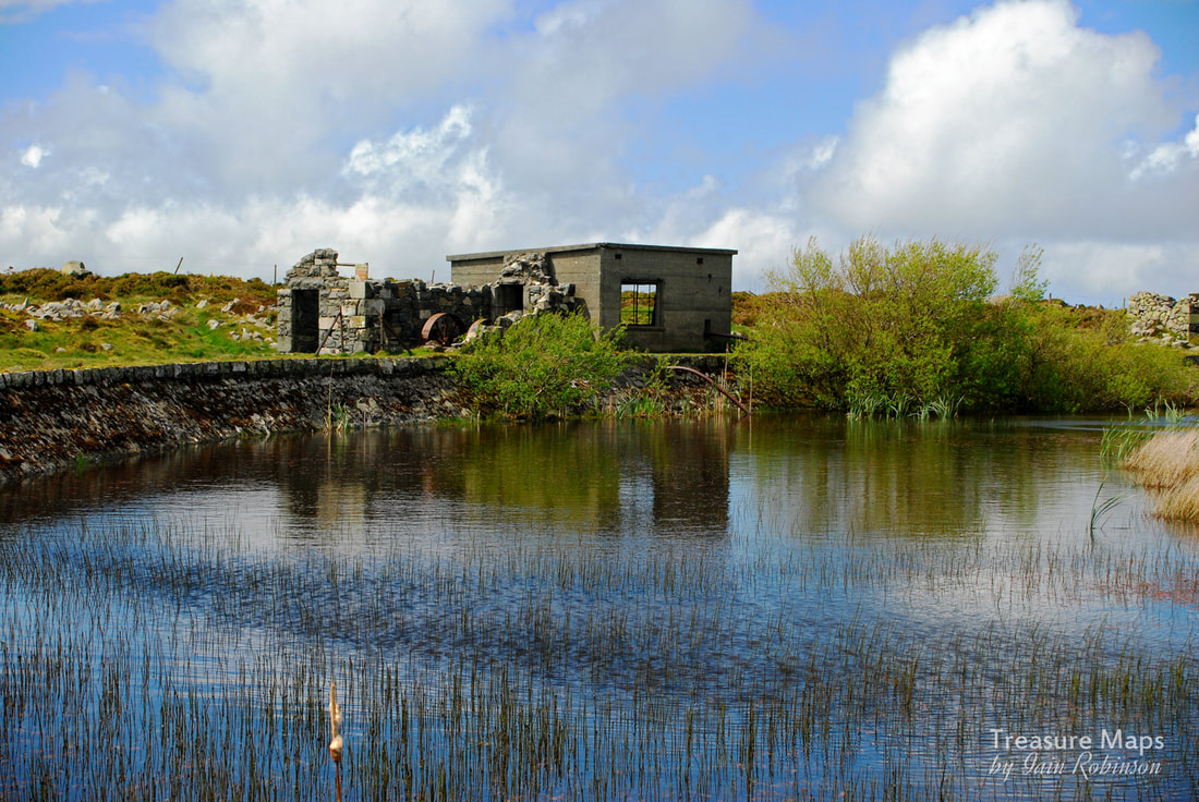 The Hushing pump On our visit, we arrived at a plateau, where a ruinous concrete building revealed a rusty old machine- a fly-wheel could just be made out behind a fallen wall. In front was a small holding pond and evidence of some leats running towards the structure. Inside there was a modern-ish turbine or impeller while in the other, older compartment of the structure was a victorian three-cylinder pump. I looked at this for a while and came to the tentative conclusion that this must have been for "hushing" the rock faces of spoil, the pump providing a strong pressure jet of water. At this altitude the quarry hardly would have needed to be pumped out. On a later visit with my daughter, several wild Carneddau ponies were relaxing in the heat here, their hooves in the water. After mooching around and looking over the lip of the quarry face, where the wind was strong enough to send you flying backwards, we headed up the hill to a ramshackle range of structures looking as if they had strayed from a Sergio Leone movie. Here, various dire warnings greeted us on signs installed by the quarry company. I guess if I owned the land and was responsible and concerned about litigation, I would put signs up too. I think mine would be worded something like "You're big enough and ugly enough to think for yourselves, so don't come crying to me etc..." I was, however, disappointed that there were no signs featuring the falling man with flared trousers, an omission, I think. These structures here were compressor houses and some smaller buildings that might have been cabans or the like. The larger ones were made of concrete, a material readily to hand on site, while the others, which must have been older, were expertly constructed from Whin Stone, a hard, brittle form of rock which chips sharply and is difficult to build with. It must have overlaid the granite as overburden and used as it was easily to hand. A very steep incline ran down from this level, leading to many more interesting structures. including the level where the famous De Winton "coffee pot" locomotive, "Penmaen" still slumbers. The views are fantastic from up here though. I know that the mountain has been despoiled by the quarry- and that the quarry masters are like some mischievious agent of destruction, obliterating not only the pretty views but also anything of worth archaeologically which gets in the way of making money. I admit to being one of those people who love scenes like this, although I regularly get my fingers burnt when artifacts from an earlier and more colourful quarrying era are destroyed by the very process that fascinates me. C'est la vie. 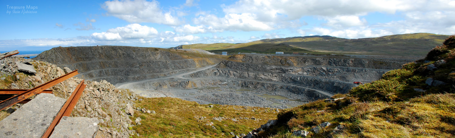 For the view from the north side of the pit, see my earlier blog about Penmaenmawr and Fox Bank. Over a few months, we made various sorties up and down the various levels, but didn't make it over to Penmaen West due to the old quarryman's path being eroded away almost entirely. Looking at the 1890 maps the path seems to have been the main route for workmen coming from Llanfairfechan, but that it is also joined by a steeper path coming up, I can only assume that these old quarrymen were made of stern stuff. The track has collapsed in several places and sometimes progress can only be made by inching along a very narrow ledge- it's very dangerous, but as I said before, you are big enough etc...just don't say I told you to do it. 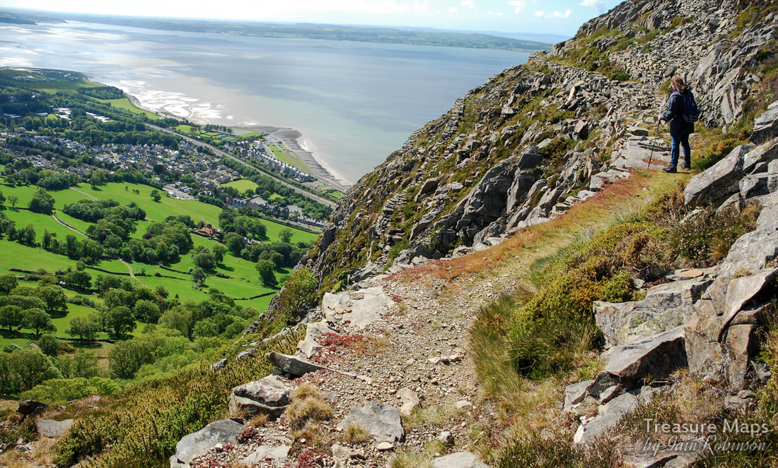 Petra considers the view from the old quarryman's path. While wandering around the slopes, we encountered a very fine powder store, one that I've not seen mentioned anywhere else. It's below the top level at SH 69712 75755 and is quite easy to access. 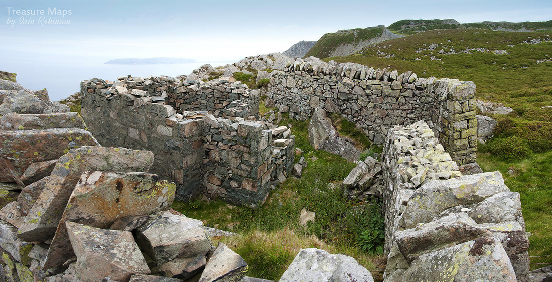 The ruined powder store, with curtain walls still intact. The temptation of the "Coffee Pot Level" was becoming hard to resist, so we made our way down the steep incline from the outer lip of the pit. There was nearly a foot of heather on the slope, but the rails were still in place underneath. Similarly on all the levels, there is still a wealth of ironwork and relicry hidden beneath heather and undergrowth, and long may it relish. A glance at Google earth will see how this joins other inclines and leads to a cornucopia of structures and other delights, of which I can only hope to give a flavour of here. And what of "Penmaen"? Eventually, we were standing outside the shed, looking at the old De Winton's remains. What a lovely thing it is, being left to rot away in dignity. The unseemly paint daubs of a few years ago have faded away- after all, these days anyone who wants to know about the loco just needs a browser and Google. The loco reminded me a little of "Alice", left slumbering away in her shed on Australia level at Dinorwig- except that Penmaen will actually be left to rust in peace. This side of the quarry has such a proliferation of structures; there's almost a feeling of "drumhouse fatigue" after a while- but guard against that, these lovely things won't be here forever. I am conscious that they could be swept aside by some new development, however remote the possibility seems. Here are some shots of the buildings, in no particular order, to give a flavour of this side of Penmaen head. The light is quite critical here, better to be earlier in the day; when it's later the shadows are in the wrong place (as you can see from my "Penmaen" shots above); not helpful. There are still many areas of Penmaenmawr to explore; I want to have a look at the brick built loaders at Bonc Jolly, but have been chased off a couple of times so far. There's the Pendalar Inclines, whih we almost got to before being stuck in acres of brambles -and then there's that clock, which still eludes us. Soon... Here are a few more random images of the place... |
TracksReceive the occasional Treasure Maps Newsletter- and alerts when a new post is available!
If you enjoy my content, please buy me a coffee!
Check out my other online activity...
Index
All
|


 RSS Feed