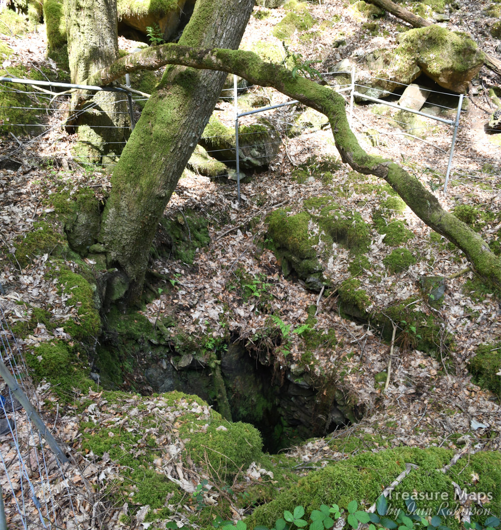
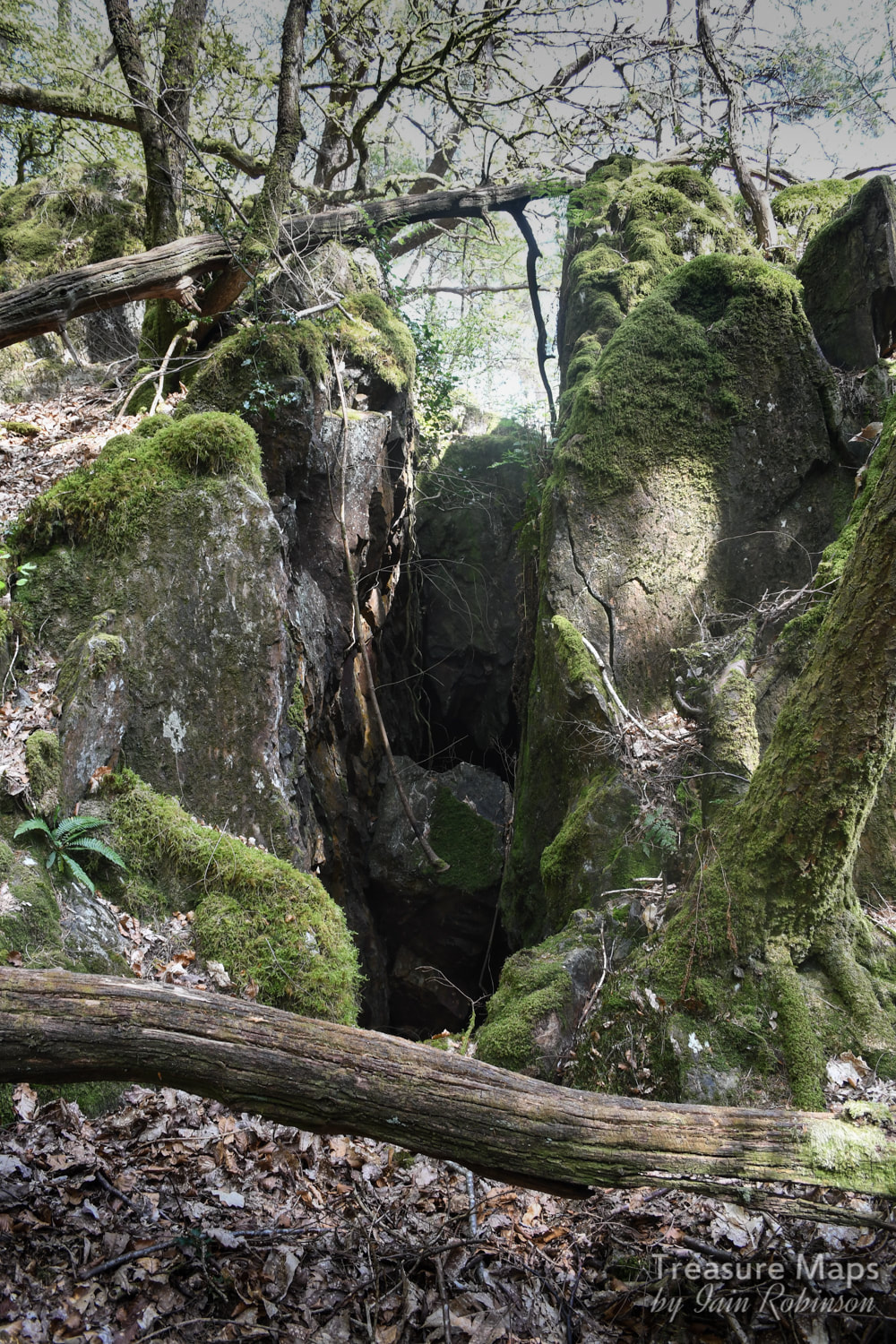
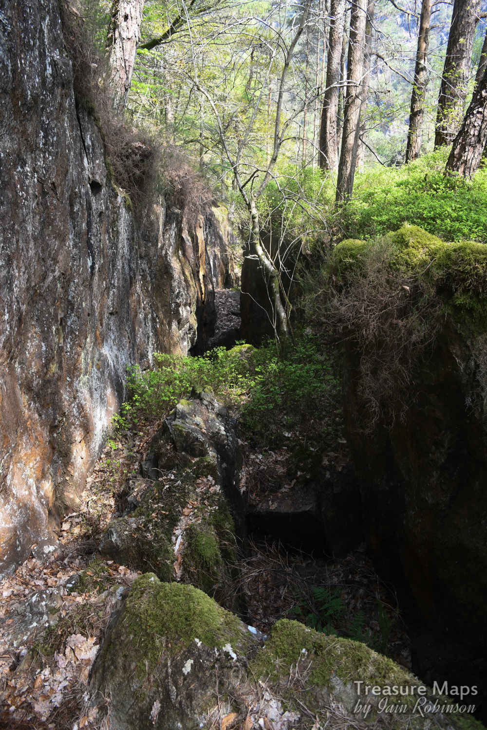
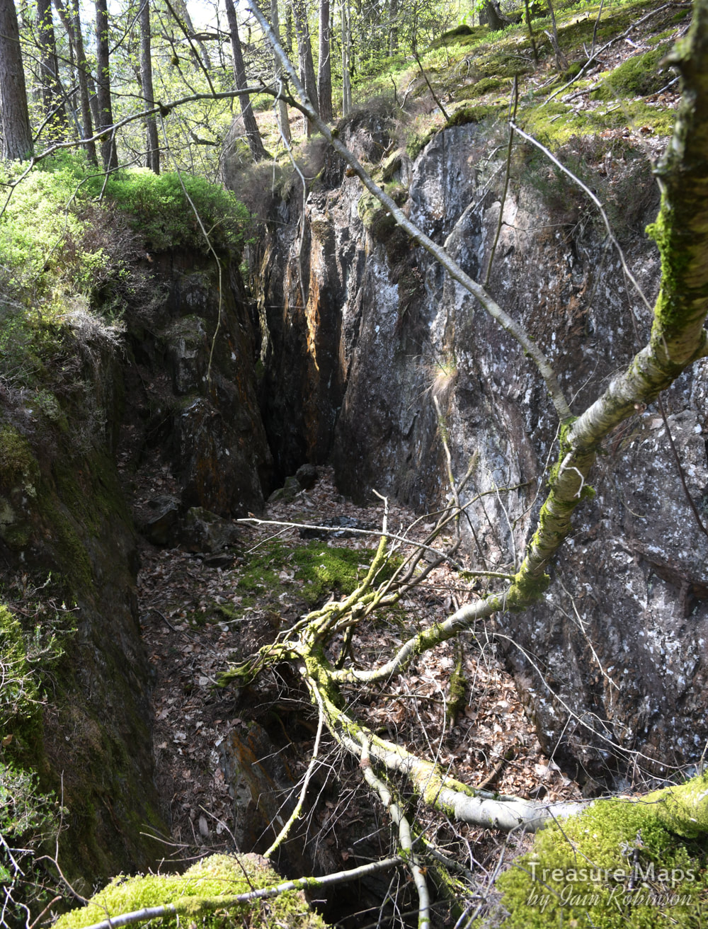
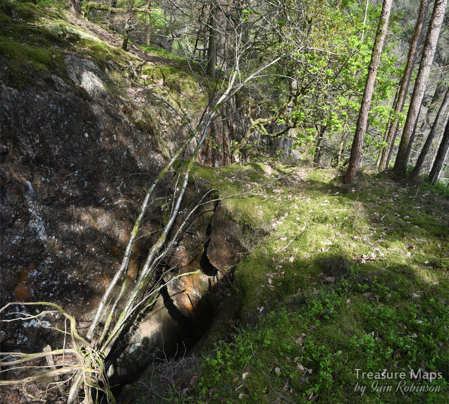
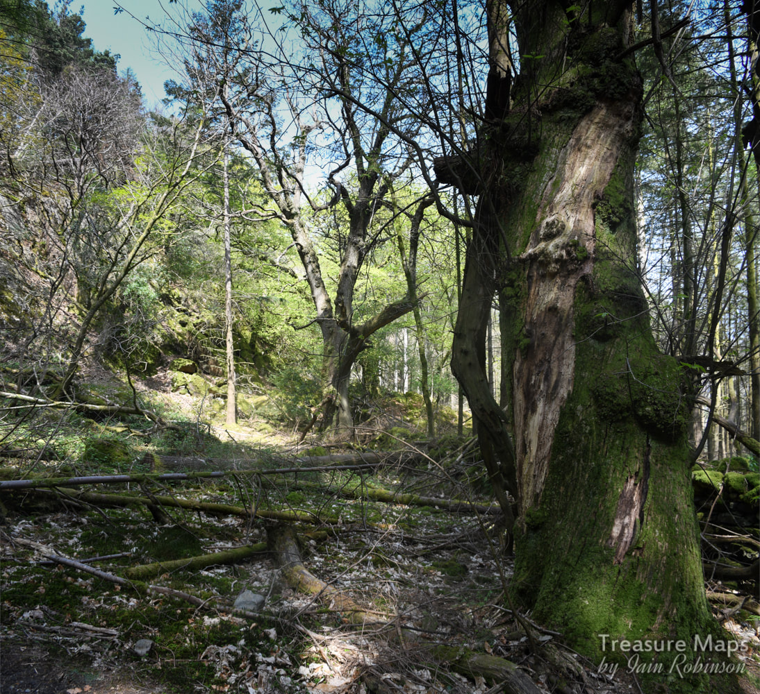
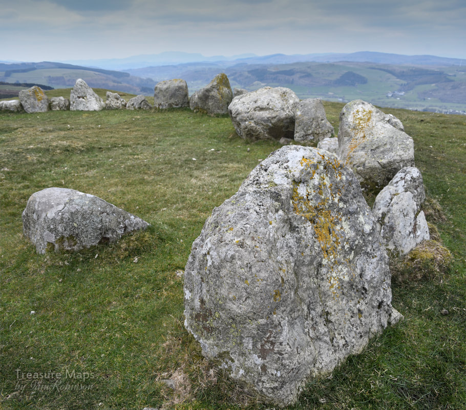
 It was Easter Saturday and the weather was perfect. Of course, that meant that the tourist hordes would be milling in their hundreds round the usual places, but Petra hatched an idea to take a look at the little-visited neolithic fort at Pen y Gaer, high up above the Aberglaslyn gorge. For some reason, neither of us had checked the route- both thinking that the other had done the homework. That wasn't actually to be the disaster that we feared, although it was far from best practice. Once at Nantmor, it became evident that all of the folk in Manchester and Liverpool had got up early to come to Cwm Bychan...the car park was beyond full and cars were abandoned everywhere. The path at this point in the gorge resembled a long conga line. Don't get me wrong, Wales needs people to come and spend their money- I'm just glad we know a few places they don't- although perhaps one less after this :-) Undaunted, we renegotiated the busy traffic . Petra spotted the rumour of a space opposite Aberglaslyn Hall- incredibly, there was room- and after some Reginald Molehusband* style manouevres, we managed to get the car parked completely off the road. A National Trust footpath wound up the hill directly opposite. This was surely a sign from the gods of mining, and we wasted no time in getting the boots on and setting off. Petra muttered something about remembering a road going up, but the last time I had looked, I'd seen the path through the woods, so I didn't pay as much attention as I should. However, within a few yards, the site of a quarry pit opened up in the trees. Things were now looking promising and we dismissed any doubts we might have had about the route. We climbed on and came to a junction, where yours truly made the executive decision to take the right hand path. As we later found out, the left hand path would have taken us to the fort, but never mind, what we found later made up for that temporary disappointment. 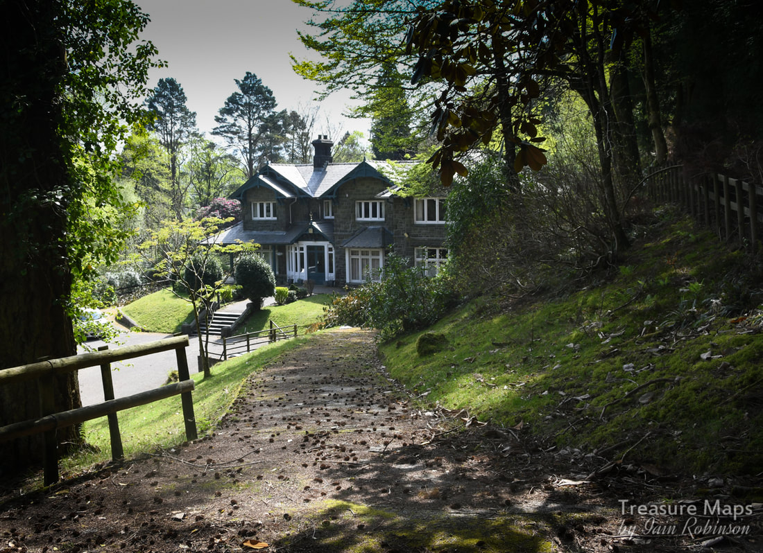 Aberglaslyn Hall, once a study centre for Leicestershire Council. The hall was originally built in 1880 as a private dwelling by John Ernest Greaves. A later owner built an organ powered by the stream! A mine opencut appeared, looking like a trial. This boded well, and I brandished the trusty Nikon, only to find that I'd forgotten my memory card! Ugly tantrums were averted as Petra always carries a spare- what a top girl. Whilst ruminating beside the opencut we spotted some ruined buildings in the trees...the game was on! The structures were what looked like mine offices, with some curious copper sculptures inside. It reminded me of the office at the Gamallt mine. Nearby was a fenced shaft, looking like it reached a level fifteen feet down and then carried on to the east. To the North of the shaft was an opencut which started off in a modest way, but soon became a massively deep stope, testifying to the large amount of material mined from here. We followed the stope for a few hundred yards, amazed at the depth and the work that had gone on. 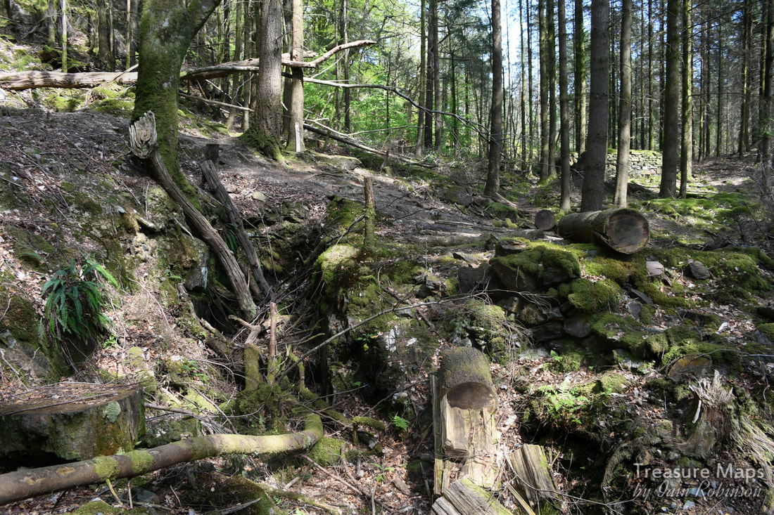 The first opencut, with the mine buildings in the background. 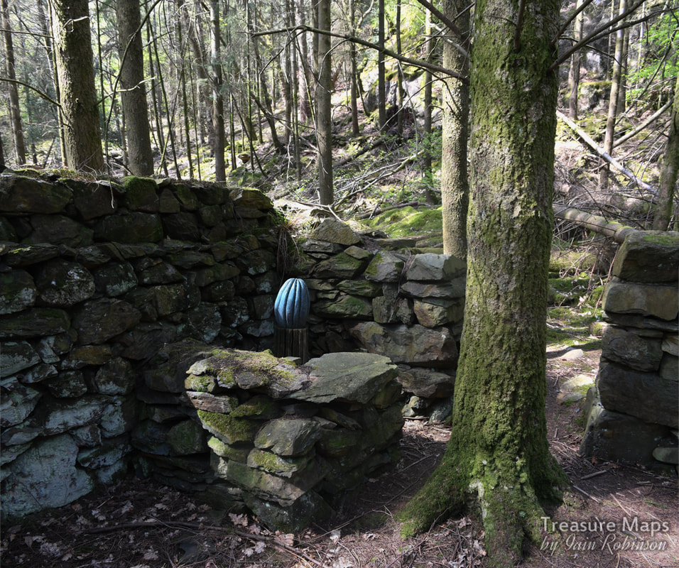 One of the sculptures inside the building. 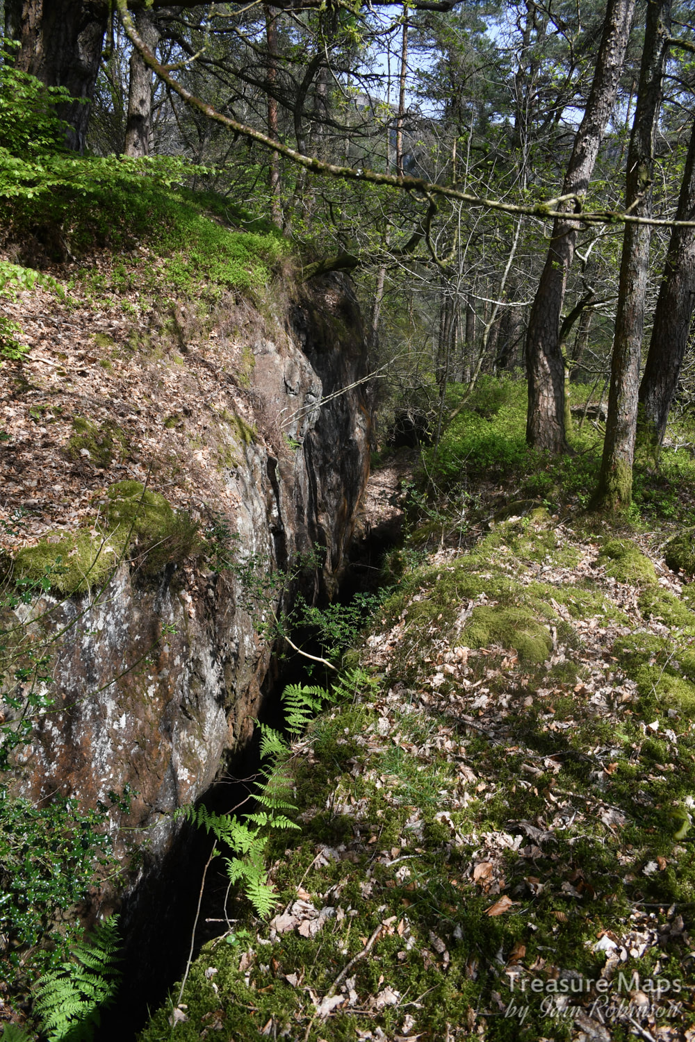 The stoping, continuing down the hill and getting deeper... I consulted my patchy memories and surmised that this must be the Aberglaslyn mine, a fascinating early copper enterprise which starts in the garden of Bridge house on the road below and continues up the hill in a series of shafts, opencuts and adits. We didn't find any open adits- the ground was difficult, being thick woodland, but I was so pleased to have found the mine- I had not imagined ever being lucky enough to see it. Below, things became very steep, and then the garden of the house precluded further exploration. Bick, in his "The Old Copper Mines of Snowdonia" has an amusing description of exploring the adit near the house in 1955, when it was in use as a larder! Bick also talks about a waterwheel pit and area for a stamps battery higher up, but these appear to have been lost in the forestry. After exploring for an hour or so, we found an ant-free log and sat down to eat our lunch. Wood ants were swarming everywhere, intent on whatever ants do, looking busy and preoccupied. They are fascinating creatures and I spent some time watching, until a large one crawled on my hand and bit me. It was a sharp nip for such a small being, and I wondered if I was going to be assimilated into the hive mind. But nothing happened, so I gently brushed the pugilistic fellow off. 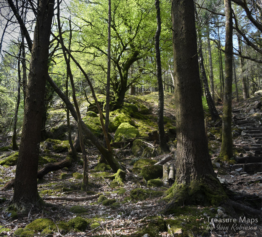 The woods, continuing up to the tower on the top of Bryn Du. The woods were absolutely wonderful, the air full of bird song...thrushes, blackbirds, other less obvious calls- and woodpeckers, drilling away manically. It felt like the place was teeming with life. We climbed further up, hoping to find the edge of the woods and perhaps see the fort. At this point, we encountered the only other folk we were to see in the woods, a rather miserable American family who also seemed to be having memory card problems- we couldn't help overhearing their loud conversation. 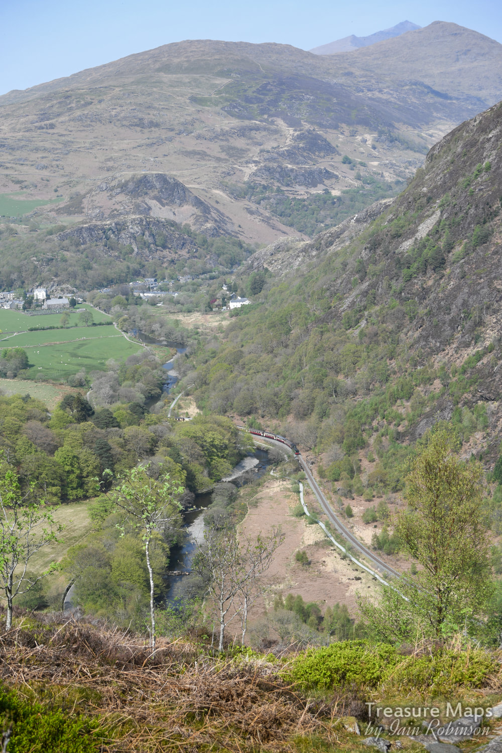 The view from Bryn Du towards Beddgelert, complete with train. Finally, the path left the woods and continued to a fascinating knoll high above the pass. This really felt like Bestall country...not surprising as the creator of the beautifully crafted illustrations in the "Rupert" annuals lived in a cottage at the foot of Mynydd Sygun near Beddgellert. I felt he must have walked here, as the scene reminded me of a puzzle in one of the books I had as a child. The view was spectacular, and took in Snowdon as well as the village of Beddgelert. There was a "tower" here, looking like a powder hut. Coflein suggests that it may have been a WW2 lookout post, but I don't really believe that. What were they looking out for? Had the germans a plan to bomb the heck out of Beddgelert and we weren't told? There was also the small matter of the hike up there. Petra noted from the rubble around the tower that something much older had once been on the site... perhaps a neolithic cairn- there are plentiful remains of prehistoric settlements here. It might have been the right shape, but it didn't really seem like a powder hut; for one thing it was too far away from the mine. There are other mines below, notably the "Level Goch", the blocked deep adit level of which is betrayed on the road as a series of red water stains. We could also see the Bryn y Felin mine far below. Being a simple soul, only then did I join up the dots and realise the genius loci and where we were in the geographical scheme of things. That's what relying on Streetmap and online mapping will do for you, you miss the bigger picture. Petra is a Google Earth girl, so was way ahead of me. We relived our fun explore of Bryn y Felin, then watched a Welsh Highland Railway train snake through the pass below looking like an 009 model. 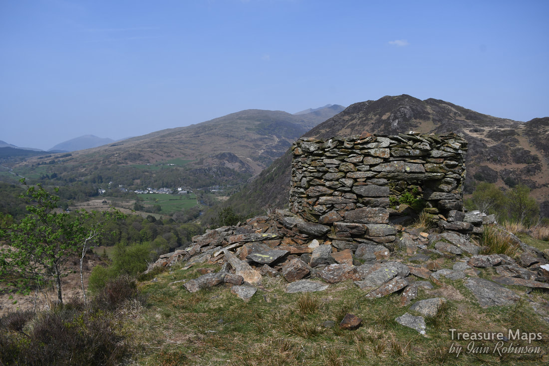 The "tower". The hill behind is Moel y Dyniewydd, behind that is Craig Wen, and then the mighty Snowdon. Behind them all on the left...I think it might be Moel Eilio. It was still early in the day. All around were familiar hills, blue in the warm haze- Cnicht, the Moelwyns, Moel Hebog and of course, the big boy, Snowdon- all familiar to the readers of this blog. I could almost see the mass of humanity on the summit of Snowdon in their shorts and flip-flops. We realised that our path continued on, down to Beddgelert- somewhere we had no intention of going with all those folk wandering about. Perhaps we could do a traverse across trackless country and still find the fort? Find out what happens in the next post soon :-) 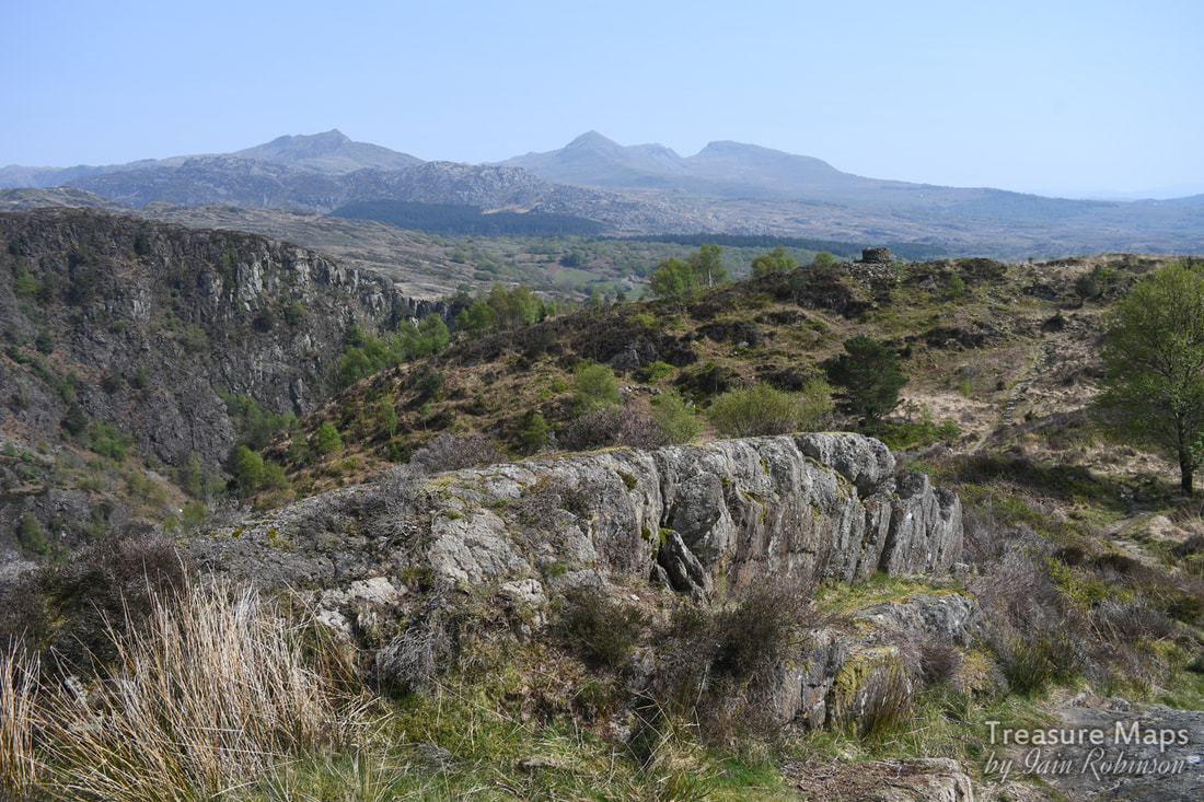 A distant Cnicht, with the Moelwynion massif to the right. In the middle foreground is Bryn Du. Aberglaslyn mine factoids: Copper was known to be here by the Romans, although it is doubtful whether they ever did anything to extract it. In 1769, correspondence appears from John Griffiths of Portmadoc (sic) and Lord Powys- a year after the great discovery of copper at Parys mountain. Griffiths implores Powys to invest in the location, saying: " Your Lordship will find there the noblest vein with such prospect for profit I ever saw..." Powys was interested; his Uncle's large gambling debts needed clearing among other things. Bick points out that at this time, the Glaslyn river was tidal at Pont Aberglaslyn, and that boats could come up and load ore almost directly from the mine. The construction of the Cob at Porthmadog in 1811 changed all that. Also, in the 1760s, there was no road through the pass. In 1810, Richard Fenton observed that a copper mine adit was being worked energetically by some "Cornish Adventurers". Afterwards, it was reported that a stamping mill had been erected. Sadly the sources do not mention where. After 1847 the mine continued only sporadically, dependant on the price of copper. A report by a mining engineer in 1907 indicated that nothing had been done at the mine since it had been closed when in posession of J.W. Greaves, putting 25 men out of work. The mining engineer thought that the site was very favourable and that prior to his report, the site had been worked in a most primitive manner. Bick seems to think that the deep adit near the house was driven after the mine closed (?) connecting to the main workings. The paucity of records during the entire life of the mine make it hard to guess at the output, although we know that between 1804 to 1847 only 56 tons were sold at Swansea. But genuine figures rarely reached the authorities in the early part of the C19th, so that figure is relatively meaningless. "The Old Copper Mines of Snowdonia" David Bick, Pound House press, Newent. Reginald Molehusband Aberglaslyn Hall To the next post
0 Comments
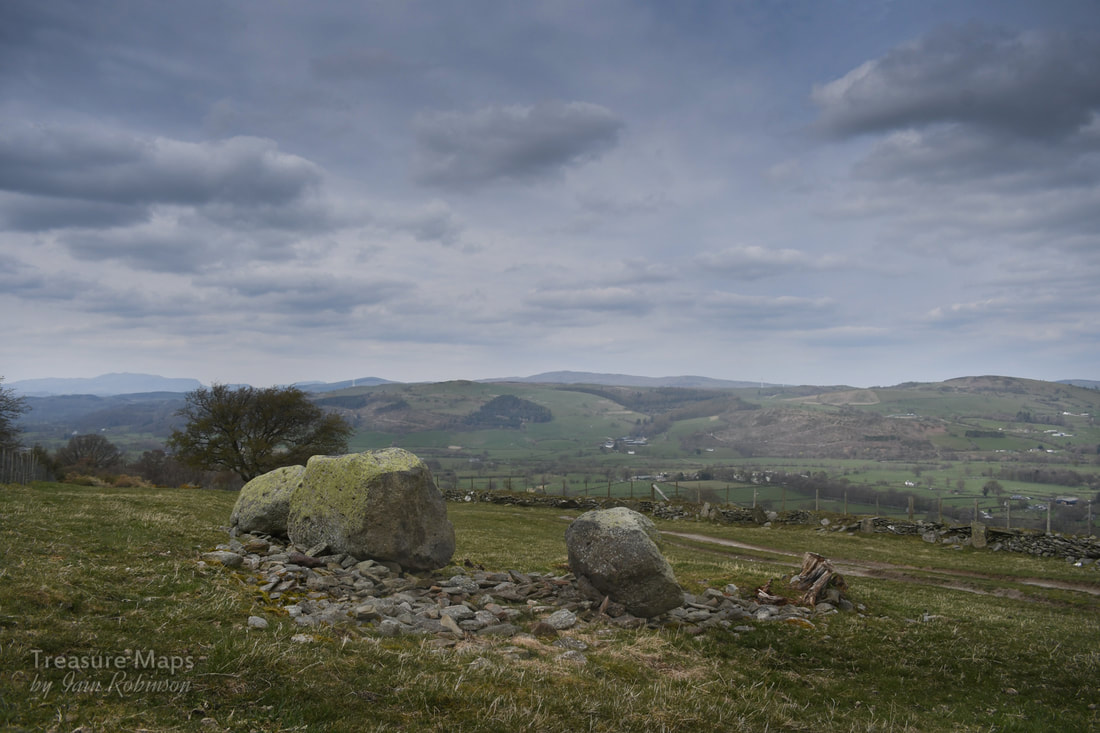
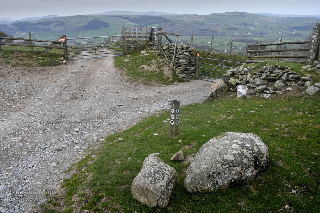
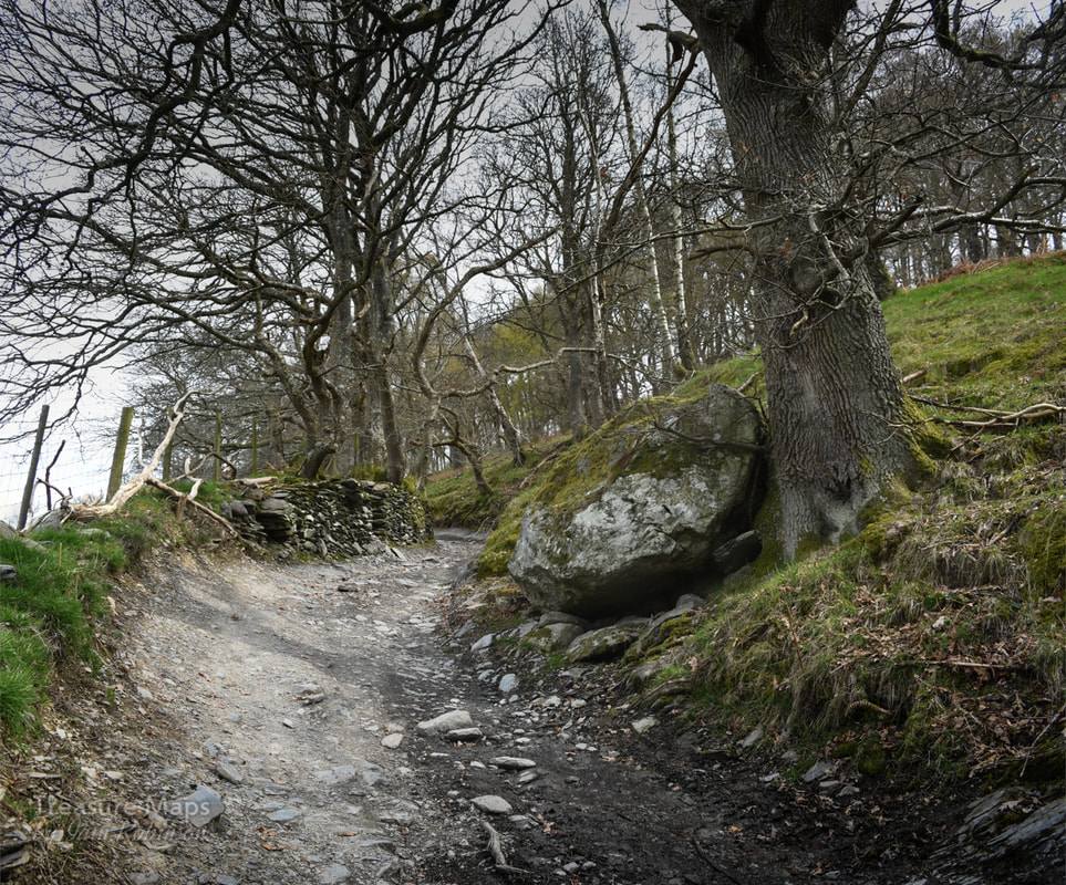
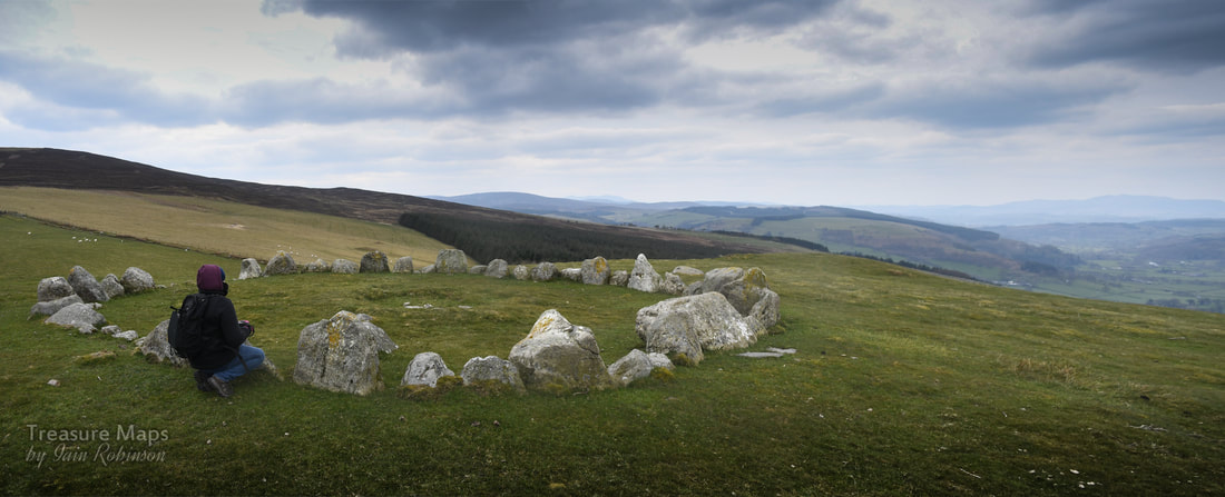
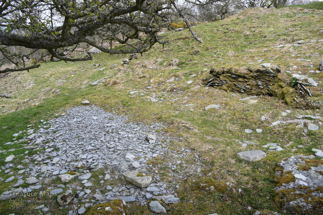
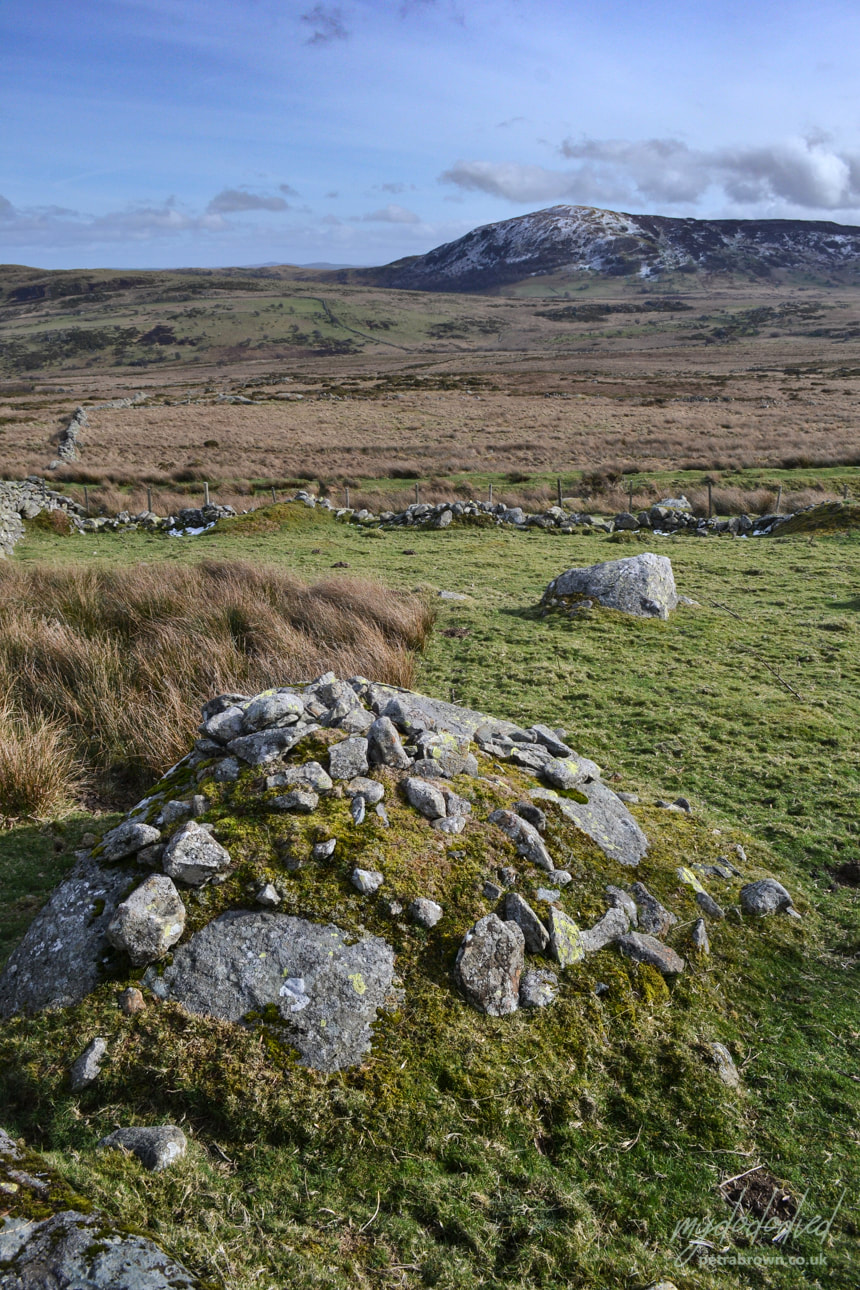
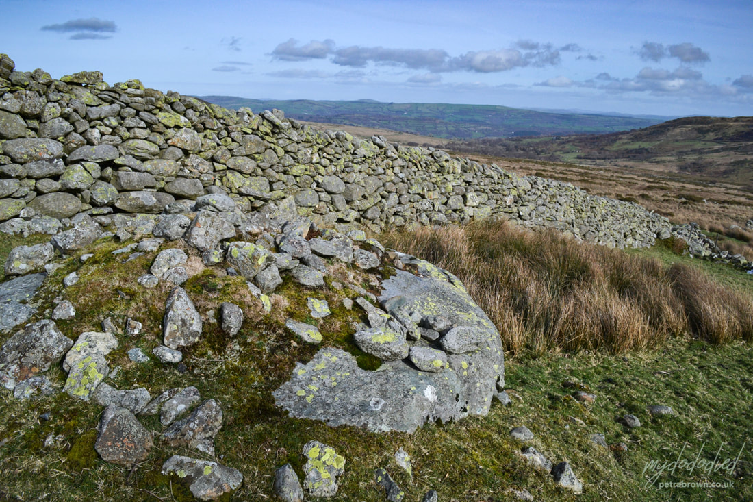
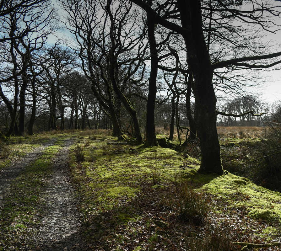
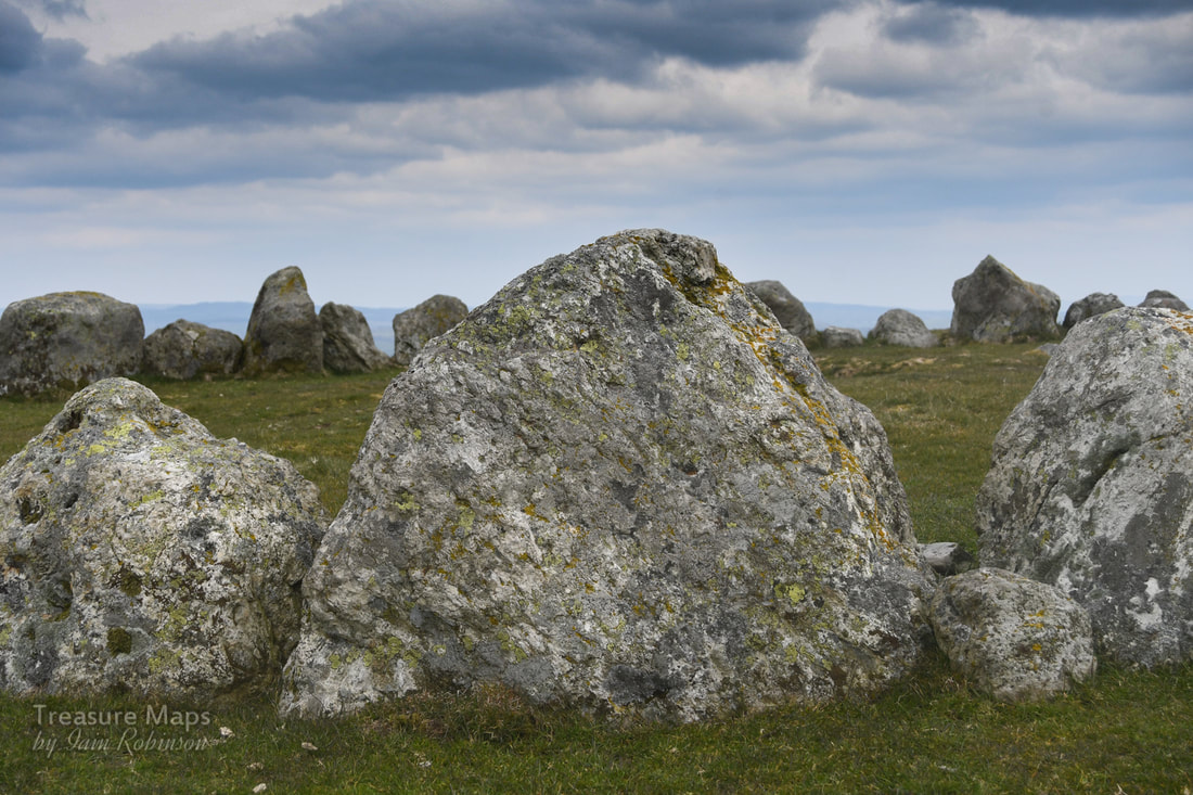 It was a bitterly cold Saturday in early April- the weather hadn't been told that buds were on the trees and spring was supposed to be coming. We'd travelled to Llandrillo, a pretty little village between Bala and Corwen- and were walking up the steep road that wound up the slopes of Moel ty Uchaf. The plan was to see what most authorities call a ring cairn, a remarkable survivor on the summit of this dinky little hill. It's a ring of 41 stones, (although there may have once been more) and it's around 12 metres across. The setting is stunning, even on the indifferently gloomy day that we had to work with, and it is well worth the climb. There are a couple of cists and cairns as well, and a standing stone further to the south. Petra found a small and ancient slate quarry on the way up...we were expecting something like that, as the ground had been disturbed in a way that suggested old workings. There were also some massive clearance cairns, evidently made by heavy machinery, so obviously quite modern compared to the ring cairn! 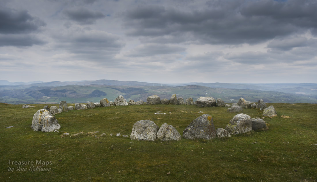 I had also read that there were many stories about the site. Some say that they have felt malevolent vibes, others that the place has a benign feeling. Not surprising, the site is dated from the bronze age and was apparently a place of ritual and sacred significance. Stories will abound in a special place like this. But perhaps there are none so strange as the claim made by locals that UFOs have been seen over the circle. Stranger things in the Berwyns Back in 1974 locals reported strange lights across the sky, then a colossal explosion which sent tremors through the village. It all seemed to be centred on the stone circle. One witness wrote: " something came down in the Berwyn mountains on that night, I am certain … we were visited by an object that evening..." Ministry files show that it was taken seriously by the RAF and the police- a search and rescue sea king was scrambled and deployed. The search continued until 2pm the next day. Locals and ufologists claim that roads were sealed off and men in black were seen taking remains away, prompting claims that this might be the "Welsh Roswell". Who knows? It all seems very far-fetched. The files show that officially, nothing was found...or was it? 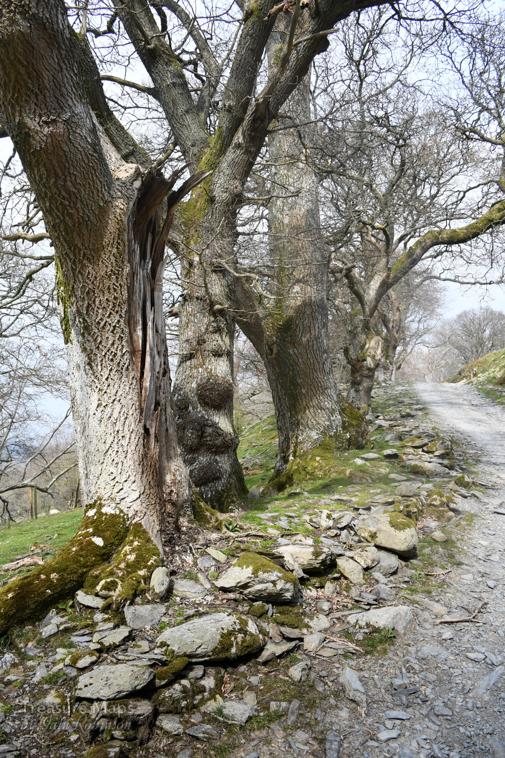 We, at least, got a great deal from the walk. The trackway up is lined by some beautiful trees; old oaks and later hawthorns of some age. Giant stones appear at the side of the track, placed no doubt by a glacier, although one group looked a little suspicious- I put them down as a possible bronze age feature. One of the gates below the moor whistled eerily due to the wind blowing across it's tubular steel framework. It was a surprisingly lovely sound, rather like those folk who used to run their fingers around the rims of banks of wine glasses on TV. That dates me, doesn't it? Hey, that was what ordinary folk thought was cool in the 'sixties. Somewhat enchanted by the sound, we sheltered behind the wall and had some lunch before tackling the last half mile to the circle. The wall itself was interesting, made from small chunks of slatey rock, interspersed with tall stones set on end. Perhaps it was a local style; I am not yet familiar enough with the area around Llandrillo to say. Petra wondered where the slatey stones had come from, as the fields were remarkably bare of any stones, apart from the occasional massive erratic. 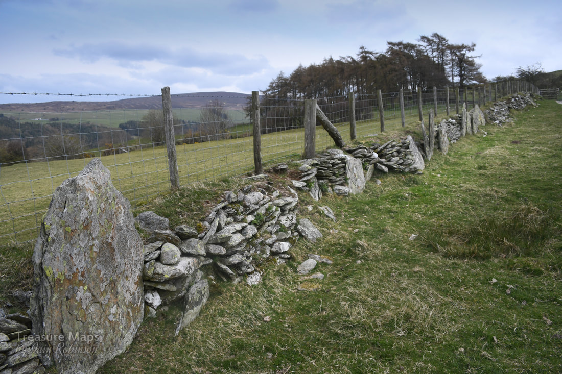 Further down from the circle on the hill, there were two cists, greatly eroded by the activities of the farmer- and a pattern of field markings which were quite pronounced on the ground. Coflein considers them to be cultivation marks, so I am glad my intuitive feeling was correct there. Someone on the Megalithic portal site thinks there may be a second circle on a site about 60 metres SE- I didn't see it when I was there, partly because it was so cold that we didn't hang about. But here's a photo on Megalithic Portal which shows that there is a circle, quite clearly. 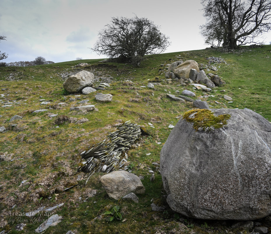 The ancient quarry site, with one of two stocks of moss slates beside a boulder which has only recently been moved, judging by the scars on its flanks. Above is a shallow opencut with a tip. Parking- It's best to park the car in the (free) car park in the centre of the village. Take a left turn out of the car park and then walk up the road marked as a bridle path to the right, after the war memorial. A grumpy moment I thought twice about mentioning this, as I don't want to be intolerant of others enjoying the hills- but again on this visit, there was the malodorous presence of two- stroke motor bikers on the hill. We were forced to the side by a group hurtling downhill without any consideration for anything. Later we had a nosey around the rather lovely village of Llandrillo and were standing at the crossroads when the bikers appeared again and stopped at the junction. The noise was incredible as the eight of them revved their engines and bellowed to each other. We picked our way out of their petrol fumed world of noise without taking them on and they roared off back up the hill to do more mischief. I wonder if making the maximum noise is part of the fun of this activity. Apart from that smallish irritation, it was a wonderful day; perhaps it might have been more peaceful on a weekday, although apart from the bikers we only saw two other people. Location of the stone circle: Map Ref: SJ05613717 Landranger Map Number: 125 Guide with map for locating the stone circle. 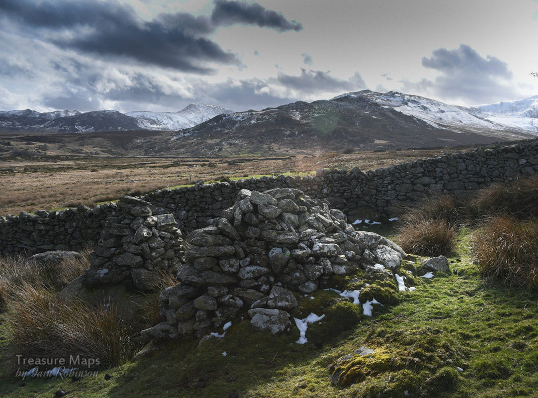 While we were wandering about, photographing some abandoned farms in Cwm Dulyn, we encountered a couple of cairns whose shape and construction seemed difficult to explain. They were very carefully built showing considerable skill. They were very old, too- judging by the lichen growth on them. Strangest of all, they were slap bang next to an enclosure wall, which also passed very closely by a row of three standing stones. 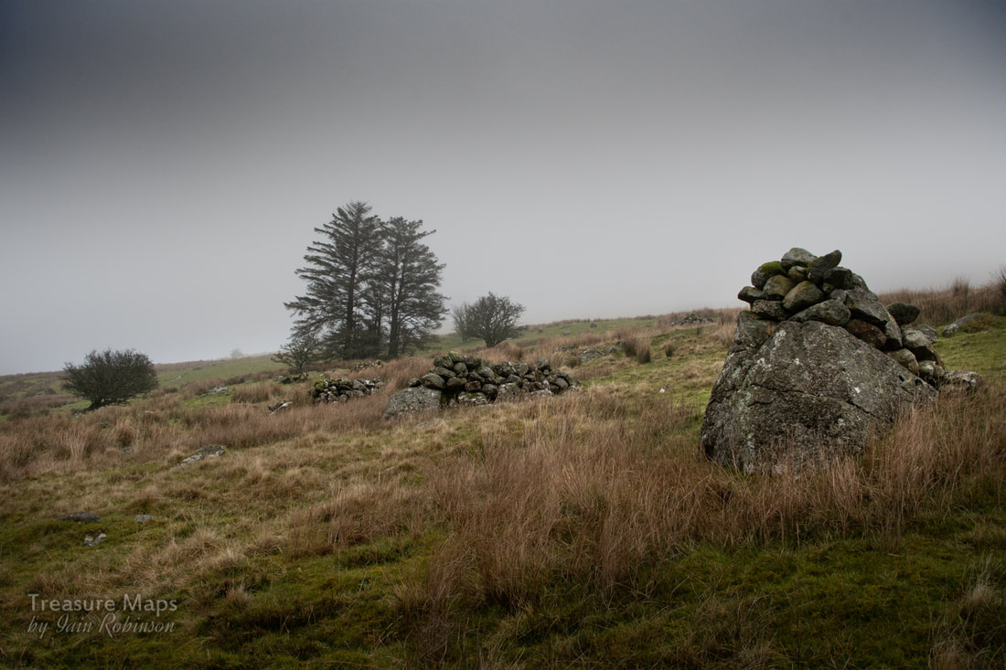 A swarm of cairns in Cwm Pennant. Like the ones in Cwm Dulyn, they are placed on top of a much larger, immoveable rock. We pondered this for a while, then I remembered seeing something similar in Cwm Pennant- again very old, on rough moorland that bore the signs of ancient cultivation. I had read a blog that suggested these were ritual or funerary markers made by bronze age peoples, but somehow, that didn't seem right. I asked around and one or two people suggested that they could be field clearance cairns. This doesn't necessarily mean that they are recent, as clearance cairns can date back to the neolithic farmers. But it did seem a lot more plausible. Of course, once you have seen something, and have an idea about it, you start to see that thing everywhere, and so it was on our next few explores where we were again roaming over moorland looking for old settlements 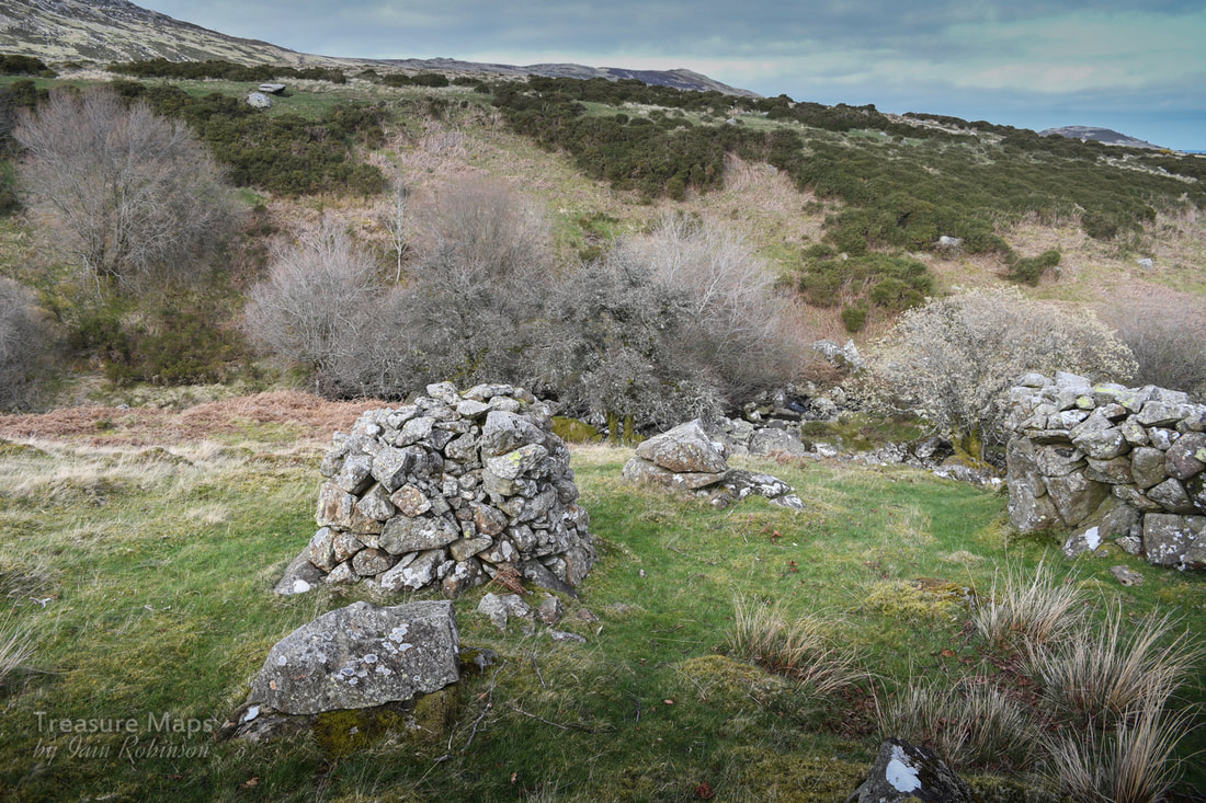 Two cairns in a field at Hafod y Gors wen- a consumption wall is on the right...leaving little doubt that these are clearance cairns. There are a few guidelines for recognising clearance cairns. The old ones are usually on moorland; they will be associated with ancient settlements and often are completely covered over with moss or grass. Often there will be evidence of long-abandoned cultivation such as ridge and furrow marks and ancient walls. They will also be composed of stones that can be carried easily by hand. More modern clearance cairns are made of larger stones, moved by machinery. 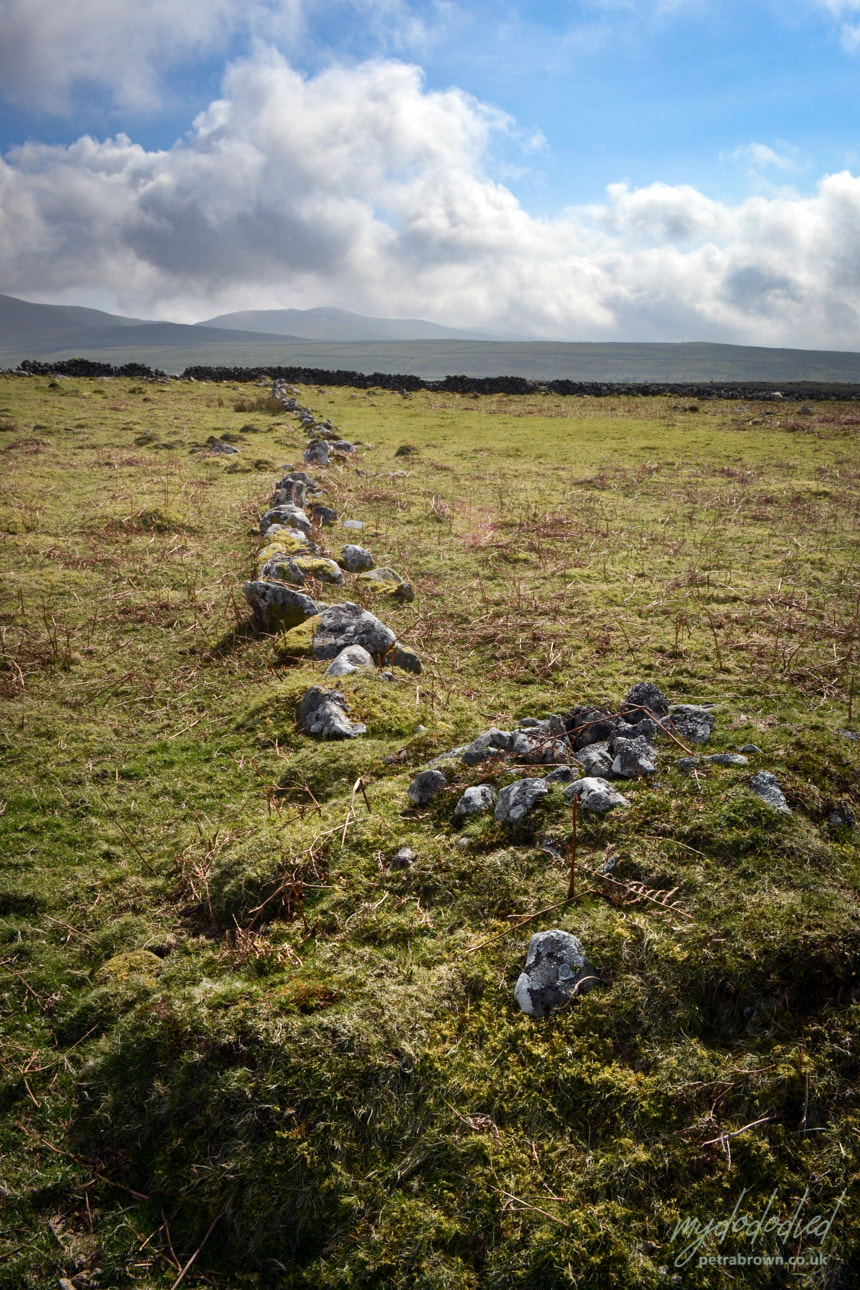 A very old cairn at the end of an ancient wall line above Cors y Gedol. There were ridge and furrow marks in the field which was obviously mediaeval- or older. Sometimes, the cairns are grouped together in a circle (we found one above Dyffryn Ardudwy that was obviously ancient) and it has been suggested that there is some ritual significance in this. But generally, bronze age and earlier cairns are so common (once you start to see them) that the claim seems hard to justify.  A consumption wall arranged as a sheepfold (gorlan). Hafod y Gors. The cairns are not to be confused with "Consumption Walls" which are sometimes of a similar age, but are thickly constructed walls, sometimes as much as ten feet in width, constructed simply to clear the surrounding fields. The obvious reason that the stones were cleared is that the early ploughs found it hard to work in stony ground, especially since at first, the blades/mouldboards were made of wood. It would be very advantageous to get rid of as many stones as possible. Later, the stones would make a handy source of walling, or could be used as markers and boundaries. One thing is for sure, whatever the date of some of the cairns we found, many were built with some skill. They are not just random piles of stones.  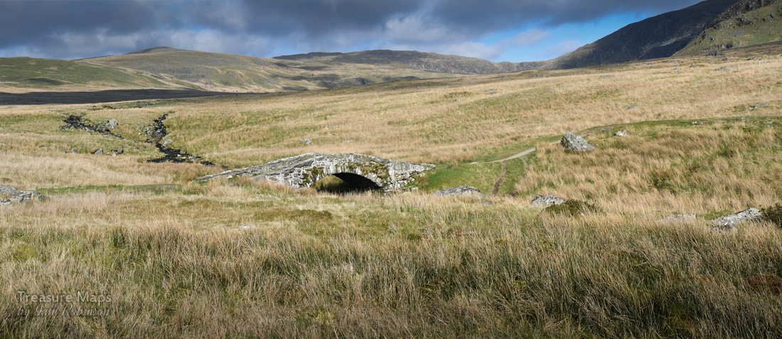 The ancient bridge of Pont Scethin sat in the middle of the moor, leading the eye to the mountains, whose deceptively smooth flanks coruscated with sunlight and shadow. It was early spring, and we were sitting on a giant boulder near the bridge, resting after the trek over from Tal-y-Bont. The Afon Ysgethin was flowing normally again after weeks of rain, chuckling and rattling over the moor. The skylarks and meadow pipits were singing, the sunshine was warm. All seemed right with the world. I didn't know at the time, but we had been walking on the route of a bronze age trackway through the mountains- I had some suspicions after coming up by the old burial chamber of Cors y Gedol and seeing in the grass what I thought were the frail bones of ancient settlements, almost submerged by the passage of time. 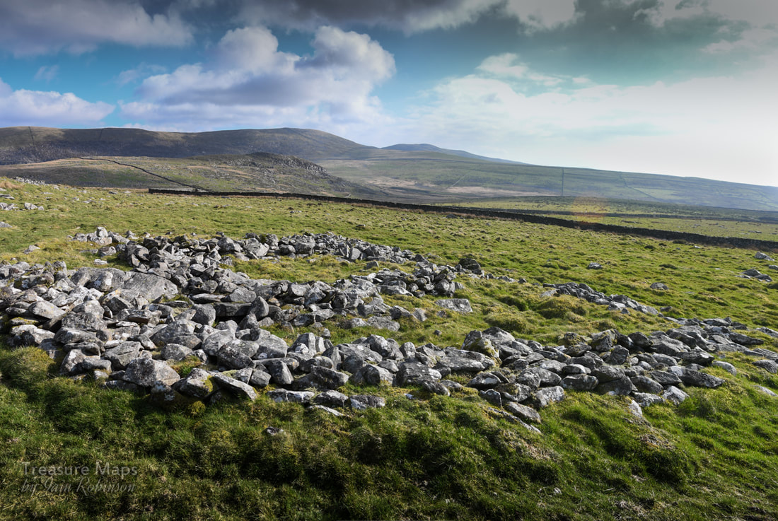 Ruins of an ancient hut/settlement. 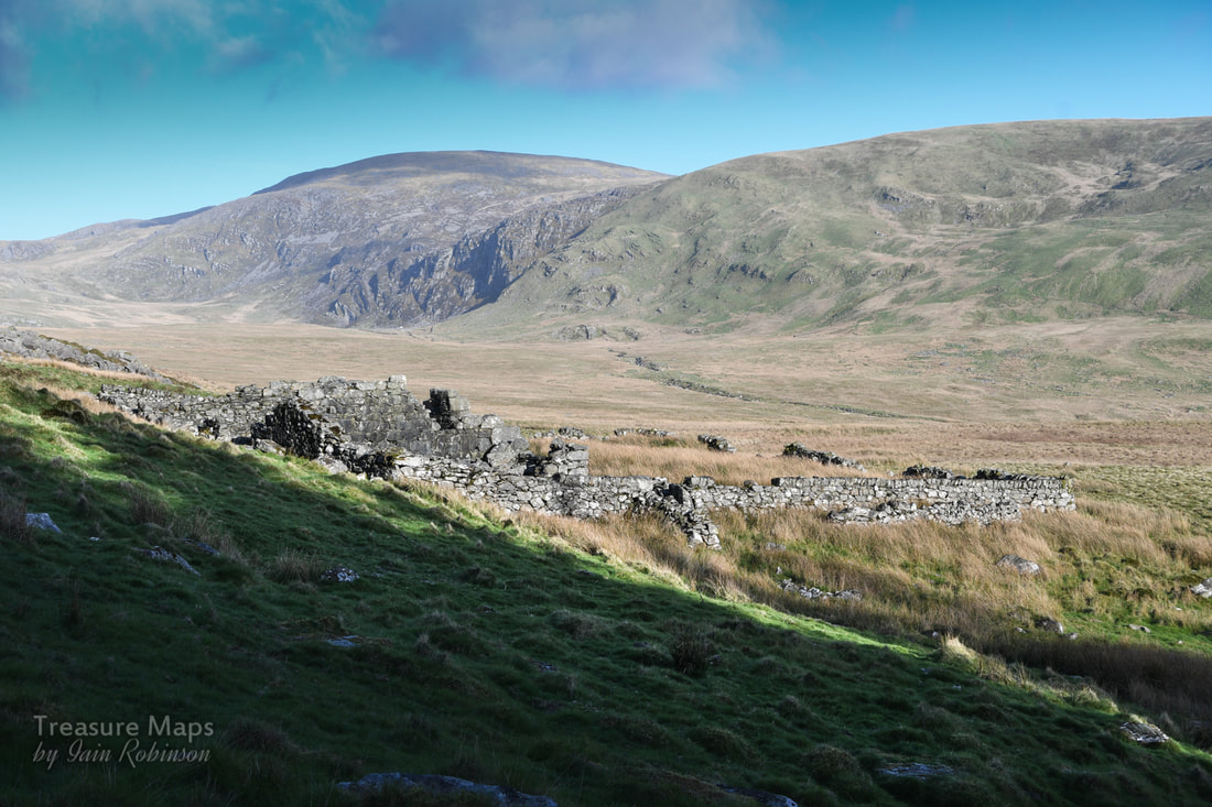 The ruined Coaching Inn. The hill in the distance is the mighty Diffwys (750m), while under that small area of crags is Llyn Bodlyn. Then, we'd passed the ruins of what we thought might have been a rambling sort of farm, just before the trackway made a dive for the river. Later, I found out that the farm was actually the remains of a coaching inn on the London to Harlech road. That would explain the unusual layout, but not the situation, a way off the "road". Surely, even "Jamaica Inn" was beside the road? And this place was called "Tynewydd" (the new house). I also discovered that the route over the bridge had been a drove road, which had wound it's way on over the Bwlch y Rhigwyr (which translates as the Pass of the Drovers). While the cattle droving had been carried on for centuries, the stage coach was a relatively new development in the C18th.  To be honest, I can't imagine how a coach and horses could be driven over this terrain, or over the surface of the trackway that remains, which comprised of gigantic boulders placed with no regard for smoothness of passage, rather like the ones on the Roman Steps in Cwm Bychan. The bridge itself seems hardly wide enough to permit the passage of a coach, or a cart. Perhaps, as Rob Collister postulates in his excellent "Days To Remember" , this part of the route was undertaken on ponies. It seems logical to think that the Coaching inn was there for passengers and mails to re-alight onto a coach, plying roads more suitable for iron shod wheels down to Harlech.  Apparently, there were considerable dangers in this area from highway men and gangs of brigands. Shirley Toulson, in her fascinating "The Drover's Roads of Wales" tells of one occasion when a fashionable party of Londoners, going to a posh wedding in Harlech were fleeced of their valuables. Perhaps that is why many folk preferred to travel rather more slowly with the cattle drovers, who were, as a rule, extremely handy fellows and who travelled in numbers enough to see off the occasional robber. The drovers were sometimes armed, as well, to protect the large sums of money they carried. (They received an exemption from the Disarming Acts of 1716 and 1748). Other travellers had cause to get out of the way of the cattle drovers. The sound of the drive could be heard for miles and farmers would gather in their own cattle lest they be carried along by the driven herd, while coaches mule drivers and carters would lie well off the road until the melee had passed.  A view from the south side of the river. The hill in the background is Moelfre (589m) I thought I had managed to lose all the bike tracks, but I see the farmer's quad bike tracks intrude. As we were sitting there beside the bridge, munching Petra's famous home-made flapjacks and supping coffee, I pondered (as you do) on the way that the landscape is a fragile palimpsest of man's activity throughout the ages. The land that we see is the result of habitation and use, even if it looks to us like "wild" country. So it was ironic to think of one instance, in 1989 -when this place was ransacked, the bridge almost destroyed and the river banks used as a ford for massive tracked vehicles. The river became a dumping ground for used drums of diesel and the ancient trackway was transformed into a 50 metre wide scar. The perpetrators of this sacriledge were the contractors for Welsh Water Authority in the run-up (read crazed stampede) to privatisation. Luckily, outdoor writer Jim Perrin encountered the scene and sent photographer Fay Godwin some snaps of the damage. Between them, they made enough published noise to embarrass the Authority into retribution and restoration. 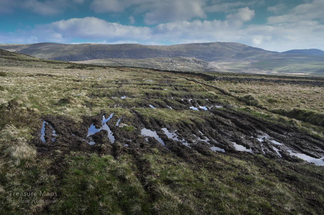 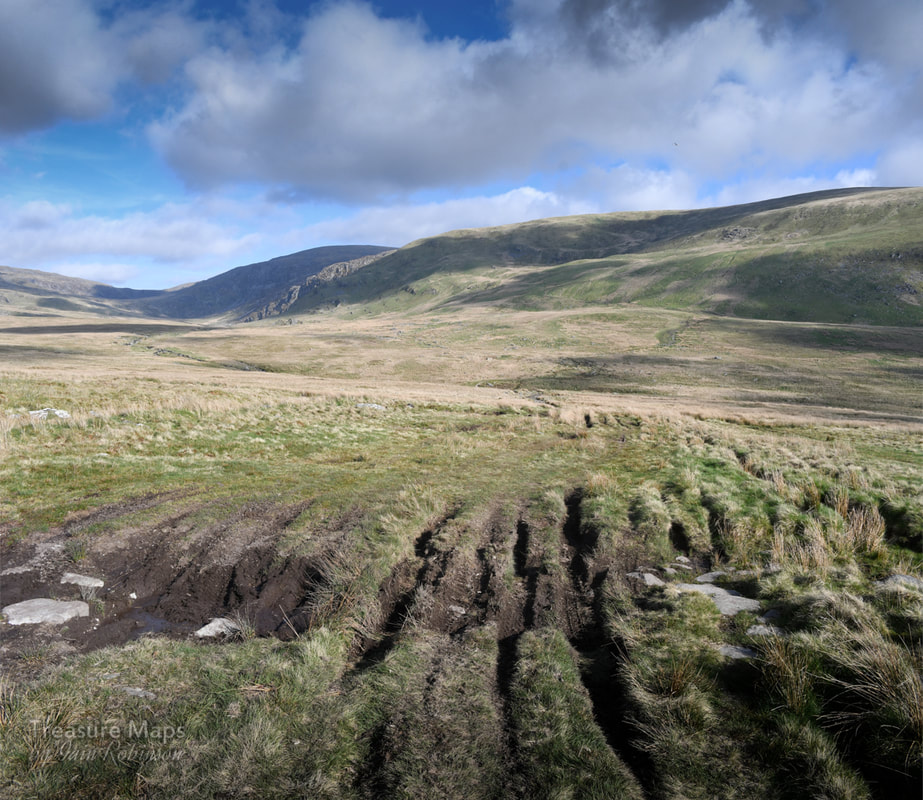 You can see the wide swathe of motor cycle tracks going up the other side of the valley. Sorry folks, but there's no excuse for this. ,Fay Godwin, in her book "Our Forbidden Land" says that although the Bronze age tracks around the bridge are lost forever, "at least the scars are now healing." I'm not so sure about that. Due to the increasing popularity of motorised trails biking, the trackways are being damaged all over again by a bunch of oblivious fools who think it's fine to pollute these quiet places with their noise and their fuel stink as they churn up the ground, making it difficult for anyone else to make progress. This time, the damage wasn't just around the bridge, either. It was visible for a mile or so up the opposite hillside. I noted, too, the tracks of farmer's quad bikes and Land Rovers, as if sheep farming in these moors was profitable or even justifiable in the 21st century. The farmer seemed to be using a different crossing beside the bridge perpetrating a new scar. And yes, I know that by law, they have the right of access as this is technically a "bridleway"...but really? It seems as if we can't really be trusted to take care of anything in the landscape. What survives, survives because of disinterest. The moment something attracts the gaze of financial or recreational interest, all restraints are off. Certainly, SSSIs or "listings" are worth nothing, since there are not the funds to implement any policing of them. Quietly thinking our own thoughts, and luckily not meeting any motorised trails bikers, we went carefully on our way. 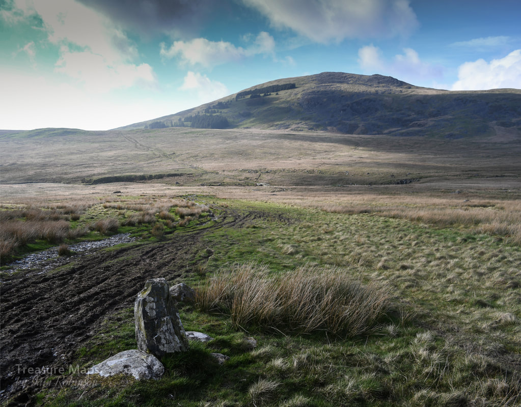 Recommended Reading
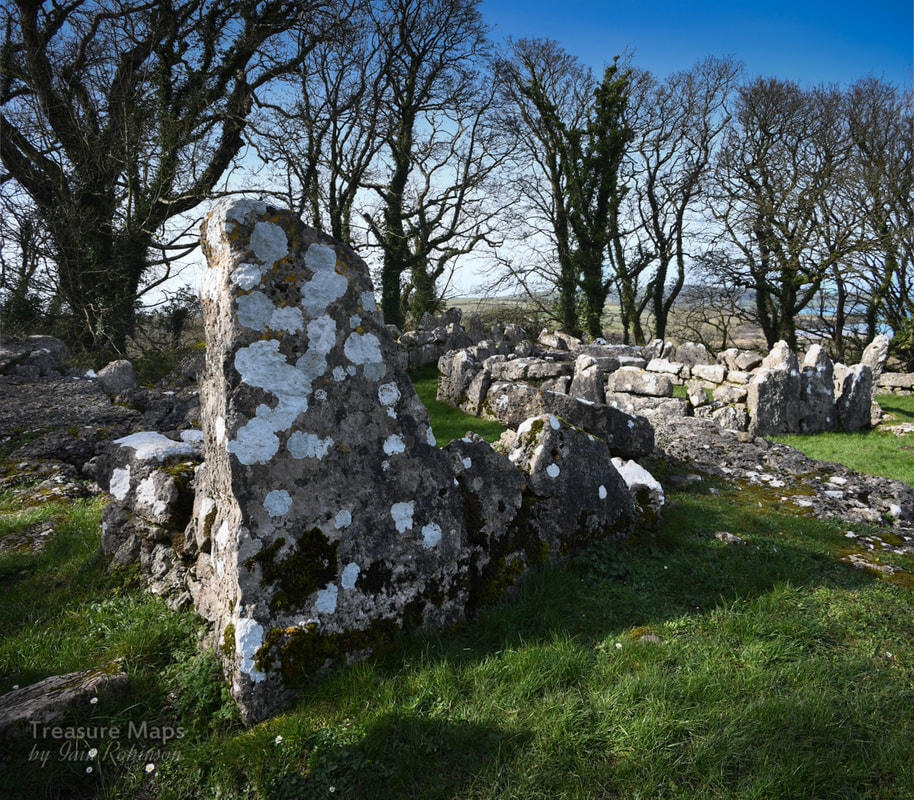
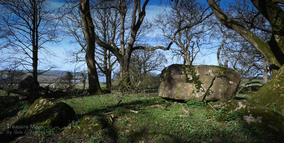
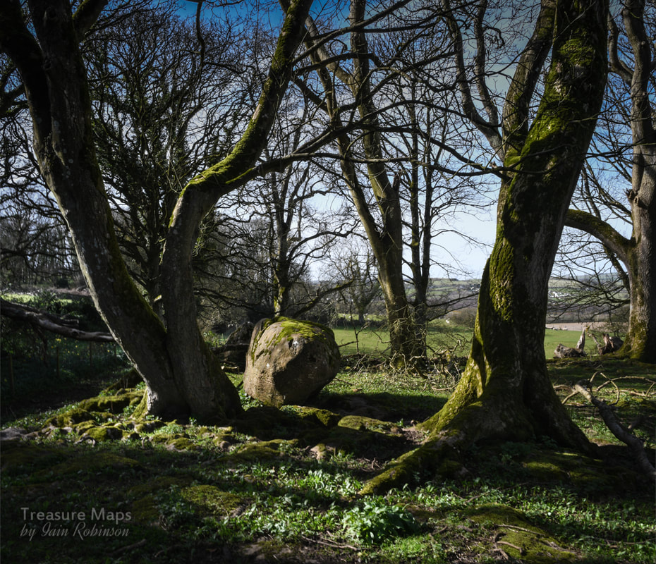
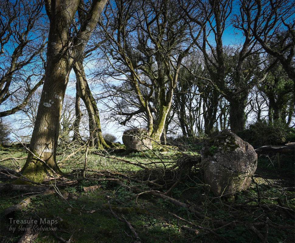
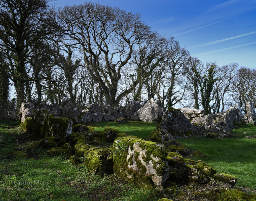
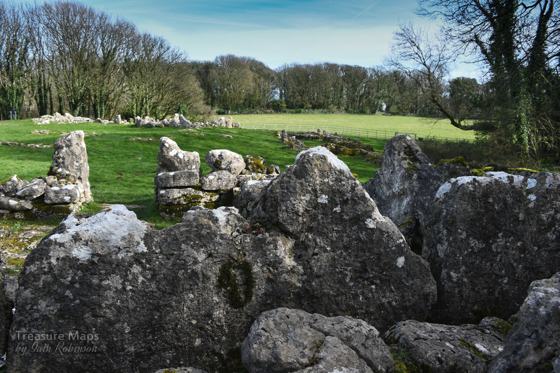
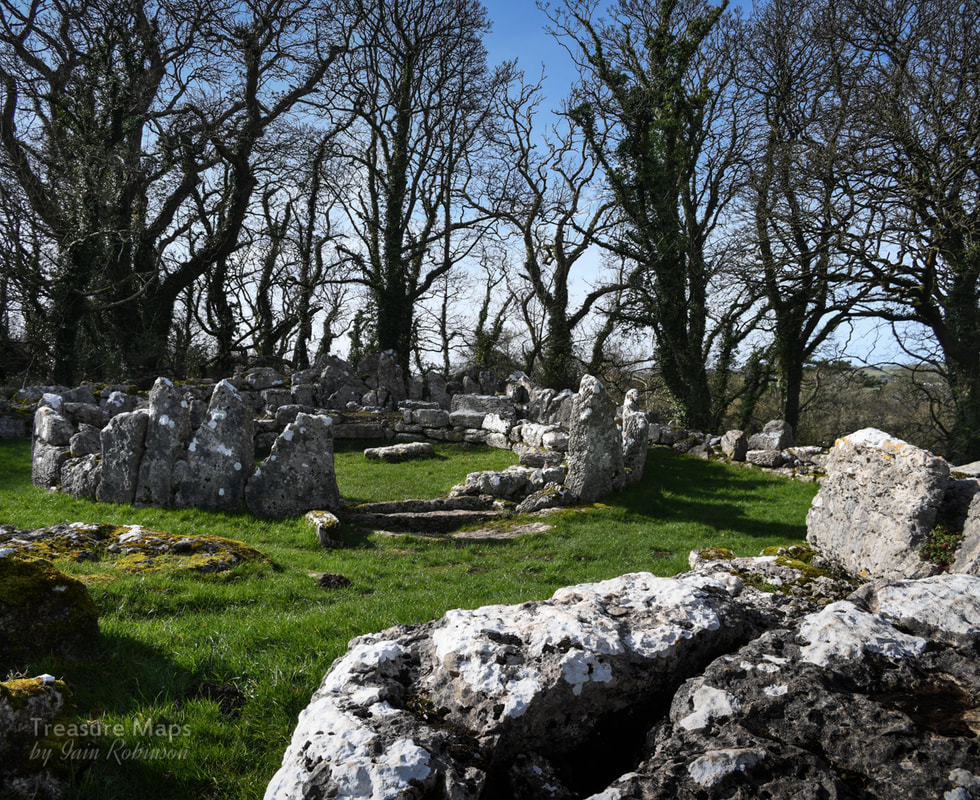
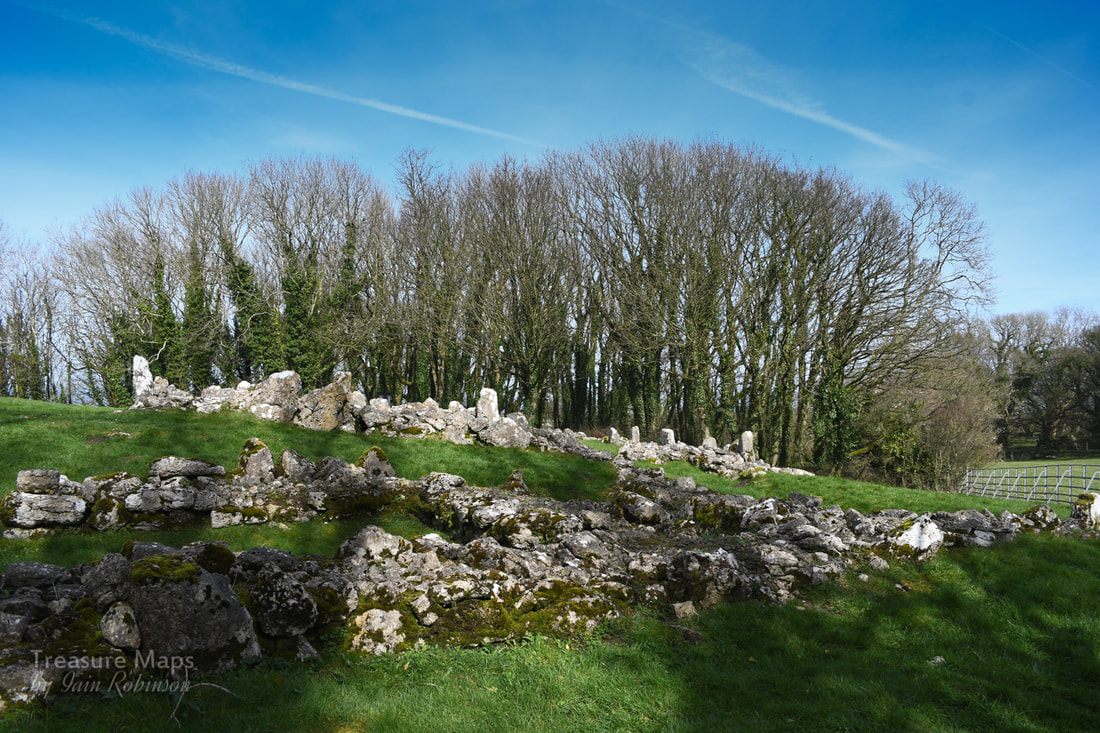
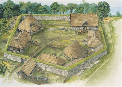
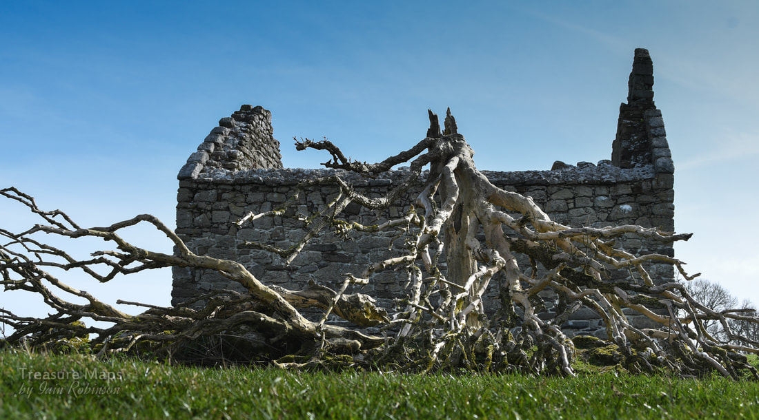
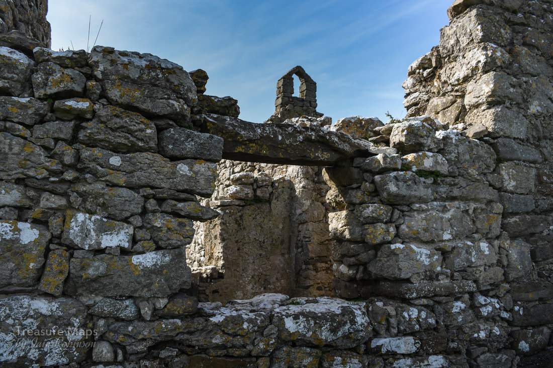
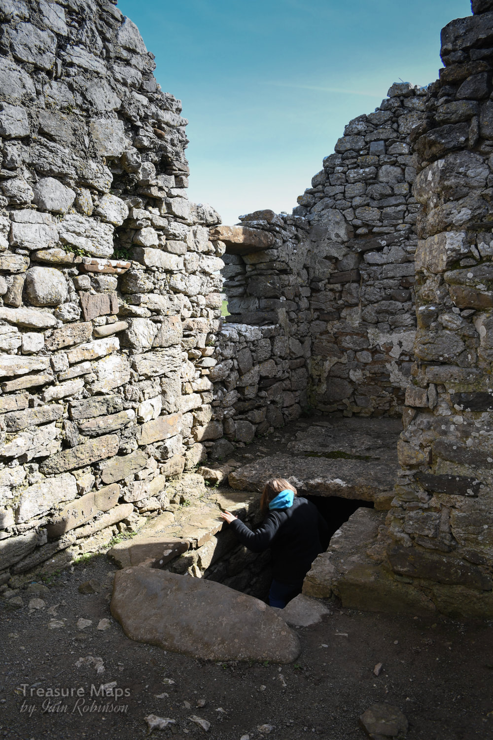
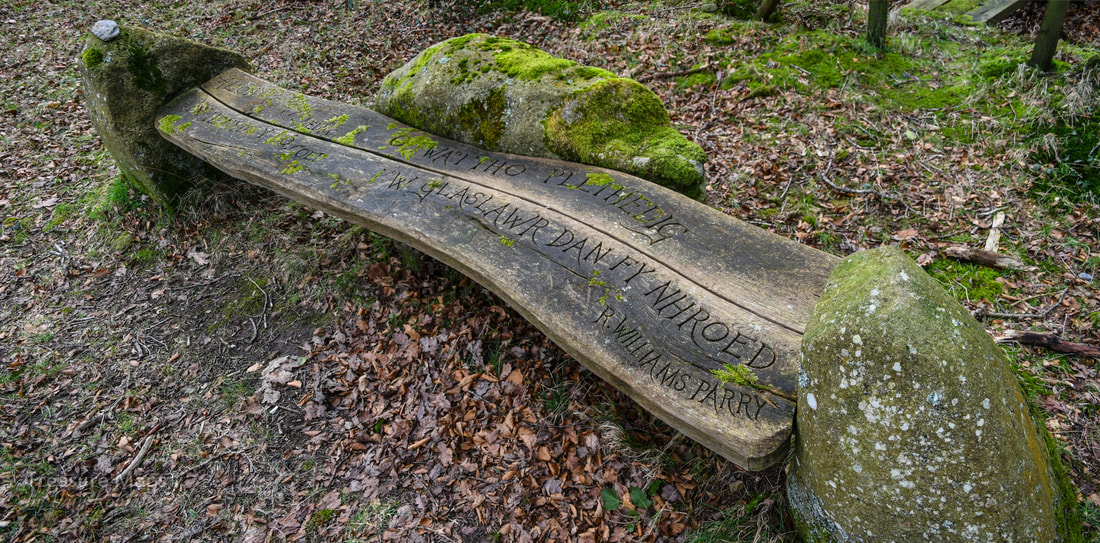
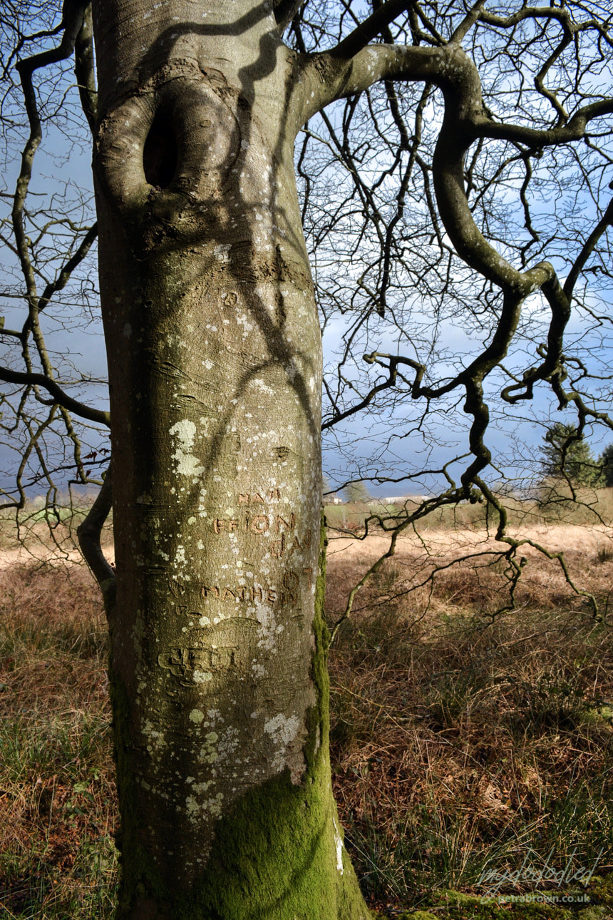
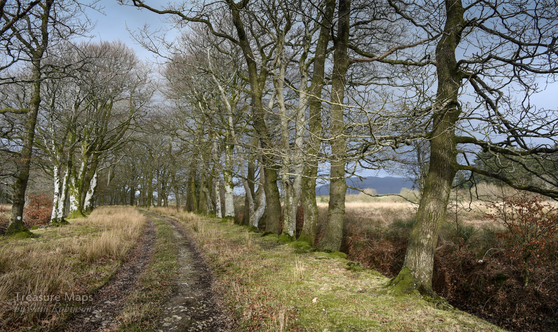
"The Drover's Roads of Wales" Godwin and Toulson, Wildwood House, 1977 "Our Forbidden Land" Fay Godwin, Jonathan Cape, 1990 "Days to Remember" Rob Collister, Vertebrate Publishing 2016 Web sites Walkingworld, drover's roads The Drovers of Snowdonia Jean Napier's page about the Bridge 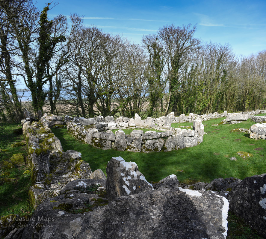 The fascinating ages of Din Lligwy- Megalithic, Roman and Mediaeval. Anglesey, as most people know, is a place rich in the remains of prehistory. But even on an island famed for its evocative ancient sites, Din Lligwy is something special. It's a walled settlement, standing on an eminence a little way outside the popular tourist village of Moelfre, on the north east coast of the island. It sits within a mature grove of Sycamore, Ash and Hawthorn trees, which allow the light to gently dapple the bright white limestone blocks making up the remains. Din Lligwy was excavated in 1905-7 by Edward Neil Baynes- in those days, excavation techniques were slightly clumsier than they are today, with subsequent technological and cultural advances in the science. But nevertheless, significant quanties of Roman material were recovered, mostly of the late third-fourth century AD. The remains here have been consolidated for public display- at the time we visited, (March 2019) some of the found artefacts were on display at the excellent Oriel Ynys Mon at Llangefni.  However, Neolithic flints have been found here, although we don't know at what horizon within the excavations they were located. But the presence of another feature nearby, the Din Lligwy burial chamber, makes it more than likely that this site was in some kind of use then. The interpretation board at the site suggests that the village may have been in use during the later roman period, explaining the outer wall- the Roman influence was waning and chaos was beginning to descend on the land. We can't be certain. What we do know was that there were settlements here before Roman times that may have been consolidated...more remains lie outside the perimeter including a hut and stones which may be the remains of enclosures. This would suggest that the site was a locus for agricultural activity and fits in with the idea that this place was associated with a person of power and wealth, not a Roman. While the round huts would have gone out of fashion by 4AD, it may be that they were a return to the old pre-Roman ways. One hut base is larger, this is at the top of the enclosure and would have been the high-status dwelling. Excavations in this hut found Roman coins, pottery and a glass jug, as well as a silver ingot. Other (square) huts were used as workshops- here large amounts of metallic slag, as well as remains of several hearths with charcoal formed from oak were found. It was evidently a workshop for the smelting and working of iron. The original entrance to the fortified compound was through a gap next to the external building. The unanswered question here for me is: where did the ore that they were smelting come from? The nearest iron deposit was at Llandyfrydog Quarry, Llanerchymedd on Anglesey at SH451861, and there are other iron mines on Anglesey as well. Of course, this site is relatively close to the sea- perhaps ore was brought by boat, along with other high value items- in which case the ore could have come from Europe. We don't know for sure, but it is a fascinating thought.  Looking over the site from the top, above the high-status dwelling. 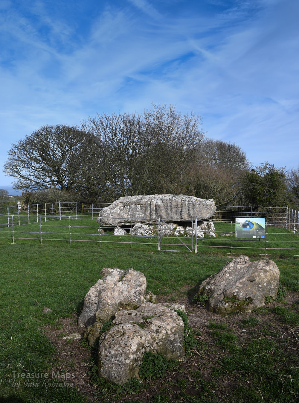 The Burial Chamber Not far from the settlement is the Neolithic burial chamber of Din Lligwy, dating back to the 3rd millennium BC. This is an impressive reminder of the determination and capability of the Neolithic peoples, since the capstone is thought to weigh 25 tons! This site was also excavated in 1908, when the remains of 15-30 people were found. Along with them were pieces of beaker and grooved ware pottery that provide evidence for the age of this tomb. It is from the end of the Neolithic period and so was among the last of these types of tombs in use. The interpretation board reminds us that this tomb was covered over with stones and earth- I wonder where all that went to? Taken by farmers for rubble, perhaps. The sides of the gigantic capstone are marked with lines where the stone was hewn. It's not clear, of course, where the stone could have come from, but it was quarried and shaped. A little awe-inspiring to think that these tooling marks were made by men from such a long time ago- that really brought home to me the significance of this place. The chambered tomb is nowadays surrounded by railings, the gate is locked but doesn't seem to preclude visits from sheep. The railings do spoil the atmosphere for photographers a little. 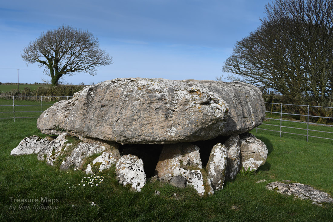 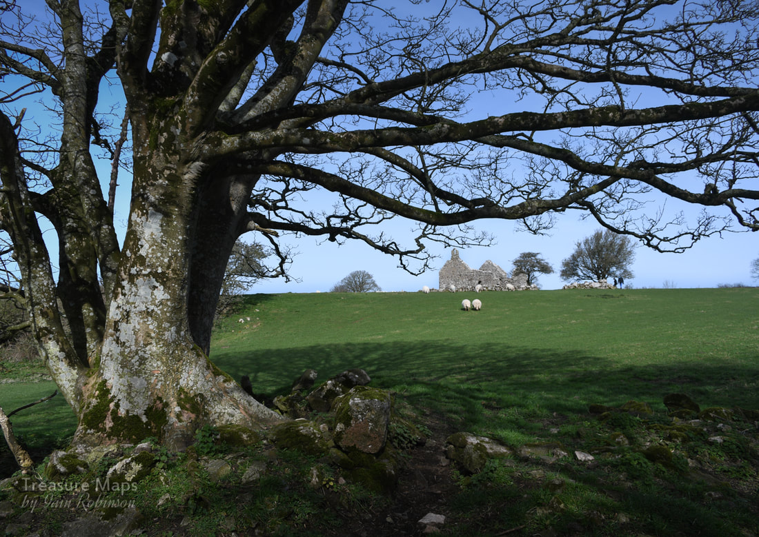 Hen Capel Lligwy Nearby, to the north east of the settlement is a ruined chapel. This, perhaps, offers some clues as to the prosperity and population of the area in prehistory. Originally, this would have been a wooden church, but it is thought that in the middle of the C12 AD, (with the raids on Anglesey by Vikings becoming rare), many places of worship were rebuilt in stone. We know that this chapel was first built in stone in the 12th century, but the upper parts of the walls were reconstructed in the 14th century. A small chapel, with a crypt underneath, was added in the 16th century. There is a small "borrow pit" nearby where stone was quarried to build the church. It's also possible to make out from the walls where repairs have taken place, as different types of limestone have been used. The interesting point here is that the settlements that surrounded the church were probably made from wood- the area was likely to have been much busier than today, but most traces of the hut dwellers have gone. Populations moved away, and the wood from their dwellings was burnt as fuel by those who remained. 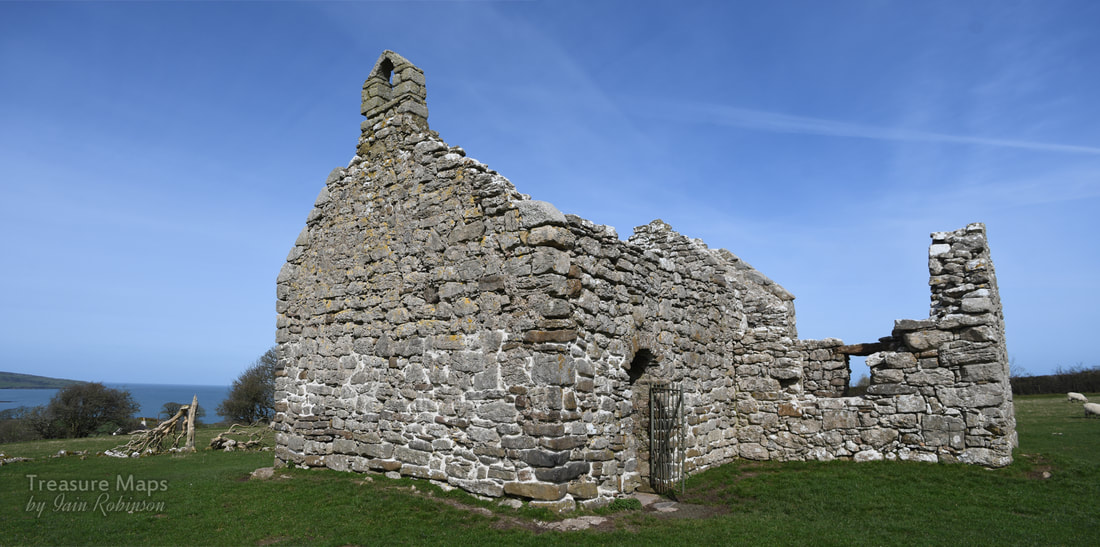 Locating the sites- and parking. Din Lligwy Settlement is at Map Ref: SH4970286134 Burial Chamber- Map Ref: SH50138604 Both are Landranger Map Number: 114 The site is signed from the roundabout on the A5108 at Llanalgo. Coming from Moelfre, it is a right turn. Turning along this road, the Burial Chamber is seen first on the left- a small lay by offers parking for one car here. A quarter of a mile further on and there is parking for three/four cars at a layby - the chapel can be seen clearly, and the settlement is in the woods to the south east. I am indebted to my friend Dave Linton for pointing out to me that iron ore could have come from Anglesey- and for his diligence generally! Sources Lynch, F. 1995. Gwynedd: A Guide to Ancient and Historic Wales, Cardiff: Cadw Yates, M. J. and Longley, D. 2001. Anglesey: A Guide to Ancient Monuments on the Isle of Anglesey, Cardiff: Cadw. P30. 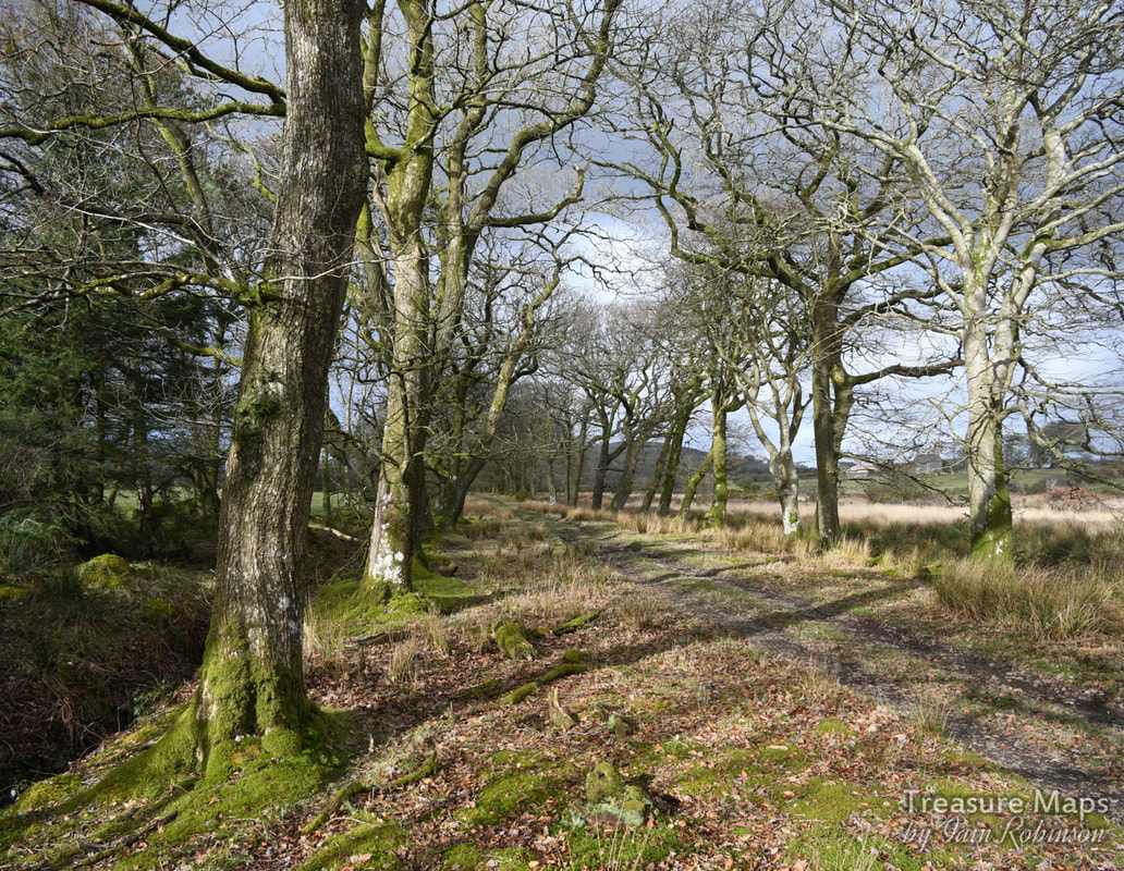 We were out on the Llŷn recently -and we were lost. For those not familiar with Wales, the Llŷn is that bit on the map which looks as if it's an arm, pointing towards Ireland. A peninsula, and perhaps because of this, there's a particular quality which sets it apart from the rest of Wales. Maritime weather, low hedges and small fields, ancient, stunted stone hedges, even older hill-forts- and big skies. In some ways, Cornwall and extreme south west Scotland also have these traits, as does western Brittany. Bocage country. Anyway, as I say, we were lost. But you don't stay lost for long here- as the Llŷn isn't exactly massive. More often than not, you just end up back where you started, but unable to find the place you are looking for. I noticed that we'd passed a couple of fine avenues of trees, going off into the fields. We kept passing avenues like this- or perhaps the same one... Then I spotted a place to park at the side of the road near one of these avenues, and we decided to explore. 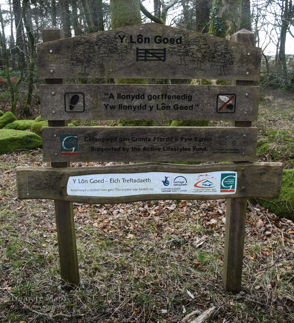 There was a fine footpath board which informed us that this was the Lôn Goed, and that the path was supported by the active lifestyles fund. So we walked along in the early spring sunshine, enjoying the peace. The only sounds were the beautiful birdsong and the faint breathing of the wind in the branches overhead. I looked up, aware of the fluctuating light as the oak and beech branches sparkled, making a lacework canopy above. I could almost feel the returning life in the trees after a winter of waiting. The green fuse, and all that. 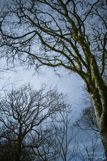 Starlings weave in and out of the canopy. Photo by Petra Brown. We came to a bench, carved with some lines of poetry in Welsh..it seems that the Lôn Goed is prominent in the Welsh cultural consciousness through a resonant couplet by the Dyffryn Nantlle poet Robert Williams Parry: "A llonydd gorffenedig/Yw llonydd y Lon Goed," he wrote. "A perfected, accomplished quiet/Is the quiet of Lon Goed." (the words are from the poem "Eifionydd") 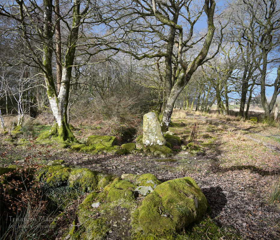 Mossy boulders to the side of the road. We dawdled along for a couple of miles, enjoying what felt like a healing quiet. You could hear stuff going on, sure- but as if in the distance. A tractor, a cow voicing a grievance. The inevitable transatlantic jet, high above. I imagine in summer, those noises will be muted by leaves. We turned back, deciding to come back again in summer and see.  A day of sunshine and shadows... So what was Y Lôn Goed? Apparently, a road made between 1819 and 1828 by John Maughan, steward of the Talhenbont/Plas Hen Estate, to facilitate the transport of lime and peat. The reasoning behind the trees was that they would help drain the land, making it easier for the farmers of the estate to carry lime from the kiln at Afonwen to the different farms and therefore improving the pasture. Y Lôn Goed runs for about five miles, winding in a northerly direction from Afonwen to Hendre Cennin. If you look on the old maps, it's possible to see a couple of tributary roads leading off, similarly flanked by trees. It is also referred to locally as "Lôn Môn," a corruption of the name Maughan. Y Lôn Goed means something like "wood lane" in english. 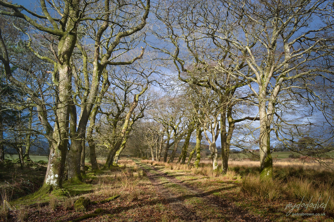 Photo by Petra Parking is something of a problem at either end of the Lôn Goed. I suggest parking near the middle where we did, at SH 45910 43269. There is a very small length of the Lôn Goed which has been adopted by the highways department here, with space to park a couple of cars if done considerately. Useful Maps: Landranger 123 Lleyn Peninsula Map Explorer 253 Lleyn Peninsula West Explorer 254 Lleyn Peninsula East You can purchase a poster with the poem and an illustration of Y Lôn Goed from Graffeg here |
TracksReceive the occasional Treasure Maps Newsletter- and alerts when a new post is available!
If you enjoy my content, please buy me a coffee!
Check out my other online activity...
Index
All
|

 RSS Feed