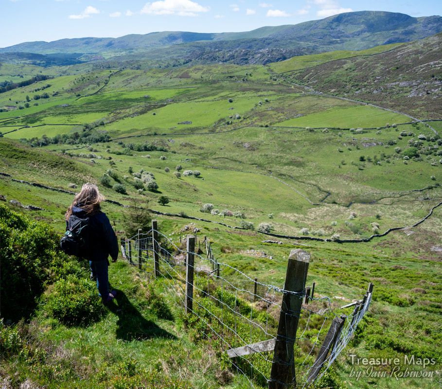
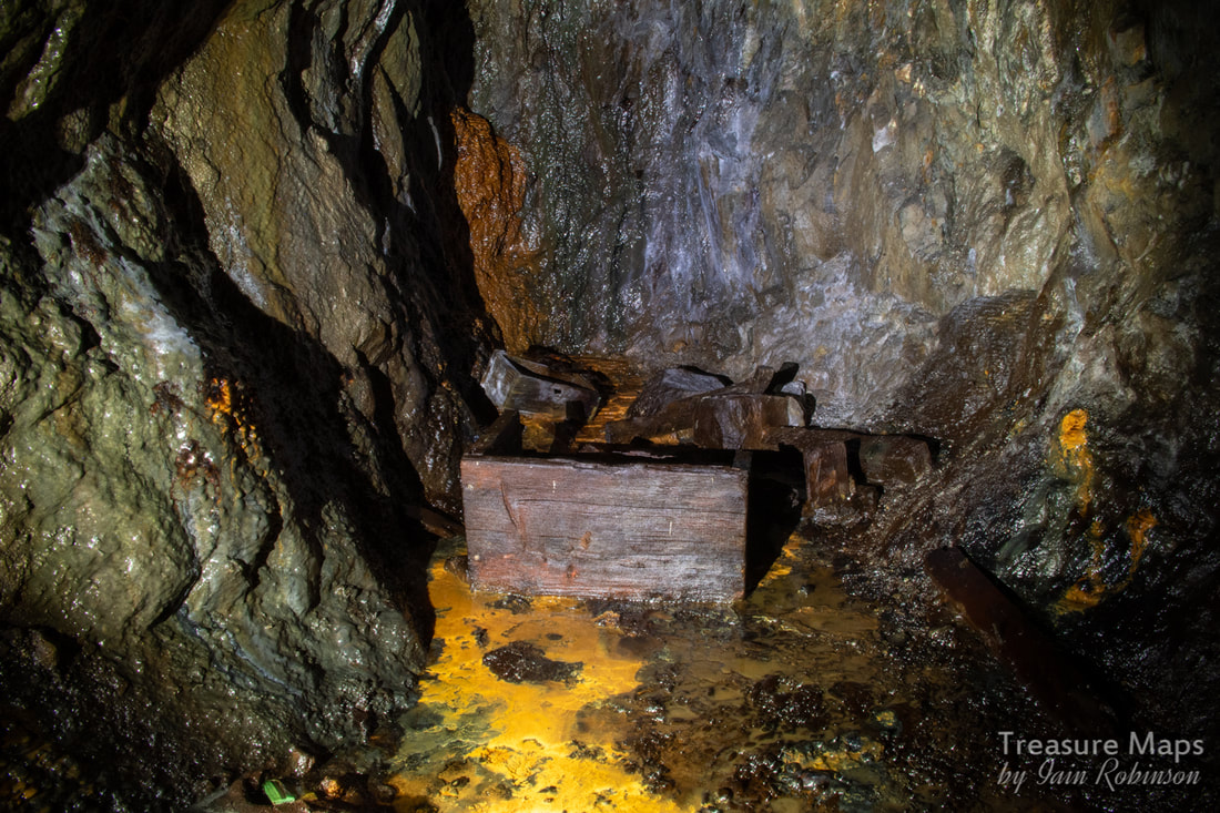
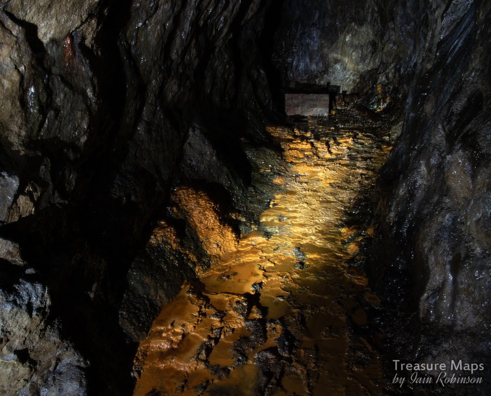
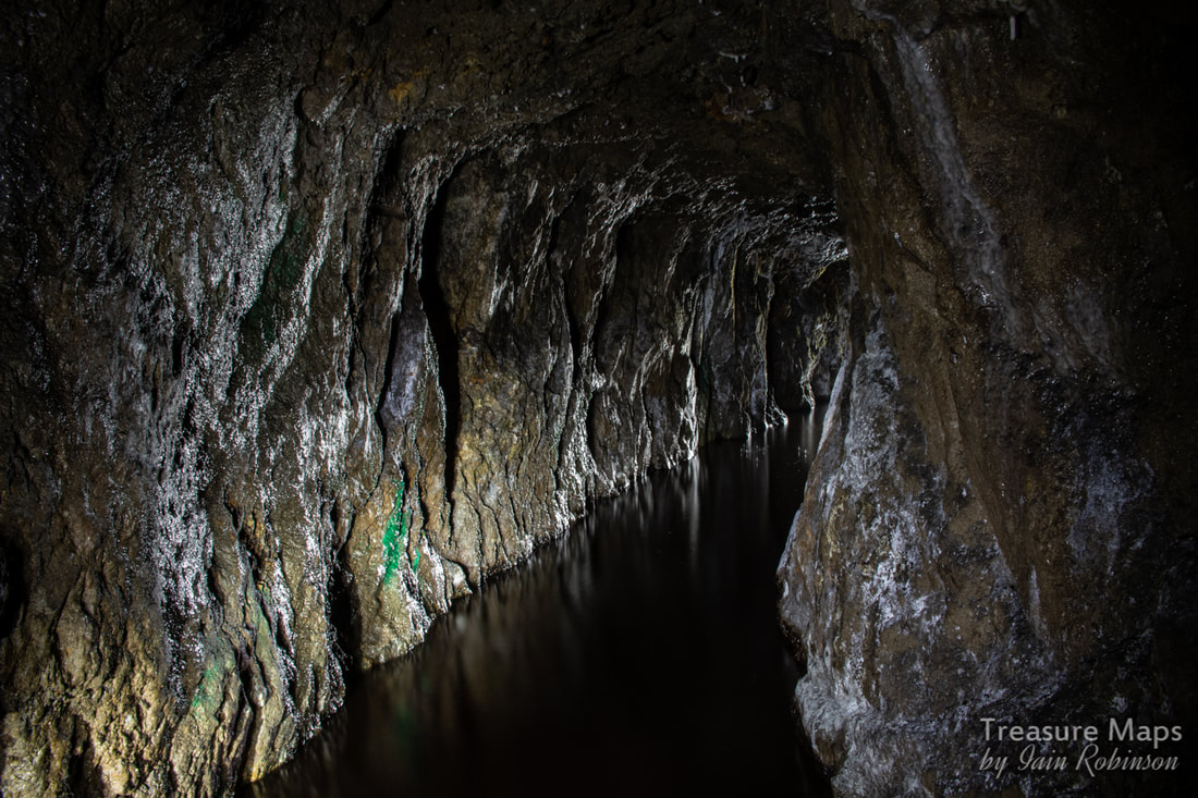
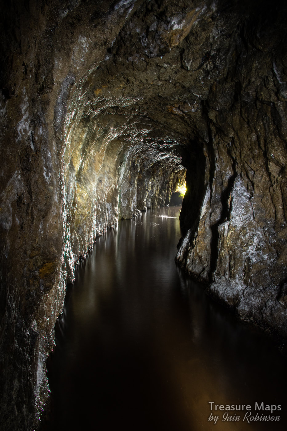
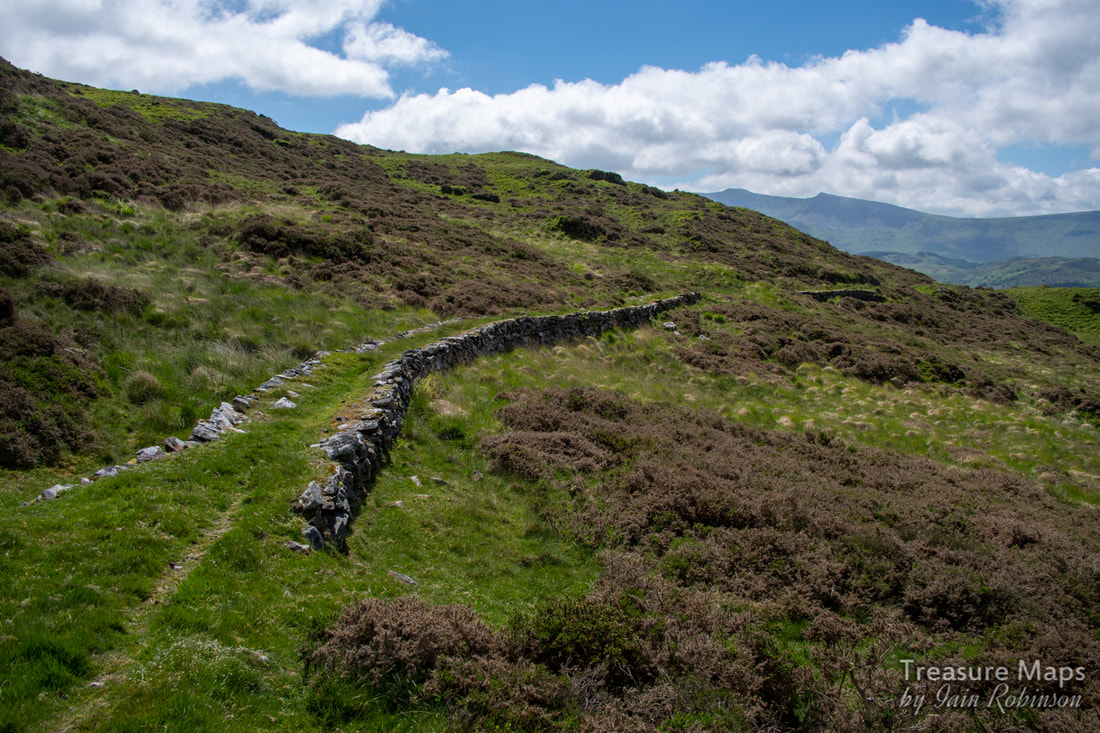
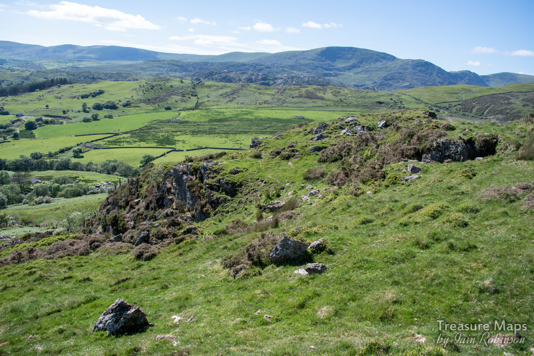
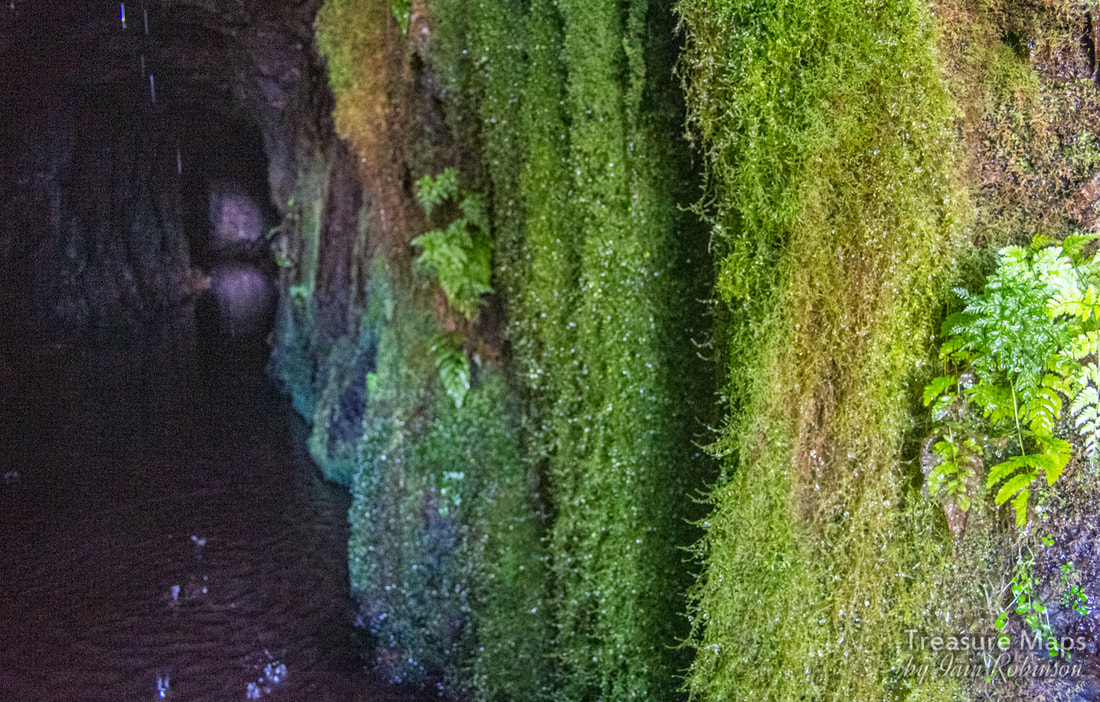
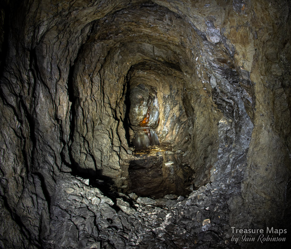
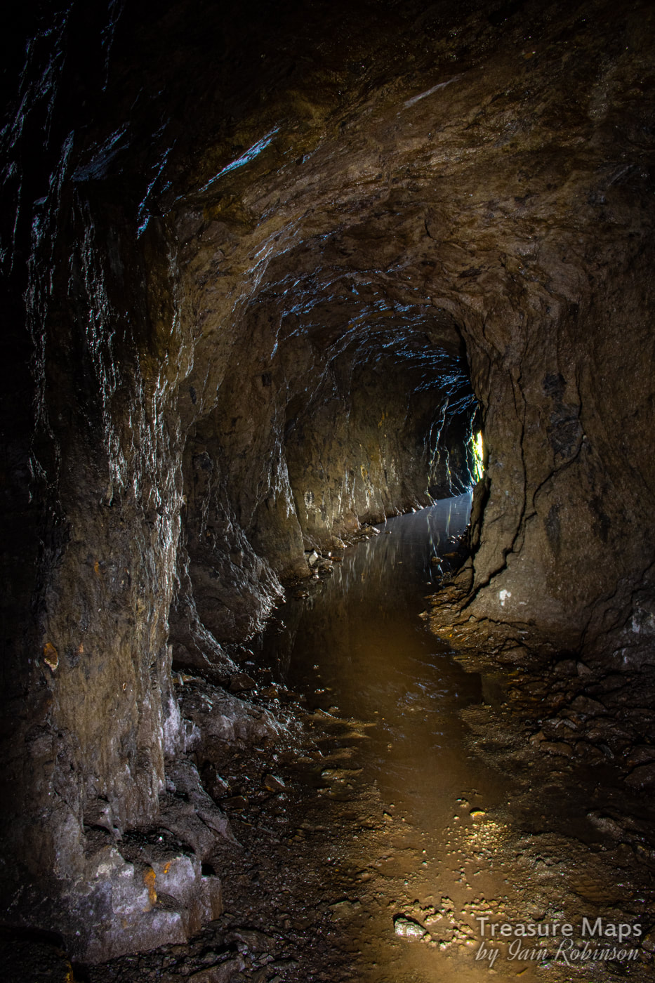
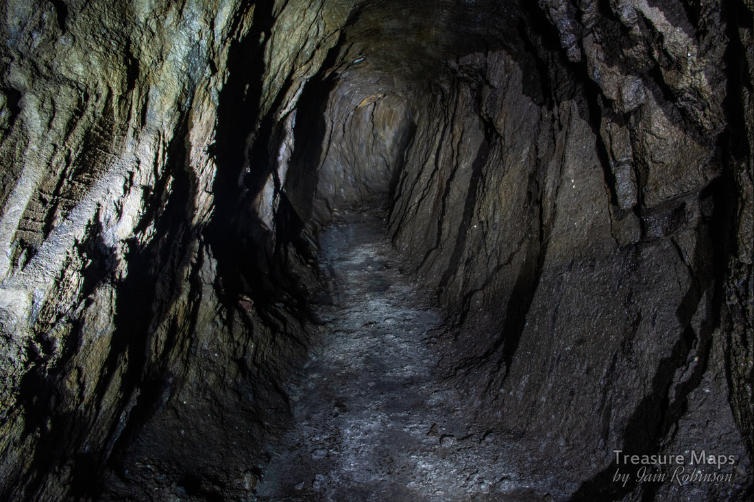
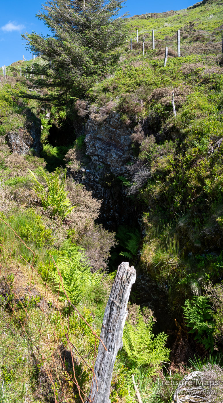
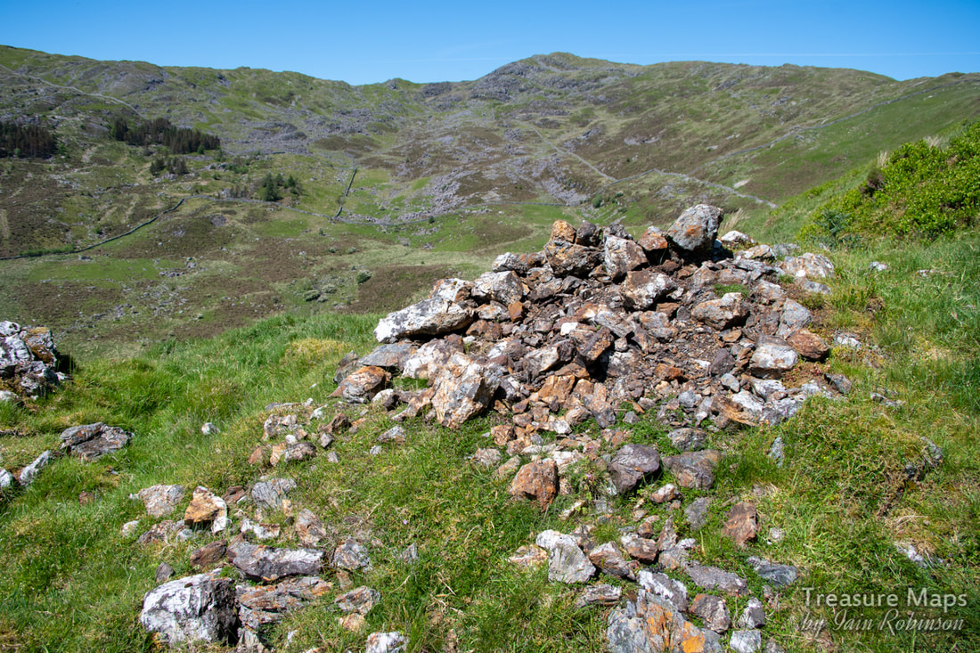
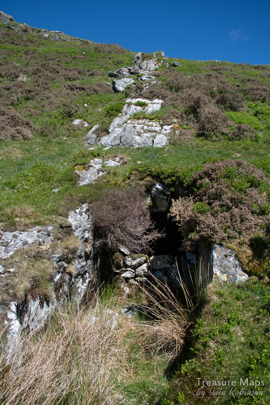
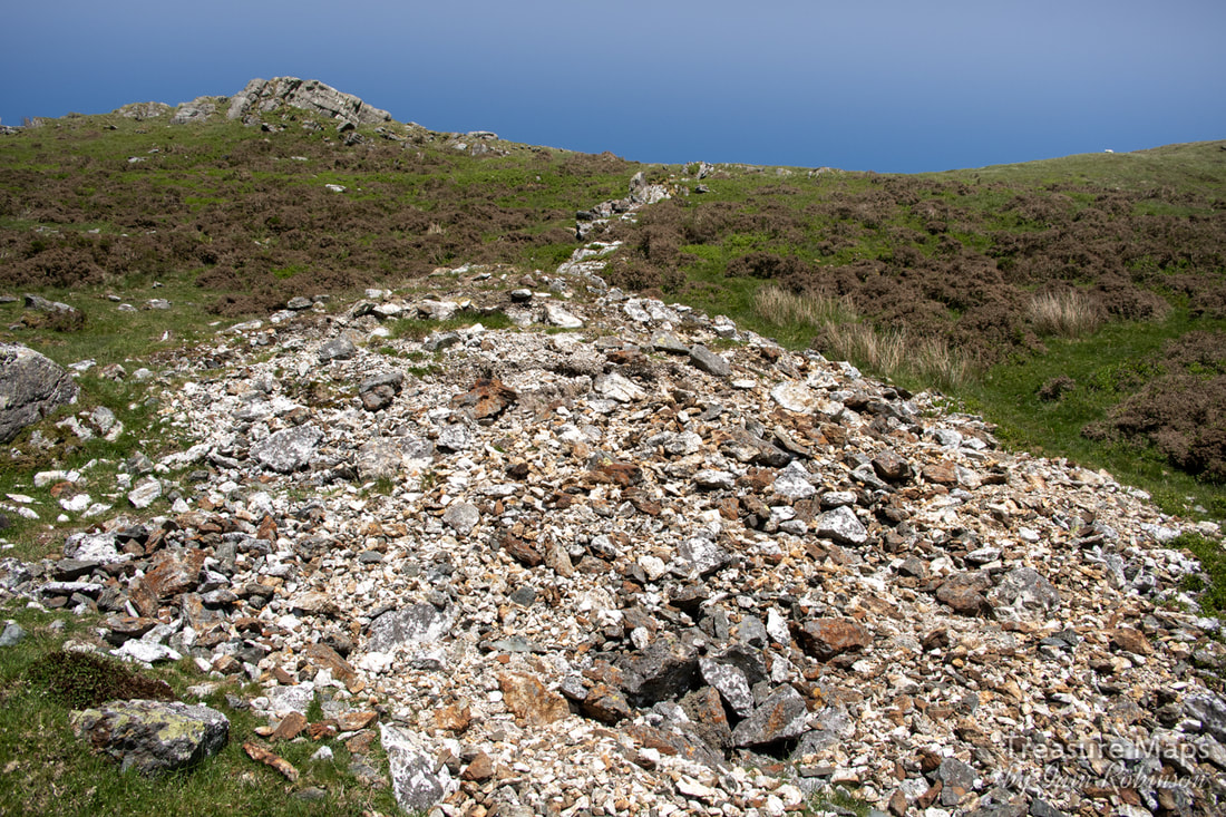
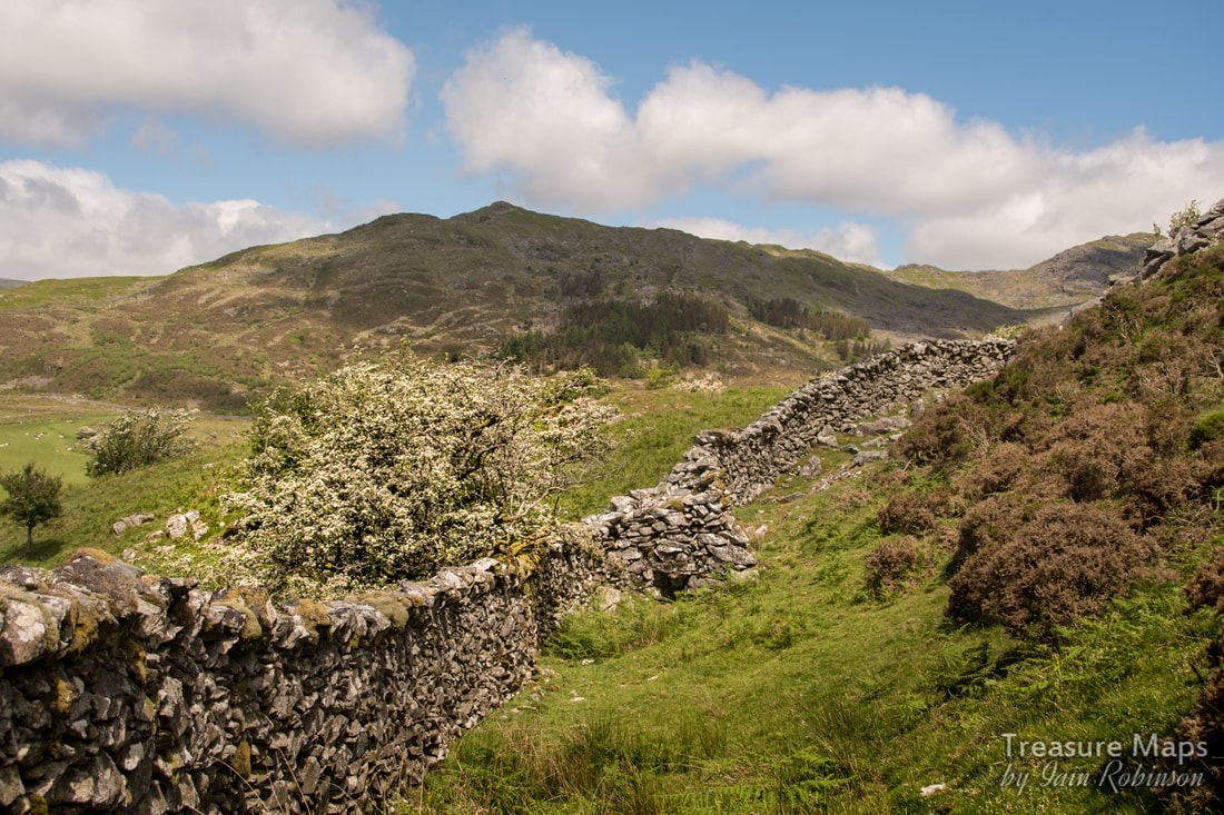
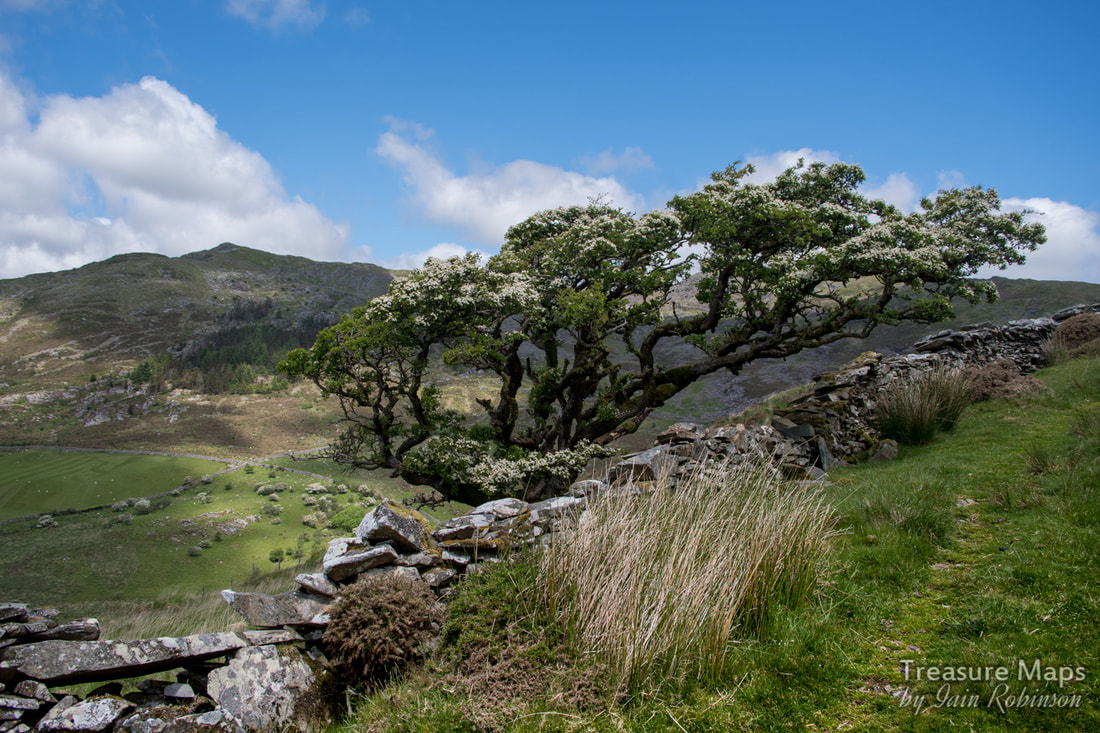
 Petra surveys the view from the top stope of the Cesailgwm uchaf trials. The Cesailgwm mines ticked all the boxes for me. The workings were sited in a lovely, lonely cwm, which became more beguiling as we walked up to the highest diggings on the West slope of Foel Ddu. We sat for quite a while there, listening to the skylarks and drinking in this idyllic place. Petra spotted another, higher working below Y Garn and of course, we climbed up to that too; it felt even more remote and still. I gazed at the spoil, basically all quartz, and wondered about the men who made the workings which occur like a rash on the mountains here. It's almost as if they were possessed with the idea of finding gold. I wondered what they ate, where they slept and whether they were paid. 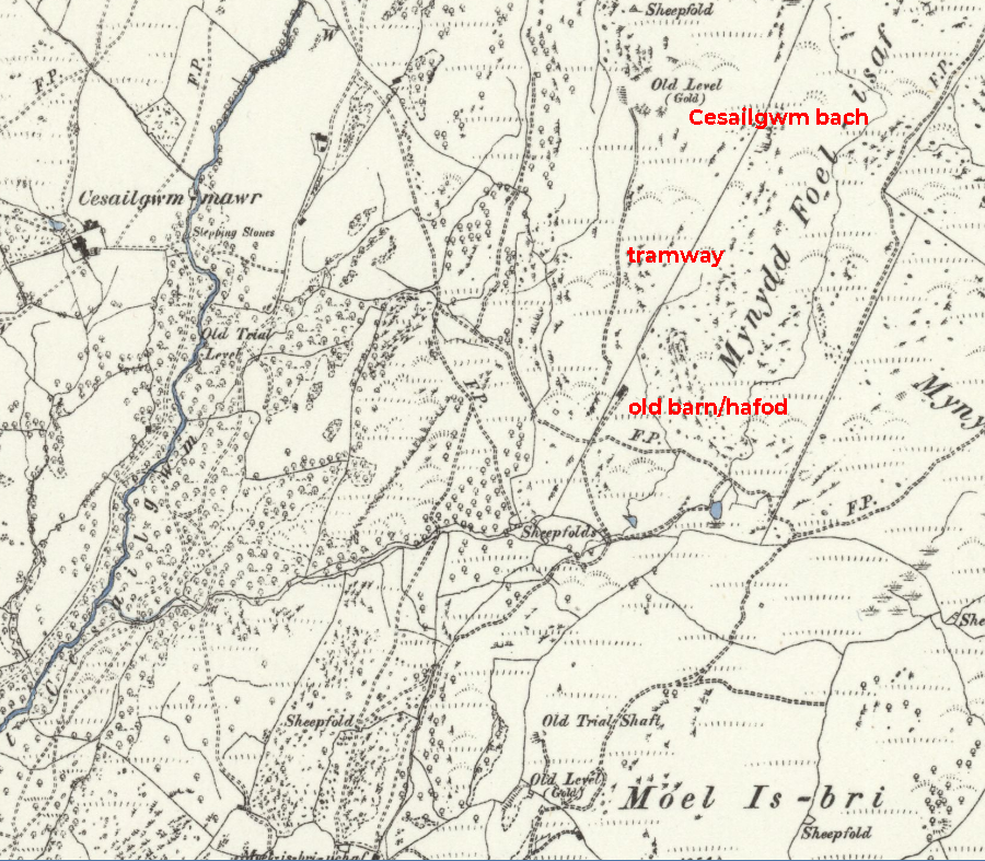 1880 Ordnance map of the Cesailgwm Bach trial. Used by kind permission of National Library of Scotland. We started with the Cesailgwm Bach mine, as Wilkinson calls it. An intriguing working which follows a vein of what the miners were hoping was auriferous quartz up the side of Foel Ddu. It starts as little scrapes in the ground at the top, gradually becoming more determined as things progress down the slope. Just how determined the miners were can be seen on the Zoom satellite view below, where you can see the little diggings all over the hill. 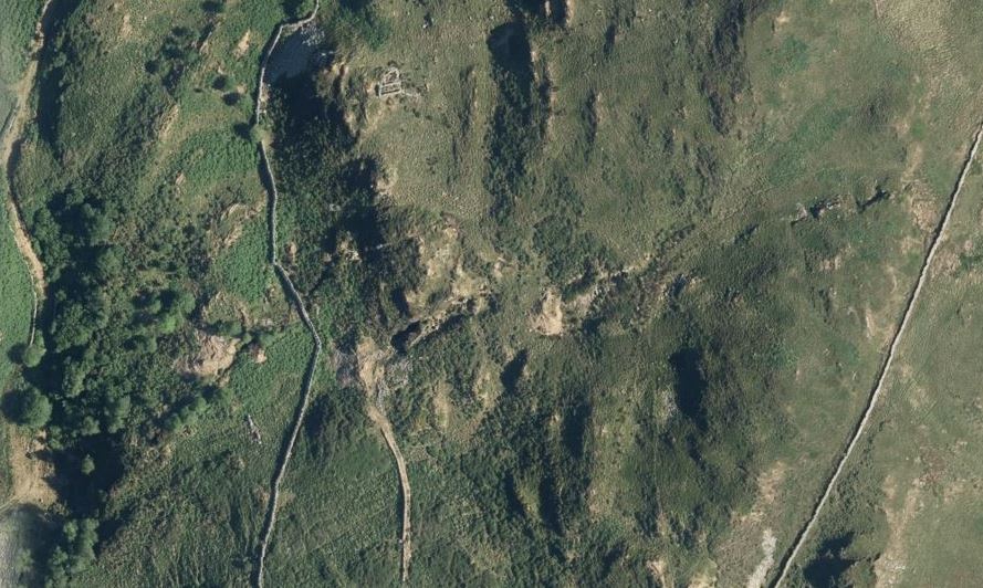 The Zoom Earth view. You can see the vein being chased all the way up to the top of the ridge by the wall. A cart road approaches the mine, revetted and levelled. At first I thought it might be a tramway, but it takes a turn near the boundary wall and dives down, curving towards the valley at a steep gradient...so perhaps not. 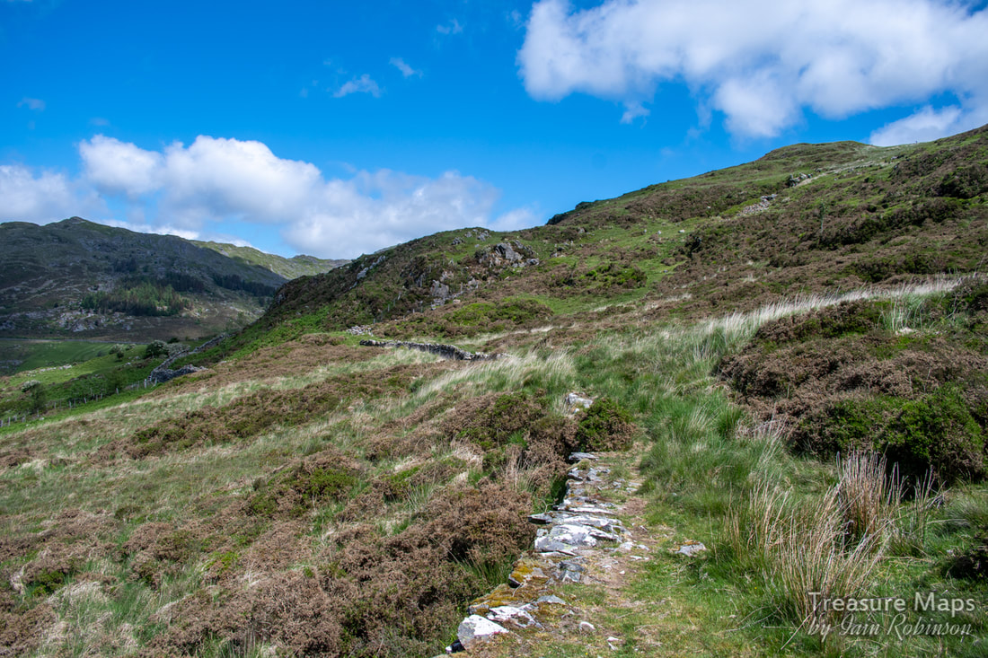 Looking north on the cartroad. The mine is on the ridge in the middle, going left to right uphill. 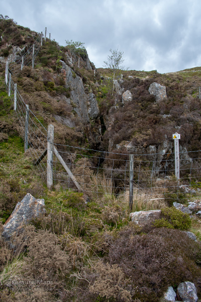 The opencut...an adit lurks... There were two adits- neither looked very encouraging, but we tried the one nearest to the revetted cart road. Looking more like a stope than anything, the cutting did a jink to the right, and then- a dank looking portal appeared. We were in business! The adit was wet, up to knee height, although it dried out further in. All adits are driven with a slope to drain them and to make tramming rock out just that little bit easier. The tunnel jinked and passed several attempts at crosscuts, all abandoned. Eventually the drive ended in a forehead. To our surprise, there was a gunpowder box and a small box for fuses sitting in a pool of iron run-off. I really hadn't expected to be able to access the workings, so this was a treat, even if the water was freezing. I am convinced that there must have been a tramway inside the adit, even if the causeway was simply a cart track. The lumps of rock sitting on the tip outside couldn't have been carried easily by men, or even a mule. 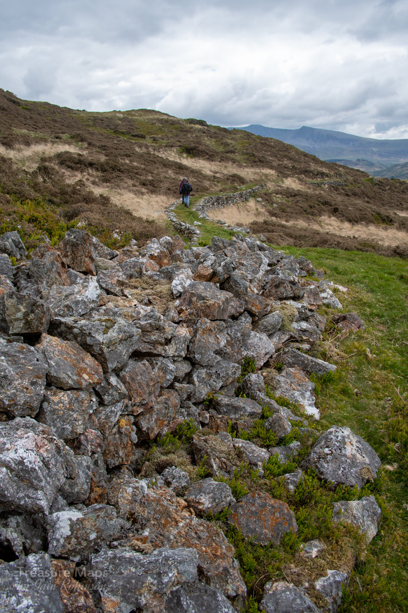 Rocks piled up by the adit. The revetted causeway goes off south in the distance. The adit below looks worthy of study- we didn't explore it because of the difficulty of getting over the wall, which looks as if it might be damaged by us climbing over it. The farm of Cesialgwm bach is below- there were some mines close to the farm which are supposed to have been connected to the Borth Company's mill by aerial ropeway. (post here). There's not much to see down there, apart from an extensive collection of abandoned cars and agricultural equipment. I note on AditNow that Britten Pans were found near the farm in the eighties, but they have disappeared now. Strange, since they seem to have saved everything else! 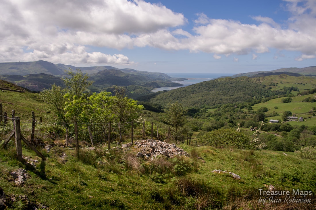 An adit with a view- the lower adit. After we'd savoured the atmosphere of the Cesailgwm bach mine, we moved on towards the trials in the north. I'm not sure they are part of the Cesailgwm operation, there is absolutely no record of them, but I'm going to call the trials "Cesailgwm Uchaf". We kept to the wall, climbing steadily until we met a cart road coming down from Mynydd Foel Isaf...it's a relatively modern track and doesn't appear on the old pre-1940 maps. This went towards the mine, which we could now see stretched for a fair way up the hillside. 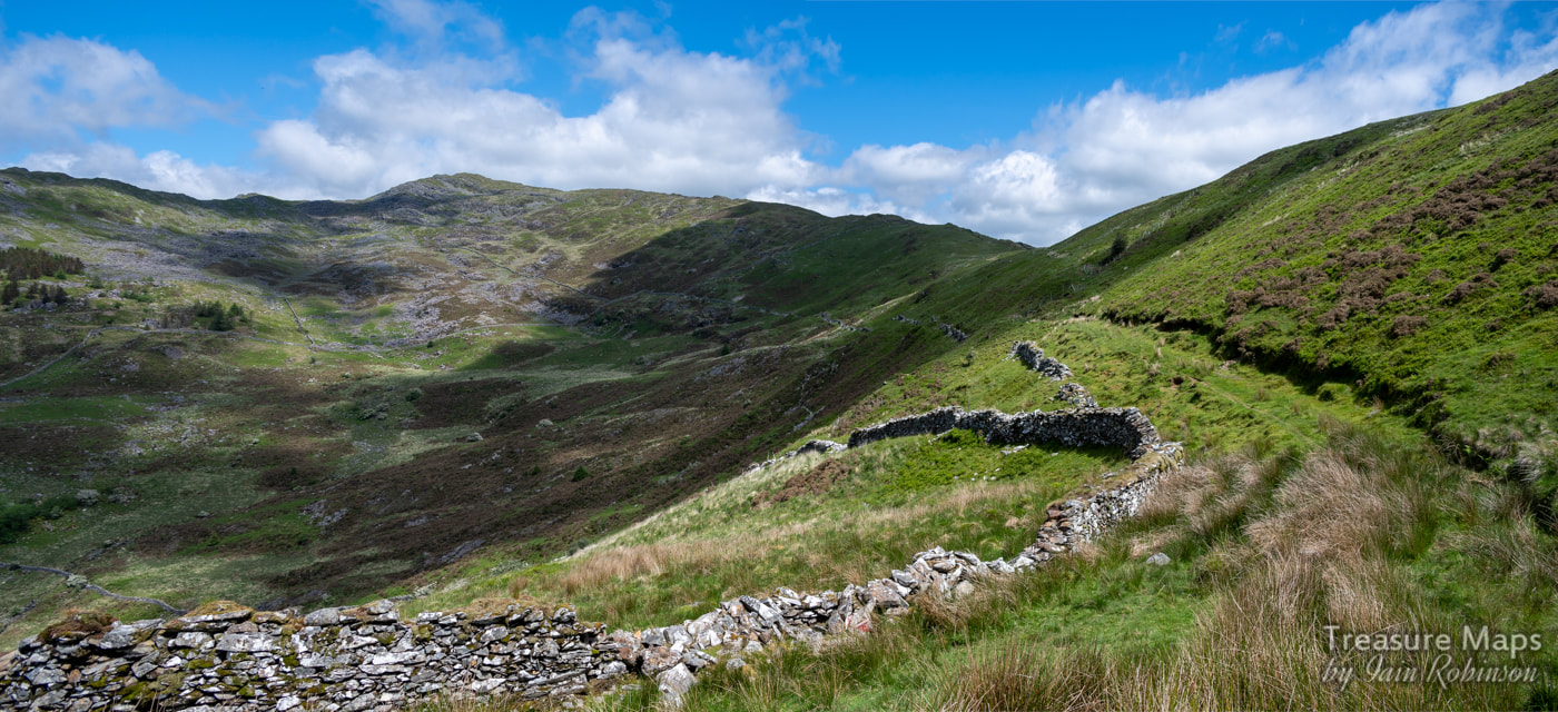 Our first view of the mine, which follows the line of the shadow on the hillside. 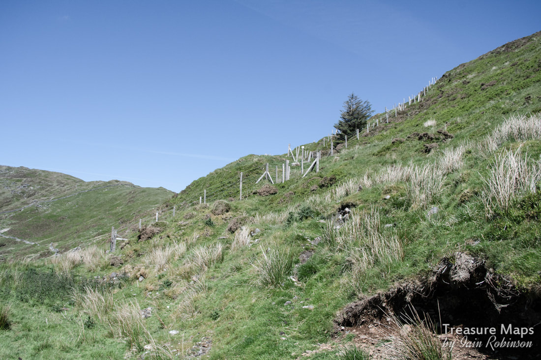 Looking up from the trackway...adits and stoping continue up the hillside. We looked at the adit next to the track...it went in for no more than a couple of metres. Then Petra set off downhill to a fenced digging below the track. It was quite a steep slope, so I stayed behind nursing my aching knees, a product of too much running and Munro bashing in my youth. I was nevertheless delighted when she cried "You should see this!" 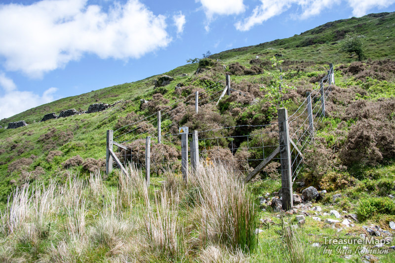 The adit below the track... On the way down, I noticed a much earlier digging, it's opencut and tips grassed over, before I reached the level Petra was looking at. Once I saw what the adit beside Petra looked like, I deployed the trusty tarp, covering the barbed wire and enabling us to climb over without injury. The adit was a long (and wet) one, easily 400 metres, but twisting and turning. Again, I had the feeling that there was a determined search for the lode going on. It eventually dried out just before the forehead. At one point, there was a hanging wall of rock, what in slate mines is called a "bon". Here it represented gangue rock. Quartz veining was encountered, but to my untutored eyes, there was nothing that spoke of gold. The interesting feature of this adit was that there were no footsteps in it; we were the first visitors for a very long time. That felt good. We came out into the warmth and light again and spotted a further adit downhill- after we'd taken all the wetsocks and gear off, of course. It was over a wall and in a patch of bracken and gorse...at which point our resolve failed us, and we decided to go for the metaphorically low hanging fruit above us. 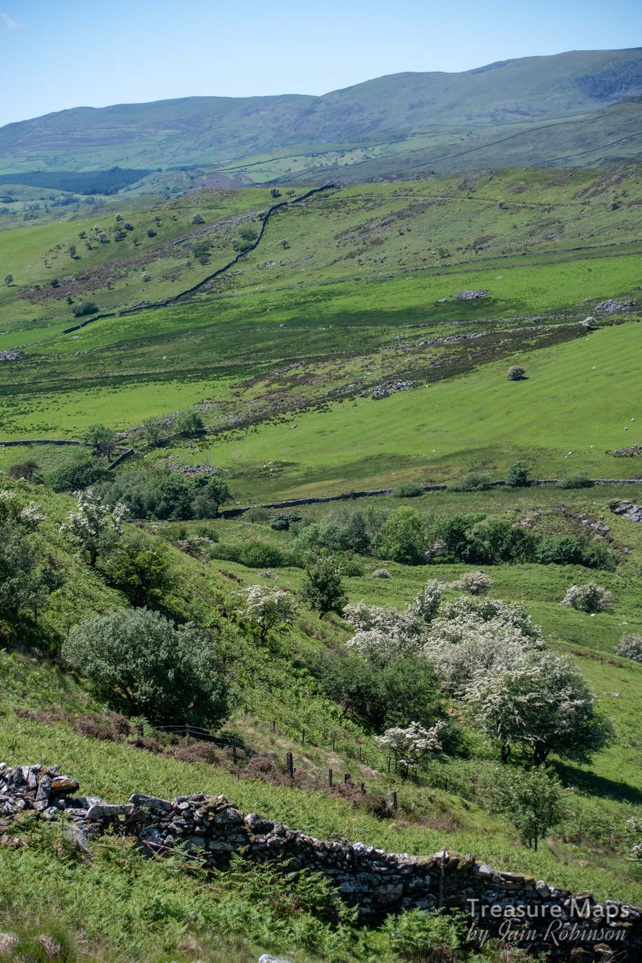 The lowest adit...not encouraging, but you never know...That's Cwm Mynach in the distance, over the first ridge. We climbed up to the other diggings on the hill. The first was a stope, a lengthy opening with stulls visible in the depths below. I had hoped that one of the adits would have opened out into this, but it was not to be, sadly. 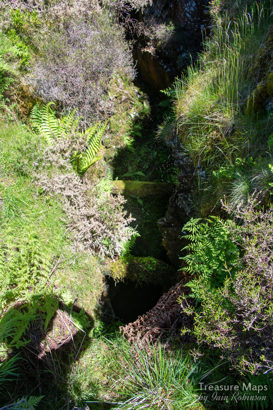 The stulls were easy to see by eye, but difficult to show in a photo...you can just make them out... 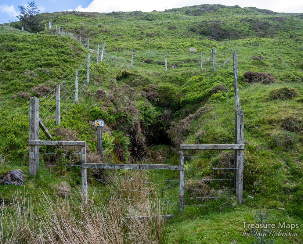 The adit next to the trackway. Once we'd reached the top adit (only a very short one) we paused for more refreshment- it was a very hot day by now. As we enjoyed our food, Petra's keen eyes caught something that looked like a mine in the distance- so off we went again! It was on the slopes of Foel Ddu, within shouting distance of the headwall of the cwm, and as we walked closer, we could see that it was at the base of a sizeable outcropping of quartz. It was only a short trial and is not marked on any maps. But the tips proved that the miners were looking for gold; there were flecks of fool's gold in several chunks of quartz that I picked up. After raking the tips for any nice samples, we reluctantly turned back along the spine of Foel Ddu. Near the ridge, more diggings appeared, as frequent as every twenty metres apart. Each digging would have taken a day or so and represented a huge effort. It reminded me of the trials above the Gamallt mines, although those were for lead. Getting to the mines: Of course, there's no easy way to get to the Cesialgwm trials. We usually set off from the car park at the western end of the New Precipice Path, although it still requires quite a bit of climbing- tiring with a rucksac carrying a camera, tripod, helmet, lamps, mine exploration gear...and lunch! You go immediately uphill along an old cart track, keeping the rocky screes and tips of Mynydd Foel Isaf to your right. You come to a wall, with a lake in view on the moor a quarter of a mile away. Take the left hand branch over a stile. Now the track meanders through gorse and heather, past a cute little Llyn. An old ruined hafod can be seen in the distance and a couple of suspicious diggings on the heathery hillside, marked on the old 1880 map as "trials". Once at the hafod, go left along the wall and cross over the stile. This wall is the spine wall which marches over the ridge between Foel Ddu and Mynydd Foel Isaf. The track becomes more definite now and soon turns into a revetted way. Pretty soon, you can see the workings on the hillside ahead. The Factoids: Very few, I'm afraid, and what I have is culled from Jeremy Wilkinson's Gazetteer. 1900–1903 St David’s Mining Development Co Ltd Operator 1903 Isaacs, J Mine Agent 1904–1905 Roberts, Thomas H Mine Agent 1904–1905 Roberts, Thomas H Operator The Cesailgwm bach trials appear on the 1880 OS as "Old Levels (gold)", suggesting perhaps that they were started much earlier than 1900. A note on pronunciation: The "C" in Cesailgwm is pronounced as in "Cat". I'm told locals abbreviate the name to "silcoom". Above: a couple of nice shots of Hawthorn bushes in blossom on the way up to the trials.
Comments are closed.
|
TracksReceive the occasional Treasure Maps Newsletter- and alerts when a new post is available!
If you enjoy my content, please buy me a coffee!
Check out my other online activity...
Index
All
|
 RSS Feed